|
 Boundary Waters Quetico ForumGroup Forum: Other Canoe Camping LocationsSan Juan River, Utah
|
Author
Text
")

10/10/2019 01:24PM
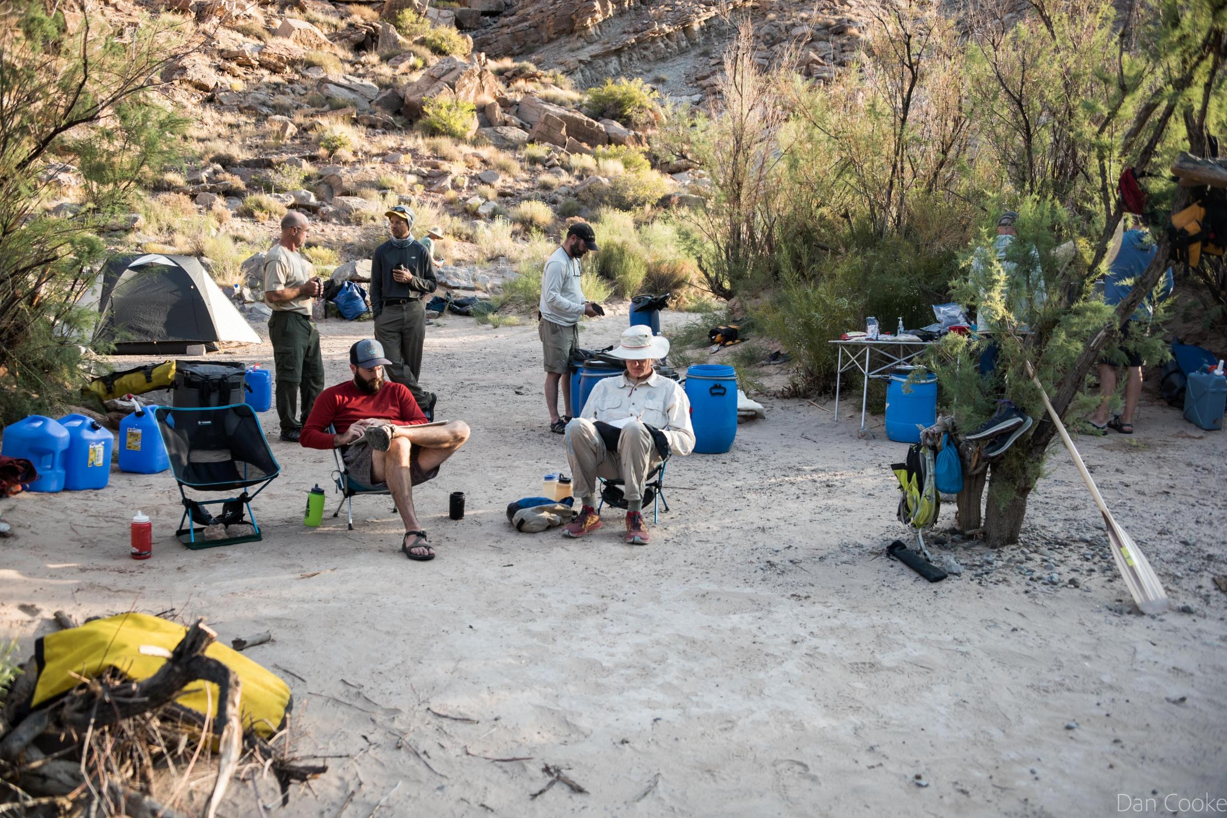
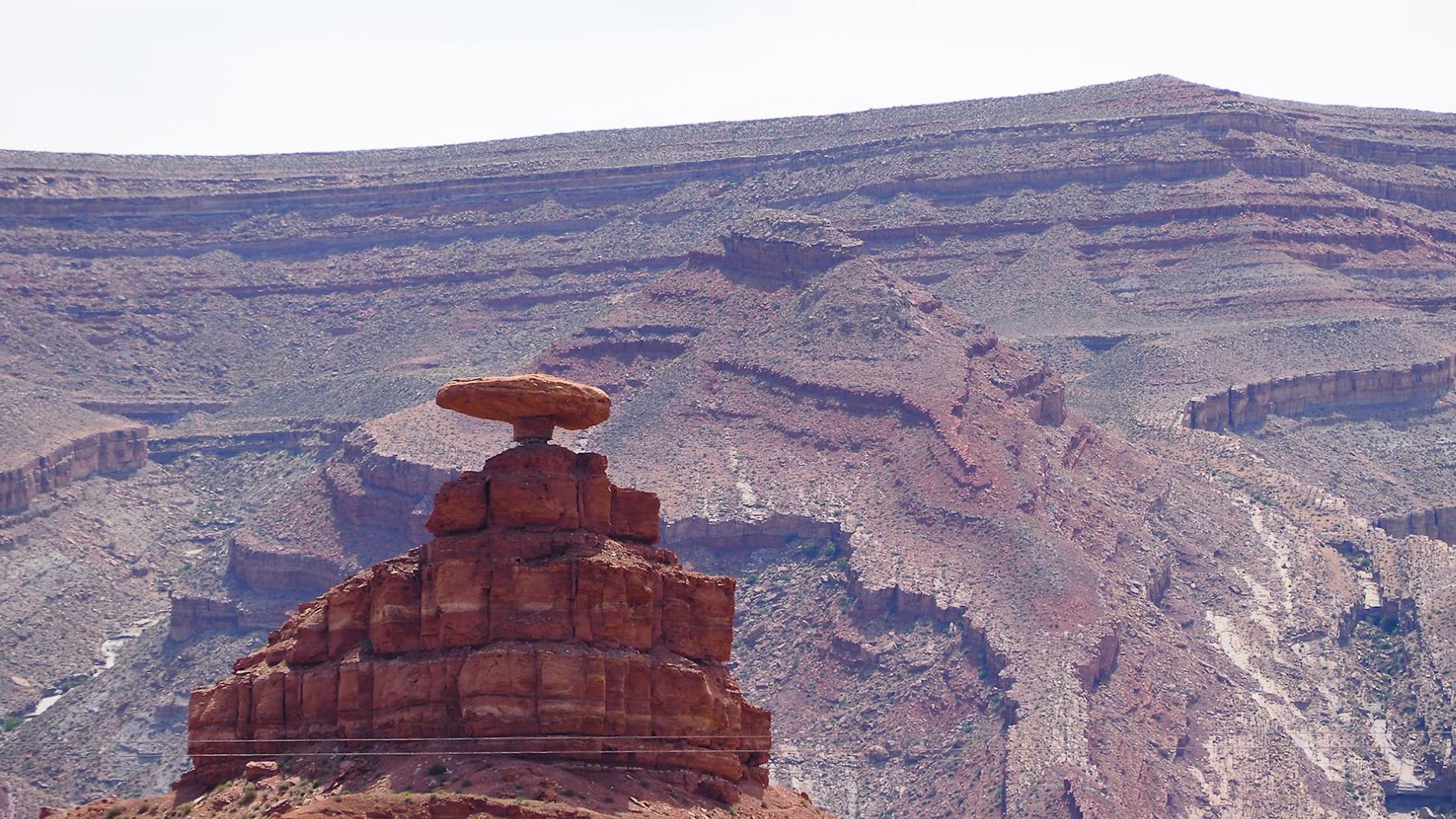
I had a great time on the San Juan River in Utah. Old indigenous petroglyphs, ruins of cliff dwellers, big canyons, hiking side trips, some Class II and Class III rapids in the stretch between Montezuma Creek and Clay Hills Crossing 103 miles.
Two suggested Guidebooks - RiverMaps San Juan River 3rd Edition Guide Book,
San Juan River Guide Spiral-bound – May 6, 2014.
Be sure to read up on the Petroglyphs near Sand Island BLM campground and the Butler Wash panels. We paid extra to go on the Navajo reservation and check out some ruins. There are several ruins in the upper portions.
Many more photos on the Cooke Custom Sewing Facebook page. It is broken up by days.


Dan Cooke
10/11/2019 12:18AM
Great photos! Was 'One Match' on this trip?
Joy is a great teacher, but so is dispair. Wonder is a great teacher, but so is confusion. Hope is a great teacher, but so is disillusionment. And life is a great teacher, but so is death. To deny yourself any of those in any aspect is not experiencing life totally.
10/11/2019 07:23AM
One Match - Jerry Vandiver - was on this trip and gave all a performance every night. We also had three others that either sang with Jerry or played and sang their own original songs. Never had such great times around the evening campfires.
Dan Cooke
10/11/2019 10:17AM
Beautiful pictures. Thank you for posting. Can you comment on air temp and water level at this time of the year. Is fall the preferred time for canoe camping? No idea about the precipitation in Colorado, but believe I did hear there was not much of a monsoon season in AZ this year... although some rain storms did appear 3-4 weeks ago.
Also, It does not appear that you have added floatation or splash skirts? Was this ever a problem?
What were the biggest obstacles and how did you get through them?
Thanks!
Also, It does not appear that you have added floatation or splash skirts? Was this ever a problem?
What were the biggest obstacles and how did you get through them?
Thanks!

10/11/2019 10:26AM
Have been following the photos as you've posted them on Facebook, Dan. Looks like you all had a great time. Some of those rapids looked exciting! =)
When a man is part of his canoe, he is part of all that canoes have ever known. - Sigurd F. Olson, "The Singing Wilderness"
10/11/2019 11:31AM
Fall worked well for us. Temps during the day was 70's to 90, our first night we had frost at the sand River BLM campsite/ landing prior to put in. Water temperatures were pleasant to swim in for 20-30 minutes without a shiver.
We had no extra flotation or spray covers. Two canoes overturned with the 1 being pinned on rocks for 15-20 minuets. Packs and barrels floated and would displace quite a bit of water in the event of a capsize.
Flow is partially a result of dam release. Flow at sand River when we paddled through. Flow rates
Some of the rapids were significant to say the least. The wave trains were quite tall, and I am a bit spooked by some the big water with a heavily loaded open canoe. Bear took the canoe down solo on two rapids - one of which I carried a pack and camera stuff to the bottom.
Dan Cooke
10/12/2019 09:53AM
They say you never paddle the same river twice, seen some you tube videos of others canoeing rafting and dory descents of the river. Higher and lower water flows. Sometimes the river looked like chocolate milk we had relatively clear water. At 700 CFS some folks walked through the lower stretch some in sloppy soupy silt.
With large rafts people are bringing in full size sun umbrellas, 20 lb propane cylinders for their stoves . A far cry form canoe tripping equipment that the BWCAW canoeing crowd is used to.
I still have photos to go through.
With large rafts people are bringing in full size sun umbrellas, 20 lb propane cylinders for their stoves . A far cry form canoe tripping equipment that the BWCAW canoeing crowd is used to.
I still have photos to go through.
Dan Cooke
10/15/2019 10:58AM
Could be good could be some walking.
00060, Discharge, cubic feet per second,
YEAR Monthly mean in ft3/s (Calculation Period: 2014-11-01 -> 2018-12-31)
Period-of-record for statistical calculation restricted by user
Jan Feb Mar Apr May Jun Jul Aug Sep Oct Nov Dec
2014 845.0 835.4
2015 733.0 903.3 1,192 680.8 1,337 4,668 1,941 1,659 878.0 1,334 901.3 706.1
2016 797.8 1,100 999.6 954.5 3,026 6,538 1,732 1,779 771.2 769.8 851.1 796.7
2017 979.1 1,173 1,565 2,019 4,960 7,065 1,573 1,084 761.7 1,049 782.8 685.5
2018 646.4 574.5 506.5 537.7 886.5 623.6 702.1 504.0 471.2 667.3 613.8 523.5
Mean of
monthly
Discharge 789 938 1,070 1,050 2,550 4,720 1,490 1,260 721 955 799 709
usgs monitoring station
You will need a shuttle service - they may help with your question as well
San juan River raft outfitter
Dan Cooke
")


Subscribe to Thread
Become a member of the bwca.com community to subscribe to thread and get email updates when new posts are added. Sign up Here
Community Links
 Search BWCA.com
 Donate
 Featured Sponsor
