|
 Boundary Waters Quetico ForumListening Point - General Discussion Significant severe threat tonight
|
 Forum Sponsor

Author
Text
")


07/17/2020 12:12PM
Yep. Even expanded the area. "Hatched " area under wind threat is rarely seen this far north. Day 1 severe threat
At this time it appears to late night / early morning threat and perhaps a derecho. event.
At this time it appears to late night / early morning threat and perhaps a derecho. event.
The two loudest sounds known to man: a gun that goes bang when it is supposed to go click and a gun that goes click when it is supposed to go bang.
07/17/2020 02:26PM
No. Was just thinking about your question. I personally don't allow "potential" weather to make or break a trip. Just be prepared... I will be able to provide updates throughout the evening and into the early AM. I will add that current radar and intensity of storms in ND is lining up well for the above event to materialize. 
The two loudest sounds known to man: a gun that goes bang when it is supposed to go click and a gun that goes click when it is supposed to go bang.
07/17/2020 02:32PM
WhiteWolf: "No. Was just thinking about your question. I personally don't allow "potential" weather to make or break a trip. Just be prepared... I will be able to provide updates throughout the evening and into the early AM."
Thank you WhiteWolf for the encouraging comment, I’m always as best prepared as possible for changing weather, and will make sure to be extra vigilant this time, and have been stuck in some nasty stuff, we’ll keep our eye on the weather throughout the night and your updates are appreciated. We’ll just be a 2 mile hike in so not in the middle of nowhere.
For some reason this storm just alerted me more, maybe cause it seems to be headlines everywhere, and 75+ MPH winds under a large tree canopy doesn’t sound comforting.

07/17/2020 04:36PM
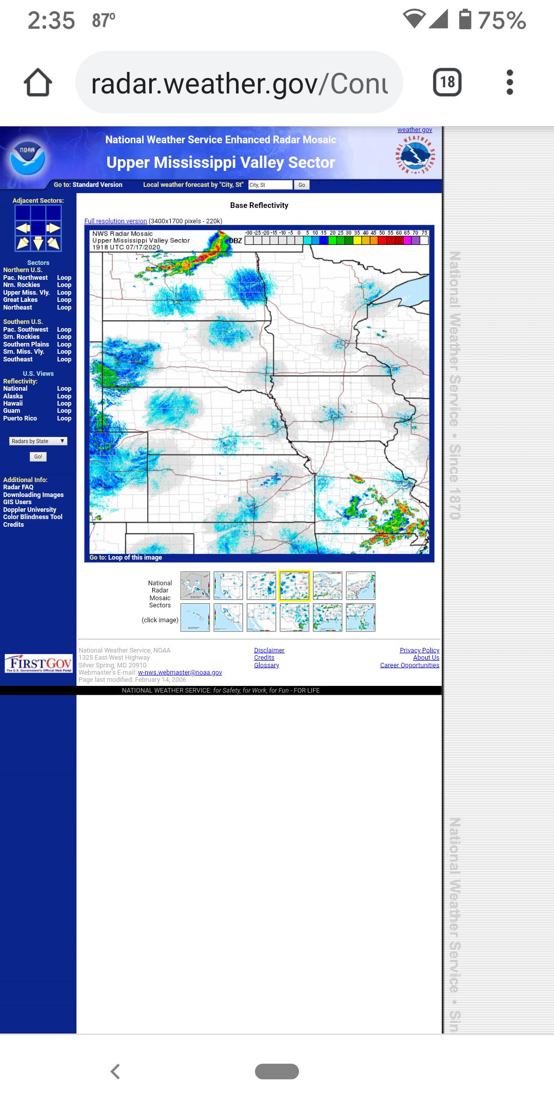
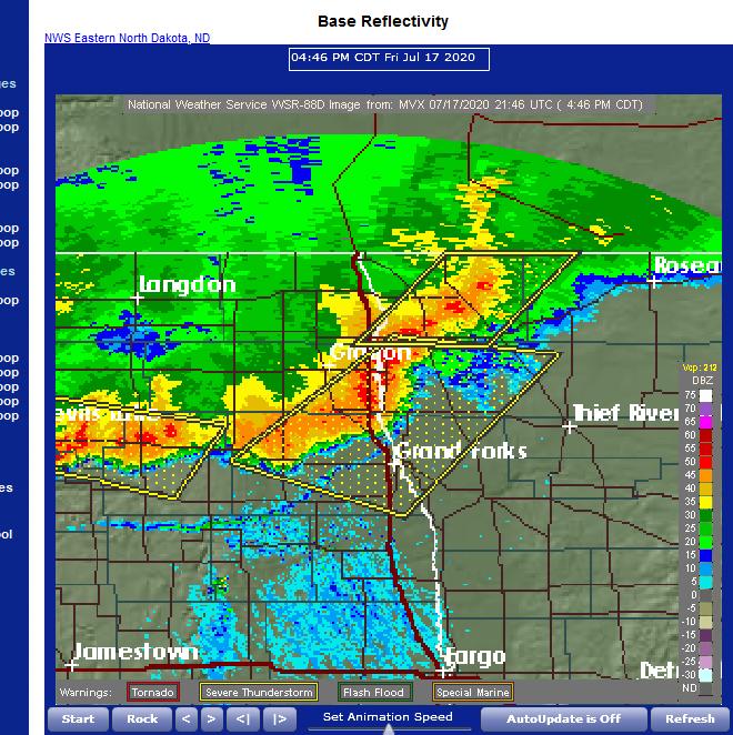
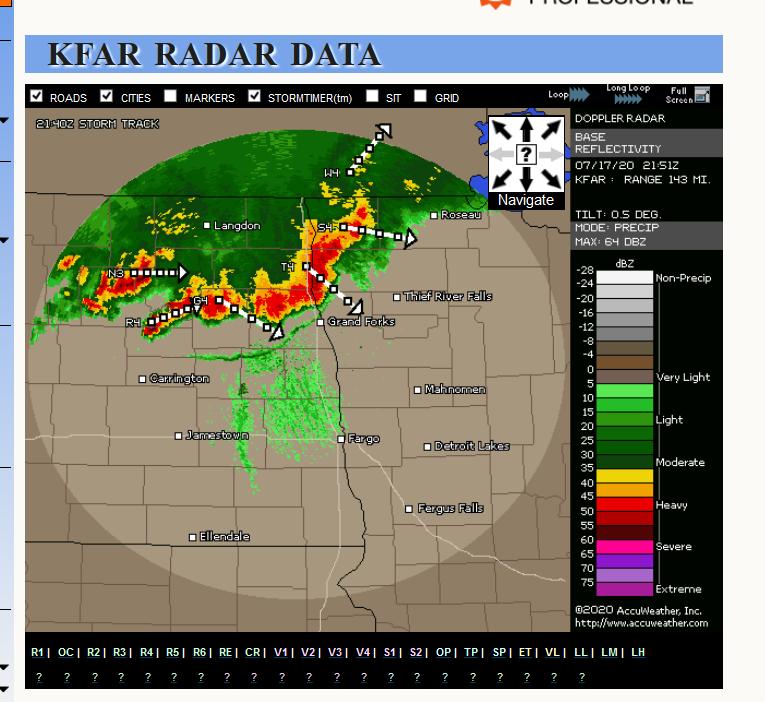
Things appearing to be gelling together faster than what was expected. The storms in NW MN were not supposed to be there until much later this evening. This is good and bad. Bad for those in NW- N-Central MN has it appears this line is "bowing out" and is taking on characteristics all ready of a severe wind event - see below. The good is that it's not at night so people will be able to see and it should suck energy out of the atmosphere for another forecasted line to develop S and W of the current- likely mitigating it. IF one see's the "outflow boundary" in this latest image= (squiggly - narrow line on the radar stretching from just N of Grand Forks back to near Carrington,ND) that is a sign of weakening - the storms are gusting themselves out at this time in areas just near the outflow boundary. Where there is no outflow boundary means the storms are still mature and can grow even stronger.


Hopefully this weakening will continue but what will likely happen is that returns in far NW MN will slowly "turn" to the right or South- that is something that needs to be watched and is indicative of classic straight line wind events.
Hopefully no more 101 mph wing gusts are reported.

Hopefully this weakening will continue but what will likely happen is that returns in far NW MN will slowly "turn" to the right or South- that is something that needs to be watched and is indicative of classic straight line wind events.
Hopefully no more 101 mph wing gusts are reported.

The two loudest sounds known to man: a gun that goes bang when it is supposed to go click and a gun that goes click when it is supposed to go bang.
07/17/2020 05:13PM
new watch coming and they even mention my forecasted S to SE trend--
Even mention into the Brainerd area by 7pm
Even mention into the Brainerd area by 7pm
The two loudest sounds known to man: a gun that goes bang when it is supposed to go click and a gun that goes click when it is supposed to go bang.
")
07/17/2020 05:23PM
WhiteWolf: "new watch coming and they even mention my forecasted S to SE trend--
Even mention into the Brainerd area by 7pm "
Thanks Whitewolf-over the years you get those days you know something bad may happen. It is very hot, and extremely humid with so much moisture hanging in the air. Who knows, I sure don't, but this may be one of those nights.
07/17/2020 05:40PM
Not good. First time I've seen this this year. PDS- or Particularly Dangerous Situation.
PDS Severe Thunderstorm Watch
PDS Severe Thunderstorm Watch
The two loudest sounds known to man: a gun that goes bang when it is supposed to go click and a gun that goes click when it is supposed to go bang.
07/17/2020 05:48PM
I am in Thief River Falls. We have high gusty winds and heavy rain at this time. Looks like it might be a long night. Rusty is in the house with my Daughter with his teeth chattering! Right now it looks like the weather is north of Itasca park.
Carl
Carl
07/17/2020 07:44PM
schweady: "Feels like you're wearing a hot, heavy blanket outside right now in Perham. Everything has gone still. Not a good omen.
"
Agree, that is what I remember about the worst 4 storms in my life. Gets hot and dead calm during the day, humid as heck and you can just see things building. Forecast for me is changing every 5 minutes, now one has over 3 inches rain predicted. WE can use the rain, but not the other stuff.
07/17/2020 07:48PM
Jaywalker: "WhiteWolf: "...Hopefully no more 101 mph wing gusts are reported. ..."
That sort of blows my mind.
I'm suppose to be entering tomorrow at Hog Creek. We'll see how that goes."
couple years ago my niece got hit with 120 mile hour winds. Went out there right after and so many trees down I couldn't even find the driveway at first. Luck no body got hurt. One big white pine landed on the house and like a 100 trees down in the yard area. Almost all big white and red pine, many just up rooted.
07/17/2020 07:56PM
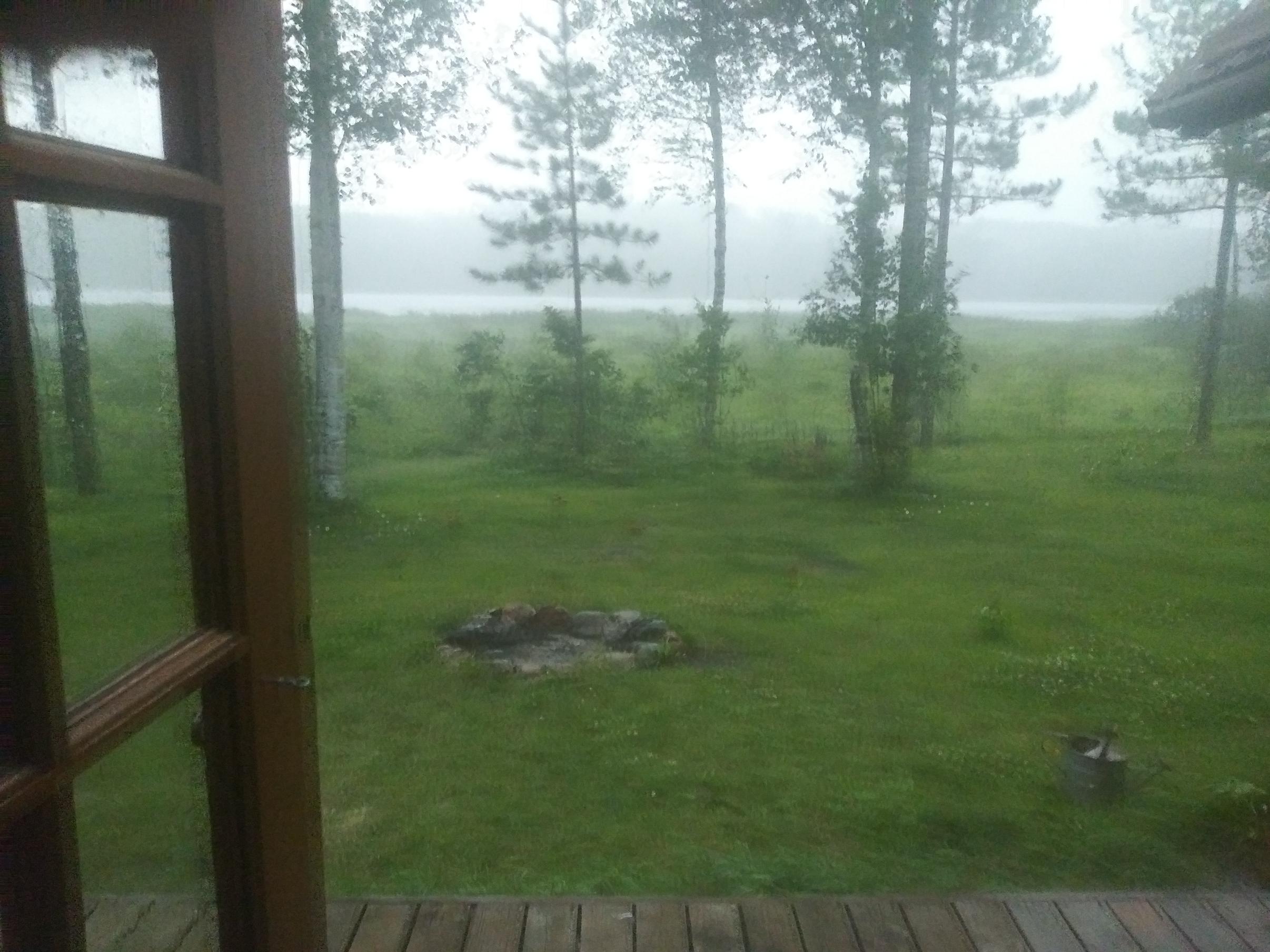
I think I'm in the heart of it right now, im at my cabin by Itasca SP.
The first wave came with really strong gusts 40+ mph at least.
It hit here pretty good, but not bad IMHO. Sure wouldn't want to be in a tent now.
Pic was taken at 7:45 pm. Extreme southern Clearwater County.
First pic is the first wave of strong winds, with no rain.
2nd is during the storm.


The first wave came with really strong gusts 40+ mph at least.
It hit here pretty good, but not bad IMHO. Sure wouldn't want to be in a tent now.
Pic was taken at 7:45 pm. Extreme southern Clearwater County.
First pic is the first wave of strong winds, with no rain.
2nd is during the storm.

May the rivers be crooked and winding, and your portages lonesome, leading to the most amazing view.
07/17/2020 09:32PM
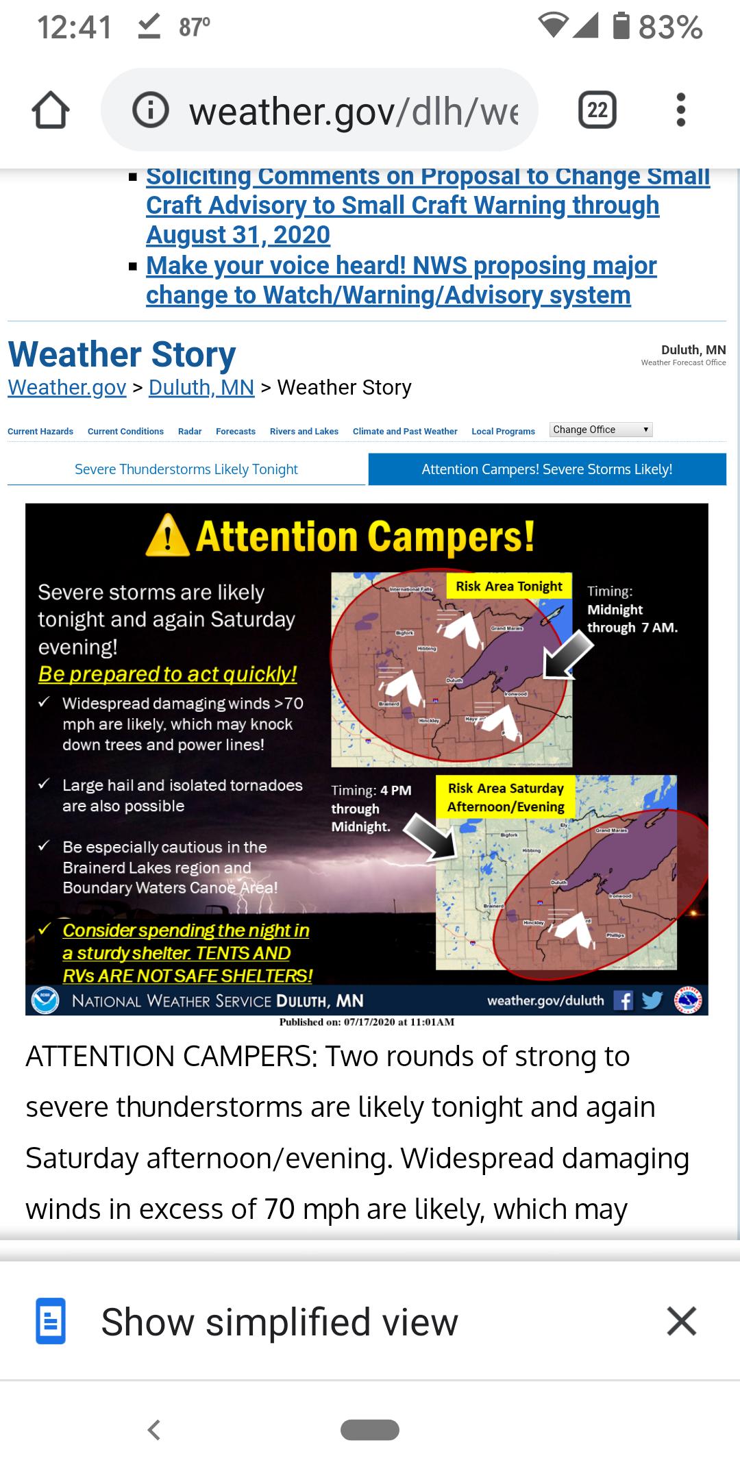
Lakes area residents should begin preparing now for what's expected to be a wild and severe night of summer storm weather.
By Saturday morning, July 18, the full breadth and power of a severe summer storm should be visible — and whatever that storm leaves is expected to be followed by a second storm wave.
“This is probably going to be the worst storm the Northland sees this summer,” said Joe Moore, warning coordination meteorologist with the National Weather Service in Duluth. Moore spoke Friday afternoon during an online media briefing on the approaching storm.
07/17/2020 10:37PM
Watch issued for Twin Cities on up to Superior into N.MI. BWCAW "may" dodge a bullet as they are not in watch but still a lot of moving parts with this very fluid situation.
New watch until 6am for Twin Cities etc.
New watch until 6am for Twin Cities etc.
The two loudest sounds known to man: a gun that goes bang when it is supposed to go click and a gun that goes click when it is supposed to go bang.
07/18/2020 01:55AM
I think now for most of the BWCAW the main threat is going to be heavy rain and minor flooding issues etc.
The two loudest sounds known to man: a gun that goes bang when it is supposed to go click and a gun that goes click when it is supposed to go bang.
07/18/2020 04:05PM
Just put a watch out for tonight for much of E and NE MN including the BWCA. Things don't look as explosive as they were yday; but still a watch is a watch and does include the BWCA.
Until 11:00 Pm 7/18
Until 11:00 Pm 7/18
The two loudest sounds known to man: a gun that goes bang when it is supposed to go click and a gun that goes click when it is supposed to go bang.
07/19/2020 07:47AM
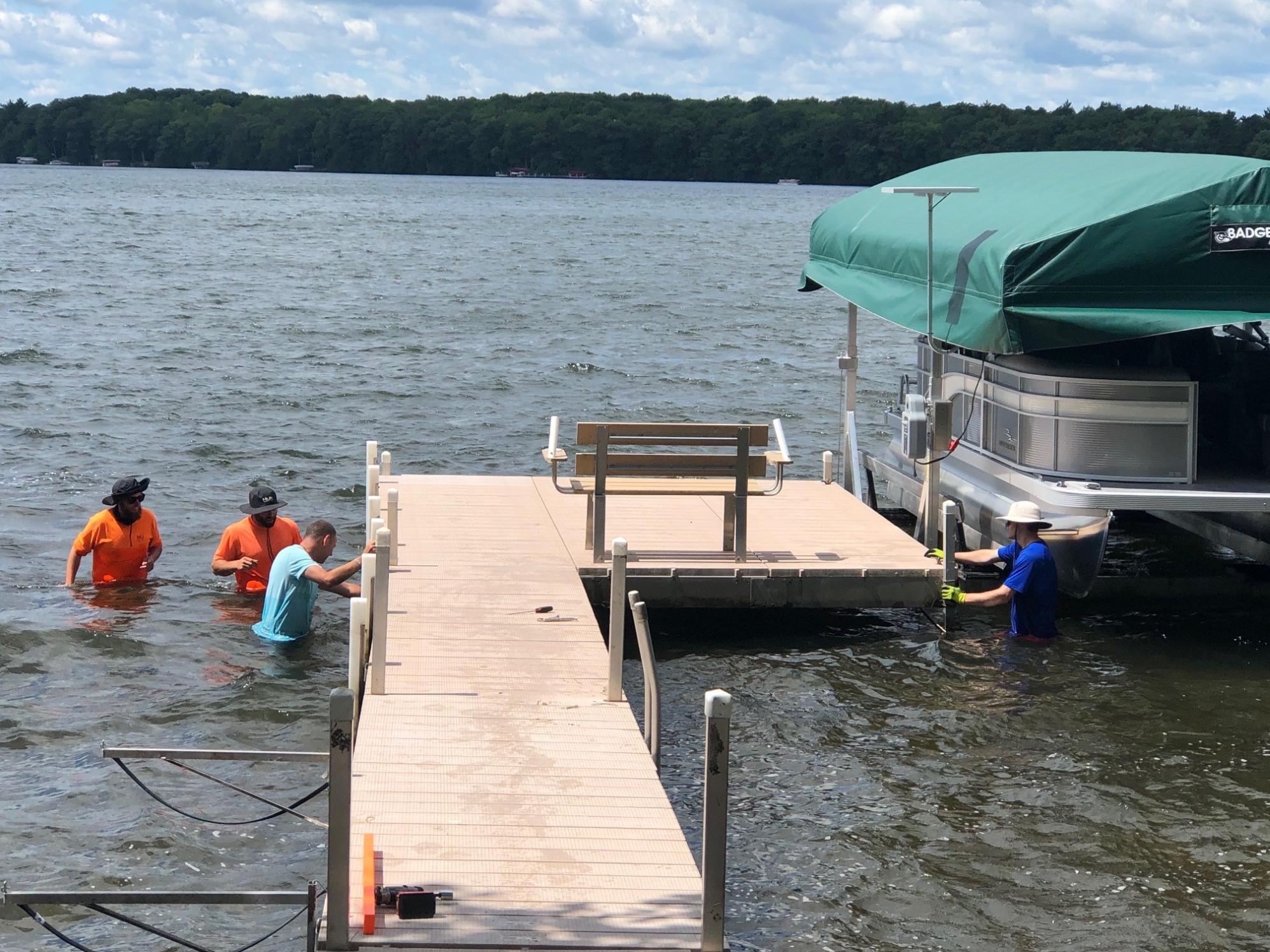
Had a strong band come through Hayward area last night around 10:00. Thankfully it dissipated a little bit right before it hit. Here on Lac Courte Oreiles, the dock seems to be the only thing damaged...that and the grill.


Fate whispers to the warrior "You cannot withstand the storm" and the warrior whispers back "I am the storm". Unknown.
07/19/2020 10:09AM
JimmyJustice: "Had a strong band come through Hayward area last night around 10:00. Thankfully it dissipated a little bit right before it hit. Here on Lac Courte Oreiles, the dock seems to be the only thing damaged...that and the grill.
I used to take weekend trips there with my Dad and his buddies in the late 60's to mid 70's. We stayed at a resort called Fredrick's I believe. It was in a bay till a fire burned down the main building. This view looks to be the same as there. Big water and big muskies.
"Life is not about finding yourself. Life is about creating yourself." --- George Bernard Shaw
07/19/2020 01:38PM
Tom T.
Feel free to PM me regarding the muskies. I always assumed Muskie Bay was named in a manner similar to Greenland.
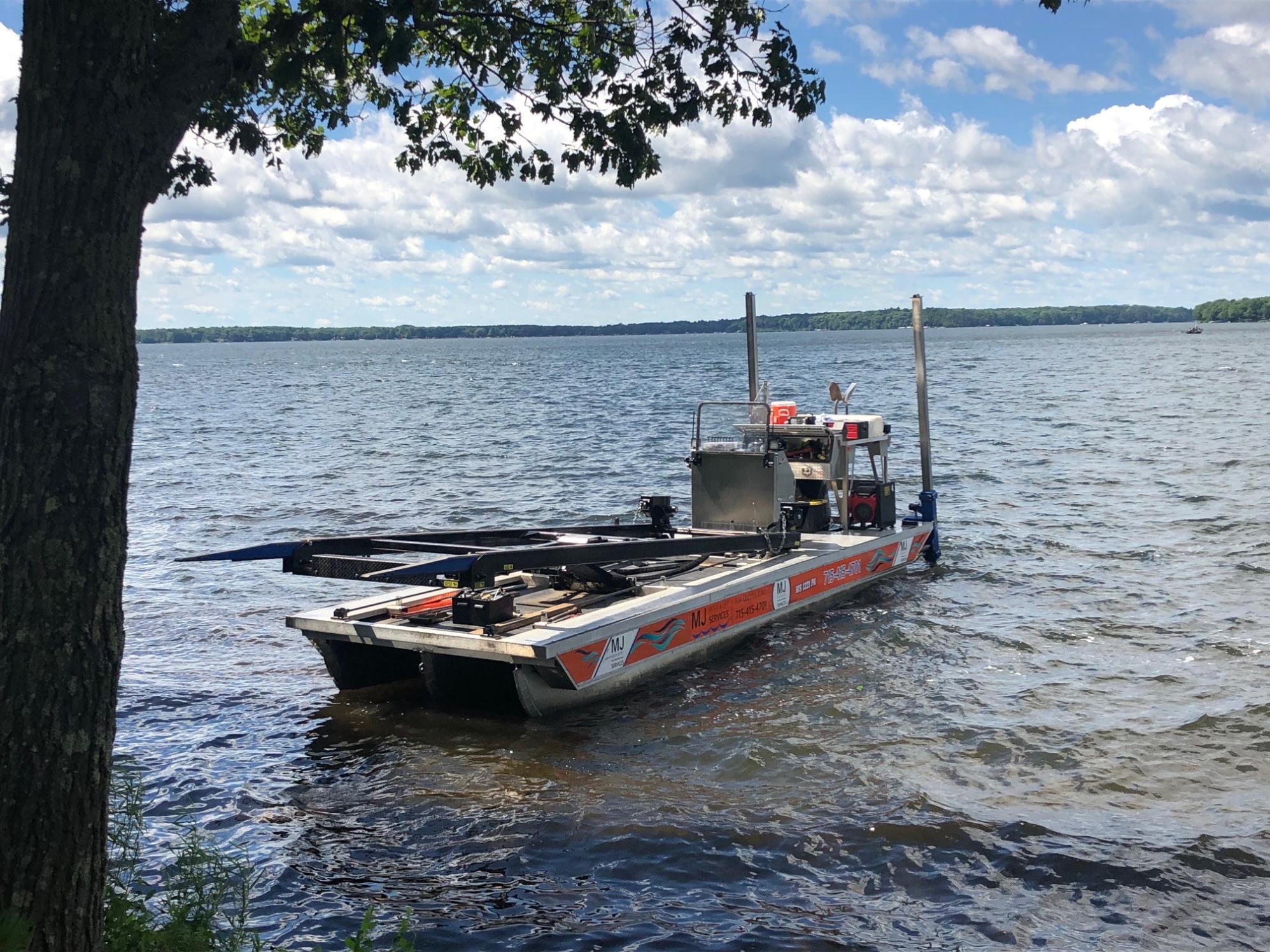
WW,
Any idea how strong the winds were here last night? Dock guy Markus and his crew were here already and up-righted the the dock. A couple of structural matters to attend to int eh fall but usable for now. He said his side of the the lake is still without power and he had repaired 5 lifts today with more to go. Several torn canopies, down trees etc.
JJ

Feel free to PM me regarding the muskies. I always assumed Muskie Bay was named in a manner similar to Greenland.
WW,
Any idea how strong the winds were here last night? Dock guy Markus and his crew were here already and up-righted the the dock. A couple of structural matters to attend to int eh fall but usable for now. He said his side of the the lake is still without power and he had repaired 5 lifts today with more to go. Several torn canopies, down trees etc.
JJ
Fate whispers to the warrior "You cannot withstand the storm" and the warrior whispers back "I am the storm". Unknown.
07/20/2020 05:01AM
From storm reports in the area and gut call is 45-65mph. If your on the downwind / angle side of the winds ( generally E side of lake) I'd say lower end of that range. It takes less wind than one would think when it has little friction over a total flat surface of a large body of water and fetch to leverage a dock up like pictured. Even "wind" has momentum. A 50 mph wind over long sections of water/land etc/ (fetch) compared to 50 mph winds on lee of an island- is not the same deal in force lasting pounds. Don't wanna get too technical- and some may argue but this is a proven meteorological (really simple physics) fact.
All it takes is one section of dock , ( like tipping a canoe) and it's all over. It does look more than "flipped", my experience from field work says around 55-60 mph. 80mph would easily have removed the pontoon canopy and likely the rest of the dock and thrown them. Wind - force- too damage is not linear, it's exponential. A 60mph wind has WAY more force (damage) than double a 30mph, too lazy to break out the calculation, but I know a 100 mph wind doubles in force at 126 mph
Impressive winds nonetheless. Second look at pic is that winds may have been funnled along the shoreline , that pontoon canopy has too much surface area to not show otherwise.
Wind Power Riddle
The two loudest sounds known to man: a gun that goes bang when it is supposed to go click and a gun that goes click when it is supposed to go bang.
07/23/2020 06:49AM
Got back from Ogish last night. We put all the tent tie downs to use and put all gear away in prep for this storm. The west side of the tent definitely got pushed around, but held up. Rain did get bounced under the rainfly on the south end of the tent, enough that the dog moved. We FELT the continuous rolls of thunder. Luckily no trees down by us and the canoe was ok.

Subscribe to Thread
Become a member of the bwca.com community to subscribe to thread and get email updates when new posts are added. Sign up Here
Community Links
 Search BWCA.com
 Donate
 Featured Sponsor
