|
 Boundary Waters Quetico ForumGroup Forum: Quetico AfficionadosWhen and Where Next?
|
Author
Text
")

08/09/2007 07:50PM
I want to kick it up a notch next time, so I thought, hmmm, early spring, creeks, rivers and big water, 10 - 14 days.
I don't know if it would be better to get the advice of people who have been there or be surprised, but with my recent promotion at work and nothing more worthy of spending it on, here's my idea;
Park at Crane Lake, fly into Nym Lake Ranger Station and paddle out; Nym Lake; Batchewung; Pickerel; Pine Portage Bay; Dore; Twin; Sturgeon; Rouge via Jean Creek; Jean; Red Pine; Badwater; Omeme via Bearpelt Creek; Cub; Wolseley(BP Creek); Namakan River; Sand Point and back to Crane.
Somewhere in there will be time to skip a day or two of paddling and spend some quality time with the fish.
Some part of it will have to be trimmed out because it is just too many miles, but I'll wait until my McKenzie Maps come in to figure that

08/09/2007 09:16PM
Sounds like a great trip! We toook the first part of your route:Nym Lake; Batchewung; Pickerel; Pine Portage Bay; Dore; Twin; Sturgeon, in 1993....we continued south through Cairn, Kahshahpiwi, and out at Prairie Portage. We had a great time, only drawback for us were the crowds on Russel and at Chatterton Falls, after that we were by ourselves.
fishguts
08/11/2007 01:08PM
Great trip ideas. I need to get my maps out and trace these routes -I do love the Namekan - lots of adventure there and rivers have their own alure!  High Falls on the Namekan
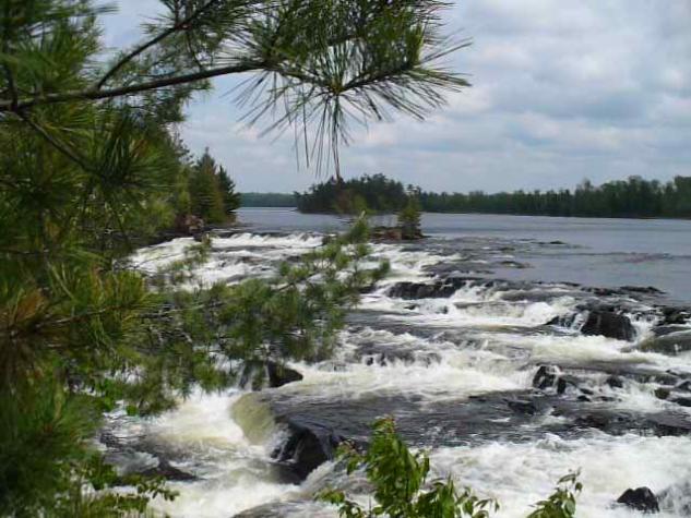 High Falls on the Namekan
"You're not serious about wearing sandals on this portage.... are you?"

08/12/2007 02:32PM
psukontaraks--you need to get an official Park map for those portages most likely. I find the Chrismar map highly accurate. It is too small for navigation, but you can cross check the portage info and add it to your McKenzie or Fisher maps.
You can buy it here:
http://www.quietjourney.com/tradenpost/park/index.html
or you can also check here for data.
http://www.quietjourney.com/pdb/queticopark.html
Tim
You can buy it here:
http://www.quietjourney.com/tradenpost/park/index.html
or you can also check here for data.
http://www.quietjourney.com/pdb/queticopark.html
Tim
“Many go fishing all their lives without knowing that it is not fish they are after.” Henry David Thoreau
08/12/2007 03:17PM
Thanks Tim;
I will definitely do that. I was just going through all the old Quetico Forum posts and found a map loop from bonelli that would make for an interesting shorter loop that could encompass many of the lakes that members want to visit.
Gunflint to Falls Chain, Kawnipi, Lemay, Wawiag River (I want to revisit there), Mack Lake (supposed to be outstanding fishing)then meander back to Saganagons.
I love reading maps and daydreaming . . . . .

08/28/2007 08:41AM
Pete,
I agree you need to pick up the The Adventure Map of Quetico by Chrismar Mapping. These portages are the ones that are “maintained” by the park.
I use this map to get an overall view of the area and for the portages, but use other maps for navigation. I also use McKenzie maps for navigation but they aren’t updated so they can get outdated. They’re still good, but just something to be aware of.
I checked my map and here are the portages between Jean to Badwater.
Jean Lake , 430 m portage, unnamed lake, 550 m portage, unnamed lake, portage- no distance, Red Pine Lake, 980m portage, Pelee Kake, portage- no distance, Badwater .
Chuck
Subscribe to Thread
Become a member of the bwca.com community to subscribe to thread and get email updates when new posts are added. Sign up Here
Community Links
 Search BWCA.com
 Donate
 Featured Sponsor
