|

 Forum Sponsor

Author
Text
")

03/06/2008 09:12AM
July is going to be my first time going to the BWCA. I was wondering about the camping spots. I keep reading the posts saying there is a nice campsite, and all of them are taken, and other things. Are there only certain spots you can camp in the BWCA or can you camp anywhere and those spots are just preferred? Thanks for your help!

03/06/2008 09:17AM
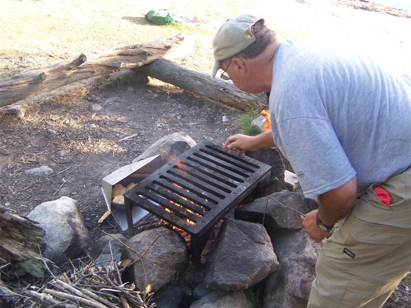
There are designated spots for camping in the BWCA--if you look at a map, the places where you can camp will be marked with red dots. All designated sites will have a fire grate for cooking and a "throne" for a latrine.
But you're right that the quality of a campsite varies widely--some are small (fewer tent spots) with less scenic views or located by swamps which can mean lots of bugs. Don't worry too much about getting a "bad" campsite though--as long as you don't get one with a really full throne which you can smell from the fire grate/tent area you'll be fine. Even if you do happen to get a less than ideal site one night, that just makes the next "good" campsite that much better!
But you're right that the quality of a campsite varies widely--some are small (fewer tent spots) with less scenic views or located by swamps which can mean lots of bugs. Don't worry too much about getting a "bad" campsite though--as long as you don't get one with a really full throne which you can smell from the fire grate/tent area you'll be fine. Even if you do happen to get a less than ideal site one night, that just makes the next "good" campsite that much better!
03/06/2008 09:24AM
This is the official word on the subject:
--------
"CAMPSITES:
Camp only at Forest Service designated campsites that have steel fire grates and wilderness latrines. You may camp up to 14 consecutive days at one site. Be sure to make camp early enough in the day to be able to find an available campsite. Keep the campsite clean and free from litter. Do not build structures, cut live wood, carve names in trees, or write on the rocks."
--------
Campsites are not hard to find, but you may not get the one you want every time you want it. There will be days when you have to keep paddling or go back to a site that you noticed earlier that was unoccupied. Campsites close to entry points tend to get used the most and the further away you get from entry points, the more open sites you will see.
If you plan on moving everyday, break camp early, and start looking for sites around the early to mid afternoon.
--------
"CAMPSITES:
Camp only at Forest Service designated campsites that have steel fire grates and wilderness latrines. You may camp up to 14 consecutive days at one site. Be sure to make camp early enough in the day to be able to find an available campsite. Keep the campsite clean and free from litter. Do not build structures, cut live wood, carve names in trees, or write on the rocks."
--------
Campsites are not hard to find, but you may not get the one you want every time you want it. There will be days when you have to keep paddling or go back to a site that you noticed earlier that was unoccupied. Campsites close to entry points tend to get used the most and the further away you get from entry points, the more open sites you will see.
If you plan on moving everyday, break camp early, and start looking for sites around the early to mid afternoon.
")

03/06/2008 09:32AM
Go to the map section at the top left of this page. Click and go to lake maps..then go thru the list and pick out your lake(s). Once you get to your lake map, put the cursor on a "red dot"...it will tell you the campsite # and if you click on it there may be a comment posted (by fellow members) about that site. Not all sites have comments, but many of the nicer sites do and this may help you when you go to choose a site for that lake.
"What could happen?"
03/06/2008 09:34AM
A small thing you may run into, quite often entry lakes have no unoccupied camp sights, which may require you to travel farther on your first day than you planned. I don't have the answer how to avoid this, but it has happened to us enough that i only go to Quetico now. I imagine that things open up depending on time of day or day of the week. If anyone knows how to avoid this I would like to know how they do it.
03/06/2008 10:01AM
G1, ways to avoid "full sites": Choose less popular routes, be willing to do those BIG portages, stay away from weekend entries, go in May or Sept., Quetico, start looking for site early in day, LUCK. It happens, but sometimes it leads you to new places that are neat that you may have otherwise never discovered. Stay flexible, have a backup plan if you are going to arrive late in a popular area, like one short portage into next little dead end lake just off route. Then get back on track the next morning. Don't allow it to "make or break" your trip.
"What could happen?"
03/06/2008 10:53AM
Here is a link to a map of Clearwater Lake, the place you will be entering. The red dots represent campsites. Click on the orange triangles (arrows) outside the map to move the map in that direction. For instance, click on the right arrow and it will take you to the rest of Clearwater Lake. Click it again and you will see the portage (yellow triangles are the beginning and end of portages) to West Pike Lake. Click again – more of West Pike. Etc.
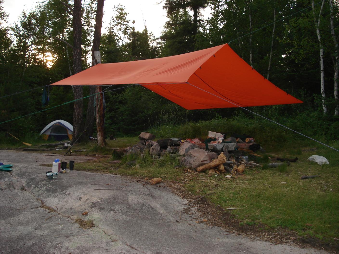
Folks here will have lots of pictures of BWCA Campsites and the firegrats and toilets that are there. I don't have any of your area online, but here is a sampling of others.

Fire Grate at a campsite

Sawbill Lake Campsite

Lynx Lake Fire Pit

Campsite on Mesaba
Folks here will have lots of pictures of BWCA Campsites and the firegrats and toilets that are there. I don't have any of your area online, but here is a sampling of others.
Fire Grate at a campsite

Sawbill Lake Campsite

Lynx Lake Fire Pit

Campsite on Mesaba
Bannock

03/06/2008 04:25PM

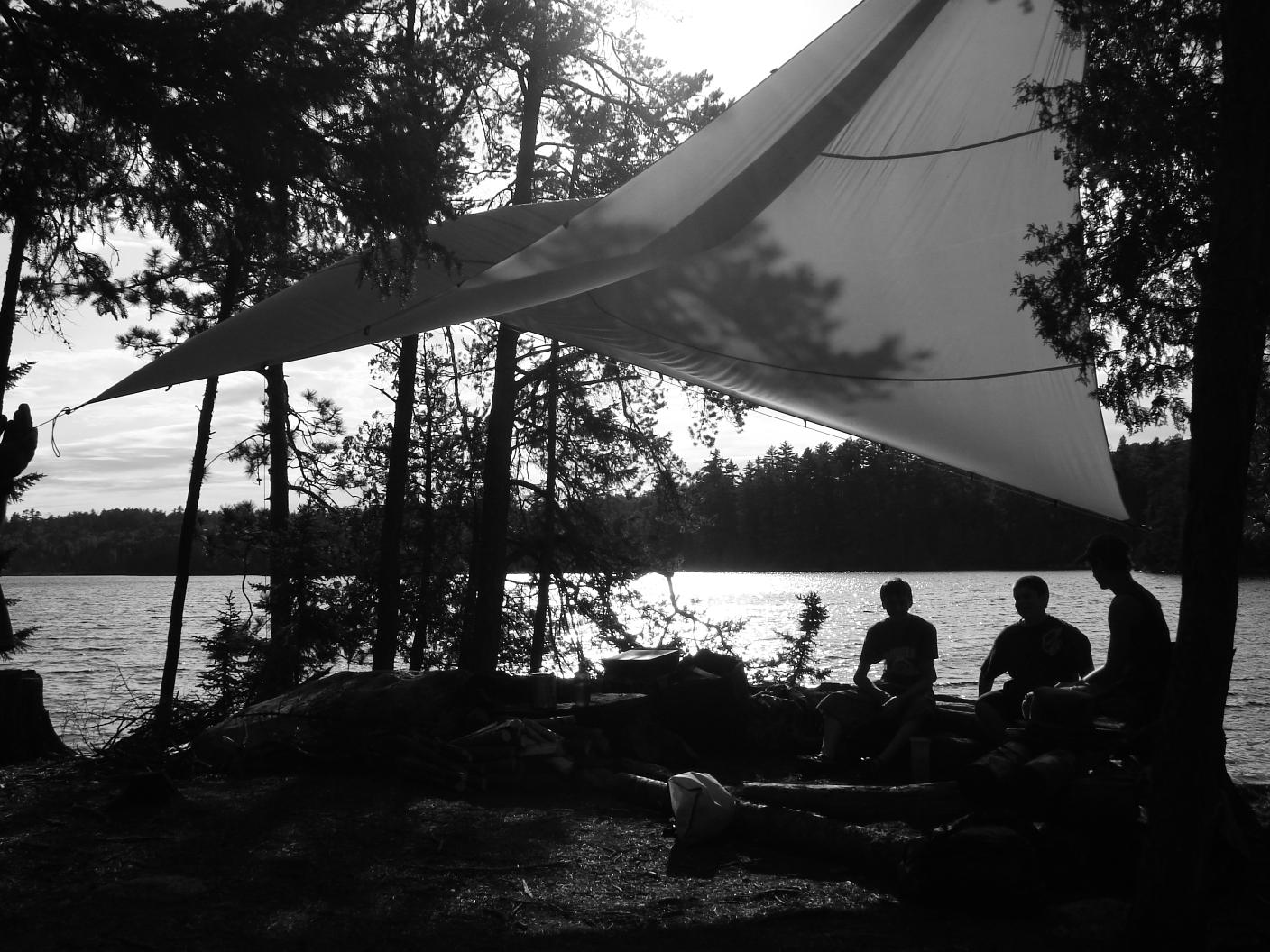
Hudson Lake

Hudson Lake

Insula Lake (Williamson Island)

Insula
*You'll notice foil on the fire grate in pic #1. We wanted to grill steaks and thought it would be a good idea to do this instead of putting directly on grill. Well the fire pretty much melted the foil. It's probably better to bring a type of grid of your own if you want to do any grilling.
"Life is not about finding yourself. Life is about creating yourself." --- George Bernard Shaw

05/17/2020 06:38PM
lincolnmurdoch: "What does a purple dot mean?"
I am wanting to know how you managed how to resurrect this ancient thread!! Good thing some of us are not running for a public office. The opposition could search and find a number of outlandish or inappropriate postings we have made. There goes that career.
05/17/2020 07:11PM
nctry: "lincolnmurdoch: "What does a purple dot mean?"
Where are you seeing a purple dot? Actual paper canoe map or the map on this website. Here you click on it and you may get information or a picture."
It's right there in this website's map legend: purple dot - Closed campsite. There are lots of them on this website's map pages, especially on larger lakes that used to have oodles more sites. Old paper maps will still show them with red dots; on newer maps, they've disappeared. I add them to my newer maps as a hollow circle; sometimes, they're fun areas to explore.
"You can observe a lot just by watching." -- Yogi Berra
05/17/2020 07:20PM
x2jmorris: "It looks like either it is a photo or an unrated camp site. I can't quite tell which one is purple."
Even the unrated camp sites still are marked on this site's maps as red. Photo locations are indicated with light blue dots.
"You can observe a lot just by watching." -- Yogi Berra

Subscribe to Thread
Become a member of the bwca.com community to subscribe to thread and get email updates when new posts are added. Sign up Here
Community Links
 Search BWCA.com
 Donate
 Featured Sponsor
