Quetico September 2009
by Ho Ho

About 5:00 in the morning a light rain started falling. We got up to put the fly on the tent and then crawled back in. The rain settled in for the next couple hours and we stayed in the tent, serenaded by loon calls echoing off the cliffs all around the lake. When we finally got up sometime after 7:00, it was still raining a bit off and on. We put the tarp up to make a dry zone in case of more serious precipitation -

The moisture brightened up the reindeer lichen -

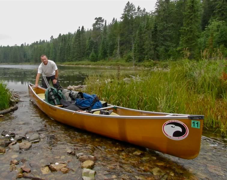
We took our time breaking camp, hoping the skies might clear, and finally shoved off around 10:40. There appear to be three routes to and from Blackstone Lake. The first is the portage from Bell Lake that we crossed yesterday. Second is a series of three portages form Slate Lake connecting to Saganagons. And then there's a route with several portages down what looked on the map to be a wide and marshy creek flowing from Blackstone to Saganagons, which, in an outpouring of creativity, we dubbed Blackstone Creek.
We like marshy creeks, so we opted to head for Saganagons over the last-named route, which begins at the northeastern tip of Blackstone Lake. But first we wanted to explore the western parts of the lake. Going that way we found one of the few places on our trip where we saw a browse line on the cedars -

We wondered if the browsing was from moose instead of deer. When I got home I poked around a little and found that moose do browse cedars sometimes, but in contrast to white-tails, they don't like it all that much. So who knows.
Continuing on our exploration, we followed the sinuous rock-lined passage to the long north-south bay at the west end of Blackstone Lake -

With the low clouds, wind, and sporadic precipitation, that back bay really felt like a remote and primitive region far from civilization. Which is exactly what it is. We decided Blackstone is a real gem of a lake. There were fire rings and primitive campsites scattered here and there on its shores. We wondered who built them, on a lake that can't see too much traffic and already has one really nice campsite.
Turning around, we made our way up to outlet at the northeast corner of the lake where Blackstone Creek begins. Along the way we also passed the terminus of the series of portages from Slate Lake. From what we could see from the water (which wasn't much), the Slate route looked better used than the routes we took in and out, though that may have been deceptive. We'll have to take the Slate portages on our next trip to Blackstone. Continuing now toward the creek, we got to the outlet of the lake and our first portage of the day at about noon. Looking back at green shores under grey skies -

Cliffs at the outlet -

Like many other portages on this trip, this one paralleled a burbling creek through a cedar glen. It seemed a little more trodden than the route in from Bell yesterday, but still didn't seem to see very much use. The put-in at the other end was kind of mucky and stinky. The creek opened into a wide expanse, and we were glad there was enough of water in it -

After a mile or so, this first wide part of Blackstone Creek ends in a shallow area with an old breached dam. Hopefully the sand and gravel won't erode too much with the breach and lower the water level upstream. I suppose we were agents of erosion when "floating" the canoe through -
A bit further and we came to another old overgrown dam -

We pulled over that one too, thinking the pull-overs would let us skip the portage in this section. But just after the second dam pictured above, we came to a screeching halt where the creek became impassable. We got out to look for a portage trail. The bottom here was made up of multicolored rubble a few inches below the clear yet tannic water -

We did not have much luck finding a trail. Maybe it started upstream before the lift-overs and passed further inland, or so we thought. But it seemed there was some kind of path on the south bank, and I started in that direction crashing through with the canoe. The "path" promptly disappeared, so then we bushwhacked along the creek to the other end, which fortunately was not too far. Our portage route -

We never did figure out where the real portage was in that area, but by the time we were done we suspected it might be on the other side of the creek. After carrying our gear through the woods, we continued down the broad creek with its grassy edges -

We really enjoyed this stretch of creek, twisting around to ever-changing vistas. Some places the shore was just marshy -

Other places it was rocky too -

Grass abstract -

At some point a skein of large waterfowl flew over us heading south. The white sky made it hard to get a good look, but we were pretty sure they were swans.
There were more beaver dams to pull over, some small -

Some a little bigger -

Right after we took the picture above, water started gushing through the spot we had just pulled over. Uh oh, had we breached the dam? But the moment we paddled away, a beaver was already on his way to make the repair. These interesting plants were right below the dam -

A little further downstream we came to the third portage of the day. We decided to skip lunch and snacked on some trail mix here. A bit of blue sky appeared, and it felt steamy when the sun poked out (the high this day was probably in the 60s). Looking back upstream from the portage landing -

This is as close as we got to seeing a moose this trip -

Fungus and Lichen -

Fungus and Lichen II -

Blackstone Creek coming through at the other end of the portage -

Below the portage the creek broadens out yet again. Thunder started rumbling in the distance as we shoved off, and it continued off and on all the way to Saganagons. The rumbling seemed far enough away that we felt like we didn't need to pull over, which was fortunate since there weren't really any good places for a long layover along the creek.
Eventually the marshy creek widened out into Unnamed Lake. The fourth and final portage of the day was at the outlet of Unnamed where Blackstone Creek continues on its way to Saganagons. There are cliffs on the south side of the creek at the upstream end of the portage at the outlet, and more cliffs on the north side of the creek on the downstream end, so the portage path crosses the creek in the middle -

Ancient Birch and Goofball -

Below that portage, Blackstone Creek widens out again and continues another half mile or so before emptying into Saganagons. This stretch was filled with water lilies -

Monet -

By the time we got to Saganagons, it was time to look for a campsite, especially with thunder still rumbling in the distance. I had marked two potential sites in the Saganagons bay where Blackstone Creek deposited us, one on each of two small islands right next to each other. We checked the first island and found a very small, simple, seldom-used but serviceable site. It would do, but we decided to check the other site too. As we started to paddle toward the other island, though, we could see a tent among the pines up on the second island's crest. People?!?
We decided to go back to the first island rather than look further, even though it wasn't the greatest site and we would have neighbors very close by. Thunder was still echoing from afar, and we didn't know what else we might find further afield. It was a little disappointing to come down Blackstone Creek to camp right next to other people. But truth be told, we barely saw them (it seemed to be a duo), and never heard them make a noise. So it was more a psychological intrusion than a real one. As it happened, they were the only people we saw between Bell Lake and the far end of Ottertrack over the course of almost four days.
It was 4:15 when we started setting up camp. We got the tent and tarp up first in case it started raining, then went for a swim. The site was simple, but cozy -

This shrub was on the small island's rock point. I had seen a few others like it earlier in the trip. Does anyone know what it is? -

The marshy backside of our little island camp -

Monet II -

The thunder died down, and after dinner we went for a paddle to the very tip of the bay to our south. We sat floating at the marshy edge down there as twilight fell, with a lone white-throat singing mournfully somewhere in the woods - a rare treat in September. Then we returned to camp and enjoyed a little Maker's Mark looking back toward the mouth of Blackstone Creek. The mosquitoes came out in some force, while bats swooped over the darkening water.
As we had on other nights this trip, we got in the tent about 9:00 and read a little before dozing off. We were awakened in the middle of the night by something bumping into the tent. We never figured out what it was. I woke up again somewhat later to hear a barred owl calling, then fell back to sleep till dawn.
 Donate - BWCA.com