The Wabakimi Project - The Ultimate Portage Clearing Trip!
by OneMatch
First, some bits of information about Wabakimi Provincial Park. It is over 4 million acres in size. That is twice the size of the BWCAW and Quetico combined. The park employs only 2 portage maintenance crews (2 men on each crew) to clear these trails. Considering the fact that we're not sure where most of those trails are, that is a daunting task for 4 men to accomplish. Wabakimi has no management plan in place (there is one scheduled to be publicized by September 2012). As a result, there are no can, bottle, motor or any other restrictions in place. There are many "fishing outpost" cabins spread throughout the park that outfitters have built for fisherman getaways and such, but no one person knows where they all are. In fact, our fly out pilot wasn’t aware of the one on the lake we took out on.
When Phil first started the project 7 years ago he had the blessings of the existing park superintendent. The new superintendent and Phil have not seen eye to eye, however, and this relationship has been the subject of some controversy. But I digress.
Phil Cotton has an amazing and efficient system for meeting his goals. He begins every season with his first crew (a crew of four - he and 3 others) taking the train (with gear and canoes in a special boxcar) out of Armstrong to Savant Lake and working his way to the first area that needs investigation. Every Wednesday of every week, Phil gets on his satellite phone (Iridium - very reliable, I found) and calls into his daughter and next door neighbor in Thunder Bay for a list of needed supplies to cover the next week. On Friday he first calls the float plane staff (Mattice Lake Outfitters) to find out their schedule for the next day and to also inform them of his location. He then calls Thunder Bay at 5:30pm to check to see if the new crew has arrived, tell them their flight departure time and any last minute details that may need to be covered. The new crew gets an orientation in Thunder Bay and loads up. Saturday they drive to the float plane dock (3 hrs from Thunder Bay), load their gear and supplies in the plane and take off to Phil’s location. When they land, they get off, the old crew gets in and a new week with a new crew is under way. It all seems to go very smoothly.
With that info in mind, me and a delightful couple from Strathroy, Ontario - Tetcy ( a Dutch name) and Ray - met for our orientation in Thunder Bay, had a get acquainted dinner there and took off for Wabakimi the next morning.
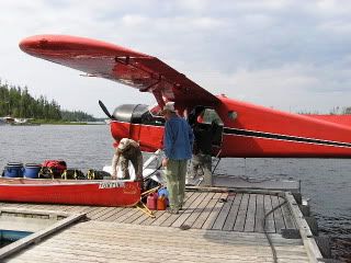
Here we are loading our float plane (a De Haviland Beaver) at the outfitters:
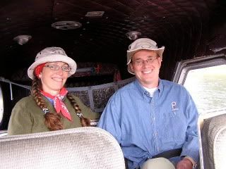
Tetcy and Ray had the back two seats, I sat next to the pilot:
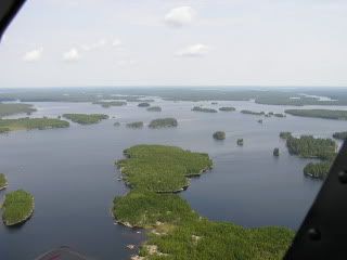
We take off promptly and see Wabakimi first from the air:
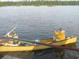
about 20 minutes later we land (very smoothly!) on Elf Lake – in the center of the park - and Phil and crew were paddling up to us before you know it:
Phil gives us another orientation – how the Sat phone works (I got to call my wife - got a voicemail!), camp layout and such.
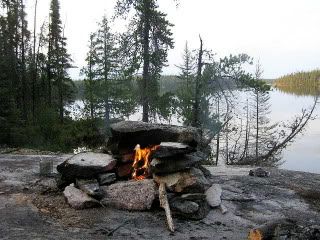
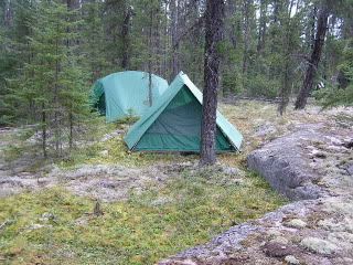
Here are some pics from our first site on Elf Lake:

Our tents were Eureka! 4 person tents so there was lots of space. Tetcy and Ray, of course had a tent and I shared with Phil:
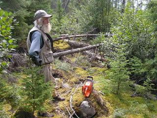
After a short lunch, Phil wasted no time putting us to work. A nearby trail had some blow down that needed clearing, so off we went:
The trail before cleaing:
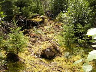
and after clearing:
We then headed back to camp for dinner, libations and set the plan for the next day. It seems there was a 650 meter trail that the previous crew had found and flagged and it was very much over blown with trees and shrubs and virtually impassable. Our job was to clear it and measure it.
 Donate - BWCA.com