Summer 2011 Quetico Solo
by OldGreyGoose
I had another Mountain House Pro-pack dinner – Sweet & Sour Pork – and it was very good. After supper I walked up and down the beach for about the fifteenth time, trying to loosen my aching back, then took another muscle relaxer. The sky was almost completely blue now, so I might not need the tarp. In fact, I t thought, maybe I’ll get to see some stars tonight with the tent pad not being back in the woods. It had gotten very warm and I could hardly drink enough to keep hydrated.
When the sun was “down” with respect to my area, I went to the sloped rock shore and had another wash from the waist up, then soaked my tank top and put it on. Very cooling! The three-canoe party across the way had paddled north, the dogs had stopped barking or gone away, and it was peaceful. I sat on the beach with a cigar in the shade while the other side of the channel was in full sun. As I smoked, the dragonflies began their evening ritual, with one intent on flying as close to me as possible, while schools of tiny minnows disturbed the surface in the shallows.
At 8 p.m. The barometer was 29.89/falling. Strangely, I had to replace the Samsung camera battery already. I decided to brush my teeth and hit the tent around 8:30, even though it was still light. I really needed to lie down comfortably and try to rest, if not sleep. Fortunately it was not too warm in the tent. I must have dozed for a bit lying on my bag/pad in just my boxers, then I woke up and it was still not dark but a couple stars were shining. Around midnight, I woke up again and through the tent mesh I could see a showcase of stars. Awesome!


Day 5: Around 4:15 a.m. I woke up and shut the tent fly to make it a little darker in the tent. It helped some, but I still was up “early” at six. Temperature was 16.1C./61F. It seemed cooler than any morning yet. Good. While retrieving my food stashes I almost stepped on one of the resident toads. Had a cup of hot tea and oatmeal with cranberries, walnuts and powdered milk. I was going to head down to West Bay today, but there was no hurry, so I leisurely packed the non-tent stuff and in the process noticed the three-canoe party departing.
I packed the tent stuff and now the sun was fully up so I was sweating already. A little after eight I left the beach campsite. I wanted to see where the First Nation couple had stopped yesterday, so I headed that way first. About a ¼-mile west of my site I found where they had stopped at an un-marked small beach site with a small old fireplace full of sand and two tent pads just off the beach. (Of course the beach would hold tents too.) I made note that this would be an okay spot.
Then I headed straight across the arm to the shore of the long east-west peninsula and paddled east along the shore to the end, rounded the end and paddled very close to the shore heading west again. (From this point on, I would be in unfamiliar water until I reached the narrows north of the Badwater portage.) It was a beautiful morning with only a little west breeze, my back felt good, and I was in tune with my surroundings.
I took a photograph of some yellow flowers that looked like gigantic dandelions, wondering if I could find them in Shan Walshe’s book when I got back to civilization. At a position along the peninsula where I was close to the island between it and the southern mainland, I angled southwest so that I met the island at its eastern end and then paddled west along its southern shore. Nearing the western end, I began smelling smoke, probably from a campfire. The breeze didn’t seem right for it to be from the campsite at the narrows, so I was kind of puzzled by that.
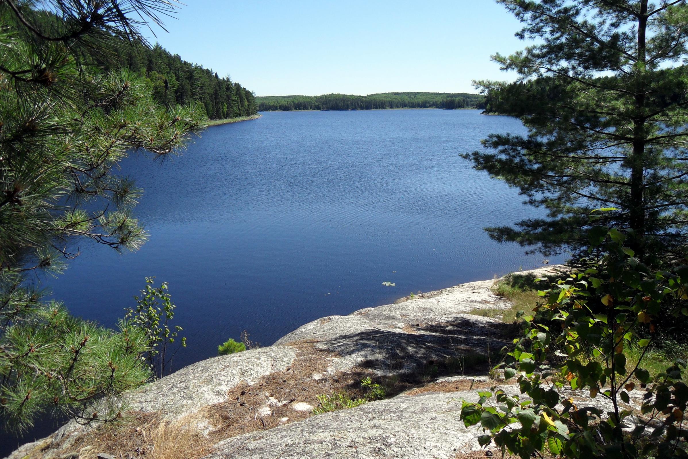
When I reached the west end of the island, which has a prominent sloping rock point, I saw a yellow tent back in the trees above the point. This is an un- marked campsite, so I made a mental note to try to check it out later. Turning south now, I approached the narrows and begun looking for signs of the site that sits up high on the left side. I could see no sign of a “landing” and could not remember where I had read it was and since I was wanting to camp closer to Sly Creek I did not investigate further.
The breeze was getting stronger now as I cleared the narrows, so I hugged the right shore, noticing how fertile looking it was in this area with a variety of water plants, more stained water and lots of minnows in the shallows. As I approached the (very) small island with the “1-star” campsite (PCD #532) I spotted an adult merganser and two young ones fishing. They didn’t seem bothered by me until I was very close, enabling me to get out the camera and take a photo. Farther along I saw a heron flying and another merganser, this one resting on a shore rock.
Going down the northern channel of the island that has two campsites, I wondered about getting drinking water from this shallow stained area, but decided it wasn’t worth worrying about now. As I approached the west end of the island, I wondered if both of the sites in this seldom-traveled area would be open. I rounded the end and saw that the first (#2V), which appeared to have some sort of table, was open. Paddling a short distance further, I could see the other (#2W) was also open, and paddled to it.
I had a hard time deciding where the landing was for this site, but finally decided on the main channel side where the slippery rocks and seemingly low water level made things interesting. Once I landed and walked up the slope to the elevated main area, I was pretty sure I wanted this one, but where to put the tent? I decided my two-man Kelty would fit perfectly on the only semi-flat place I could find, so it was decided. (I never did check out the other site and see how it compared, but this site was situated higher and I thought it might be breezier/less buggy.)
By early afternoon I was all settled in and this site already felt like “home,” perhaps because it reminded me of a couple of other sites I had liked. I could only find one small flat spot for my tent, and there was no soil to drive a stake into. There was a very old rope stuck in one tree, the fireplace was on a humpbacked rock and in need of an overhaul, but it had my two big priorities -- seating and shade -- one pair of logs even had flat rocks placed on top for nice level surfaces. Funny, it also had some Robins.
For lunch I made a pot of instant noodle soup and threw in some tuna. Then I figured out a tarp-hanging option and hung it, but hoped it wasn’t needed. I had cleaned my water filter’s screen and started treating some water collected in the deeper water nearby and by now had almost one gallon. My backache was worse again, so I found a shady spot and lay on my sleeping pad and did a little daydreaming, tree identifying, and watched the few clouds in the sky sailing on a strong breeze.
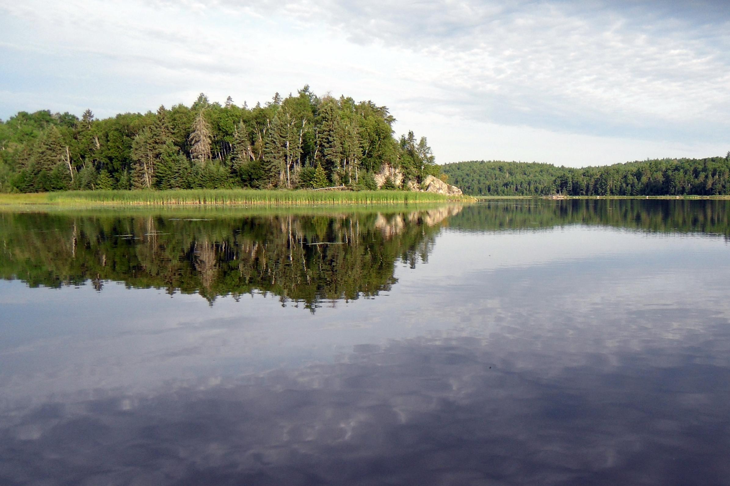
Later I aired out some things on a clothesline and went down to the shore for a wash. This site had no beach or any kind of easy bathing access like the other two. I had to settle for a squat-on-the-rocks “bath.” After washing I was marking some things on my map when a single loon appeared nearby. Some wispy fair-weather clouds were scooting by, and a second loon joined the first.
I ate a freeze-dried beef stew supper around 7 p.m. It was very bland and the meat and potatoes were tough and I wondered if they had not fully hydrated. A few flies and mosquitoes were pestering me as I took another back pill. Only six pills left now. I tried to sneak down and photograph the loons, but they were too far away for the compact. One of these days I’m going to get brave and bring the Canon EOS!
Despite my back I paddled out to fish near camp from 8-9 p.m. I used a frog- colored Pop-R and almost at once misconnected with what seemed to be a huge pike. Then as I was reeling in the lure, it charged up, and turned at the last moment, throwing water into the canoe and across my lap! Later I caught two pike -- one <20” and one >20,” and a 15” smallmouth, but no walleye. After paddling back to camp and securing the canoe, I had a cigar and a small drink, but no fire.
By this time it was getting hard to see and I had not put the fly on the tent. By the time I did that, brushed my teeth and got in the tent, it was 10 pm. For the first time on the trip I had to kill a few mosquitoes inside the tent. At bedtime the barometer was 30.01/falling; temperature 19.4C./67F. (Not too bad.) Today was a really good one! Tomorrow I hoped to explore the Sly Creek area. A couple hours later I awoke and lay and stargazed for a bit before falling asleep again. Awesome sky!


Day 6: 6:15 a.m.: Barometer 30.02/Temperature 15.5/60 It was clear and calm with some gray sky in the west as I had some Grape Nuts “plus” and hot tea. A little after seven I was on the water with my fishing gear, camera, a meal replacement bar and two pint bottles – one water, one “Koolaid.” I had thought to fish my way to the west, but a westerly breeze started up and I decided to just paddle leisurely down to where I hoped to find Sly Creek.
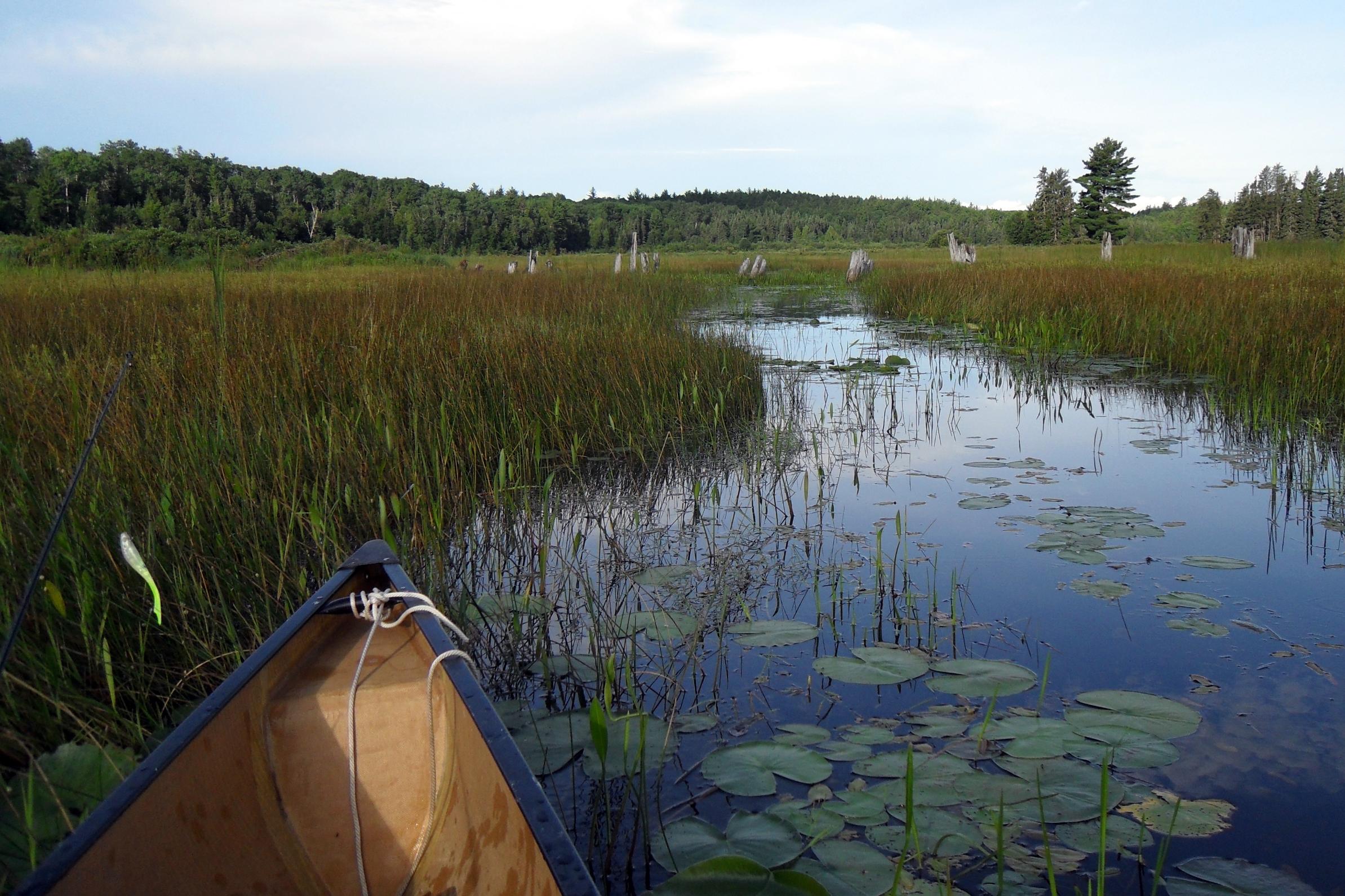
I saw a few more ducks on the way and when I reached the shallow bay “fed” by Sly Creek. It was very “weedy” with what looks similar to what we call “cane” back home and choked with water lilies and shields and what I would call coontail moss back home. Paddling into the “creek channel” (fairly open water through the weeds) was hard work at first, then easier, then after 200 yards or so much easier. (I assume this would vary considerably depending on the time of year and water levels, etc.)
At times the opening was three canoes wide, at times the canoe sides brushed against the vegetation and I could hardly paddle. I checked the water depth from time to time with my paddle and came up with 20” much of the time. I took my time and observed the variety of water plants, uncountable spider webs, and only occasional signs of animal water trails in this bog. I wondered when the last human had paddled here and how far I would be able to get.
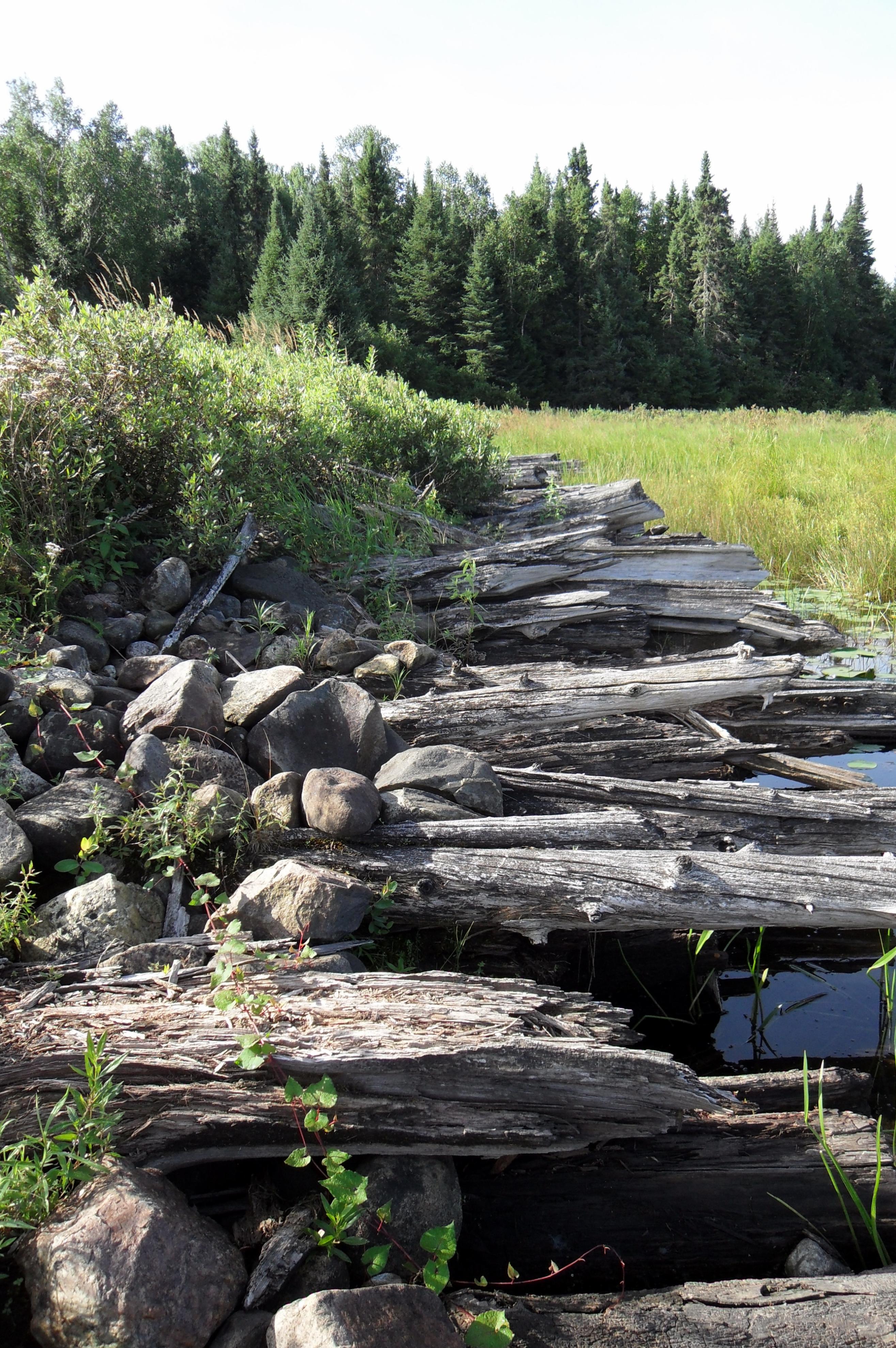
Before long I came to the remains of the old logging-days structure. I knew that logging had begun in this area in the late 1800’s and that from 1920 –1936 Shevlin-Clark had eleven lumber camps in the northwestern part of Quetico Park. I had seen the old log flume and other relics between Badwater and Omeme Lakes last year. This structure was certainly part of the old road from Beaverhouse that went south to the Bearpelt area. After passing this, I knew from my online research that if there was a way to paddle to a portage to Curtis Lake, I should see it soon on the left. I didn’t. So I continued west.
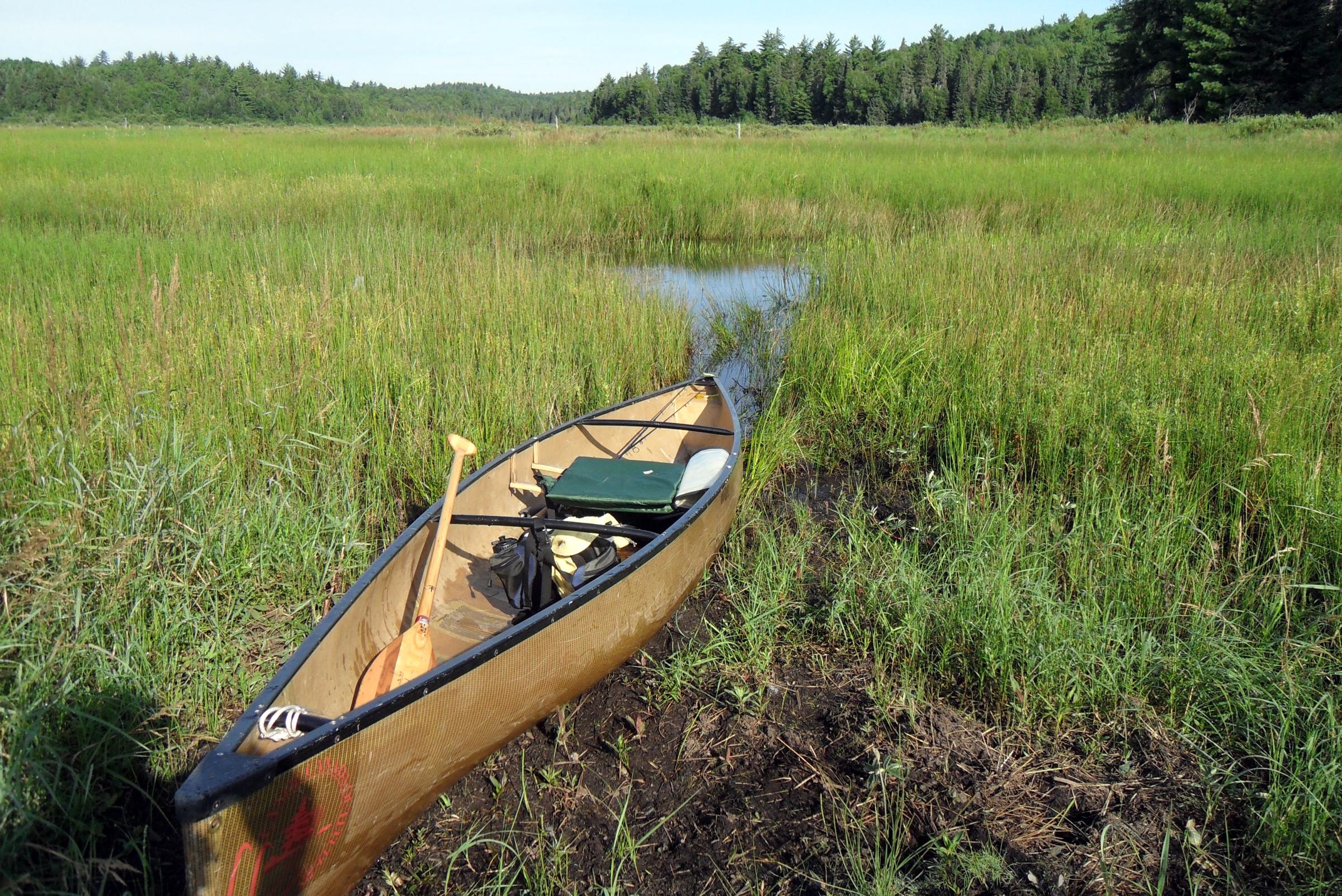
I was able to paddle on for a ways, making some twists and turns. At one point, I thought the channel had ended, but then I saw a sharp turn and it continued. Finally, however, I came to a point where there was no opening, just a continuing marsh with no visible way through. At this point, I stood in the canoe (it was practically “stuck” in the vegetation which I later identified as water horsetail) and took a photo. I was able to paddle/push the canoe backwards for perhaps forty yards to a spot where I could turn around. It was about 8:30 a.m.
I paddled back a little and noticed some solid looking “ground” that apparently was used by animals, and carefully got out on it for a stretch and a snack. I took a 360-degree video here. Getting back in the canoe I stepped into some knee-deep muck and brought some stinking mud into the canoe. When I had paddled back to the logging road structure, I got out and bushwhacked through the thistles, raspberry bushes, wildflowers, and other vegetation to an old “clearing” on solid ground. I hoped to find some relics or other logging remains, but it was so grown over that nothing was visible if anything was left.
After making my way back to the canoe and taking a few more photos, I paddled back out into the open waters of West Bay. I was disappointed that I could make it further up Sly Creek, or find Curtis Lake, but it had been very enjoyable trying! It was getting warm now and I was sweaty, so I dipped some water with my hat and splashed in over my head and upper body to cool off. Paddling towards the shore where a campsite was supposed to be, I scared up a baby duck that tried to fly but couldn’t get airborne. When reached the north shore, I saw a small fireplace on the rocks, but decided not to land and check it out. (PCD Site #2P)
I tried to fish the shore towards the east from this campsite, with no luck, and then an east breeze started blowing (Signifying rain, maybe?) so about 10:30 a.m. I decided to paddle around the east end of “my” island and maybe the breeze would aid me fishing from east to west heading back to camp. On the way I saw a flock of about eight ducks flying – teal, I think. About a half hour later I had made it around the end and spotted a small cove with a little bluff at the back on the south shore that looked “fishy.”
After a few casts with no results, I had a hit but misconnected. Then I saw what looked like a nice size walleye following the lure almost to the canoe. I made a cast to the previous spot and connected with a really nice fish. After a good battle I landed a 20” walleye! After this I landed two smallmouth – one 15”, one 12” – and lost another before I could boat it. After that I had a few hits but could not hook them. I figured they were small ones anyway. I stopped fishing for a bit to watch a mother merganser and her seven young ones fishing near the little bluff. By this time it was getting pretty warm so I decided to quit and paddle the short distance back to camp.
I left the cove and was letting the breeze push me along, when I spotted the merganser family again, up ahead on a shore rock. I tried to get my camera out without disturbing them when I heard a loon alarm call. Looking in that direction, I saw a bald eagle swoop down and hit the water with his talons and then fly to a treetop nearby. The mergansers bugged out to some nearby weeds, and my camera “froze” for some reason. The loon had dived to safety, I guess.) I put the camera away.
With the eagle threat over, the mergansers swam out of the weeds and climbed up on another rock. The young ones huddled so close to the momma that they blended right in with her. I paddled over to camp, tied up the canoe and washed the mud out of it and off my feet and legs, then started some water purifying and made some notes. At 1 p.m. I wrote, “Temperature 29C./84F., Barometer 29.12/falling, AWESOME MORNING!”
After eating some lunch near the fireplace, I noticed the merganser family fishing the shore across from me. Cool! Around 2 p.m. I lay in the shade for a while and black ants kept pestering me and the temperature was 94F. so I went down to shore and had a wash and soaked my tank top in the lake and put it on. Later when the fireplace was shaded I removed several gallon Ziploc bags full of ashes, but the rocks still needed some work. (Ashes had reached the top of the rock sides!)
Around 5:30 p.m. I had a supper of Chicken Teriyaki w/Rice. Very good! After supper – too early, probably – I decided to paddle back to the “honey hole” I had discovered this morning. At first the little cove was still in the sun, it was hot, the flies – not fish – were biting and I caught nothing. As the sun got lower I was able to get in the shade but still had no bites. Eventually I caught a 20” pike on a jig and fluke, then tried to catch something – anything – other than a pike before quitting, but finally gave up.
Around 7:30 I noticed the sky looking dark in the west so I started paddling back to camp. On the way I got some photos of the sky reflected on the water. (Changing the battery had fixed the earlier problem.) I did my nightly chores, had a smoke and drink and hit the tent beat, bearded, baggy-eyed. It was 78F. in the tent and felt warmer. I lay on top of my pad/bag and looked at my pictures on the camera, took a back pill and drank some water. Later I took a Benadryl and checked the barometer. It was falling from 29.04. The clouds would cancel any stargazing tonight.


Day 7: It started raining sometime after midnight and rained steadily well after daylight. I got out of the tent around 8 and got a granola bar and some water, then lay down and dozed off and on for a while. Around ten o’clock there were some water drops falling off the trees overhead, but it wasn’t really raining. When a little sun appeared to hit the tent, I got out for a look and decided it would probably clear up by midday.
I put on some water for tea and while waiting decided I’d pack up and paddle. (I thought: If it stayed cloudy it would be cooler while paddling, and if it rained, I kind of like paddling in the rain.) I was on the water heading north before noon. A short distance from camp along the shore of my island, the bald eagle startled me by flying from the trees nearby and sailing across to the other shore. When I looked into the trees where it came from I thought I saw a nest, but wasn’t certain. A white eagle feather lay on the ground near shore. (I hope to return here and check this out!)
As I paddled towards the “narrows” a light north breeze was in my face, but no problem. Once through the narrows though, the light breeze became a stiff breeze and I had to bear down and paddle hard for the first time in days for about a quarter mile or so. After that, as I headed for the peninsula portage into western Quetico the paddling was easier and I sat back into my backrest and enjoyed the rest of the way across West Bay. (By the way, I saw no one at the narrows campsite or on the unmarked island site and it had now been two days since seeing anyone.)
It was completely calm in the peninsula lee when I landed on the familiar sandy beach. I drank some water and headed over the sandy path through the narrow woods with my first load, not thinking about the wind on the other side. Wow! The beach was surf! I set my gear down and looked over the scene. No one was paddling and there was no sign of anyone at the nearest campsite on Eden Island or up or down the beach. I went back for the canoe and loose gear wondering if I would be able to paddle off the beach!
When I got back to the windy side with the canoe, I decided to carry it far down the beach to the west where it appeared the “surf” was a little weaker than at the portage. After that I came back and hauled the rest of the gear down there. Whew! This usually short portage was now the longest since the Beaverhouse parking lot. I rested there with the gear and ate some trail mix and drank some water. By then it was around 1 p.m. and I figured the wind was going to blow like this the rest of the afternoon, so I needed to go, or stay.
 Donate - BWCA.com