|
 Boundary Waters Quetico ForumTrip Planning ForumNumbered lakes
|
 Forum Sponsor

Author
Text
")

02/16/2019 07:34PM
Good evening all! Long time to speak. Any info on the numbered lakes? I took my first BWCA trip there years ago, but I haven't been back since the fire. How is it rebounding? There is an island on Lake 3 that I'm aiming for, and assume would have been safe from the fire, but just want any additional info that you all might have regarding the entire area. Thanks!!
"Once more unto the breach dear friends, once more."
Reply
Reply with Quote
Print
Top
Bottom
Previous
Next
02/18/2019 08:51AM
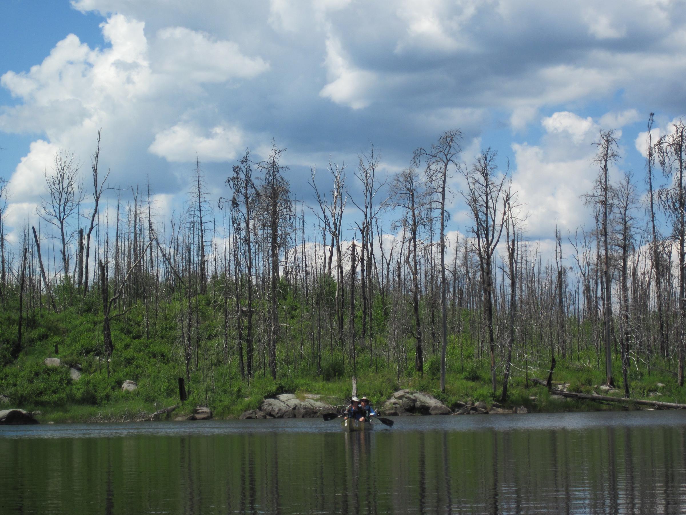
One of my favorite routes prior to the Pagami fire. I paddled thru 2 years ago, and the devastation is hard on the eyes for those of us with better memories. Others on the trip who had not seen it prior were impressed at the greenery of the low brush and grasses that have moved in amongst the burned out pine pillars. Berries are abundant. Campsites are few, and there is almost no shade. Interestingly, there are patches here and there on peninsulas, islands, and mainland that escaped the flames, and maybe your objective is one of these areas.
Despite the bleak appearance, plenty of signs of moose. Also a lot of paddlers as this continues to be a great way in to Insula and beyond.

Despite the bleak appearance, plenty of signs of moose. Also a lot of paddlers as this continues to be a great way in to Insula and beyond.


02/18/2019 09:30AM
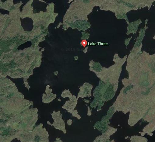
The islands in the south part of Lake 3 were burned. There were 2-3 sites spared on the big island (and small island) near the SE shore. Half that big island was burned, half not. The last update was 2013, but some of this info may help.
"What could happen?"
02/18/2019 05:17PM
We camp there burn or not. It is recovering right on schedule. Most of the camp sites on the north side of the lakes were spared by water dumps. They are still pretty good. The south side has a ways to go. I assume the island you spoke of is the one just to the left as you come through the 2-3 narrows. The island and the other sites in the narrows and on dowy the right shore of 3 are fine. The water dumps saved them.
02/18/2019 06:24PM
Using Google Maps (satellite view) you can get a good sense of what campsites have been affected. We passed through lake 3 last year, camped on the edge of 3/4, let me know if you want to talk specific spots.
Cheers,
Scott
Cheers,
Scott
02/19/2019 12:57PM
We surveyed most of the campsites on the south side of 3 last summer. Most are good campsites. One of them had very little shade left but most of them still had trees in the immediate vicinity of the campsite but just outside the campsite it was devastation. There was one campsite on a tiny island that was untouched and had some huge trees on it. It looked like a great site.
Reply
Reply with Quote
Print
Top
Bottom
Previous
Next

Subscribe to Thread
Become a member of the bwca.com community to subscribe to thread and get email updates when new posts are added. Sign up Here
Community Links
 Search BWCA.com
 Donate
 Featured Sponsor
