BWCA Entry Point, Route, and Trip Report Blog
June 30 2025
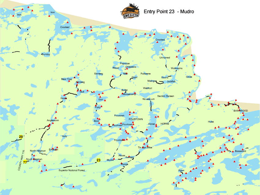
Entry Point 20 - Angleworm Lake
Number of Permits per Day: 2
Elevation: 1260 feet
Latitude: 48.0659
Longitude: -91.9303
Angleworm Lake - 20
Solo October 2016
Entry Date:
October 04, 2016
Entry Point:
Snowbank Lake
Number of Days:
6
Group Size:
1
Later, as I crossed Ima toward the Hatchet portage, I realized how tired I was -- 2 hours of sleep in the past 36. Camped at the first site I saw on Hatchet (No. 1908). It was a cool but sunny afternoon, and I set my new Helinox chair on a ledge and simply enjoyed being outdoors. I had encountered two other groups this day, and seen one other from afar.
Two other new items of equipment deserve mention. The Sawyer mini gravity filter, which I screwed directly onto an old, 1-liter pop bottle, was a wonderful way to stay hydrated with minimal fuss. I had read some concerns about the need to back-flush, I encountered no reduction in flow during six days. And storing my food in an Ursack/Opsack combo was much easier than hanging a pack. 
That changed as I threaded my way toward the Thomas-to-Fraser channel. It grew suddenly dark and the mist changed to sprinkles then heavy, cold rain in the course of a minute. Before I could pull out rain gear, I was soaked and there was an inch or two or water sloshing in the canoe. I was offshore from Campsite 1187, starting to shiver. Landed and set up the Kelty Noah's Tarp 9, put on dry clothes and rain gear. The Helinox came in handy again, as I sat and watched it rain for perhaps a couple of hours. Fired up the Whisperlite, made tea, and eventually made a hot meal. When the rain ended, I hung my wet traveling clothes and let the spotty sunshine and strong breeze dry them a bit before I packed and headed out. Paddled and portaged through Fraser to Sagus and Roe, then camped at No. 978 on Cap Lake.
The first portage out of Fraser made it clear I was heading off the beaten track. It was narrower and less trodden than the heavily used trails I'd been on so far. This intensified as I pushed on into the three-letter lakes. Although there were obvious portages, they were narrow, and as I carried I continually heard brush and branches scraping along the upturned hull. I saw one paddler on Thomas, but no others, and I spoke to no one this day.
With its bay-pocked shoreline and speckling of islands, Little Sag can be a navigational challenge, and degraded visibility was not helping. But rather than follow a safe course around the western shore, I opted to try a more-or-less straight shot toward the portages to Gabimichigami. This was a mistake, because I paddled almost straight east, rather than north-northeast, and quickly became disoriented among the bays and islands. I compounded this error when I finally took out my compass and, upon finding it at odds with my sense of direction, decided the compass was broken. Rain fell intermittently and it began to blow strongly out of the northwest as I bumbled around. I finally paddled past a campsite, pulled in to brew some tea, and decided it was unwise to proceed. As the day wore on, some sun finally showed and I was able to reckon up my position (campsite 821). Rattled by the weather and navigation errors, I didn't feel any will to push on. I pitched the tent and settled in.
This was a beautiful island site. Situated at a narrow neck, a 15- or 20-rod trail cuts across the island to a small bay with a sand beach. It is no doubt in high demand during the summer, but I saw no other paddlers this day.
I had chosen the closest campsite to the portage off Kekekabic, No. 1468, and it proved interesting. A small, slanted site, it offered just enough level area for me to pitched the tent. I also set up the tarp and then, in fading light, followed a short trail to the latrine. At one spot along that trail, a nearly perfectly square section of earth had been removed and set to the side. The hole was perhaps four inches deep, and I stared at it for awhile trying to figure the purpose. It did not appear any food waste had been buried, and in any case why would anyone dig such a perfectly square hole?
Not long after dawn clouds moved in, teasing me with occasional blue-sky breaks. Wind out of the southwest was in my face most of the day, and I felt real doubts about making it back to Snowbank before sunset. I rested and ate a quick lunch at the same Thomas campsite where I had sheltered on Wednesday, and reckoned the many portages and lakes still to go.
I had expected to see other paddlers, but my first glimpse didn't come until I was battling a headwind the length of Disappointment, where I saw three groups fishing from canoes. At the portage to Snowbank/Parent, I met a group of three outbound to fish on Thomas. One man told me they had used the direct portage from Snowbank to Disappointment, and that they had encountered three-foot waves on Snowbank. The wind hadn't seemed quite that strong, but I opted for carrying to Parent Lake, then portaging again to Snowbank to leave a short paddle across to the landing. Two trees were down on the carry from Disappointment to Snowbank, too tall to climb over with a canoe, and too low to go under. The portage out of Parent to Snowbank was a muddy mess, and I was running on fumes by the time I put my canoe in the water on Snowbank for the last, short paddle. The wind was not a problem, waves were small, and I was stacking my gear at the EP27 landing at least half an hour before sunset.
After a quick dinner in Ely, I headed for home, arriving just after midnight. On the long drive, I reckoned up some successes -- acquiring the Helinox chair and Sawyer filter, cooking freeze-dried dinners in freezer bags -- and some mistakes. I had packed for the forecast, but the weather had been considerably colder and wetter than expected. But above all, I had planned a relatively ambitious route without leaving enough time. My hurried pace on Saturday and Sunday had kept me from truly enjoying the experience.