BWCA Entry Point, Route, and Trip Report Blog
July 12 2025
Entry Point 9 - Little Indian Sioux River South

Number of Permits per Day: 1 permit every other day
Elevation: 1362 feet
Latitude: 48.1420
Longitude: -92.2079
Little Indian Sioux River South - 9
First Solo - Crane to Gunflint - September 2007
Entry Date:
September 07, 2007
Entry Point:
Little Vermilion Lake (Crane Lake)
Exit Point:
Magnetic Lake (57)
Number of Days:
6
Group Size:
1
The things I like about the BWCA are 1. time with Amy, 2. time with friends, 3. Hot days laying in the lake, 4. relaxing in the hammock, 5. fishing, 6. dawdling. I realized on my last day, that I had done NONE of those things. I wasn't having a lot of fun and I was in pretty rough shape physically. Time to go home.
I'm glad I did the trip, and even thought I didn't make it to Superior, and probably will never go solo again, I think I still accomplished a lot. Although I did wake up this morning thinking "I should have kept going." Easy to say after a night in a warm bed, a hot meal, and visit with your loved ones. I'm sure I made the right and safe decision.
Day 0, Thursday September 6, 2007, Chisago City – Babbitt I'm all packed up and ready to head out by 6pm. It's been a hot week, but a dramatic drop in temperatures and some rain is in the forecast for my trip. I prefer hot. Oh, well. I take a picture of my girls next to the canoe so that I can look at them in the camera if I get lonely. This later proves insufficient to quell my lack of affection for solitude. I hit the road, on the way stopping at my friend Tom's house, where he has been downloading detailed map data from his computer to his GPS, which I am borrowing. In spite of some technical glitches, solved with assistance of his able wife Robin, he gets the detail downloaded. THIS will later prove over and over again to be a great addition to my gear bag, a tremendous time saver on the lakes, and an amusing way to keep myself occupied as I try to keep myself on course out on the water. My other friend Tom has provided the other very expensive item of equipment for the trip: his Bell Magic solo canoe, a great boat that I name "Homer" due to the first letters of the serial number spelling out "DOH". During the course of the trip, every hint of rock scrape is accompanied by an audible "Sorry Tom" from yours truly. At 10pm, I hit Babbitt, where I am staying with Amy's dad, Chuck, and his partner, Carol. This is the day, of course, where the Ely area got around 10 inches of rain. So I arrive to no power…very dark. I have a flashlight, of course!
Day 1, Friday September 7, 2007, Babbitt-Ely-Crane Lake-Lac La Croix 20 miles traveled, 5:46 hours moving, 0:23 stopped, Moving avg. 3.4 mph, Overall avg. 3.2 mpg Lakes: Loon Lake, Lac La Croix Portages: 60 r. Beatty Portage
Day 1 starts out as day zero ended: dreary and overcast, but with me filled with hope and anticipation about the journey that lies ahead. I wake up pretty early, but without much need, as we have until noon to get to Crane Lake to meet my shuttle boat captain at Anderson Outfitters, who will take me across Crane and down the Little Vermillion River on the first leg of my trip. We hit the ranger station in Ely at 8am to get my permit, with a quick stop to pick up a bailing sponge (another great late addition to my equipment set). I left the bailing sponge on the floor in front of me (attached by a strap so I can tug it back to squeeze it out, and so that it hangs on portages) so the splash as I switch sides with my paddle gets absorbed by the sponge without drifting aft to get my feet wet. We head up the Echo Trail and are at Crane by about 10am. They drive me down to the landing, and I unload my gear and wait for the group of 5 that are heading into the Quetico that I am piggybacking with, which allows Mark at Anderson to give me a better rate on the boat ride. I have to wait rather than going early, but I saved a lot of $$$ American. 
One note on the shuttle: I chose to bypass paddling the Little Vermillion after a couple of outfitters and several books told me that it can be rough waters for a canoe given the narrowness of the river and the speed at which the motorized boats run the river. After riding in a motorized boat down the river, I am glad I made the choice. It is very narrow, and these guys are running big aluminum boats with 225 horse outboards on them. I pulled out the GPS at one point and we were doing 40mph…around a corner! Anyway, the shuttle ride itself was worth the price of admission!
The guys I am riding with show up at 11am, and man are they packed heavy! We laugh about my load compared to theirs, but they will have more drinking and fishing choices than I do. They are a good crew, most from Kentucky with one transplanted to MN, and everything gets loaded and we are at customs on Crane Lake by 12:10. After doing what has to be done, we head up river. By 1pm, we are at and over the motorized portage at Loon Falls, which is where I get off. I pack some of my clothes, as I started the day in a long john top and a t-shirt and my fleece jacket, and by this time am down to the t-shirt.
Heading across Loon Lake, I'm struck a bit by what I'm doing. All alone, heading into the wilderness with all this mileage spread out in front of me. I'm pretty delighted to have a sunny warm day to start, and really am enjoying the paddle. I am mostly using my bent shaft Bending Branches paddle, but I have a Bending Branches kayak paddle that I will try out as well, on the theory that I will make better time with it. Going across Loon, I see one more tow boat, empty, coming back from Lac La Croix, otherwise nothing. This looks like a nice little lake to hang out on, but I'm moving on.
I hit the Beatty portage, my first chance to see how single portaging is going to be. This is only a 60 rod portage, and it looks like you are hiking across someone's lawn as you walk next to the rails for the mechanized portage, so this is a good one to break myself in on. I seem to be exerting myself a little more than I expected I would, but figure it's because this is the first portage. I unload and head north onto Lac La Croix, right into a headwind. Not a lot of chop, so it can't be that strong of a wind, but enough to impede my progress a bit, although later I figured out I was averaging about 3.5 mph into the wind, so not too bad. One weird part about this part of Lac La Croix is all the cabins on the Canadian side. Very strange to see. Some nice cliffs on this side of Lac La Croix (I have only been on the east end before), which has always been one of my favorite lakes. Heading past Sandbar Island, which looks pretty cool, I am passed by Mark from Anderson's, heading home after dropping off the Kentuckians.
By now the sky is pretty well overcast, and I've got my rain jacket ready to go, just in case. For this trip, I've finally bought some good rain gear, so I am, in a perverse way, looking forward to a little rain to try it out on! After going around the corner and making the turn to the east, I get my chance. As I'm cruising through the mishmash of islands around Fortyone Island (and thanks again to Tom for the use of the GPS), I get hit by a real heavy rainstorm, at right around 5 pm. I'm in a protected channel, but as far as I can see, the lake is calm except for the froth thrown up by the raindrops hammering down. Since its calm, I keep moving, but I figure if things keep up, I'll look for a campsite around here, otherwise, I'll scoot the gap to Twentyfive Island and camp on that end.
By 6 pm, the rain has stopped, and I get a nice rainbow. There's a distinct line behind the storms, and I can tell from the blue sky that it should be a nice evening.

Storm Line on Lac La Croix 
I press on, and decide that, given what I know about Lac La Croix, a morE PROTECTED ROUTE MIGht be beneficial in the morning, so I make plans to head down the western end of Coleman Island, so I'll be protected in the case of winds in the morning. I find a campsite at around 6:30 pm before I head into the narrows, with a nice high (20-25 foot) fire grate looking south into the western narrows of Coleman. Setting up camp is pretty straightforward: I have a 10x10 nylon tarp I throw up, and then put the entrance to my tent under that, so I've got a dry "porch" area in case of rain. Then I find a branch to hoist my food up to after eating, to keep it from the bears. I've packed all my food in a separate clear dry sack, so that I can hoist it without worrying about it getting wet. During the day, the clear sack goes into my duluth pack behind my seat. I did try putting the clear food sack into the front of the canoe one day for trimming purposes, but noticed no difference, so it stayed in the duluth pack the rest of the trip.
Supper is a dehydrated Spicy Thai Chicken. I am transported into the back streets of Bangkok as I munch the soupy mess I've made, but then the cry of a couple wrangling loons out front of camp brings me back to the good old BWCA, and the realization that this is not really Thai tasting, or spicy, and I don't see much chicken.
I think it's around this time, after camp is set up, that I begin to realize that being alone can be lonely. I obviously knew that I was going to be alone, but I guess I didn't realize what it would be like until I actually experienced it (which, obviously, is one of the reasons for doing this type of trip). I'm looking at the GPS, and in my effort to save memory (or something) I accidentally delete the "track" I left today by leaving the GPS on during my travels. Oops. Tired, I hit the hay at dusk and set the alarm for 6am.
Camp on Lac La Croix 

Day 2, Saturday September 8, 2007, Lac La Croix-Basswood River 31 miles traveled, 8:54 moving, 1:34 stopped, Moving avg. 3.5 mph, Overall avg. 2.9 mpg Lakes: Lac La Croix, Bottle, Iron, Crooked Portages: 80 r. Bottle Portage, 140 r. Curtain Falls Portage
Sunrise on Lac La Croix: 
I wake to fairly clear skies on Saturday morning, and relatively warm temps. I've had a bit of rain overnight, so everything is damp. Breakfast is oatmeal. Yesterday, I made the mistake of not packing lunch into my day pack, so I remember to do that today so that I don't have to dig around in the food pack during the day. I am eating Clif energy bars and GORP for lunches, so I take my pick of flavors, and grab 2 Crystal Light single serve drink mixes and put those in my day pack. For water, I have a 32 oz. Nalgene bottle that I fill whenever I'm thirsty, that takes 2 of the single use drink mixes to flavor (I prefer the strawberry energy ones during the day and peach tea or lemonade in the evening). When I get set to stop at my campsite, I also fill a 2 liter collapsible platypus jug so that I have all my meal and drinking water needs taken care of without having to take the canoe out again in the morning. I have brought a filter this trip, just in case I get stuck on a river or somewhere I'm not willing to drink water straight. But, I've been drinking unfiltered lake water for 25 years and never had an issue, so my basic plan is to keep the filter stowed.
Panoramic photo looking up the pictograph cliff: 
Heading out, I move south around Coleman Island and east through Fish Stake narrows. I am a bit disappointed not to see the fish stake (whatever that is), but what the heck, you can't have everything. Straight east and a bit south of the narrows "pictographs" are noted on my map. I head toward a grouping of them and find them, as advertised, at the base of spectacular cliff. It is a pretty amazing experience to sit here and try to picture people painting this stuff on the cliff walls and having it last so long. There is a beautiful moose, very clear, and some other images that might also be moose, and maybe a canoe. There are also a lot of very clear handprints, some of which seem to be ten to twelve feet off the water surface. Now, granted, the water was most certainly much higher than it is now, but I kept having this image of one person sitting on another's shoulders while making handprints! Everyone pretty much acknowledges the importance of these paintings in native culture, but I started thinking "What if these pictographs are just graffiti?" I mean, maybe instead of tagging a rail car, native teens headed out and marked up the cliff walls. Then the elders would have to jump on them about being irresponsible and wrecking the earth and stuff, so that's why there aren't many of them. Maybe not.
Pictographs: %2Ejpg&name=TripReport">


I head out and curve around toward the east at the base of Warrior Hill. My first trip to the BWCA was in 1981 or so, and we traveled to Lac La Croix. I remember visiting warrior hill, Curtain Falls and Rebecca Falls. Our honeymoon, in 1991, was to Lac La Croix, and Amy and I stayed on the island to the south of Warrior Hill that we call Professor's Island, so this area is pretty sweet for me. It brings back lots of good memories. On this trip, being alone, it makes me a little wistful as well. I see someone camping on the north end of Professor's island, a canoe heading toward warrior hill, and I saw a boat with people fishing off the pictographs. These will be the only people sightings I have today, until the very end of my day.
That's one of the strange parts of this trip for me. Even in the BWCA, I'm used to seeing people, and because I'm not usually alone up here, I'm usually interacting with people. Also, I have a pretty outgoing personality, so being able to chat and laugh is a big part of who I am. This forced deprivation of human contact is hard for me, and I suspect that as the days go on, I will be latching on to people at portages and who are passing me by on the water to talk their ears off.
Next stop is the bottle portage. I have only done this portage two other times, and both were years ago, so I don't really remember what its like. I do remember hearing that it’s a muddy portage, but I'm hoping that our dry weather will have tamed that a bit. I unload at the beginning of the portage, get everything ready to pack over in one trip. Again, I'm a bit uncomfortable with the load as I head over the portage. About halfway across, after fighting to get the front of the canoe up, I realize that my pack is hitting the seat, which is right behind the yoke, and forcing the canoe into an uncomfortable position on my neck, and making me shift over and over to try to get the balance right. Not realizing I'm twenty or so yards from the end of the portage, I finally give up and lay the canoe down.
My first glimpse of the Bottle end of the portage is not encouraging. It looks like a giant mud flat. As I look closer, I realize that there are footprints going out 20-30 yards in the muck, where people have had to set their canoes down and shove everything out while walking through the mud since they can't float on the mud. There's also an abandoned flipflop out in the mud, 20 feet from shore, bearing silent testimony to the cruelty of a muddy portage. I imagine a teenager ('cause who else would be wearing a flipflop on a portage) limping down a portage trail with one flat tire, bemoaning the loss of that blue flipflop.
The portage itself WAS relatively dry, but the downside to our dry summer is obvious here at the landing. While walking back to get the canoe, I'm trying to think of an alternative to the mud walk. With the canoe, I head down the shore and find a spot where there are some rocks heading out through the muck. Then, I load the canoe and, holding the rope tied to the front of the canoe, I jump from rock to rock, skimming the canoe along the 2 inches of water on top of the muck. Amazingly, the technique works, and I am able to tug the canoe out to deep enough water to get in without every dipping my tootsies in the brown snot that lines the lakeshore.
End of Bottle Portage: 
Pleased with myself and happy to not have muddy feet, I head down Bottle Lake to the opening into Iron. As I'm paddling toward where the opening SHOULD be, I start thinking "I don't remember this rocky area!" Of course, another casualty of the low water this year is the opening between Bottle and Iron Lakes. Once I get close, I realize that there's about a 3 foot wide, 6 inch deep "stream" flowing through the jumble of boulders. So, I hop out and walk along the boulders, pulling the canoe through the little stream. Thankfully, there isn't much scraping, but I can't imagine getting through here even a couple days ago when the water was even lower.
"Opening" between Bottle and Iron Lakes
I have a west wind today, which works out to be a nice tailwind as I head across Iron Lake. I'm taking the northern route around Four Island, so that I can scoot up and see Rebecca Falls on my way through. Rebecca is a twin falls around an island, which requires you to paddle across the top of the falls. This sounds more dangerous than it actually is, given how big the lake is above the falls. I remember my first trip here, paddling with all my might after my older brother and his friends told us we would get sucked down the falls with any false move! Obviously, you can get sucked down the falls, but it would take a series of very stupid moves to have that happen. Rebecca is a little low, which you can tell more on the east side than the west, but not as low as I've seen it on other trips. The west side churns like crazy, but I decide not to sit in the whirlpool, given I'm all by myself with no one to help if I lose my footing. After a few pictures and some GORP and the energy bar for lunch, I'm on my way again.
Rebecca Fallarget="_blank" href="index.cfm?fuseaction=photos.display&img=gc428%2D210907%2D110512%2Ejpg&name=TripReport">s
Next stop, Curtain Falls portage. I have never portaged this falls, only walked up the trail for fishing and picture taking. I've stood on the top, staring up Crooked Lake, feeling like I was on the edge of a vast unexplored territory, so finally heading into the lake will actually be pretty exciting. But first, find the portage. I can see the portage trail, but there's an island with rapids on either side of it between me and shore. I'm not 100% sure which way to go, so I head left of the island. I think, looking back, that this is the wrong choice. Or maybe it's just that I'm paddling alone, but I can't seem to get up enough steam to get through the faster water. So, once again, I hop out and line the canoe through the faster water.
I've been thinking about portaging technique, and deciding that until my pack gets smaller, or I figure something out, I'm going to have to double portage. I was thinking that I could make the 40-60 rod portages single packing, but then, those are the ones that are short enough where it doesn't take much time to go back and double portage. So, I've pretty much decided that in all cases, double portaging will be the way to go. I'm feeling a little dread about the Grand Portage, which lay ahead of me, thinking about walking 27 miles in a double portage. I worry about that one the whole time I'm paddling, thinking of various solutions. Ultimately (SPOILER ALERT), I don't have to worry about it, in that I don't make it that far!
Curtain portage is a bit steep at the beginning, but it's really a nice trail and a relatively easy portage to pull off. And the view once you finished is awesome. Curtain Falls is gorgeous, and everything I remembered it to be. It isn't flowing at full capacity, but it hasn't dried up enough to walk all the way across, either. I again take the time to snap a few pictures and hang out a little bit, but the call of Crooked Lake is beckoning, so I head out.
Curtain Falls:
Ultimately, Crooked is a little disappointing, in that I've had expectations over the years about what might lie around that particular bend. In reality, it's not a particularly spectacular lake, but again, its fun to see what's around the next corner. I am surprised at the great number of sand beaches I see on Crooked, though. I make pretty good time with a tailwind across Crooked, passing Sunday, Saturday, Friday and Thursday bay without seeing a soul, either in canoe or at camp. At one point, a flock of around 100 Canada Geese honks their way overhead. They are a pretty spectacular sight!
Just as I turn south into Wednesday Bay, I pass two guys in a canoe, and chat for just a second. They let me know that the "Table Rock" campsite is the only one taken until Basswood Falls, and I let them know that they're the only people I've seen since Lac La Croix. Hooking through Wednesday Bay at around 5:30pm, the folks at the Table Rock site offer to share if I need, but I'm sure I have enough time to work my way down into the Basswood River to one of the sites there. "Be safe," shouts one of the guys as I head down the river. I get that a lot when I talk to people. It's nice to have a little bit of a feeling like others are watching out for you and care about your survival. On the safety front, it makes you, as a solo canoeist feel not so alone out there.
Around 6pm, I start getting sprinkled on, so I aim for the campsite on Crooked Lake (or the Basswood River, the GPS and the map are fighting about what to call the body of water I'm on) that sits in the narrows straight east of Frolic Lake. I have developed Traveling Guideline #1: Always aim to stop at a spot with at least 2 campsites nearby, that way you can (at this time of year) assume that at least one will be open and you will be able to stop without ENDANGERING YOURSELF (foreshadow). The camp is a neat little spot, with a nice view across the channel of some pine-studded hills. Everything goes up quickly and I enjoy a hot meal. Tonight is dehydrated chicken gumbo, which is actually spicy and pretty flavorful. And tonight, in an effort to NOT wipe out the GPS record of my day, I try saving my track. Someone it doesn't work, and thinking I've saved it, I delete it from the active memory, which apparently deletes it entirely. Oops again. Early to bed gets me ready to rise early. Cloudy again tonight.


 At the top of Rebecca Falls


Day 3, Sunday September 9, 2007, Basswood River-Knife Lake 30 miles traveled, 9:00 moving, 2:55 stopped, Moving avg. 3.4 mph, Overall avg. 2.6 mpg Lakes: Basswood River, Basswood Lake, Birch Lake, Carp Lake, Melon Lake, Portage Lake, Knife Lake Portages: 33 r. Lower Basswood Falls, 50 r. Wheelbarrow Falls, 30 r. rapids, 340 r. Basswood Falls, 20 r. Prairie Portage (Canadian side), 40 r. Birch-Carp, 25 r. Carp-Melon, 15 r. Carp portage, 15 r. portage, 75 r. Big Knife Portage
After covering 30 miles yesterday, and being pretty worn out, I've decided that I'm going to try to get across Basswood today and knock off a little early. But, you know what they say about the best intentions.
The day starts out pretty overcast again. This is getting kind of old! However, I have hope when I spot some little bits of blue up in the clouds. I'm taken with this end of Crooked, and impressed with some of the cliffs here:

I head downriver (actually upriver, I guess, but going south) and soon spot the Lower Basswood Falls portage on the Canadian side. There's a group camped on the American side, in what looks like a nice campsite for listening to the rushing water. This portage isn't particularly difficult, it’s a little narrow in spots, and it heads through what looks like a giant Quetico campsite. I'd be surprised if anyone would actually camp there, in that its RIGHT on the portage trail. Maybe it gets used a lot for lunch. On the east end of the portage, there's a portion that goes along a large rock that kind of has a high road and a low road. The low road is a little too close to the drop to the falls for my comfort, so I stick to the high road. I snap some pictures, and then it's off the sand beach and heading further up.
Lower Basswood Falls: 
My next stop is the Wheelbarrow Falls. This is another twin falls around an island, but not as spectacular as Rebecca Falls.
Wheelbarrow Falls: 
For this portage, there's a choice of going up 50 rods to the left of the falls on the American side or 32 rods on the Canadian side. If you choose the Canadian side, you get a slightly shorter portage, but have to paddle around the island to end up at the same point you end up if you take the American side portage. For that reason, and the general idea I've heard that the Canadian portages are not as well maintained, I head across the 50 rod. Its pretty rocky at the bottom and the top, and the top ends pretty far up from the top of the falls. There are quite a few places people have exited (or entered) the portage early, but I head to the end, hoping for a less rocky landing. It is less rocky there, but not by much. Oh well.
The next portage is a 30 rod around some rapids downstream from the main Basswood Falls. It was hard for me to figure out where the portage was until I got right up to it. Then I realized it is right on a big rock shelf at the bottom of the rapids. Again the portage was pretty easy, heading up a bit of a cliff face and then across a lot of big flat rock to the top. There's a campsite there with a nice pile of cut and split wood, but its not even noon yet, so I'm not ready to stop! Not to mention that the campsite is only twenty yards or so from the portage…my least favorite location for a campsite.
Just around the bend from this portage, I spot the first of many groups I will see around the main Basswood Falls. I suspect that this must be an extremely busy area for camping during the peak months, as this is the highest concentration of people I have yet to see while paddling up here.
The portage itself starts at a large rock that you have to climb up, and then heads on a pretty level path for the mile it takes to get through it. There are several places where people have beat down pretty good trails to see the falls, and there are logs laid over several wrong turns on the portage path. One spot in particular, where you hit a big expanse of open rock just as the portage trail takes a 90 degree turn to the right, is marked by a log and several rock cairns to keep you on track. Very helpful! There is also a part of the portage that crosses a stream from a swamp. This area has pretty good water in it, but is traversed by a well made path of stones you can walk across.
The falls themselves weren't the best ones I'd seen, but they were definitely large. It looked, too, as if most of the campsites were taken on the point in the middle of the falls. I saw half a dozen canoes pulled up at the Basswood Lake end of the portage trail, which made me wonder if you had to portage all your stuff out to those campsite that are between the beginning and the end of the portage trail. Also found a disposable camera in a foot of water on the Basswood Lake end of the portage. I put it on a rock, but I suspect that the pictures were in pretty rough shape after sitting in the water!
Basswood Falls: 


Basswood Falls Portage: (Cairns) 
(Stream with Rock Bridge) 
I then headed northeast toward United State point, with a tailwind. I wasn't hampered, either, as I turned South to head down the lake toward Canadian point, as much of the direct wind was stopped by U.S. point. To save a little time, I cut through the English Channel along the north end of Ottawa Island, and then hooked around the south side of Rookery Island. It was about 2pm, and the sun had come out at the beginning of Basswood, so I was down to shorts and my PFD, and really enjoying the day. On a whim, as I was having a snack just south of Rookery, I pulled out my cell phone. Amazingly, I had coverage! So, I dialed up Amy to tell her hello, and give her an update on my much quicker than expected progress. The girls were updating the map I left them, and I was chatting away merrily when the signal disappeared. Ah, well, a few moments of conversational bliss and a little peace of mind for Amy was well worth the "intrusion" of technology into my wilderness trip.
My trip across the bulk of Basswood was pretty uneventful. No one shot at me, for starters. I saw one group camped off Canadian point, and one group traveling that way, as well as three or four motor boats out fishing, but other than that, not much. As I headed up to Prairie Portage, I decided that I would take the shorter 20 rod portage on the Canadian side. This portage was right off the main beach by the Canadian customs area and the store that is there, and was well groomed and pretty easy. After dropping off the pack, I headed back down, but took a bit of a detour on another well-used trail, thinking I was heading back down the portage. Turned out it was the path to an outhouse! What luxury! Unfortunately, I had no use for it at the moment, and my opportunity to experience indoor plumbing (so to speak) was squandered.
Coming off the Prairie Portage at around 4:30pm, its interesting to note the large tube in the water which carries water around the spillway for use, I assume, by the Canadian Rangers for generating power. It is also interesting to note the large spillway dam at Prairie Portage. I'm very curious about the history of that dam, and look forward to finding out how it got there! There were a couple boats just coming off the motorized portage as I head out, and as a courtesy, they travel slowly past me before heading home. Sometimes slow creates a bigger wake than fast, however, and I have to turn into their wakes to make sure I don't get swamped.
Prairie Portage Dam 
Then I'm off to Birch Lake. Pretty much the whole time I'm on Birch Lake, I'm kind of creeped out. You can see the bones of a lot of trees that have been submerged by the dam at Prairie Portage. Going over them made me feel like walking in a graveyard. I know, weird. But I'm weird, so get over it. The other odd thing was how the rising water had taken a lot of the definition away from the shores of the lake. It seemed as if the lake was just a mishmash of trees right down to the water's edge. Regardless of this fact, in line with Traveling Guideline #1, I am aiming for the last bay of Birch Lake which has not two, but THREE campsites for my choosing pleasure, and will leave all the portaging into Knife Lake for when I'm fresh in the morning, NOT LATE AT NIGHT (foreshadow). On Birch, I've passed 3 occupied campsites, a MUCH higher ratio of occupied to unoccupied campsites than I have seen anywhere else on my trip (additional foreshadow).
By the looks of the campsites on my map, the third one is along some close topographic lines, indicating that it may well be up on a hill, which is my favorite kind of site. I head into the bay, noting that the first one is kind of dumpy…low, open, not the best. The second one looks nice and high, but as I get close, I realize there's a tent on it. Ok, well, I'll head for the third one. I'm scooting down the lake, when I realize that the third site is actually pretty close after the second one. Thinking that I'd rather not impede on someone else's wilderness experience by horning in on their space in this less traveled time of year, I decide to take the 40 rod portage into Carp Lake. This despite the fact that its now somewhere around 6pm, and I am violating my travel guidelines in heading into a lake that only has one campsite. But, what are the odds someone will stop on Carp Lake? I mean, it’s a crappy lake name, and there are nicer lakes (Knife and Birch) on either side of it. Of course, I make this rational determination after having only seen one of the three lakes in question.
ANYWAY, here comes the drama. I cross the portage into Carp, which isn't very dramatic. It's pretty short, sweet and level, with good landings on either end. I head to the peninsula where the campsite is located. At the point of the peninsula is a beautiful little camping spot! I head in, jump out of the canoe and check it out. Of course, given the lack of fire grate and the rock fire ring next to a big rock ledge, I rapidly conclude that this is not, in fact, the campsite. Although it should be! So I head back into the canoe down the peninsula, which looks totally deserted. Until I get close and see the dude in his blue rain gear putting up a tent. Dang. So now, the question is, do I head back to one of the open campsites? Do I camp on the illegal bivouac at the end of the peninsula, or do I head for Knife Lake? Since I don't want to go BACKWARD, and I don't want to camp illegally, and I have at least an hour of sunlight left, I foolishly decide to head across the 4 portages and 3 miles of paddling onto Knife Lake. Duh.
The first couple portages are pretty easy: short and flat and quick. Then I head upstream to Knife, with my eye toward the campsite just north of Dorothy's Island. My map shows a 15 rod and a 75 rod portage on the Canadian side of the river as one long unbroken line. I'm not sure how this can be, but I'm willing to wing it. As I come upon the peninsula to my left that supposedly houses the start of those portages, I see that there is a bit of a dip into a swampy area. My thought is that there is a short carry, then down into the swampy area and then the start of the long carry. So, I pull up to the trail that comes off the end of the point (even though the map makes the portage appear to be a bit further along the point) and take my pack up into the woods. Thirty yards in, the trail does a switchback between a few small pine trees (as my head goes "How am I going to get the canoe through here?") and then just disappears. I stand there staring, thinking, this is not good. Turning around, I whisper, well, okay, I yell a prayer "What am I supposed to do?" into the waning sunlight. God tells me to get back in my canoe, dummy, and keep looking, because this clearly isn't the portage.
So I head out, round the corner and there's a trail. On the American side. Huh? Hopping out, I walk it without any packs or gear, and find that it's short, maybe 20 rods or so, and pretty easy. Okay, I think, maybe this is the American side alternative to the 75 rod portage on the Canadian side. I head across the portage, getting more nervous as it gets darker, but thinking that I'm going to make it to Knife Lake way before dark by not having to do the 75 rod portage. It's about 7:30 as I finish the portages, with a 7:45 sundown and a large cloud already starting to obscure the sun in the western sky. Flying upriver toward Knife, I mark the campsite on my GPS, thinking I'll be able to find it even after dark. And then I spot the portage trail on the Canadian side. And then I hear the rapids. OK, I think, I now have at least a half hour of portaging before I see Knife Lake, because this has GOT to be the 75 rodder. Sure enough, it is. Again, though, this is a relatively flat, smooth portage, and I make good time, jogging back to get the canoe after my first trip over. But its still 7:45pm or so when I make it across. Now, KNOWING I'm on Knife, I head out across the silent calm water, eyes dead ahead looking for the island with the campsite on it, FOCUSED on the end of another long day on a day I wanted to take it easy. So focused, that I nearly wet my pants when a beaver slaps his tail 10 feet to my right with a noise like a gunshot. After my heart slows down, I look around a little closer and notice another beaver ahead and to my left and another ahead and to my right. This time, when they panic and slap, I'm ready for them, and don't nearly jump out of the canoe in fright.
Finally, the river begins to open up, and I am heading into Knife Lake proper. The sun has gone down, but I can see the dark mass of the island in front of me, just where the GPS is leading me. Closer and closer I get, able to TASTE the relief of being able to find a campsite that might have a little twilight on it, coming within about 100 yards of the site when I hear "Ahhhh-Chooooo". Yeah, some dude sneezing almost puts me in tears. Grabbing my map, I see another campsite to the south and west a bit, in a bay. The downside is that the site will be east-facing, so there will be NO twilight to help me set up camp. I head there anyway, realizing on the way that the other downside is that I'm looking into shoreline that is in deep shadow, basically nightfall. Once again I offer up a prayer for assistance, thinking that there will be no way I'm going to be able to see this campsite. Oh, yeah, and hoping that no one is on it.
Around a bend in the shore I go, only to see the outline of a large rock protruding into the lake, with not so much as a tree nearby. Because it’s a big open space, I can see that on the rock are some logs and a fire grate. Whoo- hooo! It's an open campsite! The site is one that I would have sniffed at any other time: low, treeless, ugly. Tonight, in the last whisper of twilight, it looks like paradise. I have a cold supper, throw up the tent (forget the tarp…no trees) and get the food up. As I lay back on my sleeping pad, I thank God for keeping safe through a series of blunders and bad decisions that could have cost me at the very least a long uncomfortable night on a rock somewhere.
It's about 9pm, and I've traveled over thirty miles again. I'm tired and nothing will keep me awake. Right? Wrong. As I close my eyes, I hear a skittering noise outside. Looking out, I see a mouse beating a path from the fire grate to the woods. Then I notice another mouse on a stump next to where I laid my water bottle. Not wanting mouse poop on my bottle, I grab it and bring it in the tent. Everything else, I tuck under the rain fly alcove near my head. I'm guessing it took about 12 seconds for the mice to get over their fear of my smelly breath coming through the screen at that end, and start scratching through my pack and other gear. Knowing I wouldn't be able to sleep through that six inches from head, I decide to haul everything inside the tent. Thankfully, I'd moved up from a solo to a two person tent right before the trip and I had room. As I lay back to close my eyes I thought, wouldn't it be funny if I brought a mouse in with the gear? Yeah, ha, ha, ha.
Closing my eyes one more time, I'm about asleep when I hear a mouse heading for the head end of my tent. What the heck, I'm thinking. Then I hear him run up the end of the tent. Then I FEEL him run across my face! AAAAAGHGHHGHGH!!! MOUSE IN THE TENT!!! I sit up, screaming, rubbing my face, and look back to notice that one of the tie backs for the screen was hanging right over where my face would be when I lay down. So, as the mouse ran up the end of the tent on the OUTSIDE, the tie back was pushed down to brush against my face. So, I could laugh a little when the adrenaline went down. I tried everything that night to keep the mice away from me. I'd shake the tent, I'd growl, I'd yell. I even got up and urinated all the way around the tent, thinking that might keep them away. No dice. So on this, one of my most trying days on the trail, I couldn't get to sleep for the sound of scurrying mice. The last time I remember looking at my watch it was 12:30am. Finally, I fell asleep.
Day 4, Monday September 10, 2007, Knife Lake Saganaga Lake 23 miles traveled, 8:54 moving, 1:34 stopped, Moving avg. 3.5 mph, Overall avg. 2.9 mpg Lakes: Knife Lake, Ottertrack Lake, Swamp Lake, Saganaga Lake Portages: 5 r. Little Knife Lake portage, 80 r. Monument portage
After the mice incident the night before, I had shut the alarm off, thinking I went two extra hours, I can sleep in a little, right? Yeah. Sounds great, but the mice didn't want to sleep in. By 6:18am, they were waking me up, and by 6:30am, I had given up the hope that I might get a little extra sleep. It was a fine morning however, with a beautiful sunrise and some neat fog tendrils on the bay in front of me.
Sunrise on Knife: 
 Knife Lake Camp:
I dawdled a bit in camp, but got everything packed up and ready to go by around 7:30am or so. It seemed that, no matter what I did to be ready, it was taking me about an hour each night to make camp, and about an hour each morning to break camp, including making and eating meals.
The first order of the day was to head over to the Isle of Pines and see if I could see anything related to Dorothy and her living there. I had not read about her rock anywhere, so unfortunately, I didn't check for that. As I was paddling up from the south, figuring anyone who lived on an island in the BWCA would have a southern exposure, I noted a spot on the eastern end of the island that looked kind of high and like it might have been a clearing for the cabin. After landing on the western tip, I noted a piled of what looked like burned timbers, including some partially burned shingles. (PIC OF BURNS) I figured that these must have been an outbuilding left behind and burned by the Forest Service. I hiked to the east, but there was so much blow down of pine trees that I assumed the clearings I saw were probably just blow down, not actual cabin clearings. My parents used to tell me stories of stopping to see the root beer lady, so I also marveled in the thought that 25 or 30 years ago, my dad, who at that time would have been the same age as I am now, tromped around on the same land with my mom that I was walking. Kind of cool.
Burned stuff on Dorothy's Isle of Pines: 
Heading up Knife Lake, I passed a couple in a tandem canoe, with the gentleman in the rear commenting on Homer, and mentioning that he had a Bell Magic that he loved. That's about the extent of a conversation you get when riding a strong tailwind, which I was enjoying that day. It was an inch or two from being uncomfortably big waves, but it was pretty fun to surf the length of the lake. I was particularly surprised to note the clarity of the water on Knife Lake, as well as the height of the hills surrounding the lake. This is an area that I will have to come back to and explore a little more, especially the southern arm of the lake, and Kekakebic Lake, which I've heard a lot of good things about.
After lots of paddling, I hit the northern end of Knife, and the 15 rod portage into Ottertrack. One look at the creek, and the fact that it was a sunny, warmish day, made me hop out and walk the canoe up the little stream between the lakes: 
I'm struck by the cliffs on Ottertrack as well. What a neat lake. As I check out the plaque dedicated to Benny Ambrose, I'm struck by the thought of how lucky Benny and Dorothy were to have been able to spend so many years living up here. Of course, I personally would have probably gone stir crazy, but if Amy were with, it would have been awesome! This and the paddle between their two lakes, of course, made me wonder whether old Benny and Dorothy ever got together to hang out. I mean, picture it, Benny calls Dorothy up on the short wave, "Hey Dot, you wanna hang tonight? We could look at the loons, maybe watch the northern lights…" And then Dorothy would have to go through that mental checklist: "Hmm, do my hair, find a clean outfit, I wonder if Benny has bathed this month, paddle three hours….to hang with Benny." "Yeah, you know Benny, I'm going to have to take a rain check on that one. I've got a broken paddle." Yes, the mind does tend to wander when one is paddling solo!
After Ottertrack comes the 80 rod Monument portage into Saganaga. My question as I headed toward it was why it was named the Monument portage. Then, I pulled up at the portage and spotted the huge pointy international boundary marker. I was thinking "why would they haul all that cement up here so they could name the portage after it?" The funny thing is, I did 125 miles of paddling and saw international boundary markers everywhere. Each one was about a foot high and about 2 inches square. There was probably one every mile or two. Then, I hit this portage, and in the course of a quarter mile, there are THREE gigantic boundary markers…one at each end and one in the middle. Further, on the Ottertrack side of the lake, there is a giant marker about 10 feet away from a little one. Huh? I'm guessing this must have been some type of Outward Bound project, or maybe an Eagle Scout project, or maybe some bored ranger picked up too much cement at Home Depot and didn't know where to get rid of it! The portage itself isn't TOO bad…it has a real steep section in the middle, and a dock at the Sag end, where you have to walk out thirty or forty feet to get your stuff into the water.
Monument Portage on the Ottertrack end (with the little market in case you can't find your way to the big marker) 
Monument Portage middle hill (and marker in the distance) 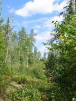
Monument Portage on the Sag end, with the boardwalk 
Heading into Sag, I've got some clouds moving up behind me and it gets overcast as I weave through the islands. I'm pleased to see that there isn't much wind, so there isn't a lot of chop on this big lake that has had me a bit worried for a while. I'm down to a t-shirt and shorts when the rain hits. I look behind me and see that there is sun behind the cloud, so I forego the rain gear, thinking it will be a short shower. Five minutes later it starts to POUR. I'm heading out onto the main lake and am shucking on my fleece jacket to ward off the chill when I pass another solo dude in a strip canoe, heading the other way, totally decked out in his rain gear. I comment "nice canoe," and he replies "yeah." And from the look of disdain in his eyes, I suspect he wasn't too impressed with my lack of rain gear during a huge downpour. Oh well, it ended up lasting a little longer than expected, but I didn't get THAT wet.
As I'm heading toward American point, I'm watching a pretty dark cloud form behind me. It's only about 3:30pm, but I'm thinking about grabbing a campsite. The first one looks nice, and has a nice beach that I pull up onto. There's a little stream flowing across the beach, and I sit and relax for a minute, mentally debating whether to stay or move on. I watch the clouds for about five minutes, and realize that the dark clouds are skidding east on the north side of Sag, while most of Sag stays in the sun. Because of that, and the lack of much wind, I decide to head onto Sag toward the campsites on Horseshoe Island, to knock off some of the big lake when its not so choppy. This plan works to perfection until I'm halfway across, and the afternoon wind turns from lightly out of the southwest to strongly out of the south. I am getting broadsided by waves in the 18 to 24 inch range, and I can't turn and run downwind due to the direction I'm headed and more importantly, the fact that the broadside waves are too strong to allow me to turn. So I head straight across them, bobbing up and down in the swell. I'm moving fast (averaging about 5mph according to the GPS), but Homer is handling the big chop very well. I finally hit the island south of Voyageur's Island that purports to have a campsite on the western end. Rather than fight my way around it in the wind, I tether off and walk the circumference of the island. I find the site on the far southeast end, and it’s beautiful. Huge pines, big rocks, just a nice place to stop. So, I stop for the night. Later, I listen to my weather radio and hear the forecast for 20 30 mph winds with 40 mph gusts the next day and almost wish I would have braved the rest of Sag to get across it, because I KNOW I'm going to be blown in with that kind of wind.
Camp on Sag: 
Day 5, Tuesday September 11, 2007, Saganaga Lake No miles traveled today. I am officially blown in. Huge waves and whitecaps on Sag. I debate whether, with a northwest wind, I can scoot along the back side of the last islands, get around the point and get into the relatively protected waters of Maraboeuf Lake and the Granite River. I decide better to be safe than sorry. The next day this is confirmed as I paddle the lake and see the size of the openings I would have had to cross in the wind. It would not have been pretty.
Whitecaps on Sag (not great pictures of the big wind!) 

I take a picture of myself, and I look BAD. Puffy eyes, beat looking:  Surprisingly, I look better than I feel! I'm really worn out, and hoping that I can recover some energy today. If I can't I'm going to be in bad shape tomorrow. The day is overcast in addition to the wind, and cold. I listen to the weather radio, and they are forecasting lows in the 20s tonight. I am wearing long johns (top and bottom), 2 pairs of socks, my pants, my t-shirt, my fleece jacket, a stocking cap and gloves to bed. It works, as I don't freeze to death, but this is not my idea of fun!
My journal reads only "This officially stinks. Really homesick, can't do anything about it. Tonight is supposed to be in the 20s. Wind is REALLY blowing. Sleeping in, try to keep warm, rest my sore body." Before I go to sleep, I check out my map, guessing how long I have to get to Superior. I also, though, make some notations on where I can get out of the BWCA if need be.
Day 6, Wednesday September 12, 2007, Saganaga Lake-Gunflint Lake 21 miles traveled, 5:56 moving, 2:54 stopped, Moving avg. 3.4 mph, Overall avg. 2.3 mpg Lakes: Saganaga Lake, Maraboeuf Lake, Gneiss Lake, Granite River, Clove Lake, Pine River, Magnetic Lake, Gunflint Lake Portages: 34 r. Sag Falls, 27 r. Horsetail Rapids, 25 r. Devil's Elbow, 25 r. Gneiss Lake, 25 r. Granite River, 72 r. Swamp, 40 r. Granite River, 100 r. Clove Lake, 30 r. Wood Horse, 13 r. Little Rock Falls
This was a tough day. I started out fairly early, heading east toward Sag falls from my campsite around 7:30am. I didn't take me long to get around to Sat falls, noticing on the way all the fire damage on Sag. Given how far north I was, I didn't connect this fire damage with the Ham Lake fire (and from what I've read later, it may have been an earlier fire), but pretty much the entire day was spent traveling through fire damaged wilderness. It was interesting to see, and I've never been through this type of area, but I will not choose to travel through a fire damaged part of the BWCA in the future. I can't even imagine trying to camp on some of the sites that were still open, with the lack of trees and the barren moonscapes. Pretty bizarre. I had a thought as I traveled across a portage and noted the size of the some of the trees that had burned and fallen, that never again in my lifetime would this area look like it had just 4 months ago.
Burn on Saganaga 
The weather was ok. Most of the day after mid morning was sunny, although I doubt if the temperature broke the 50 degree mark. Even through a day of paddling and portaging, while I ended up in my t shirt, I wore my long john bottoms all day. Most of the wind was from the south, and it was supposed to shift to the southeast by afternoon. My experience was that it was pretty much in my fact for most of the day, although it wasn't too strong, as I was pretty well protected by being on the river and narrow lakes. By the end of the day, when I hit Magnetic and Gunflint lakes, I was working my butt off heading straight into a pretty strong wind that had a good distance to get its speed up.
The Sag falls portage was pretty flat, although the southern end had a pretty good rock and not much landing. I carried my pack over, and then walked back to get the canoe, carrying the camera to get some pictures of the falls and the burned area with its flowers. There was one beat down trail that went out to the falls for photos, but I wanted to get a shot from further downstream of the falls, so I headed into the brush. Two steps in, I happened to look down and notice that I was standing in a pretty healthy patch of poison ivy! I could almost hear Homer yelling "D'oh!" from the end of the portage. I scrambled out and took my photos from the beaten path, got the canoe and then, after setting it down, spent a few minutes scrubbing my shoes with mud. I am a bit of an expert on poison ivy, as I've had it pretty bad over the years (one time missing a week of school after having it on 90% of my body after burning it in a bonfire). This summer, I had gotten the poison ivy vaccine, which is a bit untested, but seems to work in anecdotal tests...that is, no one the doctor has given it to has gotten poison ivy! Anyway, as I type this, I am free from welts and itching, so I think it must have worked for me, too.
Sag Falls 
I head south to the Horsetail rapids. The portage there is another Canadian side one of 25 rods. I paddle up to the base of the rapids, and can only spot a light trail that appears to dip in and out of the rapids! The rapids itself is a beautiful little spot. The main rapids are separated from the smaller rapids on the Canadian side by a cedar covered island. The smaller rapids are then surrounded on both sides by cedars, which form a cozy arched walkway. The water on the smaller side looks less than a foot deep and not too rocky, so I head up it, tugging the canoe by its rope. This works fine, with no issues. Today I am trying out my sealskins water socks over a liner sock with my tennis shoes, because of the cold. I get my feet pretty wet here, and discover that one of the socks has a leak in it. Sweet. Even though I'm wet, the socks do keep even my wet foot warm.
Heading down Maraboeuf, I pass a group of 7 in 3 canoes, heading north. They are outfitted by Gunflint lodge, so I ask how long it has taken them to get this far, thinking it will give me a better sense of the distance. They've been in for 2 days, though, so they aren't much help on that front. They ask about the portages, and I mention that the falls one is ok, and that I've just walked up the Horsetail rapids. They give me a mildly horrified look and say "That's the one our outfitter says to absolutely NOT run." I suggest that their outfitter is probably right, but that the right side as they go downstream is where I came up, and that I walked it, I didn't run it.
The next group I encounter is at the 25 rod portage across the point into the devil's elbow area. They are moving pretty slowly, it is their third day in after coming up from Gunflint. They warn me as I pull up that the portage is pretty bad. We chat for a while, and then I head out. They are right. The portage is composed of a huge rock bed, 20 yards or so wide, and basically the length of the portage. Across the rock bed, filled with boulders that you have to pick your way over, are strewn burned trees knocked over in the fire or before it. This is not a fun portage to pick across. The landing on the other end is fine, so once you make your way through, its ok, but I would NOT want to double pack on this trail.
Devil's Elbow Portage: 

The Granite River portage is pretty scenic in the beginning, but again heads through a burned out area. I seem to be portaging some smallish rapids on a few of these, and wonder if it had been a nicer day if I wouldn't have been able to line the canoe up them. The swamp portage is also pretty easy, traveling along a large rock at the beginning. At this point, I am feeling ok for the first time today, but not sure if I'm going to go on after Gunflint. I'm trying to calculate in my head what time I will get to Gunflint, and how much further I have to go to get to North or South Lake. I had hoped to get to Gunflint by 2pm, leaving the option of moving forward still out there. It was 2pm by the time I reached the 100 rod Pine portage, however, and I had marked the campsite after that portage on my map as the last until the east end of Gunflint lake, 8 miles and two more portages away. I figured it would be at least 5pm by the time I got to the east end of Gunflint where campsites start showing up, and another two hours past there to get to North or South lake. This was basically decision time. And I decided to press on, leaning toward the idea that I would take out at Gunflint unless I made super good time getting there.
So, with all of that running through my head, I was walking the beginning of Pine portage when I looked up from checking where my feet were landing…and realized that the portage went straight up a hill, with some logs thrown into the sides to minimize washouts and create rudimentary stairs. So not only was this a sort of long portage, but it was going to be a pain in the behind, too.
Pine Portage from the top:  Pine Portage from the bottom:
With nothing to do but cross, I headed up. It turned out to not be as bad as it looked, but I think contributed to the general weariness I had. This became a bigger factor at the next portage, the Wood Horse portage. Here, when you paddle up, you are confronted with one of those big rocks that doesn't show wear no trail portages. So, I hiked over it for a bit, and found the other end, found a reasonable path (after the initial scramble up the steep rock face) and headed pack for the pack. My usual mode of operation was to grab the pack and my camera bag and paddles, put the GPS around my neck so that it would record the miles, then leave everything at the end of the portage (thus the high "stopped time" on the GPS when I was doing a lot of portages). I loaded up this way and headed over the portage. At the landing at the other end is a huge sloped boulder you would walk across. If you are tired, even though the rock is smooth, this might be the point in the day where you lose your footing. Which is what happened to me. I slipped and went down hard on my front. I was able to keep my face off the rock, and had my life jacket on, which helped cushion my fall. After laying for a few seconds and doing a mental inventory to make sure I was all there and all right, I rolled over and stood up, which is when I noticed the big crack down the face of the borrowed GPS that I had just landed on. I did not think good thoughts for a few minutes there. (Postscript on the GPS: I now own a GPS with a cracked face, and my friend Tom owns a brand new matching model. D'oh!)
Frustrated and tired, I went back for the canoe and then hopped in to head to the Little Falls portage, or Magnetic Falls as some people refer to it. One map indicates this is a 13 rod portage, the other that it is a 130 rod portage. So, I'm not sure what to expect. I can see the falls as I work my way up the Canadian shoreline, but no sign of a portage path. I get closer and closer until I am at the base of the falls, pulled up on a rock. "This must be the 13 rod variant," I'm thinking. I hop out, and scramble up the face of the 20 foot cliff in front of me (well, steep rock anyway) and find myself at the top of the falls. Huh, I guess this is the portage. I haul the pack over without too much trouble, then stand pondering the canoe and the narrow path through some rocks at the base of the "cliff." After some wandering around, I see that I can avoid the top half of the cliff by angling off up the face to the right. I will still have the scramble at the bottom, though. Oh well, I'm game. I hoist the canoe, scramble up the rock, and haul it around the side trail. Two minutes later, I'm done. There that wasn't too bad.
Picture of the portage trail at Little Rock Falls, heading straight up to the right of my paddle, along the line the paddle points out. 


Amy has promised that she'll do the rest of the border route with me some time, so I'm looking forward to that. Maybe some time in the future she and I can make the whole trip, too. Although I've also discovered I'd much rather paddle through a winding river or a bunch of small lakes than across the big lakes. I've found a lot of new places I want to take her, which was also another part of making the trip.
Anyway, thanks for reading this and I hope you got some enjoyment out of it! I look forward to seeing you out on the water.
Greg