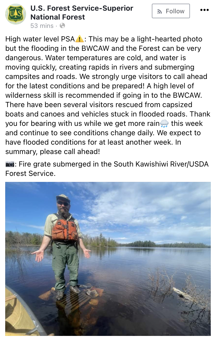
|
 Boundary Waters Quetico ForumListening Point - General Discussion Any highwater pictures or rivers...
|
 Forum Sponsor

Author
Text
")


")
05/16/2022 08:13AM
Just in case no one gets to Curtain Falls while the water is so high, here is a photo from June 1968. There had been 13 straight days of rain and the wooden dam at Prairie Portage washed out. I remember Table Rock on Crooked was submerged and we had a rough time in the Crooked Lake narrows getting up to the portage at Lower Basswood Falls.


05/16/2022 06:16PM
Just talked to a buddy that just returned from LOTW. He was out to Garden Island, (for those that don't know, it's 25 miles at least from Rainy River entrance) and encountered MASSIVE debris fields of trees etc and needed 1oz jigs to get down in 30 fow because of the strong current. That's nuts.
FTR- they limited out in 90 minutes.
FTR- they limited out in 90 minutes.
The two loudest sounds known to man: a gun that goes bang when it is supposed to go click and a gun that goes click when it is supposed to go bang.
05/16/2022 06:39PM
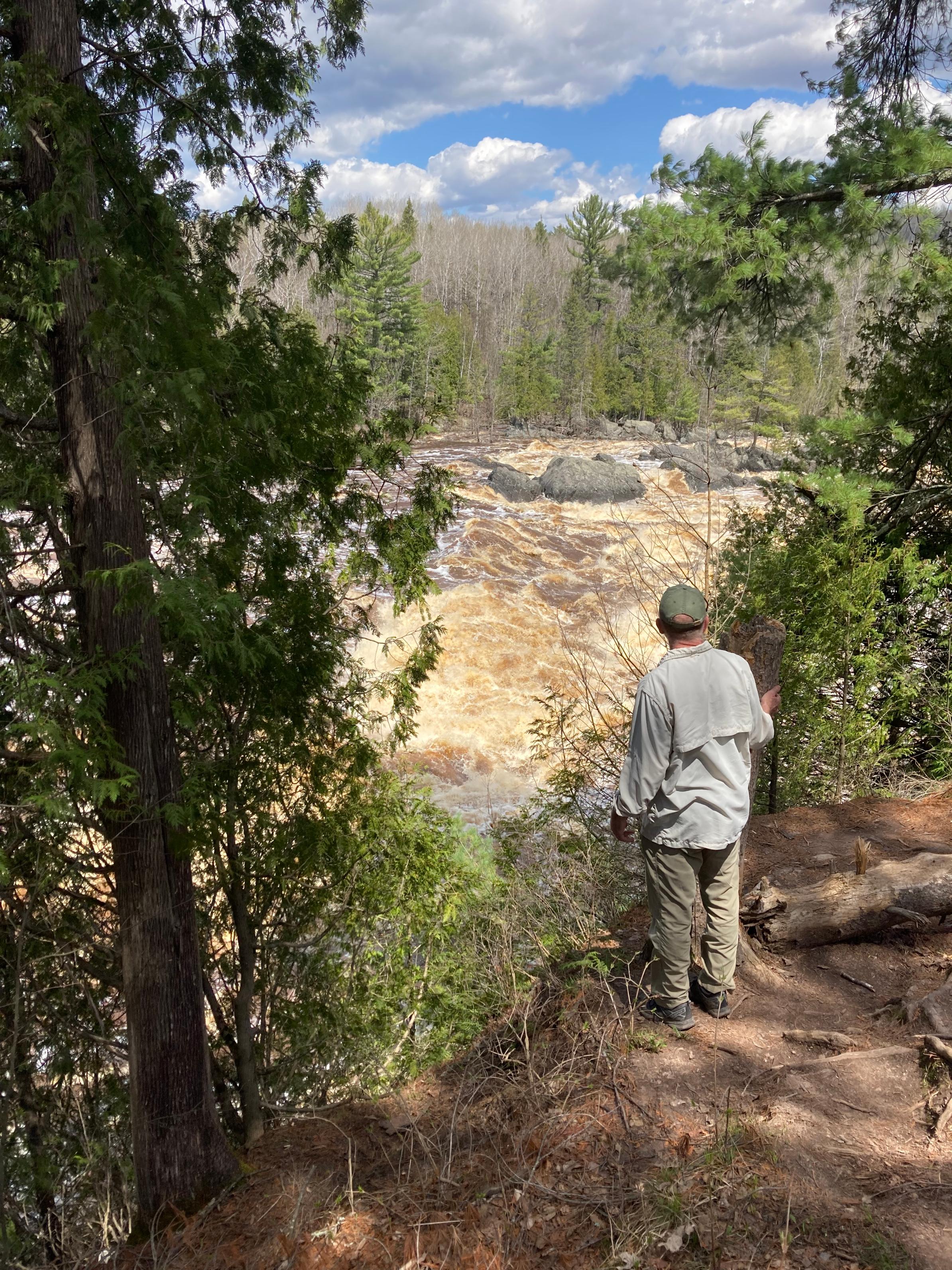
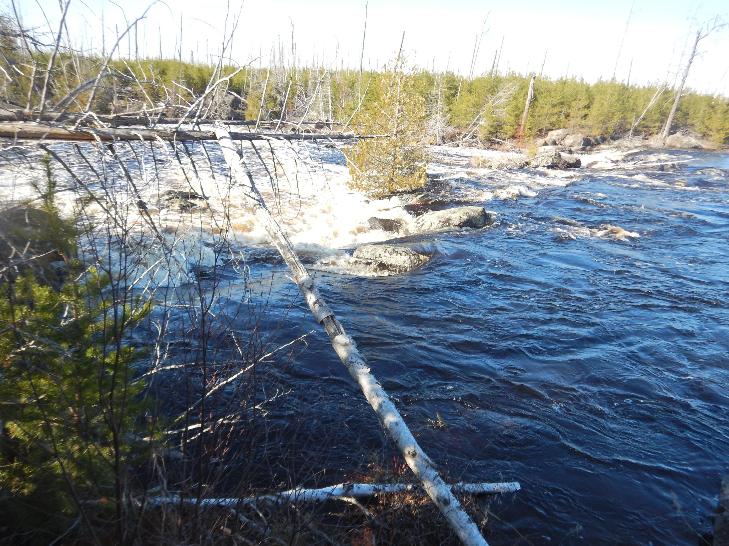
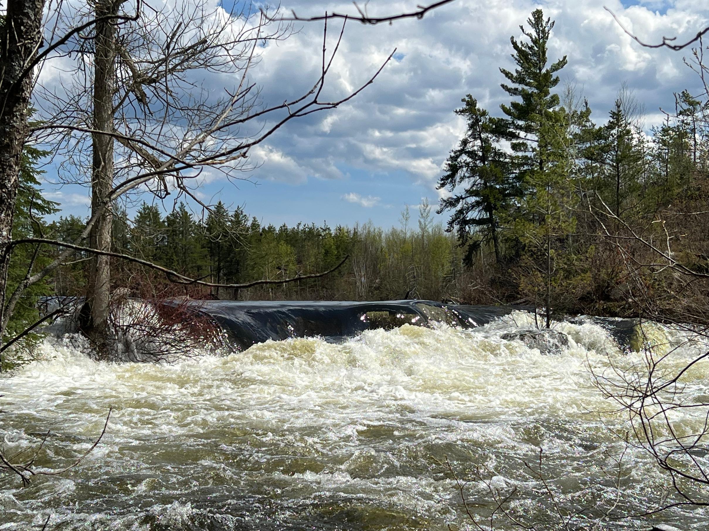
If you have instagram or maybe facebook there are plenty of posts. Cascade river on 61 is a popular spot lately. The Cross River on the Gunflint is a raging river...Tuscarora outfitters have had daily water level and ice videos. Kawishiwi Falls is of course raging like crazy as seen in other pictures and videos. I'm sure now that people can (try) getting to places like the 3 falls on the Basswood, Curtain, Eddy....heck even the little trickle between Ottertrack and Knife is maybe even runable going downstream.
05/16/2022 07:51PM
I have a friend who's doing the Mississippi from Itasca down to Hastings. He sent me some video of Lake Bemidji and the CoffeePot landing (Itasca). Docks were underwater and the current as his put-in was cruising by.
The Rum River in places such as Isanti and Cambridge is out of its banks. Maybe Canoearoo will post some pictures from around her place in Princeton? Her family lives right on a tributary (on high ground though).
Crazy flooding this Spring.
The Rum River in places such as Isanti and Cambridge is out of its banks. Maybe Canoearoo will post some pictures from around her place in Princeton? Her family lives right on a tributary (on high ground though).
Crazy flooding this Spring.
"It is hard to fail, but it is worse never to have tried to succeed.”


05/18/2022 04:25PM
I’ll have pics in a few days when I’m out and have bandwidth.
I can say the water dropped 1-2 inches in Lynx last night, based on a rock off my campsite. The portage between Shell and Heritage seemed just as flooded today as it was yesterday, though.
I can say the water dropped 1-2 inches in Lynx last night, based on a rock off my campsite. The portage between Shell and Heritage seemed just as flooded today as it was yesterday, though.


05/19/2022 02:31PM
What is dangerous is shooting rapids or fast current is when you come up against a log or overhanging branch and it will pull you sideways and the force will most likely swamp the canoe and could pin you.
I tipped once in mid-summer with no gear aboard from something like this-we just got wet.
I tipped once in mid-summer with no gear aboard from something like this-we just got wet.
05/19/2022 02:48PM
Don't know for sure but I think this is the first site west from the portage into the S. Kawishiwi from Little Gabbro. Purely basing it on the picture.
Mocha: "Pinetree: "plander: "Pinetree: "Pinetree: " No worry about a fire ban here "
Wonder what camp site? Anyone?"
"
Yes but which specific site"
hmmm....sounds like a great idea for a new "name that..." game!"
05/20/2022 07:38PM
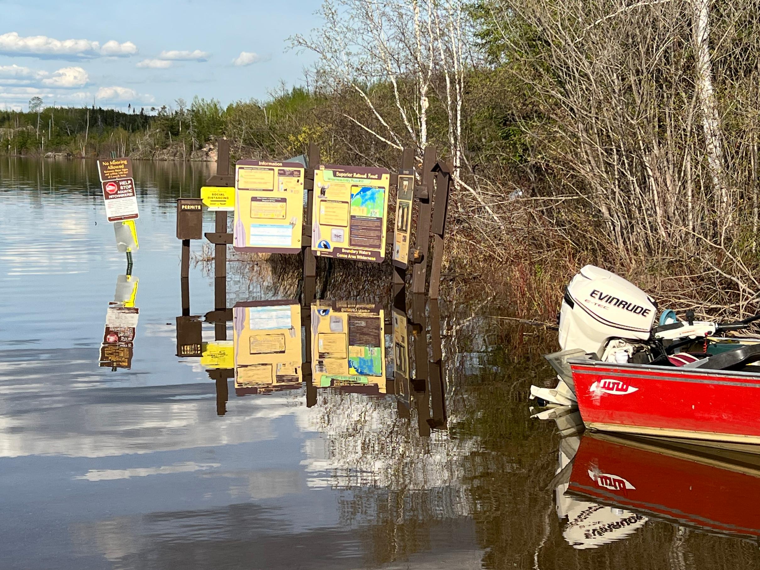
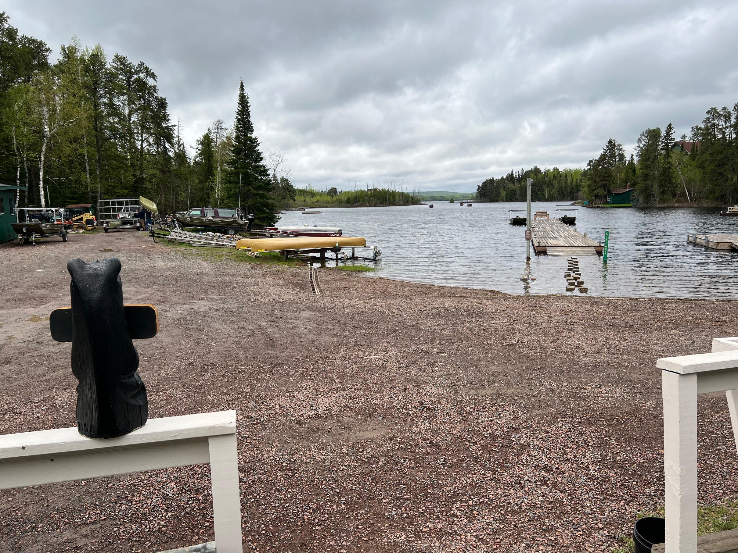
Wow, the lake levels are impressive, but not so much for the folks who have cabins along, for example, Crane Lake. I wonder if that's affecting entering/towing out of Crane?
"It is hard to fail, but it is worse never to have tried to succeed.”
05/21/2022 01:54PM
cyclones30: "Pinetree: "cyclones30: "Yeah subscription only,usually most people can get a few articles free."egknuti: " mudro to 4 town "
It's saying content unavailable for me "
It's a link to Facebook......there's paid facebook?"
Lots of folks would rather not engage with Facebook and therefore cannot view the link.
Nobody exists on purpose, nobody belongs anywhere, everybody’s going to die.


05/21/2022 04:55PM
Banksiana: "cyclones30: "Pinetree: "cyclones30: "Yeah subscription only,usually most people can get a few articles free."egknuti: " mudro to 4 town "
It's saying content unavailable for me "
It's a link to Facebook......there's paid facebook?"
Lots of folks would rather not engage with Facebook and therefore cannot view the link. "
Thanks for clearing it up.
05/21/2022 07:31PM
I have Facebook, that's not the problem. :)
Anyway, it sounds like things are slowly dropping as they should. I'd assume the smaller, upper reaches of streams drop first (as long as precip stays low to normal) and it will be some time before the large ones drop (Basswood River, etc)
Anyway, it sounds like things are slowly dropping as they should. I'd assume the smaller, upper reaches of streams drop first (as long as precip stays low to normal) and it will be some time before the large ones drop (Basswood River, etc)
05/22/2022 07:54PM
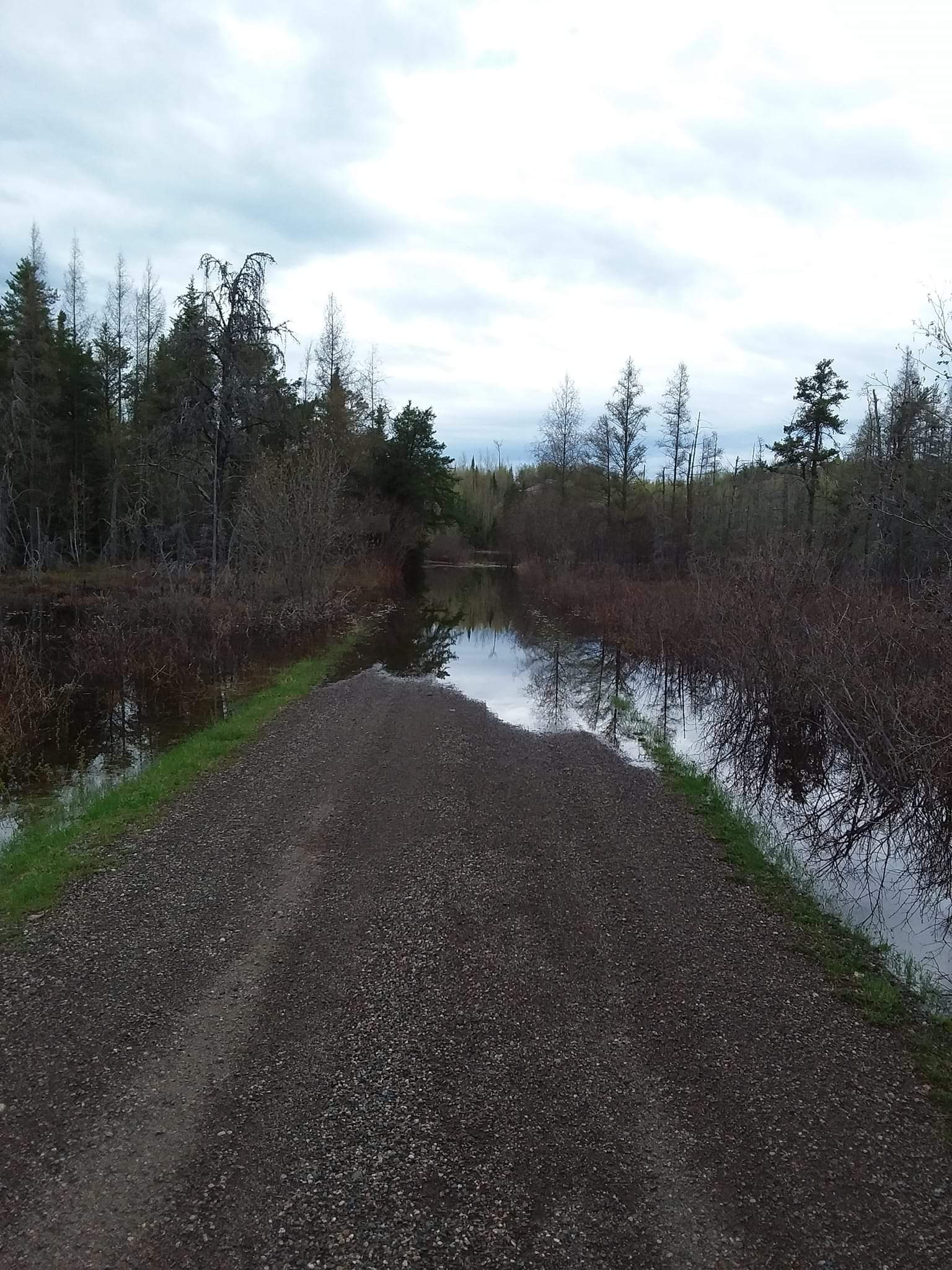
My question is how long will it take to drop to more normal levels? The 15 day forecast cast shows more rain. Not a large amounts but it seems any amount would be problematic. We're heading up mid June hoping for the best and planning to be extra careful. Wow, what a difference from last couple years.
All conservation of wildness is self-defeating, for to cherish we must see and fondle, and when enough have seen and fondled, there is no wilderness left to cherish. Aldo Leopold
05/22/2022 11:53PM
The lake and river system I just returned from near ELY in the BW, dropped 16" in 4 days. And it was very clear that higher water was present before we entered.
The two loudest sounds known to man: a gun that goes bang when it is supposed to go click and a gun that goes click when it is supposed to go bang.
05/22/2022 11:56PM
Any precip unless very heavy is not going to do much because levels are very high to begin with. Much of the high water is due to snow melt and heavy rain at the same time. Levels will slowly decrease even with some precip unless copious.
The two loudest sounds known to man: a gun that goes bang when it is supposed to go click and a gun that goes click when it is supposed to go bang.
05/23/2022 11:22AM
Was up to LLC via EP 16 over opener weekend. Like everywhere, Moose river was very high and fast. Made for some tricky landings at the portages along the way. Current was very fast, pretty tough coming back against it. We helped a couple of young guys who had flipped their canoe on a river flowing into LLC. No life jackets on, caught in a strong eddy current kept them from swimming to shore. Wearing big heavy hiking boots. Very lucky to be alive. The water is so high on LLC, many of the picto's are underwater. Crazy
Keep your line wet....
05/23/2022 03:22PM
Just back yesterday from Insula. Took oufitters advice and detoured through Fire Lake on the way in.
Came out through the Kawishiwi rapids portages on way. Still sketchy, worst spot just above first portage going east. Strong current right at the landing.
Water is amazingly high. I would guess at least 3 if not 4 feet higher than last year. The level came down about 4 inches over 5 days.
Ended up at the same campsite this year and here are 2 pictures. Notice the stump just behind the canoe in this years picture and where it is circled from last.


05/23/2022 07:17PM
Mocha: ". Grate idea!Pinetree: "plander: "Pinetree: "Pinetree: " No worry about a fire ban here "
Wonder what camp site? Anyone?"
Yes but which specific site"
hmmm....sounds like a great idea for a new "name that..." game!"
I couldn't wait for success, so I went ahead without it!
05/23/2022 07:26PM
Jakthund: "Just back yesterday from Insula. Took oufitters advice and detoured through Fire Lake on the way in.
Came out through the Kawishiwi rapids portages on way. Still sketchy, worst spot just above first portage going east. Strong current right at the landing.
Water is amazingly high. I would guess at least 3 if not 4 feet higher than last year. The level came down about 4 inches over 5 days.
Ended up at the same campsite this year and here are 2 pictures. Notice the stump just behind the canoe in this years picture and where it is circled from last.
Dang. I'm going that way in 2 weeks. How long did it take you to get to Insula, and were you single or double carrying? I was kind of expecting 8-9 hours double carrying from EP30 to Insula on the north end. The Fire route makes it look like it might be more like 10-10.5 hours which is... a little outside what my group is hoping for. We had a day like that on LLC once, 22 miles from EP16 to Lady Boot Bay. Took us just under 12 hours with the wind. Not hoping to replicate that on this trip! But... the moving water from Four to Hudson looks like it could be high current right now and I'd probably want to avoid it too. But, if the water levels drop another 1.5ft by then, maybe it'll be passable... will need to verify with outfitters.
05/23/2022 09:04PM
Jakthund: "Just back yesterday from Insula. Took oufitters advice and detoured through Fire Lake on the way in.
Came out through the Kawishiwi rapids portages on way. Still sketchy, worst spot just above first portage going east. Strong current right at the landing.
Water is amazingly high. I would guess at least 3 if not 4 feet higher than last year. The level came down about 4 inches over 5 days.
Ended up at the same campsite this year and here are 2 pictures. Notice the stump just behind the canoe in this years picture and where it is circled from last.
Reason for a detour? If that is the reason, was the problem between Lake four and Hudson strong current?
05/24/2022 09:23AM
cyclones30: "Wow, you've got signal on Lynx? Soon we'll be able to do video conferences from an island on Iron or Crooked. (yay) (sarcasm) "
I hate to say it, but there IS an island on Crooked that gets enough signal to send texts and even look at the internet a little. That was a bit of a bummer. And that was 6 years ago.
05/24/2022 09:31AM
technically_rugged: "Jakthund: "Just back yesterday from Insula. Took oufitters advice and detoured through Fire Lake on the way in.
Came out through the Kawishiwi rapids portages on way. Still sketchy, worst spot just above first portage going east. Strong current right at the landing.
Water is amazingly high. I would guess at least 3 if not 4 feet higher than last year. The level came down about 4 inches over 5 days.
Ended up at the same campsite this year and here are 2 pictures. Notice the stump just behind the canoe in this years picture and where it is circled from last.
Dang. I'm going that way in 2 weeks. How long did it take you to get to Insula, and were you single or double carrying? I was kind of expecting 8-9 hours double carrying from EP30 to Insula on the north end. The Fire route makes it look like it might be more like 10-10.5 hours which is... a little outside what my group is hoping for. We had a day like that on LLC once, 22 miles from EP16 to Lady Boot Bay. Took us just under 12 hours with the wind. Not hoping to replicate that on this trip! But... the moving water from Four to Hudson looks like it could be high current right now and I'd probably want to avoid it too. But, if the water levels drop another 1.5ft by then, maybe it'll be passable... will need to verify with outfitters."
We double portage, took about 9 hours going through Fire to the north end of Insula. Cut about an hour coming back the normal route. We had headwinds both ways which slowed us down.
The beach landing at the north end of the Hudson-Insula portage was underwater, so you can only load/launch one canoe at a time.
Water dropped about an inch a day while we were there, so should be better by when you go.
The Kawishiwi portages route is doable and should be getting better as the water comes down. Just need to be cautious.
05/24/2022 09:43AM
Pinetree: "Jakthund: "Just back yesterday from Insula. Took oufitters advice and detoured through Fire Lake on the way in.
Came out through the Kawishiwi rapids portages on way. Still sketchy, worst spot just above first portage going east. Strong current right at the landing.
Water is amazingly high. I would guess at least 3 if not 4 feet higher than last year. The level came down about 4 inches over 5 days.
Ended up at the same campsite this year and here are 2 pictures. Notice the stump just behind the canoe in this years picture and where it is circled from last.
Reason for a detour? If that is the reason, was the problem between Lake four and Hudson strong current?"
I assume the outfitter was recommending the route due to the rescue discussed on another thread and maybe word of mouth from people exiting. I take any advice from the oufitters seriously. We had not been though Fire before and decided we could check it out on the way.
Yes, the current was very strong and I can see how even an experienced paddler could easily get into trouble. We came out through the Kawishiwi portages and had no problems.


05/26/2022 11:32AM
Its not over yet.
As of Wednesday, Lakes Namakan and Kabetogama are above the peak set in 2014 and are expected to go up 5-7 inches in the next week — surpassing record levels set in 1916. Rainy Lake is 4 inches above 2014 and is expected to rise about another 12 inches in the next week. It's likely to continue to rise into mid-June, if not longer.
As of Wednesday, Lakes Namakan and Kabetogama are above the peak set in 2014 and are expected to go up 5-7 inches in the next week — surpassing record levels set in 1916. Rainy Lake is 4 inches above 2014 and is expected to rise about another 12 inches in the next week. It's likely to continue to rise into mid-June, if not longer.

05/31/2022 09:01AM
Be careful and smart. Don't paddle south down the south leg of crooked lake.
We INTENDED to traveled from west to east via entry #16 moose river to Horse/Mudro exit. When we got to the Northeast corner of Crooked, we noted the force of water at the narrows (several going south from there) to be too risky to paddle up stream. The risk of turning the the bow and canoe broadside into forceful current with 500 pounds of people and gear convinced us to go out through Thursday bay/Mudro.
Please write if anyone with full gear tried that this spring.
No pretty pictures of high water from me at this time - I'll post a few later.
05/31/2022 09:35AM
Bwana: "Be careful and smart. Don't paddle south down the south leg of crooked lake.
We INTENDED to traveled from west to east via entry #16 moose river to Horse/Mudro exit. When we got to the Northeast corner of Crooked, we noted the force of water at the narrows (several going south from there) to be too risky to paddle up stream. The risk of turning the the bow and canoe broadside into forceful current with 500 pounds of people and gear convinced us to go out through Thursday bay/Mudro.
Please write if anyone with full gear tried that this spring.
No pretty pictures of high water from me at this time - I'll post a few later. "
good advice
05/31/2022 10:23AM
Pinetree: "Bwana: "Be careful and smart. Don't paddle south down the south leg of crooked lake.
We INTENDED to traveled from west to east via entry #16 moose river to Horse/Mudro exit. When we got to the Northeast corner of Crooked, we noted the force of water at the narrows (several going south from there) to be too risky to paddle up stream. The risk of turning the the bow and canoe broadside into forceful current with 500 pounds of people and gear convinced us to go out through Thursday bay/Mudro.
Please write if anyone with full gear tried that this spring.
No pretty pictures of high water from me at this time - I'll post a few later. "
good advice"
Though the route from Friday Bay to Mudro is considerably easier than the route from Thursday Bay.
Nobody exists on purpose, nobody belongs anywhere, everybody’s going to die.
05/31/2022 12:12PM
Banksiana: "Pinetree: "Bwana: "Be careful and smart. Don't paddle south down the south leg of crooked lake.
We INTENDED to traveled from west to east via entry #16 moose river to Horse/Mudro exit. When we got to the Northeast corner of Crooked, we noted the force of water at the narrows (several going south from there) to be too risky to paddle up stream. The risk of turning the the bow and canoe broadside into forceful current with 500 pounds of people and gear convinced us to go out through Thursday bay/Mudro.
Please write if anyone with full gear tried that this spring.
No pretty pictures of high water from me at this time - I'll post a few later. "
good advice"
Though the route from Friday Bay to Mudro is considerably easier than the route from Thursday Bay."
You are right! Friday Bay is the route we took. Thanks for the correction. And I meant to say -- paddle south UP the river current from lower basswood falls -- too much water pressure.
06/01/2022 11:16AM
egknuti: "SummerSkin: "A few clips here of paddlers shooting the Ensign / Splash portage rapids."
It seems that some people will never wear their pfd no matter what the conditions are."
I stumbled across those clips on YouTube before I saw them on this site and thought the same thing!
I thought it was the Splash to Newfound rapids they were running. That was my first portage of my very first trip. We were naive enough to think that walking the canoe upstream from Newfound to Splash would be the better alternative to just using the portage. We learned quickly!
06/02/2022 07:28AM

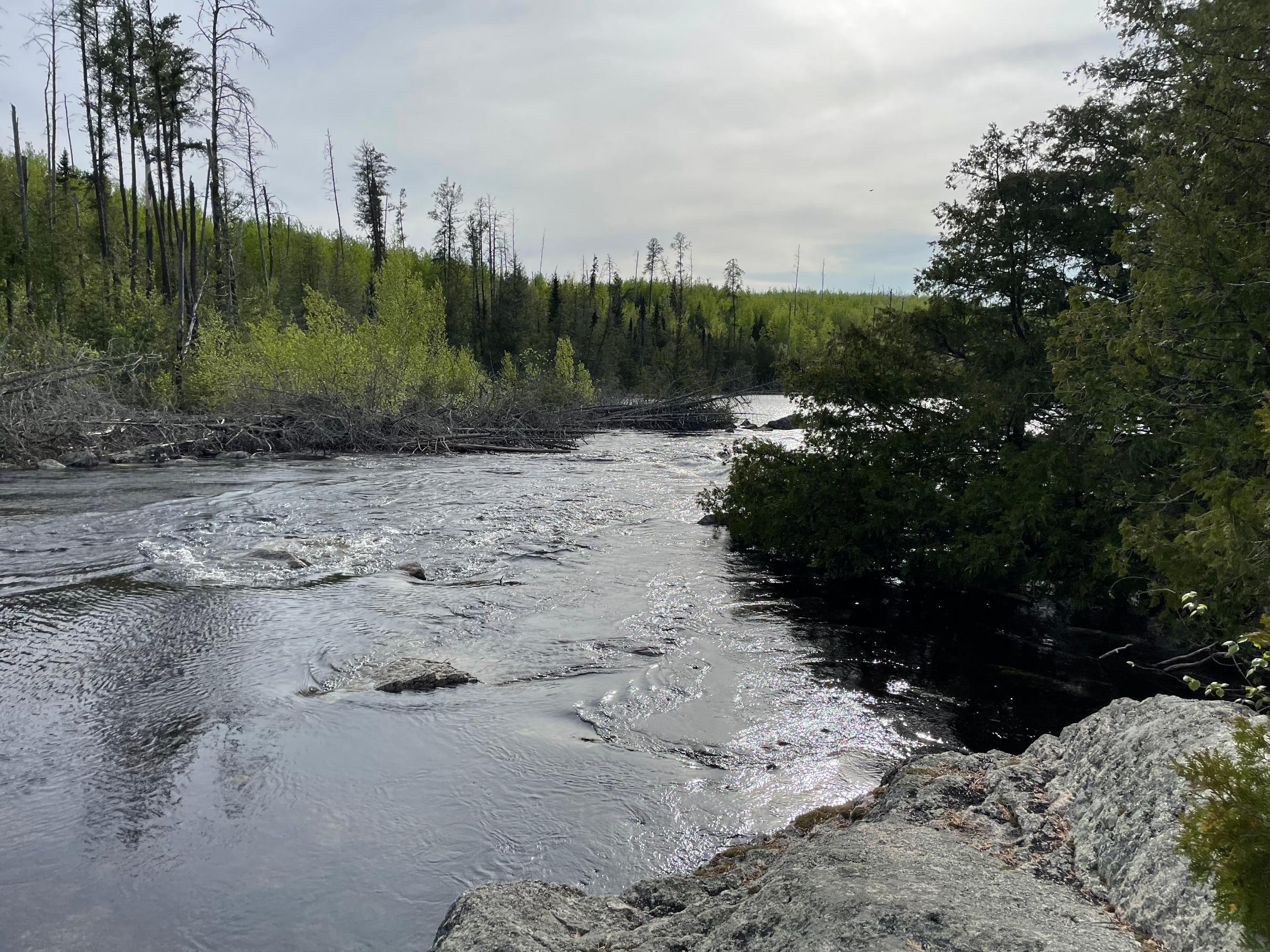


Pictures are from June 1 on the Granite River route going from the Gunflint direction. The weather was excellent and the water was calm overall. We paddled across part of Gunflint info Magnetic and then into the Granite River system. We got to the first rapids and you could hear it rushing very loudly before you could see it. We paddled to the portage on the Canadian side and I got out and took some photos and videos. The portage is flooded and a current is pushing water through the trees there. I got out on a rocky area and took some photos, then tried paddling into the flooded portage just a bit. It looked like it would be difficult to get through - the water was very deep in places between the trees. It looked to be 4-5 feet deep.
06/13/2022 01:16PM
This came up as a recommended video on Youtube, holy... I'd have turned around instead of portaging thru that current. I didn't realize the end of Horse River at Basswood Falls had actually dried up last fall. That's in here too
High Water Youtube
High Water Youtube

06/13/2022 08:10PM
bretthexum: "This came up as a recommended video on Youtube, holy... I'd have turned around instead of portaging thru that current. I didn't realize the end of Horse River at Basswood Falls had actually dried up last fall. That's in here too
High Water Youtube "
A question on the sequence of the video posted: Does the recording follow the course chronologically from the horse river, the basswood falls, then the east leg of Crooked lake?
We chose not to take this route to Mudro from the NE corner of Crooked -- and I'm curious if we are seeing the south to north paddle route in sequential order as the water is so high, I'm not recalling many landmarks.
Does anyone know the names of these guys on BWCA.com? Crazy Waters!!! Maybe never again in our lifetimes --or not.
06/14/2022 08:32AM
Bwana: "bretthexum: "This came up as a recommended video on Youtube, holy... I'd have turned around instead of portaging thru that current. I didn't realize the end of Horse River at Basswood Falls had actually dried up last fall. That's in here too
High Water Youtube "
A question on the sequence of the video posted: Does the recording follow the course chronologically from the horse river, the basswood falls, then the east leg of Crooked lake?
We chose not to take this route to Mudro from the NE corner of Crooked -- and I'm curious if we are seeing the south to north paddle route in sequential order as the water is so high, I'm not recalling many landmarks.
Does anyone know the names of these guys on BWCA.com? Crazy Waters!!! Maybe never again in our lifetimes --or not.
"
I honestly couldn't tell where they were past Lower Basswood. I would assume north/west past table rock - since they portaged thru Lower Basswood Falls but I don't know where that massive current would be.
06/14/2022 09:35AM
bretthexum: "Bwana: "bretthexum: "This came up as a recommended video on Youtube, holy... I'd have turned around instead of portaging thru that current. I didn't realize the end of Horse River at Basswood Falls had actually dried up last fall. That's in here too
High Water Youtube "
A question on the sequence of the video posted: Does the recording follow the course chronologically from the horse river, the basswood falls, then the east leg of Crooked lake?
We chose not to take this route to Mudro from the NE corner of Crooked -- and I'm curious if we are seeing the south to north paddle route in sequential order as the water is so high, I'm not recalling many landmarks.
Does anyone know the names of these guys on BWCA.com? Crazy Waters!!! Maybe never again in our lifetimes --or not.
"
I honestly couldn't tell where they were past Lower Basswood. I would assume north/west past table rock - since they portaged thru Lower Basswood Falls but I don't know where that massive current would be."
I think they entered via Fall Lake up the Range River then to Horse Lake, down the Horse River and then up the Basswood River (the portages with current and wading through the trees) and then onto Basswood and back to Fall. Note the lack of gear in the canoe.
Nobody exists on purpose, nobody belongs anywhere, everybody’s going to die.

Subscribe to Thread
Become a member of the bwca.com community to subscribe to thread and get email updates when new posts are added. Sign up Here
Community Links
 Search BWCA.com
 Donate
 Featured Sponsor
