BWCA Entry Point, Route, and Trip Report Blog
May 03 2024
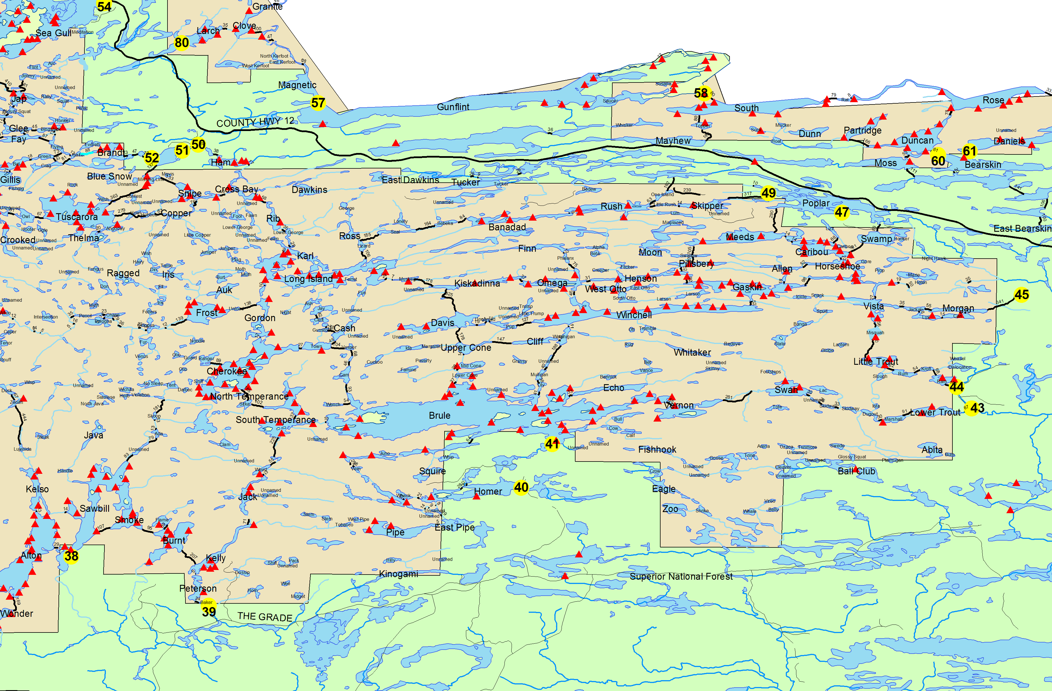
Entry Point 43 - Bower Trout lake
Number of Permits per Day: 1
Elevation: 1650 feet
Latitude: 47.9469
Longitude: -90.4442
Bower Trout lake - 43
Last Trip
Entry Date:
June 18, 2018
Entry Point:
Trout Lake
Number of Days:
4
Group Size:
2
This portage was developed by North Shore trappers Tom Parent and Bill Pembles (Tame Tom and Wild Bill) sometime around 1901 or so. The Forest Service maintained it until the late ‘60s or early ‘70s. The Kawishiwi Lake end was located in fall, 2019. Scouting work was completed in summer 2020. Amazingly after 60 years or so of no-use, the path was still there pretty much as mapped on the 1960 USGS Quad map. The portage is two miles long which is longer than the old canoe maps show. Avenza Maps was invaluable for this effort. [paragraph break] After a hearty Paddlers Breakfast, the crews headed for Perent Lake. All gear, canoes and people were at Perent Lake in 3 1/2 hours. Zoom in in the map. Notice the actual alignment (gps) vs the quad map location. 
