BWCA Entry Point, Route, and Trip Report Blog
April 27 2024
Entry Point 54 - Seagull Lake
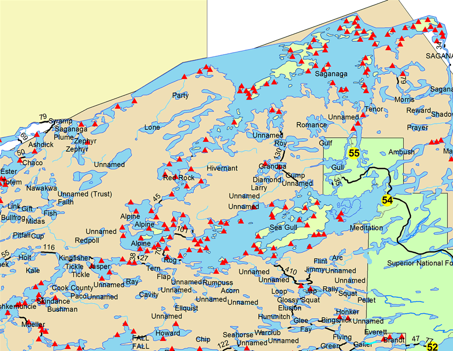
Seagull Lake entry point allows overnight paddle or motor (10 HP (except where paddle only) max). This entry point is supported by Gunflint Ranger Station near the city of Grand Marais, MN. The distance from ranger station to entry point is 50 miles. No motors (use or possession) west of Three Mile Island. Large lake with several campsites. landing at Seagull Lake. This area was affected by blowdown in 1999.
Number of Permits per Day: 8
Elevation: 1205 feet
Latitude: 48.1469
Longitude: -90.8693
Seagull Lake - 54
Number of Permits per Day: 8
Elevation: 1205 feet
Latitude: 48.1469
Longitude: -90.8693
Seagull Lake - 54
easy as it gets
by oldnewbie
Trip Report
Entry Date:
July 12, 2011
Entry Point:
Seagull Lake Only
Exit Point:
Saganaga Lake Only (55A)
Number of Days:
3
Group Size:
1
Trip Introduction:
Tuesday, July 12
Trail’s End Campground is remarkably convenient: break camp, drive a quarter mile to the put-in, and park the car in a lot that’s even closer to the take-out on Saganaga. I was the only person at the entry (though I think others started from the other entry off the Gunflint). I stayed to the north part of the lake, hoping to see cliffs and avoid motorboats. In hindsight, I see that I quickly lost track of my goal, and took the shortest path between islands. Dumb. The wind would have been far less and the travelling more scenic if I had really hugged the north shore; it wasn’t that much more paddling.
I was surprised to see that the now-visible rock formations in this burn area were not the giant grey monoliths I had expected, but mostly appeared fractured and buff-colored. I assume that the latter could be the result of heat, but the broken-up piles of rock must be what underlies most of the forest in the area. The big faces visible on Knife, Ester and Ottertrack really are the unusual formations!
A couple guys smoked on by me, clearly intent on the west end, so I kept track of where they went—might as well let them find the portage. They knew exactly where they were going—to Rog. I really wanted the other way to Alpine because it meant unloading only once. Since I have to stuff everything below decks, it’s the number of portages that counts.
While searching the wrong inlet for the portage to Alpine, somebody at a campsite called out something, so I paddled over. Turned out he just wanted to ask about the boat, but he also told me that he and his son had come up from New Mexico to get away from all the fires and smoke (a great deal of the state had already burned with some pretty intense fires). I was immediately curious why he had chosen a burn area in the BW. I’m still not sure, but I think he just didn’t know—and the only map he had was a Fisher, so I showed him the extent of the burn on my Voyageur. He said he and his son had just yesterday been to Ogishkiemuncie, and it looked just as bad. He had only looked from near the portage and had missed the start of the forest by very little; they decided to come on down once more. I told them I’d look for them this evening.
It is overcast and cool—a wonderful relief from the heat and storms of St. Croix Falls a couple nights ago—but I am already tiring as I carry everything to Alpine. Even dropped the boat because of inattention when taking it off my shoulders. It only weights 44 lbs., but I made a yoke for it by bending 1” PVC drain pipe, and the yoke just clips to the coaming so I can take it off to get in. One has to have solid grip on the boat to set it down safely, and it’s kind of slippery. Much better to walk out into the lake whenever possible.
My plan had been to paddle as long into the day as possible, just take kind of long breaks to recharge. (Older people are like older NiCad batteries: run out of energy quicker than before/recharge in a couple hours!) So I sat at the portage and ate lunch. There hadn’t been anybody around since I started, so I figured that if I sat out of the way it wouldn’t be a problem. Well, it wasn’t a problem, but three canoes came around the bend and landed—with lots of ‘discussion’ about where to go next and a few other things. That was nothing. The next group of four boats arrived, literally on the others’ heels, and proceeded to get out and lift boats right over me! Young crew, metal boats, zipped lips. They would have had much better landings a few yards further.
Having thus gotten in my socialization for the day, and feeling it was much safer on the water, I loaded and pushed off. I don’t remember that Alpine, Jasper, and Kingfisher were much to write home about, but the larger factor was that I had lost track of my objective to “cool it” and sightsee, so I just pushed on through. But once I got onto Ogishkiemuncie, and the forest was dark green and full, it was like all the uptightness of being in the burn area melted away, and I relaxed.
It was only mid-afternoon, but I took the island campsite at about mid-lake. I was bushed. The landing was a little tricky with the wind and waves, but it is a great campsite. I only have a little tent, so the spot littered with pine needles off to the south was perfect. And, since I do not yet trust hammocks to give way, hanging it over something soft was comforting. I finally figured out that a tiny ENO hammock will work as the backpacker’s answer to a camp chair. No, it’s not at the campfire, but I’m not much of a fire-builder anyway.
So here I am, swaying in the wind in the hammock, and I am actually COLD. It felt wonderful. But I had to do something. The micro-thin nylon hammock and pants don’t add up to much buffer against a cold wind. Obvious answer: 3/8” closed cell sleeping pad. Problem: it is sticky, and I can’t move. And it doesn’t wrap around very well. I can make it for maybe 20 minutes before I’m shivering. Next up: sleeping bag. I’m unwilling to actually worm my way INSIDE the bag, and it wouldn’t be thick enough anyway, so I gain another half hour of reading and writing. These nylon hammocks would make paper feel thick, so a warm-weather bag in a wind won’t do it. Wrapping up like a cocoon works for a while, too. All of it is fun because it’s been in the 90’s at home and on the way up here, and it is wonderful to be cool.
But, eventually, it is off to the tent if I want to read and write and be sedentary. Tents are always hot, and this is no exception. Even a Half-Dome 2, which is basically mesh over a bathtub floor plus a rain-fly, even pitched under pines, even in a good wind at what must be 60 deg., even then it is much plenty warm inside this thing.
This all consumed the rest of the afternoon, and I suppose I cooked something from the little bear barrel. Ah, now I remember: we had two pouches of Mountain house dinners left from previous years, and I felt it was my duty to use them. So I made the beef stroganoff, and was prepared to force down both servings. Now, don’t faint: it was really quite good. I won’t be making it at home, but with only a tiny campstove and very limited space for ANYTHING, I’ll take it. But now I am really FULL. (I could only make the whole package, and I am NOT going to carry leftovers the rest of the trip…)
It has gone from completely overcast to partly sunny, and it feels very cheery. Towards evening it clouded over again, and I was afraid I’d lose the joy of the full moon the calendar said was in the offing. No worries, toward dusk it cleared again, and I thought there can be no better time for a paddle, so I set out on a tour of this section of the lake. Across the lake I found a few “bonsai islands”—it looked like tiny imitations of a rocky island that had been kept to about ten feet by two feet, with no trees, but tall grasses and the ubiquitous hypericum bushes. (I’m guessing what the bushes were, but they were everywhere.) So I am trying to get a good photograph of these, and I float past a campsite where two guys wave. I paddled off toward the north end of the lake, when I think, “hey, I wonder if that’s…” So I went back to visit with the father and son from NM, and feed the mosquitos while sitting on a terrific viewing rock at their site as the moon rises and shines a light past the only cloud—right on my campsite across the lake! OK, this is officially picturesque! No, I am too slow to get the fantastic photo, but I got one shortly thereafter that was a decent substitute.
After I tired of the mosquitos (but not the pleasant company), I just paddled up the moonbeams to my site.
Now came the tricky part. A few years ago I developed an amazing claustrophobia on an icky night on Kelly. I woke up about 11PM and could not shake the feelings of being trapped, so I got up and paced the site for a while in the wind and a little bit of rain (very grateful for a headlamp on a very dark night). It took less than an hour to talk myself down, but for the intervening years I fought a non-rational fear each time I drove north, and it didn’t seem to matter who was along on the trip.
So this time I bought a new tent, with TWO doors, no ‘solid’ walls, and much smaller. It worked. All I did was keep myself busy till it was really dark, and slept through, peacefully, happily. This, to me, was a major victory. I now knew that I was happy and at home out here—even more when alone.
(btw, REI’s Half-Dome2 is the cat’s pups. I absolutely love having two vestibules, aluminum poles, good ventilation.)
It was, however, cold. A little bit better bag would have been wise—I had kept bag-plus-clothing to a wad the size of a basketball, compressed. That fit well in the rear hatch with the food barrel and the backpack (partially unloaded). So I shivered.
But seeing your breath in the morning in July is a treat. And the still and misty lake (no horses, only mist at the forest edge) made delightful paddling. The quiet lasted long past sun-up and there was a WEIGHT to the forest and its reflection as I snuck in and out of the interesting-looking parts of the lake. Today would be sunny; I’m sure it got no warmer than 80. Loons were hanging out in groups of 3-5, but they seldom called. I even discussed this with them, but they remained silent.
Paddled through Jenny (pretty), Eddy (meh), and South Arm Knife (ah, cliffs…). Eddy Falls is probably nice, since it falls so far, but I only saw the top and bottom. Too much work to hike into the middle. Sounds great, though.
South Arm would have been a lot shorter if I hadn’t convinced myself I had left something at the portage. (I didn’t.) All this because LAST year I left the portage yoke at the Clearwater/Mountain portage (gone when I came back the 8 miles). Thus the new yoke this year. Well, what’s a couple extra miles?
Crossing Hansen, still breathing hard from a portage of only 100 rds., I spied a group of three canoes coming from Cherry. I kind of figured the Cherry portage was more than I wanted, but I thought I’d ask…. I was delighted to find it was a group of East Indian paddlers, 20-somethings. They had not been enamored of the Cherry portage, so I told them the one I had just been on was “scenic”. Hope they took it easy and enjoyed it—it was, honestly, beautiful under a high canopy of pines, with a carpet of needles to walk on. (A young ranger at the GM station had asked me where I had seen stands of mature pines. Guess he thought an old guy had seen a lot…I told him I had seen a real big one on a Kawishiwi portage once. Don’t know if he figured out the depth of my ignorance.)
I was real glad to be able to slide through a skinny spot directly into Ester. One less pack-and-unpack. Now, Ester, THAT is a beautiful lake! Unfortunately, everybody else already knew that, and I was lucky to get the last site on the north end. Interesting site: a knob of rock sticking into the lake a bit, with a depression behind it for a tent site. Hope it doesn’t rain much if you’re on this one. I’m starting to get a little stinky by this time, so I took off the shirts I was wearing and waded into the lake with them, then spread everything on a rock to dry in the last of the sun and wind. I’ve been wearing the same long-sleeve shirt the whole time, and it has worked well. Some kind of synthetic, weighs nothing, treated with permethrin (thanks for the tips, everybody!). Very few bugs even touched down, and it was cool even in the sun. Even better when wet.
The people on the center-of-lake island sites had set up some major homes in there—and they were pretty easy to hear for a long time. You wouldn’t think a person could talk so loud while swimming, but….
Nevertheless, those are the sites to try for on Ester: open stand of BIG pines (found ‘em, Mr. GM ranger).
It was hard to stay focused tonight. It was obvious that I had just about completed this loop, and could easily be at the Sag entry point tomorrow, depending on the wind and waves you all have warned about. Should I go the other way on Ottertrack? Camp on Sag? With all the motorboaters? Nah, just paddle what I set out to do , and be happy with it.
Towards evening, I heard quite a bit of noise in the woods. I knew my site was close to the portage from Ashdick, but I assumed that route was less desirable, so I didn’t expect any traffic. So I wandered over to the knob of rock and looked over: a couple of graybeards were moving smartly past, and one gave the briefest look my direction, said “nope” and were gone. I think they had quite a paddle before an open site.
Clearly, conditions had been about as good as they can get for paddling and enjoying (“idyllic” was the word that came to mind). And other ‘events’ were working heavily in my favor as well. For instance, the next morning I got up at daybreak and headed uphill for brief relief. But I tripped on a tent-line and went down—hard—onto a flat rock. I landed on my forearms, not my wrists or my elbows, hard enough that the forearms tingled for quite a while. AND I had hit on a pocket of duff nestled in the middle of the big, flat rock. I was not much awake, so I was down before I knew I was falling. So I said “thanks” and headed uphill, a grateful guy, laughing.
Morning was beautiful—again—and I headed up to Ottertrack. I was pleased to see the Canadian side was well wooded and sculpted with rock. (Last year, the north side of Mountain appeared more like a grassy knoll, and the little motorboat going back and forth just didn’t seem right.) Ottertrack looks like it would be worth exploring another year. Swamp, on the other hand, somehow confused me, and, if it hadn’t been for the compass mounted five feet in front of me, I’d still be confused.
So, on to Saganaga. It seemed wise to just hug the south shore and then decide at American Point whether to paddle out, camp and wait, or circle south again. Nice lake. The wind was south and there were miles to cover, but they were enjoyable. There was even a dandy sand beach for a break. At American Point there was wind, but the cirrus clouds kind of promised that there wasn’t a squall lurking—and the crossings were only a couple miles at a time between islands. I knew from Mr. Garmin that that meant only a half hour of serious paddling at a time, even with some wind, so this seemed the reasonable course. Halfway across, there was a group of three canoes (rentals) coming toward me, having come through the space between Munker and Long Islands. They were far more affected by the increasing wind, but were happily and leisurely paddling (they waved), so I asked myself why I was getting all excited about the dangers here and enjoyed the effort. Again the compass bailed me out, as I kept wanting to turn south, and you basically have to just paddle east until you get back to burned forest, and THEN go south. Straight into the wind. Man, was I glad I was sitting low to the water! There was really nothing for it but to just paddle out, and I was glad I had scouted the area on a day permit the evening before I started this. That scouting enabled me to confidently make the turns into the proper channels and make straight for the landing at Trail’s End. It should also have warned me away from a marvelous flat rock two inches below the surface beside the middle island of Gull Lake. I had hit it three days previous. Man, did I hang up. Sure hope gelcoat is not resentful of these things….
And at that I arrived at the landing; the clock in the car said 1:30, and Garmin said 38.7 miles in these three days. Not sure how accurate that is, but it does explain the overly-serious guy in the self-portrait. It would have meant almost fifteen miles today, and that’s a lot for me. Too much worry, too little dawdling and exploring and reading.
It turned out to be a nice try at journaling. I wrote things I would have forgotten, even though a great deal of what I wrote translates as drivel. I had thought there might be some wonderful new life goals come of this diligence, but no such luck. Nice paddle, though.
fwiw: I wanted to get in some miles in the car and was looking for a place to camp south of Superior. Amnicon Falls State Park is right there, primitive camping so there are sites left for the last minute camper, and a terrific little hike around rapids and falls. Even in the mist and rain it was picturesque.
Report


discuss this trip report (2 comments) - last post on November 15, 2011