



BWCA Entry Point, Route, and Trip Report Blog
September 15 2026
Entry Point 80 - Larch Creek

Larch Creek entry point allows overnight paddle only. This entry point is supported by Gunflint Ranger Station near the city of Grand Marais, MN. The distance from ranger station to entry point is 53 miles. Access from the canoe landing at Larch Creek. This area was affected by blowdown in 1999.
Number of Permits per Day: 1
Elevation: 1217 feet
Latitude: 48.1270
Longitude: -90.8304
Larch Creek - 80
Number of Permits per Day: 1
Elevation: 1217 feet
Latitude: 48.1270
Longitude: -90.8304
Larch Creek - 80
Day Trip to North Hegman.
by sdgrey
Trip Report
Entry Date:
September 12, 2026
Entry Point:
South Hegman Lake
Number of Days:
1
Group Size:
2
Trip Introduction:
This was my wife's first experience seeing the BWCA in person. This was a great day trip route.
Report
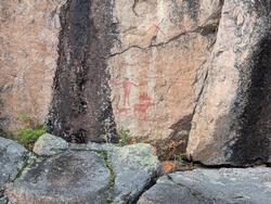
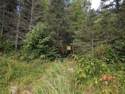
This was my way of introducing my wife to the boundary waters. All trip reports were telling me this would be a 4 hour outing. It only took us about 2 to do the 5 mile loop between South and North Hegman as well as Trease lake. Outside the portage from the parking lot to the lake only a single 2 rod portage between the lakes. We paddled up to the pictographs - this was part of the alure of this particular route. These are really well-preserved paintings. You can easily make out the moose / person / canoes / canine critter / as well as the x. Impressive for something that is suspected being 500 to 1000 years old. At the end of Trease we were going to walk the portage to angleworm but the portage was closed off. Lots of other groups doing the same day route - we also passed some people who were doing some short overnight trips. 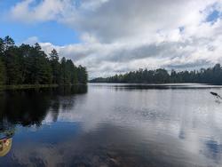
discuss this trip report (0 comments) - last post on September 14, 2026