



BWCA Entry Point, Route, and Trip Report Blog
July 28 2026
Entry Point 50 - Cross Bay Lake

Number of Permits per Day: 3
Elevation: 1670 feet
Latitude: 48.0760
Longitude: -90.8222
Cross Bay Lake - 50
The trip of a lifetime!
Entry Date:
June 23, 2019
Entry Point:
Seagull Lake
Exit Point:
Saganaga Lake Only (55A)
Number of Days:
8
Group Size:
4
“The Gathering”
Zach arrived in the early afternoon and Tony was picked up at the airport after a delay or two. Once back at the homestead, packs were emptied as we tried to cut weight and eliminate any duplicate gear that was not necessary and preparations were finalized for the following mornings departure. We were to pick Nate up in Janesville the following morning at 7am. The excitement for the upcoming trip was palpable.
“Are We There Yet?”
We left Elgin, IL at 6am on our way to Janesville, WI to pick up the fourth and final member (Nate) of our party before continuing up to Tuscarora Outfitters on the Gunflint trail. The drive was not bad and we made good time stopping off in Rice Lake, WI at the Culvers for lunch. Once back on the road we were making good time until our not so brief impromptu tour of Duluth. The Grandmas marathon was taking place and it appeared that the inmates were running the asylum. The detour signs were misplaced and we spent 45 minutes trying to get around and through Duluth and continue on our way. We stopped in Grand Marinas for leeches and to fill up the Jeep before making the final 40 or so miles to the outfitter. We arrived at Tuscarora Outfitters about 5pm and checked in with the proprietors Andy and Ada. Andy was a true professional and we settled our account, discussed our trip plans and asked for insider tips on where the good campsites and where the good fishing spots were. We dropped our gear off at bunkhouse number 4 and decided to head to the trail center for dinner and some cold brew. On our way back we stopped off at the Laurentian divide to check it out and take some quick pictures. Once back at the bunkhouse, we went through our packs one last time to cut out any duplicates and weight before heading out the next morning.  Lunch at Culvers in Rice Lake, WI
  Lake Superior, making progress
  Nothern MN - Tunnel!!
  Northern MN - still driving.....
  Bunkhouse #4, we made it!!
  Laurentian Divide
  BWCA sunset
  BWCA sunset
The longest day. September 3: We planned to spend our first night on Oyster Lake, and we knew the first day would be arduous. We entered the wilderness and traveled to Oyster Lake, 10 miles, nine portages. The weather was warm and sunny. We parked at EP16, unloaded, portaged through the forest 152 rods (half mile) to Moose River, and then paddled north to Nina Moose Lake. We inexplicably missed a short portage and blundered into a boulder jumbled rapid. Roy hopped into the waist deep river, filling his boots with water that sloshed all day. Moose River has three mapped portages, but fallen trees created two additional portages. The short portages on Moose River are 20-25r. We paddled north across Nina Moose Lake, and rested at the same sandy beach as last year. We continued to Lake Agnes 3 miles north down Nina Moose River, portaging 75r and 105r. High water made it easy to shoot through gaps in beaver dams when paddling downstream. Hummingbirds buzzed us twice, inspecting our red colored items. Both hummingbirds had juvenile or female plumage. Perhaps they will visit our feeders in Arkansas during migration. We arrived at Lake Agnes ahead of schedule at 1:30, and all six voyageurs seemed in good shape. Only two portages and short paddles remained before Oyster Lake. We paddled 1 km across Lake Agnes to portage 190r to Oyster River, reportedly a good trail, but actually an ordeal due to fallen trees, deer flies, fatigue, and boot-sucking muck at the river bank. Some of us triple-portaged this 190r trail, 3 cumulative miles on foot on this 0.6 mile portage trail. The mud sucked the sole right off the sole of Gay’s boot, and Al later astonished the group by producing shoe repair goop at camp. Gay should invest in boots that cost more than $19.95. While we portaged, the wind carried Al & Gay’s canoe down the Lake Agnes bank several hundred yards, a near faux pas. Fortunately, the canoe beached down shore, and not out in the middle of Lake Agnes, inasmuch as the other canoes awaited at the opposite end of the portage trail. We staggered to the mud hole on weedy Oyster River, and paddled wearily upstream to the final 70r portage to Oyster Lake. The nine portages will be remembered. Gay fell on her face in mud, Lee strode by and advised resting until he returned, as Gay’s mud puddle was near the end. Terri slipped on a rock, and rested there until extended a hand, and Vickie also performed the turtle impersonation on a portage. On reaching Oyster Lake, we found the shore steeply lined with boulders and the west wind blowing briskly, but we were too tired to be delayed by wind, so we launched from the boulders and paddled across to the peninsula to find our 5- star camp. We were relieved to find the camp unoccupied, and wearily pitched tents at 6 PM, our latest-ever arrival. Our campsite was the best on Oyster Lake, situated in the narrow middle of a long peninsula, affording canoe launches from either east or west. The fire pit area sits atop on a granite rise, affording fine views of the lake to the west and the heavens at night. (The BWCA website does not provide a camp number for this 5-star camp). We boiled water for a late dinner, gazed at starry constellations from our granite landing, and celebrated our accomplishment by drinking one of Al & Gay’s 5 liter boxes of wine. The first of many flocks of Canada geese appeared, flying V- shaped formations toward the east. Seems geese should fly south rather than east. 
The world is your oyster. September 4 we rested at Oyster Lake. A family of gray jays visited camp. The weather was beautiful and calm, and everyone fished, and caught bass and pike for a fine fish dinner. In the afternoon Gay and Terri laundered clothes, while Lee and Al paddled the west side fishing. Oyster Lake is quiet and scenic, with a narrow peninsula jutting almost all the way across the lake. The peninsula has a fine granite bluff visible from the east, but you can't see the granite outcropping from our camp nestled among tall evergreen trees. An indignant family of beavers slapped tails at the intruding anglers. Vickie and Roy fished shady banks and caught ten smallmouth bass, then tried unsuccessfully to troll for lake trout in the deep waters. 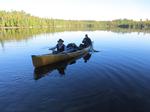
String of pearls. September 5 we traveled four hours to Gebeonequet Lake, 4 miles with 3 portages. We passed through two small, pretty lakes with three portages. The portages were medium length: 78r to Rocky Lake, 90r to Green Lake, and 130r to Gebeonequet Lake. Rocky and Green lakes are jewels, and aptly named. It was sunny with mild breezes. We failed to notice that maps indicate pictographs on Rocky Lake. We paddled across Gebeonequet and were delighted the 5-star camp on the north bank was unoccupied. Roy caught a nice smallmouth bass by twitching a topwater plug in front of camp before dinner.
From the land of sky blue waters … September 6 we base camped at Gebeonequet Lake. The weather was sunny and hot. Our campsite (118) was the best in Gebeonequet, with a granite landing, plenty of tent sites, expansive 180° view to the east. The wide, sloped granite porch was good for swimming and sunning. Gebeonequet is complex, with four inviting bays and several islands, too much to explore in one day. Gay’s almond milk leaked inside her pack, so she laid out foodstuffs on the grass like a garage sale. Vickie and Roy paddled to the south end and caught 36 smallmouth bass. Vickie twitched topwater lures and landed seven bass while Roy fished soft plastics Texas-rigged. Al and Gay caught several bass with fly rods, but decided that spinning or casting rods are better suited for the Boundary Waters. Lee and Terri caught 40-plus smallmouth with Terri out-fishing Lee with her hot SR-7 Rapala, and brought a stringer of bass for dinner. A large snapping turtle tried to steal the stringer of fish and engaged in a tug of war with Lee. The afternoon was hot and sultry, and Al led the way into the swimming hole in front of camp. The water was cool, and Al’s hooting and hollering echoed across the lake surface like a Roman orgy. The evening was humid, and mosquitoes chased us into our tents.
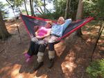
Citadel on a hill. September 7 we traveled to Lady Boot Bay, 6 miles, 2 portages. The weather was sunny and still. We paddled a few hundred yards to the short portage to Gebeonequet Creek. We glided easily downstream through golden marshes, and found the notorious beaver dam simple to cross in high water. We reached the confluence of Pocket Creek and floated over to the big lake. Lac la Croix was calm and we paddled south past massive islands with prominent granite bluffs to Lady Boot Bay. Vickie and Roy trolled unsuccessfully for Lake Trout over a deep hole en route. We soon reached the mouth of Lady Boot Bay, passed by an unoccupied campsite on the peninsula to claim a secluded hillside campsite in the back of the bay. The campsite was elevated, so we enjoyed an inspirational view from high above the bay. Roy belatedly realized we selected the wrong campsite (178). Roy planned for us to stay at the 5-star camp on the peninsula (179) at the mouth of the bay. Instead, we settled into the steep hillside aerie, and shuffled about like mountain goats. Whenever we dropped anything, it bounded down the mountain and nearly careened into the lake. In late afternoon, we explored the bay and coves. Lady Boot Bay is lovely and isolated, off the beaten path in busy Lac la Croix. Vickie and Roy watched a bull moose near Toe Lake, and the moose never took his eyes off us for five minutes before sauntering into a birch grove. Roy caught a fine 3 pound smallmouth bass by a fallen tree, and Lee landed a huge smallmouth by bouncing his lure off a sheer bluff into the lake. We wore sunglasses at dinner due to the setting sun’s glare across the bay.
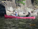
Islands in the stream. September 8 we traveled 1¼ hour to an island camp in Fish Stake Narrows in eastern Lac la Croix, 4 miles and no portages. The day was bright and sunny, our sixth day of perfect weather. Originally, we planned to base camp 2-3 days at Lady Boot Bay, but decided to move sooner because some tent sites were sloped or subject to flooding, and the weather radio predicted rain. The 5-star island camp (236) in Fish Stake Narrows was first- rate. Four minks welcomed Terri & Lee to Fish Stakes Narrows. We all trolled around two islands facing the open lake and Canadian shore, and caught a few, but Al later found a school of fine walleyes in front of camp by a small, one- acre island a stone’s throw from camp, and provided a big walleye meal. Terri & Lee contributed bass and pike with Terri again out fishing Lee with her Rapala. Roy and Lee cleaned fish on a rocky point across from the campsite, annoying some resident beavers. The canoe drifted away while the two cleaned fish. Perhaps an irritable beaver pulled the canoe away from shore? Roy advocates swimming clothed to wash away portage mud (patent pending), and swam after the errant canoe. The predicted storm in the night never occurred. A barred owl hooted, the only owl heard during the trip.
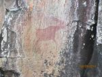
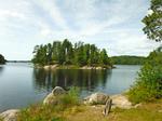 Bossy squirrel’s island. September 9 we base camped at Fish Stake Narrows. The ubiquitous little red squirrels serve as our alarm clocks every morning. A light rain fell most of the day. Lee and Al trolled while the ladies chatted under the tarp, and picked bones from leftover pike from the previous evening’s fish dinner. Vickie unpacked a large bag of potato soup mix, whipped up a wonderful fish chowder; a warm, hearty lunch on a dreary wet day. Lee and Al trolled up numerous walleye, bass and pike among the islands, with Al landing the biggest bass of the trip at 19.5 inches (4-5 lbs.). We paddled our three canoes down the Canadian shore to view the famous pictographs and Warrior Hill when the rain stopped in late afternoon. The Canadian shore is lined with awesome pink granite bluffs that slope 45° toward the water, crowned with evergreen trees. Lee and Roy scampered up the steep granite massif to see the panoramic view.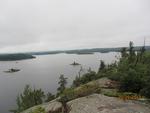
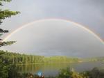
Somewhere over the rainbow. September 10 we traveled to Boulder Bay, 4 miles with no portages. The sky was partly cloudy. We paddled into Lac La Croix, hugging the west shore to avoid the windy open lake, passed through many islands, to a 5-star camp (306) in Boulder Bay. After setting up camp, Vickie and Roy paddled up the scenic Boulder River and fished a rapids, where Roy caught and released an 18” smallmouth and huge pike exceeding 30”. A brief downpour occurred while Vickie and Roy paddled down river to camp, ending with a splendid rainbow arching over the Boulder River. Back at camp, we all gazed in wonder at the most brilliant rainbow we ever saw, spanning the river. The sky cleared to display a pastel sunset. We hung clothes to dry, but midnight rain soaked them. We consumed the last of our eight boxes of wine.
Haven on a busy route. September 11 we traveled to Nina Moose Lake, 8 miles with 3 portages. The dawn was gorgeous. We paddled up Boulder River, and then portaged 118r to Lake Agnes. Lake Agnes was windy, and we paddled into steady headwinds to the river mouth, and then up Nina Moose River with 105 and 75r portages. We encountered the same beaver dam that challenged us last year when the water was lower, but we surged through gaps in the 12” rise by vigorous paddling and continued upstream. Nina Moose Lake is always busy due to proximity to the entry point and travel lanes, and our two preferred campsites were already occupied. Our third choice on the south bank between Moose and Portage rivers was a good campsite (1783) with room for four or more tents. We arrived at camp at 1:30 and ate a late lunch. A cold front approached from the west bringing a brief storm before clearing. We waited out the storm under our tarp, and then watched a pale golden sunset. Nina Moose Lake is weedy, and we were too busy drying wet clothes and tents and organizing gear to fish.
Déjà vu River. September 12 we returned to civilization. Our Nina Moose Lake campsite was only 3 miles and five portages from EP16 parking lot, and our last morning should have been easiest. Lee and Roy both packed away their maps because the route is simple and familiar. We paddled the short stretch along the weedy south bank, and then up the Moose River. We were surprised to encounter a half dozen beaver dams, although we paddled through gaps without difficulty. We did not remember beaver dams when we descended the river last week. Was the water that much lower? Is this the same river we descended nine days earlier? No travelers appeared to confirm our whereabouts. Vickie and Roy paddled ahead, and were relieved to recognize a familiar landmark, a steep granite promontory on the east bank a mile from the lake. Lee decided we were on the wrong river, so we turned around and returned to Nina Moose Lake to start over. Back in the lake again, we were confused, until Lee unpacked his GPS and realized we correctly ascended the Moose River the first time and should not have turned around and returned to the lake. The eye in the sky does not lie. We started back up the Moose River a second time. This time, we met numerous travelers entering the wilderness, but we were too proud to ask them if we were on Moose River, and we were no longer in doubt. By now, we were seasoned voyageurs, and we quickly overcame the four short portages, and then the final 152r trail back to the parking lot. We were already thinking about next year when we emerged from the forest trail at the parking lot. Soon, we were back at the Chocolate Moose restaurant quaffing cold beers.
Memories. We paddled 38 miles, not including day trips and one wrong turn, and we portaged 22 times on our loop route. Mosquitoes were bad, due to the warm temperature. We enjoyed seven beautiful sunny days, one rainy day, and two partly cloudy days with occasional showers. We hauled ten boxes of wine, totaling 28 liters, the equivalent of 37 bottles of wine. We enjoyed success fishing, as the winds were more moderate than last year. We were delighted by Oyster Lake, Gebeonequet Lake, and Lady Boot Bay and Fish Stake Narrows in Lac la Croix. The view from Warrior Hill will never be forgotten. Oyster and Gebeonequet Lakes are perfect, isolated get-away base camping lakes. We wish we could spend more than one night in secluded Lady Boot Bay. Fish Stake Narrows was wonderful, with excellent walleye fishing, although probably crowded during summer.
“We Got This”
“Day 2 morning”……. Started a little later for some of us. Zach was up first around 7/7:30am and roamed the campsite until the rest of us started stirring about 2 hours later. Apparently, we were all tired from the day before. Zach was to be our chef this morning and made us a breakfast of egg sandwiches on bagels with cheese and sausage washed down with a bit of coffee. Food seems to taste so much better in the wilds! It was still overcast but not raining so we took the time to explore the campsite a little more and do some fishing. Zach was after the BWCA grand slam and was eager to get started. The water off the campsite was a promising mix of deeper water, bays and rip rap. Artificial and leeches on slip bobbers were tried but to no avail, the first fish of the trip would have to wait. We started packing up camp around 10:30 and were back on the water around noon. Pairings were Eric and Nate, Nate in the bow. Tony and Zach, Zach in the bow. We had a shorter day planned and only wanted to get to South Arm Knife Lake, approximately 6 miles. The day started out smooth enough as we paddled the rest of Ogish although it rained off and on but nothing like the day before. Next stop, Annie Lake. The portage was a short 15 rods and was done in no time. Annie is a small lake and we were across in less than thirty minutes and after another short 15 rod portage we were on Jenny Lake. On Jenny Lake we ran across our first friendly loon. We had been seeing them fly by as we paddled throughout our trip so far but had not encountered one on the water. We slowed down and got to within 20 feet or so for some good pictures before it had enough of us and disappeared under the water. Off to Eddy lake. The portage was another 15 rods. Eddy is another smaller lake and we were across in no time. At the portage landing we had to wait a short while for a boy scout troop to arrange their gear out of the way before they went to visit Eddy Falls. Once this was done, we started the 25 rod portage to South Arm Knife Lake. The portage started out flat but then dropped off into a steep decline as you got closer to South Arm Knife. There was a large tree that fell across the trail but was still high enough where you could squeak under it with the canoe in the portage position. Once we finished the portage and arranged our gear so it was out of the way, we went to visit Eddy Falls. It is a short hike off the portage trail and totally worth it. Not the most beautiful waterfall we would see on our trip but impressive nonetheless. We took some pictures and returned to the portage landing, loaded up and were on our way. At this point we noticed the wind was starting to pick up. It really is amazing how the smaller water protects you from the wind compared to the larger water. We paddled along the southern shore to another campsite Andy had circled on our map. We arrived at the site around 4pm.
Site # 2037, the landing is a narrow stretch of beach that was probably 15 feet across and comprised of smaller gravel rock. There is a short trail that leads up to the campsite, the USFS fire grate is in a small opening and had a few “windows” to the lake below. There were two tent pads that we could see and a few places to hang a hammock. There was a good place to hang the bear rope a short way off and ample places to fish from shore. The latrine is about 75 yards behind the campsite and has a small “window” through the trees to the lake, you can see out but you can’t see in. If you have a north or west wind it can get through and keeps the bugs down. We dubbed it the “serene latrine”. The site is more compressed than the others we saw but overall not too bad. I would give this campsite 3 stars.
Working off the lessons learned from the previous day, the tarp was set up first and then immediately afterwards the tents and hammock. All this in the daylight. It is amazing how much easier it is to set things up when it is light out, and dry for that matter. We stretched ropes and hung everything up to dry and set to the task of finding and cutting firewood. Dinner was steaks over the campfire, mashed potatoes and green beans. After dinner was consumed and dishes washed, we had the chance to relax a little and do some fishing. Tony set up his lounging hammock and Zach broke the 0’fer by catching the first fish of the trip, a decent sized smallmouth bass! Nate and Zach fished for some time using slip bobbers and leeches and added a few more smallmouth to the count. Zach then switched to the “pike slayer” and started on his search for the second leg of his quest for the BWCA grand slam. During the fishing excitement, Nate got snagged on a rock and decided that instead of losing the jig and leech he was going to paddle around and free himself. Well…… due to there being no weight in the canoe and only one man paddling the wind took hold and he could not get back. So, we had to execute a rescue operation. There was really no danger to anyone, just another lesson learned about canoes and how they operate. We had some sprinkles off and on that evening before the clouds started to break up and we were excited at the possibility of seeing our first BWCA sunset. Unfortunately, the clouds did not fully cooperate and we only got a fleeting glimpse of what might have been. Still we got some decent pictures. The night was ended around the campfire drinking hot cocoa and talking. We made progress today, things started to dry out and our spirits were lifting. We had been through the worst of it, nothing but downhill from here…. Or so we thought.
Distance traveled: 5 miles (0.22 miles portage) ~Ogishkemuncie Lake, Annie Lake, Jenny Lake, Eddy Lake, South Arm Knife Lake  boats still float so we are canoeing
  since you cannot canoe on land, we are portaging
  ....and canoeing again...
  loon crossing
  Eddy Falls
 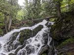 Eddy Falls, Zac is at the top so you have some sort of scale
  Campsite landing
  the main part of the campsite, note all the stuff hanging out to dry
  the firegrate
  one of the tent pads
  BWCA sunset, kind of.....
  the sun wants to come out.....
  despite the clouds the views are spectacular!!!
“Getting into A Rhythm”
The night before we decided that with the wind blowing as it was, we wanted to get an earlier start than the previous day. We deemed Zach as our alarm clock as he woke up earlier than the rest of us and he got us going. We had breakfast of Oatmeal, dried fruit and coffee (coffee being the most important of course). After everything was cleaned up and camp was packed away, we were back on the water at about 10am. Parings were Eric and Tony, Tony in the bow. Zach and Nate, Nate in the bow. The plan for the day was to paddle to Ester and find a campsite there and rest up for a longer stretch the next day.
The skies were partly cloudy with the wind out of the west and blowing steady. This was our first encounter with the wind on big water. The wind was blowing from the west right down the length of Knife lake churning the lake into a wavy playground. There were a couple of white caps but nothing to worrisome. We paddled into the waves until we were protected by an island, made an about face and rode the waves into an arm of Knife heading north and protected from the wind. Nate and Zac decided that they were going to troll for lake trout today as we were in a prime location to do so. This is where Zach conquered leg two of the BWCA grand slam, although not with a lake trout. Zach hooked into a decent sized northern pike. Although the pike was not boated due to the net being too small, we considered it a catch. The portage to Hanson from Knife was a little more difficult to find but our trusty navigator got us where we needed to be on time with no delays or backtracking. It really is amazing how you can navigate in the BWCA with just a map, we didn’t even use a compass! Although I would recommend bring a compass for sure.
The portage from Knife to Hanson was to be our longest portage of the trip and only portage for the day. Being 120 rods, we were eager to get a move on. This was hands down one of the most beautiful places on earth I have ever seen. About 30 seconds into the portage you are walking along a bubbling stream and serenaded by running water, few sounds in nature are more calming and relaxing. About half way you come to this waterfall next to some absolutely enormous Cedar trees. The place was small and intimate and perfect. The waterfall was framed in by some downed trees and the water was white, a stark contrast to the surrounding foliage and made the waterfall stand out. The trail is relatively flat until you reach the waterfall and then you take a right turn and climb towards the top of the waterfall before the trail flattens out again. A little way further you start a short decline with the trailing running past a beaver damn and the pond that was created. Although we did not see any beavers it was not from lack of trying. As you continue on the trail it winds its way up again through some stands of pine studded with groupings of purple and white flowers and onto a sharp decline to the landing on Hanson lake. This was my favorite portage.
Once on Hanson, it was pretty much a straight shot to Ester lake. Hanson is a little longer north to south so we hugged the western shore and stayed out of the wind for the most part. Zach and Nate trolled the whole way with no luck. In thinking over our trolling strategy, we were probably paddling to fast. Guestimating the distance traveled and the amount of time traveling, we were probably traveling at a crisp average of 5 miles per hour. This is way too fast as far as trolling is concerned which would answer why we caught no fish in this manner. I looked into it after we got back to civilization and one-person paddling is more than enough to get the speed needed for trolling. Any future trips when trolling, one person paddling and one fishing. It took us about an hour or so to go the length of Hanson and reach the portage. The word portage is a little misleading here as there is a channel you can float through to reach Ester. No leaving the canoe necessary. Tony and I waited on the other side of the channel while we waited for Zach and Nate to catch up as they were zigzagging all over the place while trolling. They probably paddled more than a mile farther than Tony and myself. Once Zach and Nate caught up, we noticed that the clouds were starting to build so we should find a campsite sooner rather than later. There is a larger island on Ester with two campsites on it. We tethered the canoes at a spot on the shore and sent Nate in to do some recon. We were starting to wonder what became of Nate when he came back and directed us to a landing spot for the campsite that was to be ours for the night which happened to be another campsite Andy circled on our map.
Site # 2009 is on the north west side of the island and it was awesome! It was roomy, spacious, with views for days. The site actually has 2 landings although we did not know this when we got there. It was only after we got everything unloaded and we started planning where to set everything up that we found the other landing which was right around the point a little farther down the shore. Although, tread with caution, the rocks at this second landing were very slippery. There were two levels to this campsite, a lower level and an upper level. On the upper level there is a large opening in the trees looking to the northwest towards the shore of Ester which has some high cliffs showing the rock face. The cliffs are probably several hundred feet high and were impressive to look at. The USFS fire grate is in an opening on the upper level and you can sit and look out this “window” at the rock face of these cliffs and relax. There are plenty of places to set up a tent and numerous trees for a hammock. The latrine is about 40 yards off the back of the campsite up the hill. From this vantage point, you can gaze down on the campsite. This site is 5 stars and hands down the best campsite of our trip.
Again, we set up the tarp and then our shelters shortly thereafter. Gathered and prepared some firewood and just started to relax when the first rumbles of thunder were heard. The storm was impressive rolling in from the northwest over the aforementioned rockface cliffs. During this time, we fried up yesterday’s lunch of turkey wieners with buns and fruit and sat under the tarp waiting for things to clear. Fortunately, the storm had more bark than bite and the after about 45 minutes of rain it rolled away and we were treated to the most vibrant and impressive rainbow I have ever seen. There was a double rainbow at one point. Obviously with a rainbow you need the sun and we were in for a BWCA sunset that would rival any I had ever seen anywhere. The setting, a little chop on the water, the clouds, the color, everything was beautiful. Words cannot begin to describe it. Dinner was chicken and dumplings with peas. This meal took a little while to prepare so in the down time some fishing was done. There were several smallmouths caught on leeches and slip bobbers but nothing else. Once dinner was consumed and cleaned up, we started up a fire and tried to wait out the stars. This was our first BWCA night that was clear and we were hoping for a view of the heavens in all their glory. Unfortunately, this did not happen. I am not sure if we didn’t stay up long enough or if we were too close to the summer solstice but the stars did not come out to shine. We went to bed about 11pm.
Distance traveled: 5 miles (0.38 miles portage) ~South Arm Knife Lake, Hanson Lake, Ester Lake  some morning fishing
  Breakfast
  packing up
  ready to portage! North arm of the South Arm of Knife Lake
  longest portage of the trip and absolutely the most beautiful
  the view from underneath the canoe
  check out the impressive size of these trees!!!
  the waterfall on this portage is beautiful
 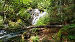 just beautiful
  find the canoe
  the beaver pond on the portage
  Hanson side of the portage
  the upper level of the campsite
  the lower level of the campsite
  here comes more rain!!
  waiting out the rain
  with some games
  Rainbow!!
  make that a double!!
  so bright!! The pot of gold was at the bottom of our lake!!
  The rock cliffs opposite the campsite landing
  the best sunset of the trip
  the air was so clear, the colors so crisp
  note the loon
  Just after sunset
  our version of a nightcap
“The Band Saga-Death”
Our human alarm clock woke us up about 7am to get an early push for the day. Our plan was to travel to Saganaga and with this being a lake closer to entry/exit points we wanted to get there as early as possible to make sure we got a campsite. Breakfast was an egg & bacon hash brown scramble washed down with coffee. After breakfast was cleaned up, we broke camp we were on the water again. Back to day one pairings, Tony and Nate, with Nate in the bow. Eric and Zach with Zach in the bow. The sun was shining with fluffy clouds and floating on a background of BWCA blue. There was wind but we were protected on the small waters of our first two lakes, Ester and Ottertrack. Little did we know how lucky we were to be headed west with the wind. Zach did a little trolling as we headed through the remainder of Ester with no luck. The portage to Ottertrack was a little harder to find but our trusty navigator again put us in the right spot. A total of only 80 rods, this was to be the hardest portage of the trip. You immediately start up a steep incline for about 50 yards before you level off for a short while before you start the decline which also had a pretty steep pitch. After bottoming out in the muck and mud that was at the bottom, you had to hurdle downed trees before you start to climb out and up before cresting and heading back down to the landing onto Ottertrack lake. This was where our only mishap took place as a pant leg got snagged on a down tree and someone almost took a spill. A day or two previously when we adopted the double portaging method, we started taking our packs first to get a lay of the land before going back to get the canoes. In this particular instance it paid off.
Ottertrack lake was no big deal and we crossed it relatively quickly. The waves were a lot like what we experienced on South Arm Knife and we were old hats at this and mastered the waves no problem. The last half of Ottertrack lake was pretty cool as you travel down a sandy channel with flowering lily pads on one side (Canada) and reeds everywhere. We were basically traveling the border. It was calm in the back waters and as we approached our next portage and we had to wait. This was no big deal as we tethered our canoes together and enjoyed the sunshine. We could tell we were getting closer to civilization as we were starting to encounter more and more people. One group that we met on the portage to Swamp Lake, also known as monument portage, told us that they had a hard time paddling west into the wind on Saganaga and that the wind was increasing as the day wore on. As we listened, we were glad about having the wind at our back for that portion of our trip.
Monument portage is 80 rods and is an up and down trail straddling the Canada/US border with three different little monuments placed along the border. The word monument is misleading as they maybe stand three feet tall. They are modeled after the Washington Monument and have Canada spelled out on one side and the United States spelled out on the other. We took pictures at one and then carried on our way to Swamp Lake. In a short while we were back on the water again and crossed Swamp in relatively short order. This is where we ran into our only trouble navigating and finding where we needed to go. The portage from Swamp lake onto Saganaga Lake is a small 5 rod portage that did not look like any of the other portages we encountered the whole trip. There was only a small opening that allowed a small stream to flow between the two bodies of water. We ended up going past it and found ourselves in a small back bay on Swamp looking over the map to figure out where we were. Once we figured it out and backtracked, we were only off maybe an eighth of a mile so really not bad at all. When we found the portage we didn’t even bother to unload the canoes. We picked them up and carried them across and into Saganaga. Now the real fun could start!
Saganaga is one of the largest lakes in the BWCA and is known to be finicky and temperamental and Saganaga was true to its reputation. The first part of Saganaga heading west from Swamp is really a series of smaller water connected by larger channels and did offer some protection from the wind. At this point we were still blissfully unaware of the wind and waves on the main part of the lake. After looking at the map we decided to stop at a campsite for lunch before getting out on the main part of the lake as we could see the white caps and knew we were in for a challenge. We stopped for about a half hour fueled up and got back to it. The next 2 hours or so would be the toughest paddling we experienced. Our saving grace was that the wind was at our backs. We saw zero canoes going against the wind and we passed more than one campsite on Saganaga with people just sitting there and staring into space, much like we did our first day. As mentioned previously we had the wind to our backs. I say this because a majority of the waves were pushing us as long as we kept the canoe perpendicular to the waves. This is great in theory but harder in practice as we also had rogue waves that would hit us at an angle on the back of the canoe and turn the canoe broadside to the east bound waves. When this happened, the person in the back of the canoe had to really torque on the paddle turned rudder to get the canoe back in position before to many waves hit broadside. I think this would happen once every minute or so and it was a constant struggle. We hugged the shore or at least tried to stay within a decent distance just in case something or someone fell overboard or capsized, we would have a chance to recover it or swim to shore. It felt like we were going so slow when in reality we were moving at a pretty good clip because we had the wind helping us out. And it didn’t help that every "next point" we saw was American Point. We kept small goals and once we accomplished that goal, we made the next small goal. Not soon enough we were around American point and out of the wind. It was amazing the difference it made. Later in our conversation we gave Saganaga the nickname SagaDeath. We estimated the winds were a sustained 15mph with gusts to 25mph with 3-foot rollers. It was quite the experience.
Once we finally got around American Point, we slowed for a stretch and then got back after it to get to the campsite we wanted. I was exhausted both physically and mentally after this and just wanted to get to a campsite and relax. Our goal was one of the four sites on Long Island, preferably one on the western shore making our paddle out the next morning that much easier. As we wove our way in-between the islands, we noticed motorboats parked at some of the campsites and hoped for the best. At last we arrived at site number 395.
Site # 395 is a beautiful site on the western shore of Long Island. The site was out of the wind and had a landing on the channel between Long Island and the island directly to the south and one landing facing east towards the main part of the lake. The site was large and had two parts with plenty of places for tents and trees for hanging hammocks as well as the bear rope. This would be our second favorite site of the trip. The part right off the south landing was pretty open and spacious and this is the place we elected to set up the tents and hammock. A short walk down the path which leads you to the other part of the site which was pretty sheltered and had the USFS fire grate. The logs that were arranged around the fire grate had you looking east over the fire grate through a window in the woods out over the lake. It was beautiful. The latrine was over a small rise towards the back of this part of the site and down the trail in the woods. It was a little darker back there and buggy.
We set up the tarp and then the shelters and hung a bunch of stuff out to dry as we still hadn’t fully dried out from our day one deluge. At this point we were a well-oiled machine and had everything set up, wood chopped and supper going before to long. Nate and Tony decided that since we had some extra time a quick rinse off in the water was in order. It was cold, or so I gathered from their reactions. The swim was short lived and then fishing started. Funny thing is we didn’t catch any fish where they were swimming, probably due to the 4 days of funk that were left in the water……. We managed to pull in a couple smaller smallmouths and then settled around the fire to relax. The weather at this point was perfect. Tony had located a small “bump” on the southeastern side of the island and a perfect place to hang his hammock. We lounged and relaxed and enjoyed our last night in the BWCA.
Distance traveled 9 miles (0.52 miles portage) ~Ester Lake, Ottertrack Lake, Saganaga Lake 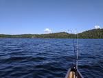 back on the water again
  toughest portage on the trip
 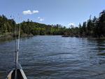 canoeing the channel to monument portage
  waiting for our turn to portage in the protected channel soaking up the sun
  yup, there were 3 of these of varying sizes
  before things got a little wavey
  let the waves begin!!
 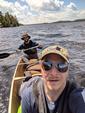 Zac and I are back there somewhere....
  round American Point, safety!! Note the whitecaps in the background
  with the waves behind us, on to our campsite
  one part of the campsite
  the path to the other side
 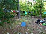 still drying out from day 1
  the firegrate
  BWCA sunset
  BWCA sunset, note the calm water. Where was that 5 hours ago!!??
 nightcap
“The Easy Day”
We were up again early this morning knowing that not only did we have about 6 miles to the take out point but also a 12-hour drive back to Illinois to accomplish. It was going to be a long day. The morning was still and warm with clear skies and was the perfect sendoff from the BWCA. We packed up, had a quick breakfast and pushed off heading east into the rising sun. Saganaga lake was like glass with the occasional motorboat sending ripples across the surface. Most of the motorboats were considerate and slowed to minimize their wake but a couple caused us to curse and change course to take the wake head on. Boat assignments were Nate and Eric with Eric in the back and Tony and Zach with Tony in the back. Nate and Eric headed out first and got three hundred yards or so into the lake when Nate yelled to slow up but not soon enough as the canoe was grounded on a boulder in the middle of what looked to be a deep channel. Upon further observation there was a boulder field extending north from one of the islands and we happened to find it. Needless to say, Zach and Tony gave it a wide berth to avoid any and all hard surfaces. As we paddled closer to the take out point we started to zig zag between the islands. It was almost like we wanted to prolong leaving the BWCA as long as possible. Once we left Saganaga we had to follow a channel or river down a way to exit point #55. Along the way we saw other outfitters and some impressive establishments. But none were as impressive as the bald eagle perched atop a tall dead tree watching us leave. We paddled as close as we could snapping pictures and saying goodbye as we entered back into civilization. We found the takeout point easily enough and made the call to come get picked up. We unpacked the canoes and made sure everything was accounted for and ready to be loaded up once our ride showed up. After the quick ride back to Tuscarora, we were greeted by warm showers and it was good to be clean. Then it was back on the road for the long ride back. We ended up staying a night in Eau Claire, WI and finishing the drive the next day.
Distance traveled: 6 miles (no portages) ~Saganaga Lake  we woke to a calm morning
  time to go
 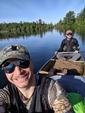 our last morning on the water, the weather could not have been better
  The BWCA sent us out in style
  BWCA guardian
  exit point 55, Saganaga Lake. Sadly our trip has come to an end.
  on the way back to Tuscarora for some warm showers
  the road home... go figure, its raining...
What a trip! What started out as a pipe dream in January, was realized by the efforts of a few good men in June. During the trip we faced adversity masked as a monsoon like rain of which this world has rarely seen, wind and waves and all were conquered. I have heard and read that you can’t quite put into words the range of emotions you go through as you travel the BWCA and it is true. A trip to the Boundary Waters Canoe Area is something you just have to experience for yourself. And when you come out the other side, and you will, you have this feeling of accomplishment that leaves you satisfied yet wanting more. In my 40 years of life there is no place like it. I will be back!!!