BWCA Entry Point, Route, and Trip Report Blog
July 12 2025
Entry Point 1 - Trout Lake

Number of Permits per Day: 12
Elevation: 1381 feet
Latitude: 47.9144
Longitude: -92.3220
Trout Lake - 1
First time in the BWCA- 73 mile solo trip - Frost River, Little Sag, Kawishiwi, Alice, Kek, and more
Entry Date:
May 24, 2014
Entry Point:
Cross Bay Lake
Exit Point:
Seagull Lake (54)
Number of Days:
6
Group Size:
1
Here is the account of my first solo adventure in the BWCA.
7:30am - Felt good to sleep in. Temperature is already 65ºF. The air is calm this morning. I end up finding a couple wood ticks crawling on me at this site. I guess it was bad site for mosquitoes and ticks. 

 I eat breakfast get camp packed up. I'm on the river a little at 9:10am. It's only a third of a mile to the first portage of the day.
P580 19 rods - It's a short portage and I'm now in Fishdance Lake. The pictographs are on my agenda, so I paddle my way down to the rock cliffs. The pictographs are easy to spot and I take some pictures. The striped rock cliff reminds me of the one on Makwa Lake. 


I then head back north and round the bend to the left towards the 2 portages that will take me to Alice Lake.
P587 95 rods - 10:00am - It's a long portage but has some very scenic and powerful rapids. I wouldn't attempt trying to run these. The next portage is less than a quarter mile down the river.
P589 24 rods - Not much for a landing at this portage. I park the kayak and scramble up the hill to check out the the rapids. I spot a couple of guys in a canoe at the bottom fishing. I see that the rapids are not much of a challenge and no strainers, so I feel they are safe enough to run and within my abilities. I head back to my kayak and paddle up the river and out to the left hand side of the river to avoid the downed trees. I run the rapids easy enough and slow the kayak to where the 2 guys in the canoe are fishing. They said they noticed me on the portage and then I disappeared. They then knew what I was up to when I came down the rapids. They said the fishing has been great and they've been catching their limit. I leave them to their fishing and continue into Alice Lake.
Alice Lake is quite large and the first few campsites are occupied. I stop at the next one (C1166) which is empty and has a nice sandy beach. It's about 11:00 so I stop and eat and also use the pit toilet while I'm there. 
 I get some photos of a loon and also talk with a large group (8 or 9 guys and 4 aluminum canoes) at the next campsite. They said they also came in from Lake One, same as the other fishermen I met. I paddle on north and up the narrow top of the lake.
P888 9 rods - It's about noon when I reach this short portage. It's a steep but short portage into Cacabic Lake. I paddle the length of the lake to the next portage.
P537 205 rods - My longest portage. As I pull the kayak in I see bluegill right by the shore. Could probably scoop them right out of the water if I was quick enough. I start the portage at about 12:30pm. There's some boardwalk sections, some of it deteriorated slightly, so I have to pay attention to my footing. I get my pack and paddles to the end of the portage and then hike the 2/3 mile back to get my kayak. By the time I get kayak to the other end and gear loaded up, it is 1:40pm.


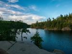
Thomas Lake is so clear and pretty. It's a long paddle to the narrows but the clear lake reveals some huge rock slabs under the water near the rocky islands. It's quite mesmerizing looking down at them that I have to be careful to keep my kayak upright. I reach the narrows and it's a cool sight to see the 2 big lakes connected by a narrow and deep rocky channel. 
 I find the channel is loaded with 24"+ suckers. Over 1000 of them in the channel I estimate.
Fraser Lake is a very long paddle, about 2.25 miles. I see one campsite occupied in the distance as I make my way to the portage.
P460 18 rods - Short portage into Gerund Lake. I stick to the right side of the lake to get to the next portage.
P452 28 rods - Very steep and rocky climb up to Ahmakose Lake. It's about 3:30pm now. It only takes a few minutes and I'm at the next portage.
P442 98 rods - I find a grass snake at the landing of the portage and get a picture. 
 This is a long portage that has some slanted cliffs on the portage trail. I start to hear some voices and shouts from the Wisini Lake area as I'm portaging my kayak. As I reach the landing, 4 guys in 2 canoes are coming toward the portage. I quickly load up and clear the portage for them. I ask if the campsites on Wisini are open and they said all of them are. I quickly spot the awesome rock cliffs to my left and put the camera to work.


I paddle on toward the campsite on the east side of the lake that's up on the cliff. On the point to my left I see a large boulder propped up by some smaller rocks and get a picture of it. 

5:00 pm - There isn't much of a landing at the campsite, so I tie up the kayak to the tree that's growing in the rocks there. I lug my gear up the rocks to the campsite. It's a beautiful campsite!


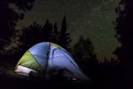
 I setup my tent on the nice grassy area. I lay my camp shower on the rocks to heat up and I cook up supper. I enjoy my supper on the rocks overlooking the lake. A nice breeze on the high campsite helps keep the bugs away. After supper, I clean dishes, take a nice warm shower, and also do laundry. I finish my journal entries at about 7:15. It is still about 75ºF. I enjoy the sunset and am in bed at about 9pm.
Day 4 Summary
12.71 miles | 8 lakes |1 river | 8 portages | 496 rods
Kawishiwi River, Fishdance Lake, Alice Lake, Cacabic Lake, Thomas Lake, Fraser Lake, Gerund Lake, Ahmakose Lake, Wisini Lake


 5:30am - Breakfast consists of apple cinnamon oatmeal, dried pineapples, bananas, and apples for breakfast. I enjoy the sunrise over the lake as I packed up camp. Looks to be another sunny day. With all the gear packed and securely loaded in my kayak I leave camp. 7:40am - I notice the guys in the camp to the north are up and about so I paddle over and talk with them briefly. They say they came up from the Frost River which is where I'm headed to. I wish them well on the rest of their trip and then head to my portage. They will be the last people I see for a couple days as I come to find out.
P520 139 rods - 8:00am - The portage is very long, steep at the start and has some very rocky sections that require careful footwork. The morning sun filters through the trees and the rapids roar down below me to my right. The sights make up for it being a long portage. Being a bit sore, I'm relieved to get to the end of the portage with my kayak and shed the weight off my shoulders. 9:00am  Frost River - The Frost river is winding and slow. The map shows a P143, but there is nothing to portage and I continue to paddle my way through to Octopus Lake.
  P523 16 rods - A short rocky portage along the river. I snap a picture at the portage. It's a short paddle to the next portage.
P144 23 rods - I pull the kayak into the landing and look at the portage trail. Not far down the trail is a huge 5 foot tall boulder in the middle of the trail that I'd have to lift the kayak onto and over. I walk toward the rapids and scope out if they would be runable or not. No strainers and no big drops. A few rocks to maneuver around, that's all. I head back to the kayak ensure my gear is secured. Carefully maneuvering the kayak in a good line, I punch the rapids. I manage the descent easily but I can tell I scraped a few rocks underneath. That was a rush! I excitedly stop the kayak at the end of the portage use my sponge to extract some the water that splashed in the cockpit, and then take a picture of the rapids I ran. 
P142? 10 rods? - This portage appeared about 200 yards sooner than it was on the map. It was short and had a cool waterfall that I snapped a picture of. Also spotted a beaver here. 
Large rocks seem to be strewn about most likely by ancient glaciers.  I continue to paddle down the Frost River make it to P138
P138 29 rods - Portage completed to Chase Lake and I stop to eat. I paddle strait across the lake to the next portage.
P133 23 rods - The portage was a bit steep, especially at the end with a smooth slanted rock face. 
Pencil lake lives up to the name as it is long and thin. An enjoyable and scenic paddle.
P136 35 rods - Portage is on the southeast side of the river, not northwest as indicated by the map. A bit mucky where I get back in the kayak and the current is moving decent as the river is narrow. I continue paddling down the river.
P141 16 rods - This portage was about 150 yards down from what the map indicated.
P880 5 rods - No portage. Paddled through.
P149 5 rods - This portage was a quarter mile sooner than the map had shown. I pulled the kayak over the rocky dam instead.
P147 14 rods - No portage. Paddled through. P139 12 rods - No portage. Paddled through.
I make it to Afton Lake. Afton Lake is nice, and I contemplate camping here for the night, but it is only 1:30pm and I still have enough energy to travel.
P131 25 rods - Steepest portage ever. Very steep going up and down. It's a bit tricky to keep the tail of the kayak up when heading down. I'm very careful with my footing as a slip here could be disastrous. The photos do not do justice to how steep the trail actually is. 

It's about 2:20pm now and the portage is completed. I'm in Fente Lake. It's alamost a mile to the other side of this long and narrow lake.
P125 15 rods - Nice and short portage that takes me to Whipped Lake.
I had originally planned on possibly going left into Time Lake and then to the west end of Mora to skip the portage, but decided against it as there was no portages and it probably wouldn't be able to be paddled through fully. I instead take the portage.
P474 98 rods - Long portage. Glad that one is finished and only one more to make it to Little Saganaga Lake.
I paddle through Mora Lake and snap some pictures before I reach the next portage. 

P451 48 rods - 4:00pm - Steep portage but it has amazing views of the roaring rapids below. A great sight. I snap a few pictures and video. 
4:30pm - I stick to the left shore as I paddle Little Saganaga Lake. I end up hitting dead end bay. Check my map and head northeast to get around the point. I paddle towards the island that has 2 campsites on it. I pass the eastern campsite and decide check the one on the west side.
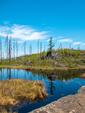
5:00pm - I reach C537. It's a beautiful campsite. The area to the north looks to be burn area with dome rock hills visable but all the islands and everything south is untouched and green. I get camp setup and gather some water in my water filter bags and fill my camp shower up and lay it out on the rocks in the sun. 
 I cook my homemade dehydrated beef stroganoff. It's delicious! I spot a float plane fly over to the north of me. Hopefully nobody is lost or in trouble. It's the only plane I see or hear the whole time in the BWCA. I hang my camp shower in a tree and take a much needed shower. I feel so much better now. The loons start to sing around 7pm and it's still about 83 degrees out. I enjoy the sunset and the island chipmunk comes by to say hi.
 I get to bed about 9pm and fall asleep to the singing loons.
I wake up around midnight and peek out of the tent. The stars are out so I grab my Canon S100 point and shoot and take a few shots and then go back to bed. 

Day 2 Summary
12.36 miles | 9 lakes | 1 river | 12 portages | 384 rods
Frost Lake, Frost River, Octopus Lake, Chase Lake, Pencil Lake, Afton Lake, Fente Lake, Whipped Lake, Mora Lake, Little Saganaga Lake

 I eat breakfast and pack up the camp. The nice trail to the pit toilet in the morning
 align="left" > I stack a few small rocks I find on the rocky point into the shape of a small bear. A loon swims nearby so I grab my camera and take a photo.
  I have camp packed up and kayak loaded by 8:00am and start the long paddle 2.3 mile paddle across Little Saganaga Lake. Still no sign of anyone else on this big lake.
 I also spot a loon as I paddle toward the portage and get a picture.
  My phone pings a cell tower briefly, but quickly loses the connection and I'm unable to get a message out.
  I paddle the small pond to the next portage.
6:30am - Looks like a calm morning. 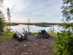
 I eat breakfast and pack up camp and hit the water at 8am.
P314 38 rods - The portage to Alpine Lake followed some powerful rapids. I paddle across Alpine Lake and take the first portage to Seagull Lake
P308 101 rods - I see an older couple doing a double portage with their canoe. Plenty of room at the landing so I pull in my kayak and start my portage. I chat with them for a while and find out they are from Fort Wayne, IN.
It's about 9:30am when I start the long paddle across Seagull Lake, nearly 6 miles. The rocky islands are picture worthy and I snap a few shots along the way.


I reach Seagull Outfitters at about 10:50am. I get my kayak and gear loaded up and chat with the outfitters for a while. I leave the outfitters and head south on the Gunflint trail to the Magnetic Rock Trail, part of the Border Route Trail.
Once I reach the trailhead, I grab a water bottle and camera and start the 3 mile round trip hike to the Magnetic Rock. This area is burnt from the Ham Lake Fire of '07, but it is still quite beautiful with the multi-colored rocks everywhere. 

 I reach the Magnetic Rock and it looks totally out of place. This tall rock just standing upright on the top of a hill looks like a giant placed it there. It's a 60-foot tall glacial erratic.


I finish my hike and start the long drive back home. I can't wait to plan another trip up here again.
Day 6 Summary
8.78 miles | 3 lakes | 2 portages | 139 rods
Jasper Lake, Alpine Lake, Seagull Lake
Also a 3 mile hike on the Magnetic Rock Trail.
---------------------------------------------------------------------------------------------------
Total Trip Summary
72.98 miles | 50 lakes and ponds | 4 rivers | 54 portages | 2122 rods (double portaged for a total of 19.9 miles of traversing portage trails)


6:00am - Clear skies. I got up and attempted to hike to Elk Lake but the terrain was tough. Lots of burnt and blown down trees. After getting half way there I head back to camp. As I get near camp my phone pings a cell tower. I get another message out to my fiancee to let her know my location and that I'm doing good yet. I get back to camp and the signal is lost. That's the last time I get cell signal for the rest of the trip. When I get to camp I eat breakfast and pack up. I decide to wear my long sleeve shirt for the next couple days. After 4 days of being in the sun all day without any sunscreen, my arms are on the edge of burning. They haven't had adequate time to adjust after the long winter we had. I leave camp at 8:30am
P423 11 rods - A short downhill portage with a stone staircase takes me to Strup Lake. The paddle across Strup Lake was peaceful in the calm morning sun.
P412 86 rods - A long fairly flat portage till the end where it went steeply downhill with a rocky staircase. I passed the intersection of the Kekekabic Trail on this portage.


9:30am - Kekekabic Lake is spectacular. Awesome rock cliffs, clear water, and lots of islands. The Kekekabic ranger cabin on the way, so I make a quick stop here.
Then I continued on to the Kek ponds. The short portages are small ponds are time consuming. It feels like I get 2 paddle strokes in and I'm across the pond. Then unloading gear only to walk about 50 yards and then load up again.
P738 7 rods - Small pond.
P737 9 rods - Pond.
P345 21 rods - Small pond.
P342 5 rods - Pulled over the beaver dam and into the last pond. I come across 8 guys in 4 canoes and have to wait briefly for them to clear the next portage around noon.


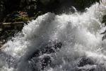 P336 12 rods - Short 12 rod portage into Eddy lake. I head toward P333 to check out Eddy Falls. Upon reaching the portage, I park my kayak and grab my camera to get some pictures.
I take some at the top and near the bottom of the falls. Eddy Falls is quite powerful.
Upon returning to my kayak, I meet a group of 4 boys from Minnesota with their camp leader. We chat briefly and then I paddle back across Eddy Lake to my next portage.
P338 20 rods - Uphill portage into Jenny Lake.
P352 18 rods - Another short portage to Annie Lake.
P064 16 rods - Portaged into Ogishkemuncie Lake. Ogish was a very long paddle. Over 3 1/2 miles to get to the other end. Towards the end I start to get into the Cavity Lake Fire area. Can see a lot of exposed domed rock due to the fire. Not as pretty here.
P319 34 rods - Portage into Kingfisher Lake. It is 3:30pm. No campsites here so I have to continue on. The wind is really starting to pick up.
P315 30 rods - Portage into Jasper Lake. The wind has picked up strong from the south and is making big waves on the lake. I decide to take the first campsite (C0801) since it is 4:00pm. The site is quite nice and the wind is keeping the bugs at bay. I setup camp and make supper. Tuna salad on tortillas with cheese. Easy to make and I didn't have to cook. I realize I've packed way too much food. I have way over half of it left and this will be my last night here. I set out my solar charger and charge battery packs for my camera and charge my phone. Also set out my shoes to dry in the sun. 
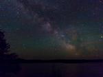
 6:30pm - Still quite windy. I can't wait to get home. It's been a great trip, but I miss my fiancee. Only 2, maybe 3 portages left for the trip. 7:00pm - A big flock of geese fly north overhead. I read a book for a couple hours and get to sleep around 9:00pm. I wake up at about 1:00am and take some pictures of the stars.
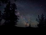
Day 5 Summary
14.23 miles | 13 lakes | 12 portages | 276 rods
Wisini Lake, Strup Lake, Kekekabic Lake, Kekkekabic ponds x 4, Eddy Lake, Jenny Lake, Annie Lake, Ogishkemuncie Lake, Kingfisher Lake, Jasper Lake
6:30am - Looks like a calm morning. I eat breakfast and pack up camp and hit the water at 8am.
P314 38 rods - The portage to Alpine Lake followed some powerful rapids. I paddle across Alpine Lake and take the first portage to Seagull Lake
P308 101 rods - I see an older couple doing a double portage with their canoe. Plenty of room at the landing so I pull in my kayak and start my portage. I chat with them for a while and find out they are from Fort Wayne, IN.
It's about 9:30am when I start the long paddle across Seagull Lake, nearly 6 miles. The rocky islands are picture worthy and I snap a few shots along the way.
I reach Seagull Outfitters at about 10:50am. I get my kayak and gear loaded up and chat with the outfitters for a while. I leave the outfitters and head south on the Gunflint trail to the Magnetic Rock Trail, part of the Border Route Trail.
Once I reach the trailhead, I grab a water bottle and camera and start the 3 mile round trip hike to the Magnetic Rock. This area is burnt from the Ham Lake Fire of '07, but it is still quite beautiful with the multi-colored rocks everywhere. I reach the Magnetic Rock and it looks totally out of place. This tall rock just standing upright on the top of a hill looks like a giant placed it there. It's a 60-foot tall glacial erratic.
I finish my hike and start the long drive back home. I can't wait to plan another trip up here again.
Day 6 Summary
8.78 miles | 3 lakes | 2 portages | 139 rods
Jasper Lake, Alpine Lake, Seagull Lake
Also a 3 mile hike on the Magnetic Rock Trail.
---------------------------------------------------------------------------------------------------
Total Trip Summary
72.98 miles | 50 lakes and ponds | 4 rivers | 54 portages | 2122 rods (double portaged for a total of 19.9 miles of traversing portage trails)