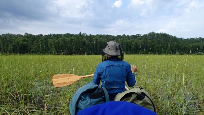
Boundary Waters Trip Reports, Blog, BWCA, BWCAW, Quetico Park

BWCA Entry Point, Route, and Trip Report Blog

October 12 2024

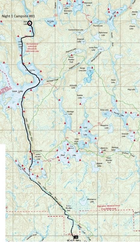
Entry Point 14 - Little Indian Sioux River North

Little Indian Sioux River (north) entry point allows overnight paddle only. This entry point is supported by La Croix Ranger Station near the city of Ely, MN. The distance from ranger station to entry point is 32 miles. Access is a 40-rod portage heading North from the Echo Trail.

Number of Permits per Day: 6
Elevation: 1364 feet
Latitude: 48.1466
Longitude: -92.2103

Kelso and Matt's 2018 Kruger Challenge

by Kelso
Trip Report

Entry Date: September 15, 2018
Entry Point: Little Vermilion Lake (Crane Lake)
Exit Point: North Fowl Lake (70)
Number of Days: 4
Group Size: 2

Trip Introduction:
When Matt (Nordstjernen) and I found out about the WaterTribe Kruger Challenge, we knew we had to give it a shot. Read the 2018 Kruger Challenge discussion thread here. It was an honor to participate in this new BWCA tradition, following in the footsteps of Verlen Kruger, Clint Waddell, BeaV, and many others. My highlight of the trip is actually not described in this report. To me, the best part was meeting the other challengers as they each finished at Grand Portage, as well as meeting Clint Waddell and hearing him describe his now legendary canoe voyages. View our trip GPS track here.

Report


[paragraph break]

Gear

[paragraph break]

Canoe: We used Matt’s Kevlar Wenonah MNII, purchased used a few years ago from Sawbill Outfitters. It handles well on big lakes and holds a true course even in strong winds. The MNII isn't very maneuverable since it has no rocker, but that is not an issue for the Kruger Challenge. For light weight and speed, we think that this canoe is ideal. In the future we want to install foot braces for more efficient paddling. Matt paddled bow and I paddled stern nearly the entire trip.

Paddles: Matt was eager to try out his new ZRE Powersurge. I had my trusty (but slightly heavier) Bending Branches Black Pearl II. Both paddles worked fine. Although the shaft of my paddle broke near the end of the trip, at that point we only had 1.5 miles of paddling left to go so it didn’t matter. We were lucky that my paddle didn’t break earlier in the trip, since we didn’t bring a spare.

Packs: We took a single CCS Hybrid canoe pack for all our gear, lined with a heavy-duty plastic bag to keep our sleeping bags dry. The main thing was not to waste time loading and unloading a small pack that didn’t easily fit all our gear. We wanted to be able to dump everything out quickly and stuff everything back in just as quickly. Matt also brought a small daypack which we used to distribute the weight for portaging.

Shelter: We left the tent at home. Instead we brought Marmot down sleeping bags and Goretex bivy sacks to keep off the rain (the bivy sacks come from the military surplus modular sleep system, very cheap and easy to find on ebay). We each had an inexpensive Thermarest Z-lite pad, which can double as a canoe seat cushion. We brought a silnylon tarp in case of bad weather, but we never bothered to set it up. At night when we stopped we just dumped out the pack, took off our wet socks, and crawled inside the sleeping bags as quickly as possible before we got chilled. We were asleep within minutes of landing the canoe. In our opinion, any stopped time that we wasn’t spent sleeping was wasted time. Matt got annoyed with me at one point because I described a toilet pit stop as “dawdling”. I suppose he was right in that case!

Food: We didn’t put much thought or effort into food. In fact, we didn’t get around to packing our food until 10pm the night before we started (much to the amusement of our bunkmate Nctry). We mostly ate Snickers, Cliff bars, cookies, tortillas, peanut butter, and venison jerky. Matt made some energy balls with creatine and caffeine which helped. A dried milk and sugar drink each evening was a special treat. For “dinner” each day we had Uncle Ben’s microwaveable rice packets, which I microwaved before the trip and we ate cold to save time. We brought a bottle of calorie-dense olive oil which we drank plain and added to the rice dinners (Matt accidentally purchased a bottle of olive oil cooking spray instead of pure olive oil, which turned out to be great since the second ingredient was grain alcohol, for uniform spray). Needless to say, we had no trouble drinking the whole bottle of olive oil. Although we brought a Jetboil in case of hypothermia, we never used it. Instead, we took turns eating and paddling. One of us would always paddle while the other ate as quickly as possible, then we switched. That way, we never stopped moving. We called this “hull foods”. Our advice is to pack less food than you think you need, since you won’t have time to eat it all anyway and a dwindling food supply is good motivation to paddle harder. There were a lot of candy bars and peanut butter left over when we reached the Grand Portage, which was just extra weight to carry.

Clothing: Each of us had a down sweater, a hat, long pants, a rain jacket, a T-shirt, shorts, and 2 pairs of Darn Tough socks. We also had a precious extra pair of dry wool socks reserved for emergencies. Underwear is useless and just causes butt rash. We wore trail running shoes, since we have learned from ultralight backpacking that boots are too heavy, cause blisters, and don’t dry out nearly as quickly as trail runners. Waterproof boots no good either, since they just do a great job of trapping water that gets in over the top. We never hesitated to get our feet wet or slog through mud; no time for pussyfooting. Socks and shoes were always wet. Putting cold wet socks back on at 4am is a miserable experience.

Navigation: We brought 3 fully charged Android phones loaded with GPS tracks of the Kruger Challenge route. We like the Backcountry Navigator Pro navigation app. Our experience with Garmin GPS units is that they are very proprietary and impossible to customize, and that they have unreliable firmware issues. One phone got wet and died, but the other two survived the trip. We also had a couple of power bricks to keep the phones charged. For backup we did take a wide-scale Superior National Forest paper map, which is printed on a single large sheet of paper (we didn’t want to waste time refolding the small-scale McKenzie maps every time we got to the edge of the page). In the future we want to figure out a hands-free way to mount a cell phone to the thwart, because one of us always had to stop paddling to check our position, which wasted a lot of time.

Miscellaneous: Headlamps were a must for night-time portaging. Trail-Toes ointment was helpful for butt rash. Since we took turns eating we only needed one spoon. Toothbrushes were useless since we were too exhausted to bother brushing our teeth. Homemade bungee-dealee-bobs were useful for strapping items to the canoe at portages. We brought a trekking pole and a big garbage bag, hoping to use the garbage bag as a makeshift sail if there was a tailwind (the bag would be held up by the bow paddler using his paddle and the trekking pole for masts). Unfortunately, we had headwinds or (at best) calm winds the entire trip so there was no opportunity for sailing. MSR Dromedary water bladders allowed us to keep our hands free to paddle and drink water at the same time. We used a Sawyer Squeeze to filter water until we got past Lac LaCroix, after which we felt comfortable drinking unfiltered lake water (we considered filtering water a waste of time). For dirty water we used an old SmartWater bottle, since the threading on the caps of SmartWater bottles match the threading on a Sawyer Squeeze filter (the squeeze bladders sold with Sawyer filters are unreliable and tend to burst after a few uses). [paragraph break]

[paragraph break]

Day One: September 15 – 53.5 miles

Our alarm goes off at 4am and we are ready to go! We have spent the night at the Voyageur North Outfitters bunkhouse in Ely, after the WaterTribe pre-challenge meeting at the Grand Ely Lodge. Nctry is already up making coffee. We drive to Piragis and join the other challengers at 4:30 am for the shuttle ride to International Falls, arriving at International Falls at 7:30 am. Our exact starting point is the Ranier City Beach on the western end of Rainy Lake. A breeze out of the east is already blowing off the lake.

Getting in the vans at Piragis in Ely, on our way to the start.

Ready to shove off from the Ranier City Beach on Saturday morning. [paragraph break]

After an exciting hour unloading canoes, taking photos, and wishing good luck to the other challengers, we shove off the beach and start paddling. Our starting time is 8:28 am on September 15th. Our goal is 100 hours or less. I have the watch, so I’ll be calling out the time every hour. Tonight we need to reach Little Vermillion Narrows, hopefully farther. If we can reach Lac LaCroix tonight we will be ahead of schedule.

Right away we are paddling hard against some chop and headwind, taking an early lead ahead of the other canoes. BeaV and Kendra keep up with us for the first 2 hours, then drop behind to wait for their teammates. We turn south around the Island View peninsula and take a heading across Black Bay, moving quickly now without a direct headwind. Thanks to a helpful tip from Mzee, we stay left of the wild rice patch and find the channel of the Ash River without delay. As we paddle upstream on the Ash River toward the Gold Portage, we see a young bull moose in the water. The Gold Portage is on the left, very scenic and well-marked by a signpost.

Back on the water, it’s just a few more bends to Kabetogama Lake, where we slow briefly for Hull Foods. We follow the northeast shore of the lake for protection from the wind, then cut south through the islands and continue straight east for a couple hours. We take a 10 minute rest to filter water after 5 hrs paddling, then press onward toward Namakan lake. We do our best to stay out of the way of the speed boats in the main channel, which don’t slow down or turn to avoid us. We chase a houseboat and match its pace for 20 minutes. A woman on the deck watches us, but if she is at all impressed that we are keeping up, she doesn’t show it.
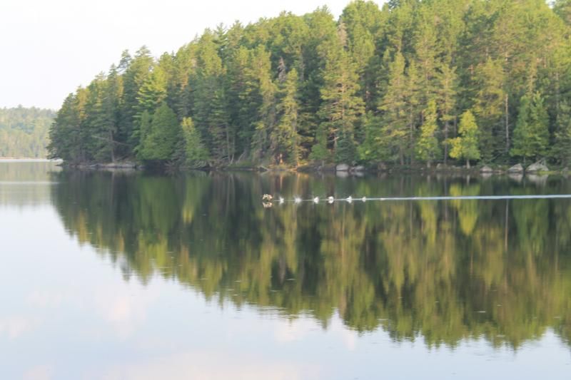
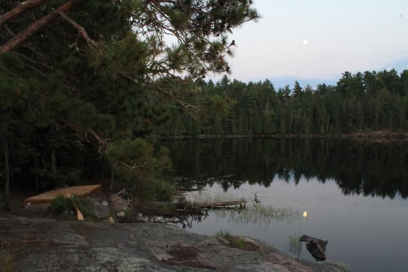
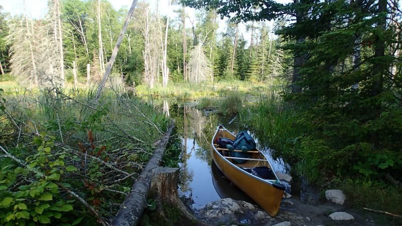
Struggling against a headwind again, we work our way from island to island and point to point. We decide to take Grassy Portage in order to get out of the wind for a little while. The sky grows dark and a line of thunderstorms approaches from the southeast. There is lots of cloud-to-cloud lightning and some rain. It’s getting darker now, with more lines of storm clouds. We finally reach Grassy Portage after nightfall, feeling chilled and hungry. We take a brief stop for food at the portage, then get back on the move to stay warm. We gingerly step over a sprung wolf trap right in the middle of the portage trail! Later Kruger Challengers encountered a young black bear caught in another nearby wolf trap, which they were able to rescue by getting a message out to the forest service via their InReach.

Back on the water on Sand Point Lake, we encounter more rain and lightning, with quiet pauses in between to dry off and warm up. At times we are surrounded by frequent cloud-to-ground lightning, cracking all around us and illuminating the shoreline. We are probably nuts to be paddling in this weather, but we don't stop. After all, the lightning is helping us see where we need to go. We have a scary moment when the lightning gets too close while we are out in the middle of the lake, but we feel safer once we get alongside the trees on shore. We'd rather not become human lightning rods tonight! We reach Little Vermillion Narrows at about 11:30pm and press the OK button on the Spot, having come 52 miles so far. Only a mile farther on, a sudden lightning strike hits much too close for comfort. We are momentarily blinded and deafened. Matt smells ozone, and we are done. Quickly pulling up on shore, we find shelter and manage to stay dry as the heavy rain hits. [paragraph break]

[paragraph break]

Day Two: September 16 – 60.0 miles

The alarm goes off at 3:30 am. We haven’t slept well in the rain, but at least we are still mostly dry, and the rain has stopped. The vote is to sleep a bit longer. We finally wake up and get back on the water at 5:30 am, feeling well rested but frustrated that we are already oversleeping and falling behind schedule. Ahead in the distance we see headlamps glittering at the campsite on the south shore of Little Vermillion Lake. Is that BeaV’s group? The lights vanish as they start moving ahead of us. Chasing hard, we start up the Loon River and hurry up the winding bends. The sun comes up and a strong breeze is blowing out of the south. At least it’s going to be a sunny day. We reach Loon Portage and start across Loon Lake, catching glimpses of BeaV’s group far ahead. We catch up to them at Beatty Portage, where we have a brief argument with the mechanical portage operator who wants us to pay $10 for using the dock. It turns out you can’t use the docks at Loon and Beatty portages without paying a fee. On to Lac LaCroix! The wind is at our backs, so we try to get ahead of BeaV’s group. Paddling past the pictographs alongside BeaV and Kendra, we chat and swap stories with them of our adventures in last night’s rain. Their group reached Little Vermillion 3 hrs behind us, but only got 2.5 hrs of sleep. We are doing much better than them on a full 5 hours of sleep.

We enjoy the brief tailwind while it lasts as we head north along the western arm of Lac LaCroix, then we turn east and the tailwind is gone. We slow down for Hull Foods, allowing BeaV’s group to catch up. Then we pass them again when they stop for lunch. We put on sunscreen, but it’s already too late. Our faces and lips are sunburned, and soon I will lose all the skin on my lower lip.

We turn south to take the shortcut around Coleman Island through Fish Steak Narrows, battling a strong headwind again. The relentless wind slows us down and saps our energy. We get a brief break from the wind in Fish Steak Narrows, then we are exposed again on the southeast arm of Lac LaCroix. The wind is blowing such a chop that every wave breaks over the bow and splashes into the canoe. After several minutes, the canoe is rapidly filling with water. I can’t steer or control the boat, and there is no time to bail water. We let the wind drive us to shore, arriving on an exposed rocky beach on the Canadian side. There we dump out our wet stuff and stop for 15 mins to dry out in the sun. While we are stopped, BeaV’s group catches up and passes us again, paddling hard into the wind. The wind dies a bit and we get back on the water; I am in front this time to trim the canoe in the waves. We watch BeaV’s group turn east toward a Canadian-side portage to Iron Lake, but we decide that we can go faster by taking the longer American-side portage, which is a short-cut past Bottle Lake. We hurry to the southeast corner of Lac LaCroix and immediately start the portage. A quarter mile in, the portage crosses a large beaver pond. We slog through muck to get across the beaver pond, then waste precious minutes looking for the portage on the other side. We find the trail and finish the portage. No sign of BeaV’s group. Did we get ahead of them?

Back on the water. The sun is getting low in the sky and the wind has died down. Time to put on some miles! We take a wrong turn around an island, forcing us onto a slightly longer course. No time for regrets, just keep paddling. We are on Crooked Lake now, right? We’ll just paddle across Crooked Lake and sleep tonight. Wait, what’s that portage there? We don’t remember that portage. Let’s just pull the canoe upstream, but where are we? Walking upstream, we feel confused. What is that huge waterfall? Suddenly we understand. We have forgotten that we are still on Iron Lake. That’s Curtain Falls. We scramble up the rocks and get back on the water, paddling on Crooked Lake for real this time.

The sun is setting, a first quarter moon is coming out, and the wind is calm. Let’s go! We paddle hard toward our goal for the night at the other end of Crooked Lake. The Milky Way is beautiful, but soon clouds roll in and it’s totally dark. Navigating is a bit slower, but Matt is doing a good job. How much farther to the pictographs on the southeast end of Crooked Lake, Matt? Only about 2-3 more miles. A couple miles later: how much farther to the pictographs? About 2 more miles. A couple miles later: how much farther to the pictographs? Actually measuring it this time, it’s two more miles, plus another mile to the portage at Lower Basswood Falls. Hang in there, we can make it. We finally pull up to the Lower Basswood portage, exhausted but happy with our big-mileage day. We must be well ahead of BeaV’s group by now. It’s 12:30am, time for a 4 hr sleep right here at the portage landing. [paragraph break]

[paragraph break]

Day Three: September 17 – 56.5 miles

The alarm goes off at 4:30am, and we are up and moving right away. Across the portage and up the Basswood River to Wheelbarrow Falls. No time for a break, onward toward the big Basswood Portage. The sun rises as we approach Basswood Portage, wading up a few short sets of rapids. A black bear runs across the portage trail right in front of Matt as he carries the canoe. No time to stop to see the falls, but we’ve seen them before. The wind is calm and it’s time to cross Basswood Lake. A brief pause for breakfast and a bathroom break, then back on the water. Around United States Point, then heading south. A southwest wind has come up, but at least it’s a partial crosswind. Maybe we’ll even get a tailwind once we turn east! After a shortcut around Ottawa Island, we find that the wind isn’t exactly helpful, but at least it isn’t a hinderance. We keep going to Prairie Portage at a steady clip. No break at Prairie Portage, just immediately back on the water on Birch Lake. We approach the Birch Lake checkpoint, press the OK button, and keep paddling. For the first time in the trip we start seeing other paddlers on the series of portages between Birch Lake and Knife Lake.

Hull Foods selfie on Basswood Lake.

Basswood skies.

Matt at Prairie Portage. [paragraph break]

As we approach each portage we jump out of the canoe into the water and wedge our paddles under our seats. I grab the portage pack and Matt grabs the canoe. We walk quickly to the other side, dropping the canoe and loading the pack in one quick motion. Then we jump in and are off again. We meet WaterTribers LaughingWarrior and Hylidae at the portage into Carp Lake, greet them warmly and shake hands, and off we go. As we are getting back into the canoe on the other side, they come running up the portage shouting our names. We have dropped one of our cell phones on the portage trail, which they picked up. Wow, thanks so much saving the day for us!

On to Knife Lake, where we meet one of the shuttle drivers from Piragis, out for a weekend trip with his buddy. We ask them to tell BeaV’s group to paddle harder. Is BeaV’s group still right on our tail, or have they dropped behind?

A long straight northeast shot up Knife Lake, paddling hard with no pauses. Then on to Ottertrack Lake, where we slow briefly for Hull Foods. We snarf down a couple of chorizos as a special treat, then back to paddling. We are still feeling good. Perhaps we can make Gunflint Lake tonight!

A couple short portages and we emerge onto Saganaga Lake. It’s huge and the dreaded headwind is back. Once again we are struggling from point to point and island to island. To keep my mind occupied I imagine the full process of changing my baby daughter’s diaper, soothing her, putting her in the stroller, and taking her for an afternoon walk. The sun sets as we finish the biggest crossing and reach shelter in the islands at the middle of the lake. We pause for a moment at an island to get out our headlamps, but during the pause we get chilled and start shaking with cold. We force ourselves to keep paddling to stay warm. It’s pitch dark and navigation through the islands is difficult, especially since many of the islands are not shown on our map. We are irritable with each other and exhausted, trying hard to keep going in the cold. We reach Saganaga Falls, but the water level is so low that we barely recognize where we are. The short rocky portage next to the falls is treacherous in the dark. We are both shaking violently from chills and struggling to stay focused. The Granite River seems like an impossible obstacle.

We must keep moving to stay warm, so off we go. At least we are more sheltered from the wind now that we are off Saganaga Lake. We cross one treacherous rocky portage and then another. There aren’t any good campsites. Then things get better. We find new energy to cross Maraboeuf Lake, taking the shortcut portage to Gneiss Lake. It’s 1:30 am. There are a few campsites here on Gneiss Lake, but we can’t find them in the dark. We drag our canoe on shore and find ourselves on a bare rock, exposed to the wind and cold. A few yards back in the woods we find a small sheltered hollow in the bushes, where we collapse. I set my alarm for 5 am. We crawl shivering into our sleeping bags, finally get warm, and fall asleep. [paragraph break]

[paragraph break]

Day Four: September 18 – 59.5 miles

The alarm goes off, but I sleep for another half hour before waking Matt up. Putting on our wet socks and shoes again is miserable, but soon we are back on the water. For a few minutes we are disoriented and paddle up the wrong bay, but we quickly get our bearings and find the portage. A couple portages later we are on the north end of Clove Lake. We see a huge bull moose in the pre-dawn light, then two cows just afterward. Across another short portage, and another. We avoid two short portages by getting out and wading, pulling the canoe through the fast water. As we emerge onto Magnetic Lake the sun is fully up and it promises to be a beautiful day with calm winds. We reach Gunflint Lake and slow down for a Hull Foods breakfast. In our minds we are now beginning the final push to the end. We have 24 hours left to reach Grand Portage if we want to beat our 100 hour goal.

Peter on a portage north of Magnetic Lake.

Granite Falls on the Granite River. [paragraph break]

The wind is calm as we paddle steadily across Gunflint Lake. We talk about a previous trip on Gunflint when we became windbound by a storm. We are grateful for today’s good weather, since we know that this could be much harder. We pass the checkpoint at the east end of Gunflint, then continue beyond the sandy beach up the channel toward Little Gunflint Lake. A thick mist rolls in as we enter North Lake. The sky and water are both soft gray; we cannot tell where they meet. Down North Lake and across the Height of Land Portage to South Lake. We have both been here several times before, so we feel like these are our old stomping grounds. Across a portage to our favorite Rat Lake, then over the isthmus to Rose Lake. A swan flies silently past in the mist. Rose Lake takes longer to cross than we remember, but eventually we reach the start of the 2-mile Long Portage. We chuckle about how we used to dread this portage. Today we don’t even pause for a break midway; it only takes us 40 minutes to complete.

Now we are on Watap Lake. In the past our tradition has been to climb the beautiful cliffs on the American side for a photo, but today we must keep moving. Soon we reach long and narrow Mountain Lake. It’s late afternoon, we feel warm and comfortable, and navigation is as easy as aiming for the farthest point on the horizon. Without slowing our pace, both of us close our eyes for a half hour nap. I keep one eye cracked to watch the horizon, but otherwise we paddle silently and rest while we can.

There are three more portages to Moose Lake, including a short hop across swampy Vaseux Lake. Here I tell Matt the story of Vaseux, an unpleasant and lazy voyageur whose fellow voyageurs spitefully named it after him, so that centuries of travelers would rue his name as they crossed this scummy little pond.

The sun is setting now, but we are eager to keep pushing onward. We continue to rest while paddling, a technique we have begun to call “Moose Motoring”. From time to time throughout the afternoon I have heard a soft cracking sound in the shaft of my paddle. Hopefully it won’t break, since we don’t have a spare. I decide to ignore it and pretend that there’s nothing to worry about. Knowing that there won’t be any more safe drinking water for the rest of the trip, we fill our water bladders here on Moose Lake, hoping we have enough to avoid filtering from now on.

We complete the portage out of Moose Lake as the daylight disappears, emerging onto North Fowl Lake. In the dark, we struggle through a thick patch of wild rice, then cross the lake. Suddenly, we smash nose-first into a long sandbar. Oops! We backtrack around the sandbar and come out onto South Fowl Lake, the last lake of the trip. Our excitement increases as we approach the South Fowl portage. This is the final leg, and we have no intention of stopping.

The South Fowl portage starts out with a steep climb up the first hill. Right away it is steeper than any portage we have seen in the Boundary Waters. We reach the top of the first climb, and then the trail starts climbing again, even steeper than before. Now it is ridiculously steep, with deadfalls blocking the trail and boulders to scramble over. “This isn’t portaging,” I complain, “this is mountain climbing!” We press on, refusing to be beaten by the portage. Finally Matt drops the canoe. The trail is so steep he can’t carry it by himself. Together we muscle it up the hill a few yards farther, then give up. Matt thinks we must have lost the portage trail. Perhaps we have taken a wrong turn and are climbing a trail to the top of the cliff overlooking the lake. I check ahead, and sure enough, just a few yards farther the trail becomes impassable. We are at a dead end, exhausted, in the dark.

No time to lose. We drag the canoe back down the way we have come, under the deadfalls and over the boulders. We reach the spot where the first climb ended, and sure enough, there is a junction where we went left when we should have turned right. Back on the correct path, we realize that the South Fowl portage isn’t done with us yet. The undergrowth is thick and there are lots of deadfalls. It gets worse the farther we go. The final hundred yards of the mile-long portage is a slog through knee deep mud, but compared to descriptions we have heard these portage conditions still seem to be better than average.

Now we are on the Pigeon River. It’s totally dark, with fog everywhere. Our headlamps can’t pierce the fog, and I become disoriented trying to peer ahead into the darkness. I do my best to follow the riverbank. The water is calm and we are paddling strong, but we know that there are rapids up ahead. We hope that the river level is deep enough that we won’t have to drag our canoe over the rocks in the dark.

The water level turns out to be extremely low. We are forced to get out and drag our canoe over the rocks in the first set of rapids, then climb back in for a few paddle strokes only to run aground on another shallow stretch. The pattern repeats over and over for the next 5 miles. We drag the canoe, stumbling and splashing in the dark, until the water gets deep enough to float. We climb back in, but only paddle a few feet before we are climbing back out again. Unable to see anything up ahead, we keep blindly fumbling our way forward, hour after hour, miserably wet and cold. We bump and scrape the canoe across hundreds of rocks. In the dark we scare up sleeping geese and swans, as well as at least four moose. There is no good place on either shore to stop for a rest. We have no choice but to keep going.

Just before 3 am we finally escape from the shallow rapids. Our map shows that we have 3 more miles to Partridge Falls. It is so dark that I cannot tell where the riverbanks are, so we zigzag back and forth across the channel, trying not to run into anything. At last we reach the minimum maintenance road at Partridge Falls. At 3:30am we scramble ashore and collapse on the riverbank, unable to go any farther without a rest. I set my alarm for 5 am and we fall asleep immediately. [paragraph break]

[paragraph break]

Day Five: September 19 – 10.5 miles

All too soon, my alarm goes off. I can’t move or sit up. I’m shaking with cold. I lie there in my sleeping bag for a few minutes, and then start yelling as loud as I can. Matt wakes up and we yell at each other, trying to force ourselves to get going again. We have no idea what we are saying, but it works. We get out of our sleeping bags, get our socks and shoes on, pack up our gear, and start the portage. As soon as we are moving the adrenaline kicks in. We are approaching the Grand Portage, and are determined to finish strong. We need to finish before noon today in order to beat the goal of 100 hours.

In the dark, we almost miss the trail down to the river below Partridge Falls. Matt bumps the canoe and my paddle falls out. I run back to pick it up, then we finish the portage and scramble into the canoe. Suddenly, I realize that the shaft of my paddle has snapped in half, probably from the cracking I heard yesterday and the shock of being dropped. With a broken paddle I’m not much use, but I can still manage to steer. There’s only a mile and a half farther to Ft Charlotte, so the broken paddle is no big deal.

At Ft Charlotte we don’t stop for a moment. We already took our rest at Partridge Falls, and the excitement of finish line fever is keeping us going. It’s 6:30 am and the sun is already up. We jump out of the canoe, grab our packs, and immediately start the portage.

Our gear is light enough that we don’t need to stop for frequent rests. At the crossing of the Cowboys Road we stop for a 15 minute break, then keep going without a break to the end of the portage. We laugh and joke and cheer each other along, excited to reach the finish line. Although we know that there is a net downhill grade for us on the Grand Portage, it still feels like there are plenty of uphill climbs. Matt’s shoulders are aching from the weight of the canoe, so he walks faster and faster. We reach the Highway 61 crossing and run across the road before another car comes speeding past. From there it’s just 0.6 miles to Lake Superior. I catch a glimpse of two wolves running silently on the trail ahead. Soon we are coming out of the woods, crossing through the gates of the Grand Portage Stockade, and dropping our canoe into the water of Lake Superior. We climb into the canoe, I take a photo, and Matt presses the OK button. We are done! To celebrate, Matt flips the canoe and we go under water. Drenched and laughing, we climb out on shore and shake hands. It is 10:01 am on September 19th, our total time is 97.5 hours.

Finish photo!

Matt at Lake Superior, after a celebratory dunking. [paragraph break]

No one is here to meet us. A park ranger named Melvin has seen us and agrees to be our witness. We call GrandmaL. She and Marcie are on their way; they will be here in a couple hours. We walk to my car, parked at the marina, and blast the heater for several minutes to warm up. Then we go get our stuff and strap the canoe on top. Matt calls his girlfriend and I call my wife. It’s great to hear her voice again. We drive to the gas station and buy Gatorade, which has never tasted so delicious before. Then we go to the casino and order lunch at the restaurant. We are obviously wet, disheveled, and bleary-eyed. We have trouble with the simple process of ordering food from the menu. Matt wolfs down his meal, but I’m too tired to eat much. Marcie and GrandmaL arrive. It’s great to talk with them. They have been referring to us as “Flash and Zoom” but we are now rapidly becoming “Crash and Burn”. We get a hotel room, check in, take long soothing showers, spread out our wet gear all over the room to dry, and fall asleep.

Grand Portage at last!


Routes
Trip Reports
a
.
Routes
Trip Reports
Routes
Trip Reports
Routes
Trip Reports
.
Routes
Trip Reports
Routes
Trip Reports
x
Routes
Trip Reports
fd
hgc
Routes
Trip Reports
Routes
Trip Reports
Routes
Trip Reports
Routes
Trip Reports
Routes
Trip Reports