BWCA Entry Point, Route, and Trip Report Blog
June 30 2025
Entry Point 52 - Brant Lake

Number of Permits per Day: 4
Elevation: 1500 feet
Latitude: 48.0692
Longitude: -90.8455
Brant to Tuscarora via Little Sag Route:
Round
Brant
Bat - Mud
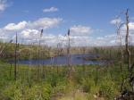
Gillis - burn area is evident:
French
Peter - first lake trout:

Virgin
Little Sag - green trees again!
Mora - gorgeous divide of burn and green
Crooked
Owl
Tuscarora - second lake trout!
Missing Link - with lighter food pack, the portage is OK
Round
Mugwump PMA -- A Fine & Pleasant Misery
Entry Date:
June 26, 2011
Entry Point:
Brant Lake
Exit Point:
Missing Link Lake (51)
Number of Days:
7
Group Size:
2
Let me start by saying that the way things ended up was not a result of “lack of planning”. We spent more time than we should have pouring over maps, old and new satellite images, and message boards. To say this trip was poorly planned would not be fair…to say it was ill conceived however, might be closer to the truth.
We were pumped for this trip. The best evidence of this was when Heavy Canoe (HC) and I called each other close to our departure date and we both should have been at work. “Guess where I am right now? I’m at Gander Mountain”. “SO AM I”, came the response.
It was to be our last great adventure trip for several years. Starting next year, both of us committed to bringing our young kids on trips = the trips would have to be easier. So we purposefully picked a tough trip. We wanted to test our limits…and we did.
DAY ZERO
HC & I decided to meet up at my brother-in-law’s property outside of Black River Falls Friday night. It was a convenient location where we could put up a tent then get an early start on Saturday for our trek up to the Gunflint Trail. On his way there HC was so caught up in his thoughts of the trip that he missed a turn and ended up arriving several hours later than planned in Black River. His late arrival couldn’t subdue our enthusiasm. We still talked for hours drinking cheap cold beer even though it was getting late.
DAY ONE -- SATURDAY -- THE TRIP NORTH
Despite being up late we were still up early, eager to get started. It wasn’t until we were at Perkins having breakfast that we realized just how early…seems our 40+ year old eyes had mistaken 5:30AM as 6:30. Heck, we now had even more time to make it to our outfitters (Tuscarora) on Round Lake.
It was actually quite enjoyable taking our time heading north. HC’s air conditioning was out but it was a nice enough day that it really didn’t matter. We could have taken my truck but my “Check Engine” light was on and we decided it was better to have an engine that worked than an air conditioner.
We made good use of the extra time. We stopped at all those places you’ve wanted to stop at but had to pass by because you needed to get to the Bdub. HC had been chatting with someone on the message boards who had a canoe shop in Two Harbors so we stopped there. We stopped at Betty’s Pies but it was too busy for us so we left. We ate the cookie I had won that morning at Perkins playing the drop-a- quarter-in-the-water-for-charity game.
We stopped at Split Rock, in spite of the crowds and went to explore the falls. It was good we stopped at there on the way up because on the way back it, along with every other state park, was closed due to the Minnesota shutdown.
We lost a little bit of time when we hit the washed out construction zone between Split Rock Falls and Silver Bay. We pushed through on the highway instead of the detour (a recommendation from our stops in Two Harbors). It was slow and muddy but it really wasn’t all that bad.
We made it to Grand Marais around 3:00. We had an early dinner at Sven & Ollie’s and picked up bait at that place just up the street from there. They guaranteed that the leeches would catch fish or die trying. In our case, it turned out that the majority of the leeches would never get to swim in a Bdub lake even though we hauled them for miles.
When we pulled into Tuscarora Lodge & Outfitters it was around 5:00. We had plenty of time to check in, watch the video, and get our permits & licenses. The outfitter tried to talk us into an aluminum canoe because of where we were headed but it was for that very reason that we insisted on a lightweight Kevlar.
We started to fill our packs. I had brought a bathroom scale along to help us with our decisions. It told us we were too heavy but we didn’t want to hear that so we ignored this early indication of what was headed our way.
We were packed before sundown. We headed to the docks to enter some GPS points and watch the sun set on a beautiful day. This was sure to be a GREAT trip.
DAY TWO -- SUNDAY -- WELCOME TO THE BWCAW or PLANNING MEETS REALITY
We were up at dawn = 5:00 and on the lake by 6:00. We chose to forgo the usual French Toast breakfast (served at 7:00) in order to get the early start on what was planned to be a VERY long day. As we paddled across our first lake we saw our first bald eagle.

Here was the plan: Round - West Round - Edith - Brandt - Gotter - Flying - Green - Bat - Gillis - French - Peter - Gabimichigami - Agamok = 11 ½ miles of portaging and paddling - a brief stop at Mueller Falls - then 2 ½ miles of the Kekekabic trail in order to get to Travois Lake in the northeast corner of the Mugwump PMA. By starting at 6:00 AM we had hoped to make Travois by 6:00 or 7:00 PM. By our calculations, that included 3 hours for the Kek trail leg.
Most of the trails were muddy based on all the rain the previous week. Whoever carried the canoe seemed to be the favorite food for mosquitoes. You would set the canoe down on the other end of the portage and a cloud of mosquitoes would rise up from the hull.
For portaging we arranged our packs so that we had options: 1) One portion was the canoe + paddles & fishing poles = 50 pounds 2) One portion was “The Big Easy” = a Granite Gear Superior One = 50+ pounds but was easy to carry given the waist belt and all the adjustments 3) The food pack = a cardboard box inside of a perfectly fitting pack = 30 pounds give or take 4) An army duffle with misc gear approximately 30 pounds

PORTAGE OPTION #1 Double Portage -One person takes the canoe the other takes Big Easy. We then both go back for the lighter packs and carry them forward. -Net distance traveled by each of us = 3 X the portage length
PORTAGE OPTION #2 Single Portage -One person takes the canoe + one of the lighter bags and the other takes Big Easy + the other lighter bag -Net distance traveled by each of us = 1 X the portage length -In our younger days this would have been the option of choice. On this trip…for the first time ever…we did NOT single portage with the canoe even once
PORTAGE OPTION #3 The 1 ½ Portage = so named because it is between the single and the double (BWCA.com) (throughout the report I hope to highlight the ideas we learned on this site that we used successfully) -One person grabs both of the light bags (one back pack and one front pack) and carries them ½ way where he then drops them and goes back for Big Easy. The other person carries the canoe all the way to the end then comes back for the combo pack (this combo pack, at 60 pounds or so, later became known as the Big Bastard). The person who went back for Big Easy then carries it all the way to the end. -Net distance traveled by each of us = 2 X the portage length -We used the 1 ½ a lot on this trip
We were in the Ham Lake and Cavity Lake burns nearly the whole way in. It really is a shame. Some of those lakes would have been very desirable had they not been wiped clean of trees. I particularly liked the layout of Brandt with all the twists and turns to explore. We saw a loon with 2 chicks there. It would have made a great short trek with the kids if there had been a forest for shade and scenery. It was clear that these areas are still decades away from bearing any resemblance to being “forested”.
The portage from Brandt into Gotter had been lengthened to accommodate lower water levels and the mud that occupied what had been lake in previous years.
Only saw 2 other groups on the whole trek in. We passed a solo traveler on the staircase from Gotter into Flying. The other group was a ranger and his summer helper on the portage from Flying into Green. That slowed us down a bit. Even though the Ranger complimented us on the speed at which we had covered distance so far, we had to stop and wait while the Ranger checked our permits and signed off on them.

The Ranger also advised us that the forecast for the day had changed and now included evening showers and high winds. With Gabi to come, the possibility of high winds was not good news.
We had lunch on the portage from French into Peter. We wanted a scenic place but that was a little challenging in the middle of the burn. We opted for the high point of the trail on a big rocky surface with a breeze to keep the bugs at bay. It is a pretty view in its own right. All of the rock formations that would have otherwise been hidden by foliage were clearly visible. We each had 2 water bottles with approximately a liter of water in them each. By the time we hit Peter we were out of water. (BWCA.com) Based on what we had read on this site we felt safe refilling our bottles on Peter without filtering them provided we filled them in deep water. Peter is a big deep lake and showed no beaver sign so we comfortable filling them there. We had to admit…the water tasted really good = better then the stuff that came through the filter.
We got to Gabi and our wind fears came true. While the whitecaps hadn’t quite formed yet it was clear they were coming soon. NOTE: on our last trip into the Bdub we challenged big waves on Saganaga and ended up swamping 2 canoes so we are more than a little sensitive to big waves. Crossing Gabi in a straight line to our portage would not be an option because that would have the canoe going parallel to the big waves. We had to head more to the southwest = more into the wind, then cut back to northeast = down wind. It was a tense time for us. Forward progress slowed as we battled into the wind and added a whole lot of extra distance to the paddle. The exit from Gabi into Agamok was a little hard to find but a good topo GPS helped us to get the right stretch of shore.
The Agamok side of the portage was a completely different story. On that small, narrow lake you barely knew the wind was blowing. That is why it is a little surprising that we got through Gabi without a scratch but then managed to run square into a Volkswagen sized boulder submerged in still water on Agamok. You would have thought we were Rookies hitting a rock like that. Yeah, the skid pad got a work out on that one.
We saw our first of many beaver on Agamok. On this trip we would see lots of moose sign but never see a moose. We would see bear sign but never see a bear. Beaver on the other hand seemed like they were everywhere.
Our plan had been to pull out at the last campsite on Agamok before the portage to Mueller. We figured that surely there would be a trail from the campsite to the Kek trail because that would provide access to Mueller Falls. We found the campsite and went to unload. Our second rookie mistake in the span of 20 minutes = we both looked for footing to unload the packs and neither of us held onto the canoe. That really wasn’t a good idea given that there is a current there drawing all things into the falls. I looked back to see the canoe about 5 feet from shore. That really isn’t that far but it was more than enough to be past the rock ledge we were standing on. In I went. It really didn’t take much to haul it in from 5 feet but I was now wet all the way up to my arm pits.
Having secured the canoe…we investigate the site. There was a trail back to the privy but it did not connect to the Kek trail. We thought about bushwhacking but decided that it would be easier to pick up the trail where it crossed the Agamok to Mueller portage. We wanted to see the falls anyway so we would be passing through that intersection regardless. We found the portage easy enough and hauled all the gear to the intersection.
The trail to the falls went through a campsite that Kek trail hikers must use. There isn’t a place to put a canoe into water but it is relatively close to the sounds and scenery of the falls. The falls was worth the side trip. The bridge gives a nice vantage point and the water fall is through a chute in the rocks forcing the water to flow through in a roar.

Below the falls was a sight that made us wince. Someone had created a “shelter” at the side of the creek. Pine poles had been stripped of branches and bark and used for rafters. Then they had taken great pieces of bark from a large live birch tree and attempted to drape them over the rafters. Finally, they made a fire ring out of rocks right there at the bottom of the falls. The scene was a perfect poster for the OPPOSITE of Leave No Trace.

After spending time with the Ranger, covering twice the water on Gabi, and our little side trip to the falls…it was now 5:30 = close to the time we had hoped to pull into Travois. We went back to the intersection to discuss our options. Did we push on for Travois? We figured we could make it there in 2 to 3 hours. That would mean arriving at 8:00 or so = still light out but not by much. We reversed our trend of making rookie mistakes by making one of the best decisions of the trip. We left the canoe on the Kek Trail then brought the rest of the gear to the hikers campsite on the way to the falls.
It was a nice enough site despite the lack of a lake view. It had a nice flat tent pad and a decent fire pit. HC got busy with dinner while I went to fill the water jug. Without a canoe I was forced to wade into the water at the bottom of the falls and fill up there. Needless to say, that water had to be filtered before use. Dinner that night was red beans & rice with TVP (textured vegetable protein).
While I did the dishes HC did the fishes. He managed to catch a sucker on worms and a small Pike on a spoon. He was fishing in the pool just below the falls.
As dusk began to fall so did the rain. After rising at dawn and the long day of paddling turning in early was the easy choice.
Getting ready to tuck into my sleeping bag I found not one but 2 DEER ticks up near the underwear line. I had been wearing zip-off performance pants all day that had been sprayed with premethrin (BWCA.com)1 week earlier. The one thing premethrin was supposed to protect me from was deer ticks and it had failed. I later found that my canvas cargo pants sprayed with premethrin did a good job of keeping the ticks at bay. The dramatic difference in performance will need to be investigated further.
DAY THREE -- MONDAY -- THE KEK TRAIL AND ONLY THE KEK TRAIL
We awoke to rain. Sleeping in a little, in the hopes that the rain would subside, didn’t work = all it did was get us a later start.
Had oatmeal and coffee with Bailey’s as creamer for breakfast. We were packed and ready to hit the trail at roughly 10:00.
Made one of my biggest mistakes of the trip right here…that’s saying something for this trip. As we were standing there in our gear we discussed the virtues of wearing performance pants vs. rain pants. We both had knee high waterproof boots (BWCA.com) because we knew we would be bushwhacking. Being ever so optimistic about dry weather we went with the performance pants. They may get wet but they would dry out quicker and they would breath better than rain pants. They would also likely hold up better to the tugs of briars and limbs than our rain gear would. Horrible decision. Even when the rain would stop for short periods of time the vegetation which crowded the Kek trail was soaked. Before the end of the day we would be hiking with water ankle deep in our boots. Waterproof boots don’t do you a squat bit of good if they are holding the water in rather than the water out. Think of all the extra weight in every step. In my case, the tops of my boots rubbed against the ultra light fabric of my soaked through pants and they started to chaff. I still have the sores now as I type this. I got so wet that my underwear got soaked and by the end of the day I was painfully chaffed in areas I will never tell my mother about.
And I got off easy…HC’s boots were the pullover type so he needed to wear other shoes inside them. The only other shoes he brought were his water shoes. They simply weren’t made for that kind of hiking. By the end of our trip he had so much duct tape on his feet it looked like he was wearing sandals. It was really a painful ordeal for him.
But all that would be realized at the end of the day and this story still has us at the beginning of the trail, optimistic about our challenge to bushwhack into the Mugwump PMA.
We had hoped to 1 ½ portage most of the Kek trail…doing it in medium sized pieces. But the rough terrain soon made that difficult. We had decided that for the toughest stretches we would double portage. Other than that first stretch…we started double portaging everything.
Ferns covering the trail soaked us as we waded through them. Branches that were out of the way for a hiker, required that a canoe be pushed through. Windfalls required that the canoe be walked through by both of us.
Generally, we are patient people. We have both run marathons and are used to enduring discomfort in the name of progress. The problem was…we weren’t making progress. The GPS showed that after 2 hours of hard work in the rain we had only managed to get the canoe about a mile up the trail. By this point we had hoped to have made it the entire 2 ½ miles. A bit frustrated by the pace we decided to change tactics. It was pretty clear that we were going to have to double portage nearly all of this. So, in an effort to feel better about our progress, we grabbed the 2 light packs (the food pack and the duffle) and decided we would push all the way through to Travois then come back for Big Easy and the canoe. The biggest mistake of the entire trip happened right here…it worked out OK but it could have been bad. By not taking Big Easy we left our water bottles behind. We also left the tent but it was the water that was really stupid.
Off we go with light packs and our pace picks up. The Kek trail takes you to some really neat parts of the BWCAW that you might not see otherwise. At one point you are high above the rest of the area and you can see for miles (when it isn’t raining). There are parts of the trail where it is really difficult to follow. Several times we had to rely on sawed logs and cairns to reassure us that we were headed the right direction. There are also parts of the trail where I found myself saying out loud, “Are you kidding?”. This usually happened when it climbed down a little cliff wall or plunged into a swamp.
The Kek trail is filled with moose sign in the form of droppings. One of the ways we passed the time was by yelling out “Poop Pile” every time we passed a bunch of moose plumbs. We also called out “Boot Spot” every time the trail got so mucky that you were glad you were wearing your boots.
Per the GPS we finally reached the saddle in the topo maps where we thought we could drop into Travois. We had seen the lake previously but it was from the top of a bluff. We couldn’t find a single spot that looked like an easy spot to start the bushwhack into the lake. We knew others had been to the lake so we decided to push forward towards the marsh at the base of Bushwah Lake. That was the lowest point into Travois. If we hadn’t found a trail in be then, that is where we would push through. We finally found the marsh and, much to our delight we also found a trail heading into Travois!
As hard as following the Kek trail had been this was several times harder. It was a path only in the sense that other people had been this way before. It was not a cleared path. You still had to climb over windfalls. The brush was so thick in places you had no choice but to cover your eyes and just push through.
Several times we lost the trail. All you had to do was go a couple of steps the wrong direction and you would lose all signs of a path. At one point, about ½ way to the lake, we were no longer on the trail and the way to the lake included climbing down a rock. We had come this far and we weren’t going to stop now, so down we went. At the bottom of the rock we found the trail again. Apparently, smarter folks than us had found a way that did not involve having to not hang from trees as you slid down the face of a rock with a pack on.
AT LAST…we had made it to Travois Lake! It was now about 2:30 in the afternoon. For those of you keeping track…we had been on the trail for 4 ½ hours. Our canoe was a mile and a half back up the trail. More importantly, so was our water and our tent. Had we been smarter we could have set up camp right then and there and gone back for the rest of the gear the next day. But we weren’t smart so our day of marching still wasn’t over. 
I had thought of drinking right from the lake but our entrance to the shore was met by a very unhappy beaver. Several times he/she slapped the water making it clear we weren’t welcome there. Given the threat of Giardia, drinking from the shore here without filtering the water was not an option.
We dropped our packs and decided to explore a bit before resuming our hike. It was clear that the lake was lower than it had been historically. It actually made it easier to walk around the lake because in most places there was a rocky shore to follow. You still had to negotiate the occasional windfall but in this part of the lake others had done the same before us and left clear indications of the easiest way to get through.
Due to the low water, the island in Travois was, in fact, now a peninsula. The connection was a bit boggy but not a problem for guys wearing boots. The island was really pretty nice. The only thing that spooked us a bit was that we found 1 beaver skull and 2 moose skeletons on the island. Wolves were the most obvious explanation. At the far end of the island there was a nice tent pad of tiny blueberry bushes and a spot with a rock bench that would be great for sitting around a small fire. It was an elevated site with nice rock formations all around. This would be our campsite. That decision made, we headed back for the bushwhack trail.

As we walked back we both admitted that we had realized some time ago that the canoe would not be making the trip to Travois. It was crushing to admit that, so neither of us had said it out loud. Knowing what we had hiked to get here it was clear that the canoe had no business on the Kekekabic Trail and stood almost no chance of being pushed through that bushwhack trail. I think it could have been done but it would have required yet another day of hiking. The canoe was still 1 ½ miles up the Kek trail (not including the distance along the bushwhack trail) and the terrain would slow the pace to a crawl. We had reached the point where the effort was not worth the reward. It was now 3:30. So we wouldn’t be hauling the canoe but we did have to go back for Big Easy, our water, and our fishing poles. Now that we had a better idea of what we were up against we were able to make better choices. We took the duffle bag and emptied the contents onto the lake shore. That would allow us to take some of the weight out of Big Easy for the trip back.
Following the trail out of Travois seemed much easier than following it in. The rain continued, to the point of pouring at times. Our boots had to be emptied several times. Without the burden of packs we made reasonable time given the terrain. We arrived back at the canoe around 4:30. We had hoped for a quick “turn” = set the canoe safely off to the side, drink some water, eat a PowerBar and get back on the trail. But we were beat. My feet now needed some duct tape and Jerry’s needed even more. We didn’t head back until 5:00 or so. At this point, the runner’s mindset took over. One foot in front of the other will eventually get you to the end of this race. We also downed some Advil which really seemed to help. We stopped a couple more times to empty the water from our boots.
The push through that bushwhack trail seemed even harder than the last 2 times. The lines on the fishing poles kept getting snagged. Big Easy was a nice pack on an open trail but here in the brush the branches constantly resisted against it. We made to the island campsite on Travois just before 7:00PM. Normally this is when you would hop to it…get camp set up before dark. But we had nothing left in us. We had been on the trail for 9 hours with very few breaks. Even the thought of going back to the shore to retrieve the food pack and the contents of the duffle bag seemed like too much work but we got it done.
Dinner that night was GORP, beef jerky, and Advil. Bed time started immediately thereafter.
DAY FOUR -- TUESDAY -- A DAY TO RELAX??? WHY WOULD WE DO THAT…
HC woke up at dawn to try his hand at fishing. I slept in until 7:30 or so. Breakfast was bacon & eggs = a nice treat after the gorp and jerky the night before.
I did a little fishing then we both got back together to discuss our options. Here are the things we took into account: -Travois is only known for having trout and trout in late June are in 40’ of water or so -We would never get our lures into 40’ of water without the canoe -The next lake over = Marble was known for walleye which would also be hard to catch from shore -If we continued on with the trip we had planned we would need to bushwhack to Van Lake and we still wouldn’t have a canoe. It also meant we would have to bushwhack through all of this again to get back to the canoe. -We weren’t likely to catch many fish (maybe not catch any) if we forged ahead with our plans -As tough as the bushwhack had been into Travois from the Kek trail, the bushwhack to Van would be worse because we wouldn’t have a trail to follow. It would also be 6-7 times longer than that bushwhack
So…the decision was made to bail on the PMA trip. We would make the rest of the trip a “standard” Bdub outing. HC’s friend at the canoe shop had talked up Kekekabic Lake and once we got out of here we would only be a couple of lakes away from there. We concluded that we would spend one more night on Travois then head to Mueller Lake, with the canoe, the following day.
That decision made, we also decided that if we were only going to have one more day on Travois that we owed it to ourselves to at least try to make it to Marble Lake. We were hoping to take it easy that day but it simply wasn’t in the cards. HC’s feet were really hurting but that didn’t stop him.
To confirm our plans we went to check the maps. NO MAPS! We checked everywhere but our maps (and permit) were gone. We had no idea if we had left them with the canoe (unlikely) or if they had fallen out of the packs on the way in. We weighed our options and decided that we would stick to our original plan of getting to Marble. My GPS had topo maps we could follow. Looking for our real maps could wait a day.
To prep for our trip to Marble we packed a lunch, our fishing gear, our rain gear, and the first aid kit. We then started down the length of Travois. We wanted to be on the northeast shore because it looked like higher ground heading into Marble. That said, on the northeast shore, right across the lake from the island were some cliffs that ran into the water with no shore to follow so we headed down the southwest shore instead. Then, when we got to that pinch point that Travois has, we waded across to the other shore.
The only wildlife we saw that day was snakes and we saw a lot of them. They were garter snake sized and none of them had a rattle. HC wondered out loud if Travois was French for snake.
The rocky shore was admittedly easier than a lake that didn’t have one but it was still tough on tired feet jumping from rock to rock. Then there was the occasional windfall that had to be negotiated. At one point, climbing down some rocks after a windfall, the footing gave way sending big rocks crashing into my leg. A big ‘ol bump showed up on my shin almost immediately but it didn’t hurt that bad and nothing looked broken so we forged on.
A little later we were walking around the end of a stream that ran through a bog. I got impatient and you could see moose had crossed the bog so I headed out across it in the hopes of saving some distance and time. It was part floating bog and part tussocks. (BWCA.com) I stayed on the tussocks wherever possible. I made it without incident and the stream was small enough to simply step across. HC followed.
We made it all the way to the ponds that separate Travois from Marble. (The canoe would have made this so much easier). We started to question the decision to follow this shore line. It now appeared that the other shore may have been a little easier to traverse and it also appeared to have the better entrance into Marble. The problem was that a creek ran out of these ponds into Marble and we would need to cross it. A small creek in the bog was one thing but this creek was easily 6 feet across and there is no telling how deep it was given the likelihood that it had a false bottom.
Our dilemma was solved when we spotted a beaver dam across the creek. We had no idea if a beaver dam would support us but we decided to try. You know…when you justify something by saying, “I’ll just be extra careful”…like somehow going along anything but “careful” is an option. The dam had water running over it and it really wasn’t that wide on top but it turned out to be a surprisingly solid foot bridge. We both made it across without incident.
It was clear we weren’t the first to stand on the other side of the dam. There was a trail from there leading in the direction of Marble. Our hopes were high. This was only a game trail but (BWCA.com) others had mentioned that game trails are often a real bonus in PMAs. In this case the game trail led us…straight into a huge marsh. The GPS topo map showed some higher ground if we back tracked to the beaver dam and followed the creek back just a short distance.
We found the higher ground but we also found our first real evidence of the Blowdown. The area was covered in windfall after windfall. We looked for game trails and started to follow a promising one. We had only gone in 50 feet or so before the trail ended in what looked like a bedding spot for moose. We tried to push forward. I climbed from windfall to windfall before finally touching solid ground again…only to be faced with the same scenario of more windfalls. Going this way was going to be very slow and it was entirely possible we would reach an impasse.
HC suggested that if we went back to the marsh and skirted the edge we would be able to get through, so we headed back that direction. This was a big marsh. We were climbing over obstacles and landing on squishy ground. The going got tougher and wetter until we reached a point where continuing on would involve getting into places where wading would be required. Wading into shoe grabbing muck just didn’t seem like a good idea.
Once again our plans were thwarted. Now if you told us that our lives were in danger and the survival of the American way depended on us making it to Marble Lake could we have done it? Probably. We could have plunged into that marsh jumping from tussock to tussock and wading through mucky streams. Or we could have taken on the Blowdown tree by tree and eventually made it through but…we would still have to come back and it was already mid afternoon. We got within a 1/3 of a mile of our goal (according to the GPS) but we just couldn’t find a sane way through so we headed back to camp.
For a change in scenery we decided to take the opposite shore back to camp. You will remember that from the other shore the one we were on looked easier. It wasn’t. This side of the ponds between the two lakes was all bushy marsh. Imagine high stepping through ankle deep water. Game trails crisscrossed the area but they invariably ended up in watery canals. This went on for a lot longer than we wanted before we finally stepped out onto solid ground and made our way to the southeast tip of Travois. We were hungry but it was really buggy there so we decided to push on hoping to find a rocky point to eat our lunch on.
After half an hour or so of more rock jumping and windfall crossing we found a point to relax on. We ate PB&J flatbread while HC decided to drown a leech. Needless to say…no fish. After resting for just a bit we decided to make the final push back to camp.
At one point the trail got tough. Boulders into the water blocked our way. We had three choices: 1) go for a swim 2) go up and around through heavy brush 3) crab crawl through a sloped gap in the rocks and if you slipped you would be wedged into a crevasse. HC took option 2 and I took option 1. HC had a real battle getting through but he made it. It turned out I only had to get about mid thigh deep into the water = I think I chose the better option for a change.
The final obstacle to this side of the lake was getting over that point that forms the land bridge between the 2 shores. Boulders and windfalls made the shoreline impassible so you had to go over the top. Just getting off the shore required a bit of climbing and then we faced our second run in with the Blowdown. Tree after tree blocked our route but we kept climbing over until we hammered our way through. (BWCA.com) I remembered where someone had suggested that this point might have been a viable campsite. That advice must surely have come from before the Blowdown. Maybe at one point it was a nice spot but today you couldn’t find a decent spot to hang a hammock let alone a tent. It reinforced our decision to not bushwhack all the way to Van. If it was all like this it would have taken 2 days to get there.
After that point we were back on our original shoreline trail and we made it back to camp in short order. All of the walking on rocks had really taken its toll on HC’s feet so he grabbed some Advil and took a nap. I grabbed my head net and caught up on journaling. I found that if I kept the journal to bullet points it was a lot easier to keep up. Just for grins I threw out a line with some crawlers but didn’t get so much as a nibble. The bugs were bad (mosquitoes and black flies) but at least the sun was out and everything was finally drying out.

That evening we had our first PMA campfire. HC used his hatchet (we had to justify bringing it along) to clear away the moss in front of our stone bench. That got us down to dirt. We quickly gathered lots of dried wood. Firewood is so much easier to find when you aren’t on an established campsite. We got the fire going easily and immediately realized the limitations of a fire that isn’t in a Forestry Service fire ring. The moss at the edge of our pit would dry due to the heat and then it would catch on fire. To compensate we upgraded our fire precautions. The fire was kept smaller -- it had to be manned continuously = you couldn’t turn your back on it for even a minute without confirming that the other guy was watching -- and we soaked the area around the pit with additional lake water.
With the extra precautions now in place we had a really relaxing evening in front of the campfire. The smoke kept the bugs at bay and the weather cooled off to the point where the warmth was nice. Dinner that night was TVP burritos and marshmallows. I can’t tell you why, but the marshmallows were exceptionally good that night. We had to force ourselves to stop eating them in order to have a few left for another night. We had hoped that this would be one of those “I can’t believe how many stars there are” nights but the clouds again rolled in. Another jug of lake water was brought up to douse the dying fire. We were sure to get it to the point of being able to stir the cold wet remains with our hands before we were reassured that the fire was out.
We took our ration of Advil and headed to bed. Yes, the Advil had to be rationed. We had brought a new bottle of 50 pills with us but it was clear that at the rate we old guys were downing them, running out was a real possibility.
DAY 5 -- WEDNESDAY -- THE LONG SLOG OUT
We woke up with the knowledge that this was going to be another long day of hiking. There were a few big differences between this and the trip in: First -- we knew what we were in for this time Second -- it wasn’t raining Third -- we had double portaged in. We would be single portaging out but it was just the packs = no canoe yet.
I had decided that much like a long race I would break this day up into a series of small goals and wrap my brain around those small victories rather than the amount of work still left in the day. My first goal: get packed up and have the gear ready to go at the entrance to the bushwhack trail. Packing went OK and I think we were ready to leave camp at 10:00. On normal trips I usually make a point of not knowing what time it was but with the long distances required today and recent experience with coming up short on goals we wanted to make sure we stayed on track.
In one of those half sleeping-half awake moments of inspiration the night before I realized that the best way to load our packs for the trek out was to lash the duffle to the food pack so that you wouldn’t need to carry a pack in front. Being able to see your feet would be valuable given the terrain we were headed for. We nicknamed this double pack Big Bastard. We took as much weight as possible out of Big Bastard and put it into Big Easy which was much easier to carry. We even poured out a large portion of the vodka that we had been hauling. Given how hard we had been working, getting dehydrated by drinking a bunch of cocktails just hadn’t worked into our evenings like it usually did. It was just one more place we could have saved weight had we known what we were in for.

With the duffle dangling off the back of the food pack we headed out. We didn’t even make it around the lake to our exit point before Big Bastard became a problem. We had to stop and regroup. HC took the Big Bastard concept and made it better by lashing the duffle to the top of the food back rather than the back of it. This made the load much more comfortable and easier to manage.
As we headed out I started to laugh. I explained my concept of little goals to HC and then pointed out that even the modest goal of having the gear at the head of the bushwhacking trail required us to completely stop and fix our gear. This was sure to be a long day. I had predicted that at some point we would laugh at challenge of our little adventure and we had finally reached that point.
We headed into the bushwhack trail and half way to the Kek Trail WE FOUND OUR MAPS. What a relief! Finding them on the trail, near a spot where the foliage was particularly thick, meant they had been ripped from the packs. This meant our mistake was not securing them properly and it wasn’t leaving them at the canoe. Somehow this made us feel better.
We arrived at the Kek trail in good spirits and decided to just keep on going until we got tired. We made good progress. We stopped to enjoy the view from the bluff that overlooks Travois. We pushed on and met another one of my little goals when we reached the canoe. We decided to leave the duffle bag at the canoe in an effort to lighten Big Bastard. The duffle could be carried later by the person not carrying the canoe.
 We pushed on past and brought the packs all the way to the end of the Mueller Lake portage. Yet another small goal. All that was left was to retrieve the canoe.
We spent some time at the end of the portage recovering. We added to the duct tape on our feet. The day was getting warm so I opted for water shoes and shorts. I know that isn’t the best apparel for taking on part of the Kek trail but the canoe was only a mile in and my boots were really rubbing the sore spots on my calves. We actually dug out the water filter and refilled our drinking bottles.
We struggled a little getting the canoe out of our little hiding spot but carrying it out to Mueller actually went fairly easy. All things considered, it had been a long day but we didn’t feel as beaten up as we did on the trek in. I had predicted it would take us 8 hours to complete our task. We started at 10:00 and finished at 5:30 = 7 ½ hours.
The canoe had been out of the water for the better part of 3 days. It felt good to be loading the packs into it and paddling again. Given the hour we decided that we would take the first decent campsite we saw and we would make it our base camp for a couple of days.
We didn’t like the first site on Mueller but the one near the portage to Ogish was nice so we unloaded there. We again saw beavers so we would definitely be filtering all our water. The site even came with lots of wildflowers…I took some pictures of them in honor of my wife who is always snapping “another damn flower picture”.


I enjoy fishing but HC truly loves fishing and he hadn’t been able to do much of it the last few days. So before we even set up camp I agreed to go with him and make an attempt at catching dinner. We set a time limit of 6:30. That time limit came and still no fish so I suggested that we go just past the campsite and drift back. If we didn’t have fish by then we would have to quit and set up. Sure enough, on that last little stretch of shore HC managed to pull in a 24” pike. Not big by any standard but more than big enough to feed the two of us. We were having fish for dinner!
I worked on setting up the tent and tarp while HC cleaned the fish. His love for fishing includes a knack for filleting. He manages to get 5 nice boneless fillets off of every pike. I had never eaten pike until I fished with HC and now I have come to prefer it.
It was a bit breezy that night so we had to create a cooking spot behind some rocks. Wild rice was one of the side dishes. This was also our first attempt at cooking our dehydrated veggies that I had made. It took longer to cook them than I thought. (BWCA.com) I remembered how folks on the food board described soaking their dehydrated food in advance so the following day we started the veggies soaking at noon which made them much easier to cook. Everything tasted great. It was so nice to finally have fish for dinner.
I don’t recall having a campfire that night. I can’t remember if it started to rain or if we just decided to call it an early night. Our evening nightcap had become standard = instant coffee with Bailey’s for creamer and a ration of Advil.
DAY 6 -- THURSDAY -- BWCA THE WAY IT IS SUPPOSED TO BE
We woke up excited to take on a day trip of paddling over to Annie, Jenny, the Kek ponds and maybe all the way to Kekekabic Lake itself. That plan, like many of ours this trip also had to be dismissed when we saw how strong the wind was blowing. Even on Mueller, which is a small protected lake, the waves were big. To take on Ogish and head for Annie would mean taking on big rollers. We instead opted to start the day fishing on Mueller which was reported to have a decent number of small pike.
Before we started fishing we wanted to cook breakfast but first I had to put up a wind break in the form of a tarp hung vertically between two trees and anchored at the bottom with rocks. Even with this set up there was still a breeze playing with the flame on the camp stove.
For fishing we started by just casting from shore with the hope that maybe the wind would die down later and allow us to still get in our day trip. HC lost a nice sized pike from just east of the campsite. I’m not sure if he was more upset about losing the pike (which got bigger every time he described it) or the lure which was a spoon that he had used for years.
When the wind had not died down by noon we ate a quick lunch of humus and decided to finish the day fishing Mueller from the canoe. Before we left we added water to the Ziplocs containing our veggies for the night. We started on the far east side of the lake near the falls. HC had brought a mesh bag from his Thanksgiving turkey that we filled with rocks and used as a drift anchor. He was using the traditional red/white Daredevil and I was using a deep diving Rapala. We also had a 3rd pole in the water with some crawlers on a slip bobber.
We had gotten just west of the falls, but not far enough to reach the section of shallows, when we started catching tiny perch on the bobber rig. Aha! I switched over to a perch colored Rapala and in a couple of casts had our first pike of the day.
We let the wind work us to the west end of the lake. The little bay in the northwest corner was the most productive. We ended up catching a couple of pike each and keeping 2 for dinner. Along the way we also saw our beaver friends again. There were 2 or 3 (we couldn’t be sure) of them swimming near the north shore.
No trophy fish but we had dinner and it felt good just to be out on the water. When we got to shore we immediately set out to clean the fish. As mentioned above, HC is the fillet expert. All I could add was skinning the fillets once he got them off the fish. HC had discovered the night before that bent shaft paddles over a log made a really nice fish cleaning station. Two northerns yielded a whole lot of fish. In fact, we had so much fish that we skipped the instant red potatoes so that we could eat more of the fish.

We had a campfire that night but kept it smaller due to the wind. Once again our star gazing was stymied by clouds. The day ended with our typical nightcap.
DAY 7 -- FRIDAY -- GETTING A JUMP ON THE TREK OUT
Our original plan, had we stayed in the PMA had been to wait until Saturday then make a big push out. Based on what we had experienced so far we opted to head closer to our take-out point a day early. We were still planning on leaving via the 450 rod portage from Tuscarora Lake and we figured it would be much easier if we tackled that while we were fresh. So our goal for Friday was to make it all the way to Tuscarora Lake. At the very least, we wanted to make it to Crooked Lake.
We woke up to another windy morning. So windy, that as we ate our breakfast we toyed with the idea of staying put. But then things started to quiet down so we decided to break camp. By the time we pushed off with the canoe fully loaded there was no wind at all. In fact, as we paddled across Gabi we were able to stop right in the middle on perfectly flat water. What a difference from our last experience with Gabi.
Our revised route for departure, now that we weren’t coming from Van Lake, was: Mueller - Agamok - Gabi - Peter - French - Fern - Gillis - Crooked - Owl - Tuscarora. We thought about going through Virgin, West Fern and Powell because we had already seen all of Peter but decided to pass those up in the name of less time and less wear and tear on our feet. We did add Fern even though we could have gone exclusively through Gillis. Our plan meant we would only have Missing Link and Round for our final day.
One of the things that we hadn’t really noticed on our first trip through Peter that we picked up on this time was that the WORST campsite in all of the Bdub now resides on that lake. I so wish we had taken a picture but we didn’t. The middle campsite on the north shore of Peter consists of a fire grate on top of a rock…nothing else. When we say nothing…we really mean NOTHING. Because of the burn there isn’t a single tree within a mile of the campsite. Heck there aren’t even some burned out skeletons of trees that you could hang a tarp from. Even on the busiest day of the year in the Bdub I can’t imagine anyone choosing that site.
We were glad to have the flat water for paddling but it really got hot that day. The air was so humid and so still that rocks in the shade actually had condensation on them. Our hats repeatedly got dunked into the water in an effort to stay cool.
The heat got to me the worst on the portage from Peter into French = 150 rods without a single spot of shade. I know it is hard to believe that there wasn’t some shade around but the burn had completely wiped out all trees and the tallest new foliage was only shoulder high. To make matters worse, Big Bastard was not cooperating. Now that we were getting in and out of the canoe, the duffle and the food pack had to be unlashed each time they were stowed and lashed again each time we portaged. For some reason I just couldn’t get them lashed together well and had a heck of a time getting them to my shoulders. By the time we reached the other end I knew I was risking overheating. I sat down in the water and waited to cool down before we reloaded the canoe. I will take the length of the Tuscarora portage over the heat of the Peter portage any day.
The portage into Crooked is nice. The ruins of the old cabin and the stream nearby make for some good scenery. More than anything I was just glad to be back in the shade again. I was actually feeling a bit invigorated. HC on the other hand was really starting to feel “the agony of de-feet” again. We had a little trouble finding the portage out of Owl. I don’t think it is a particularly hard portage to find, we just didn’t look in the correct spot on the lake at first.

We were happy when we got to Tuscarora. The breeze was starting to pick up again as we headed out onto what is actually a pretty big lake. The campsite next to the Owl portage looked nice and it was open but we had heard that the island campsite was really nice so we decided to push on. Unfortunately, the island campsite was taken. There is another campsite just east of the island on the north shore of the lake but we wanted something on a point or an island in the hopes that the breeze would keep the bugs at bay. The next site heading east shows up on the map as being on a point but it is a small site carved into the forest with no chance of a breeze so we pushed on some more to the campsite on the point near the start of the Missing Link portage.
It is an incredible campsite and it was open. Low sloping rocks make for easy canoe landings. There is even a second set of rocks just to the north of the site that function as kind of a “beach annex” for the site. The low sloping rocks stop at just the right depth to make them perfect for swimming. Up on the site the rocky point has a 100 different great places to sit and enjoy the scenery including some spots that feel just great on a weary back. The wind was whipping pretty good across the rocky point which also has the fire pit so you could sit there without being bothered by bugs. There are at least four different tent pads to chose from. There is one out on the rocky point but it is in the wind. Just off of the point you go 10 paces into the trees and you find another tent pad. It is amazing how close this pad is to the windy point but you can barely even tell the wind is blowing there. That spot is wide enough that you could easily fit two tents. The final tent pad is on the trail to the latrine. The advantage that the last pad has is that it is grassy instead of dirt and it is on higher ground so storm water isn’t a problem. We opted for the dirt tent pad just inside the trees. We set up our tarp in the second tent pad in that area. We also ended up hauling our canoe in there because it got so windy out on the point.
There are trails everywhere leading away from the rocky point that would be really fun for kids to explore. We discovered the reason for all those trails is finding firewood. It stands to reason a site that nice (it is the nicest site I have stayed on anywhere let alone in the BWCAW) would get used a lot so firewood was a little hard to come by. Being close to one of the longest portages in the Bdub also helps to explain its popularity. Luckily, someone had left some logs already cut for us so all we needed to do was put that hatchet to use splitting them and then find a little kindling.
Given how still and hot the day had started we had really hoped this would be our starry night. But on the way to Tuscarora we saw the thunderheads building. We even saw a disc shaped lenticular cloud that you usually don’t see anywhere but in the mountains. Given how hot and humid it had been and how windy it was getting we knew we were primed for a doozy of a storm.
We had hoped to get some trout fishing in but it was getting late and the wind was really picking up. We had just finished our dinner of cheese tortellini with a spicy red sauce and chicken when the lightening started. It looked like it might stay to the south and east of us but we made preparations anyway. All the gear was stored in the protected area around the tent pad. Rather than hang a tarp in the trees we lashed the two tarps together on the ground like a big gear burrito. That done, the storm still looked to be holding off to the south so we decided to go ahead with the campfire. We grabbed only the things we needed for the fire = the last of our vodka, our marshmallows, the last of our newspaper for fire starter, and some flavor mixes for our water.
HC got the fire going and once it was lit the wind acted like a bellows and kept it burning brightly. We were just getting ready to prepare our cocktails for our final night in the Bdub when the rain started to fall. We stashed the few things we had taken out, downed our ration of Advil, and headed to the sleeping bags.
DAY 8 -- SATURDAY -- THE SAD END
We awoke to find the storm had passed but the wind was still very strong. Tuscarora Lake had white caps crashing into our shore. If we had not stayed on this particular campsite I’m not sure that we would have braved those waters to get here. It also meant that our plan of getting some early morning fishing in before we broke camp would not happen.
Given how close we were to our exit point we were in no hurry that morning. We had a nice breakfast of blueberry pancakes (the blueberries were in the mix not ripe on the bushes). There were some young chipmunk siblings who were very persistent about helping us with breakfast. Despite repeated shooing they kept coming back. Finally, when we sat down to enjoy our meal they saw their chance to grab a little snack. HC got a great photo of one of them in our frying pan nibbling on a pancake morsel.

The dishes were simply rinsed instead of washed because we knew they would soon be in a dishwasher back home. Camp was folded up and stuffed into sacks one last time. Given how hard the trip had been I wondered if I would be happy or sad when this moment came. The answer was sad.
The big waves hitting the canoe landing had us looking for an alternative place to launch the canoe. Our paddling would start with a small stretch of rough water until we were able to duck into the lee of the island just a little off shore. The further we went north along our own shore line the shorter that distance of rough water got and the smaller the waves crashing on shore got. The beach annex that I mentioned earlier was OK but the rocks at the very north end of there were even better so that is where we launched from even though we had to stand in deeper water to do it.
Very quickly we were at the start of the portage that, depending on which map you look at is 400 rods +/- 50 rods or so. (BWCA.com) There are many threads that discuss this portage and the consensus seemed to be that it was long but really not that bad. It was described as rolling up and down a little but nothing too tough. It was also stated that it was more difficult going our direction = Tuscarora into Missing Link, than it was the other way. Given what we had done on the Kek trail and the not-so-bad descriptions I had read, I was thinking this would be a piece of cake. So you can imagine my surprise when the trail almost immediately inclined sharply up through a rock garden. OK, by Kek trail standards this was easy but by normal Bdub portage standards this thing had rocks, muck, inclines, and oh yeah…more than a mile length. I know there are some rougher terrains to climb through on some portages but this one certainly didn’t strike me as easy.

 We did a 1 ½ on it in two pieces and I made it through in relatively short time. HC on the other hand was no where to be seen. I waited for quite a while then went back up the trail looking for him. I started wondering just how I was going to get him out of here if he was hurt. Eventually I found him and he was moving along just fine. What had happened is that when he went back for Big Easy he passed it and kept going for quite a while before he was willing to turn around, thinking it was always just around the next corner. We took a short break then loaded up on the sandy landing at Missing Link. There were tons of minnows there. We lamented the fact that our fishing gear was stored and we really didn’t have time to get our lines wet.

We found the portage into Round and made short work of it. Heck, 138 rods was short now by our standards. We stopped at the sign along the portage to take our pictures as we left the BWCAW. When we got to the end of the portage we could see Tuscarora Lodge on the other end of Round Lake. We went to climb into the canoe and realized that I had left the seat cushion on the other end of the portage. Neither HC nor I was doing real well with remembering things on the trail that day. I went back to get it and 20 minutes later we were on our way.

During the last bit of portaging we discussed how interesting it was to be completely cut off from communication with the outside world. For all we knew China had invaded and the State of Minnesota decided to shut down (we were half right). We would very soon realize the downside of not being in communication.
We finally started our trek across the last lake of our adventure. Round Lake doesn’t seem that big but there were definitely white caps to contend with. Luckily the wind was at our backs but even when we were both paddling hard on the same side of the canoe we struggled to keep the bow downwind. HC hates to lose momentum by ruddering but as we started to get parallel to the waves I pointed out just how embarrassing it would be to capsize on Round Lake. He agreed and brought us about. Our adventure was coming to an end as we finally pulled up to the landing at Tuscarora Lodge.
With rollers crashing onto shore we unloaded the packs and hauled the canoe up to a grassy area. Our plan was to unpack, grab a nice long shower, maybe hit the outpost, then head back for a leisurely drive into Grand Marais for dinner. All that changed when one of the Tuscarora staff delivered a message. HC’s mom had called and he needed to call back immediately. The message was 4 days old.
We quickly changed our pace. Gear was just thrown into the vehicle = it could be sorted later. We still took showers but there would be no dwelling in the warm water today.
When we went to the office to close out our tab the news got worse. The complete message was that there had been a death in the family. Then we found out that the storm the previous night had knocked out all phone lines along the Gunflint Trail. Cell phones would not work until you were almost in the Grand Marais city limits. Sue tried to get a satellite phone to work but it wasn’t cooperating. She explained that it some times took twenty minutes to lock onto a satellite and by then we could be well on our way down the Gunflint.
The 50 mile trek from Tuscarora Lodge to Grand Marais always seems to take longer than you think it should but that day it slowed to a crawl. We checked for phone service every couple of miles but Sue was right = we didn’t get service until the saw mill just outside of town.
HC tried several people before he finally got his sister. It had been his grandmother who died and the funeral had been that day. His wife and kids had made the trip but he had missed it. Even now I feel bad about that, but there really wasn’t anything that anyone could have done differently. With the funeral already over there was no longer a reason to rush so we went looking for a place for dinner.
We found a place called Birch Terrace. Once the overly loud band quit playing we had a nice meal on the patio. HC was able to connect with some more of his family.
We didn’t get back on the road until late. Heading south we saw where all of the state parks were closed and talked about how awful it would have been to be kicked out half way through your Fourth of July vacation just because some politicians couldn’t do their job. We were worried about the mudded out piece of construction work and the impact that the shutdown would have but it turned out they had actually gotten the road paved prior to the shutdown = a real feather in their cap given how bad the road had looked 1 week earlier. At midnight we tried stopping in the small town of Spooner, Wisconsin but for some odd reason every hotel was booked. We pushed on through to Eau Claire and stopped for the night at the Antler Motel.
The next morning we got up and had coffee and doughnuts. We got out the Bailey’s and used it for creamer just like we had all trip long. Back in Black River Falls we got to my truck, divvyed up the gear, and I was home before noon.
SOME CLOSING THOUGHTS FOR THOSE OF YOU WHO ARE STILL WITH ME OR SKIPPED AHEAD TO THE ENDING
-Most trips have us talking about the next trip before we are even half way finished with the trip we are on. That didn’t happen this time. This was a hard trip. It met all of those drives for adventure we had and then some. We will be back but we aren’t in a hurry to do any planning just yet. -Trips over 4 nights need to include a satellite phone for reasons that are obvious to us now. -If we ever want to tackle a PMA again WE NEED TO GET LIGHTER. We had roughly 110 pounds of gear and food in addition to the canoe. I now read threads where backpackers shoot for 25 pounds each = half of our weight. I think that should be the target and you should hold to it. -Our next PMA will not be in the Blowdown. -We won’t tackle a PMA for a while. The young’uns will be along for our next few trips so they will be easier…after this trip…we are OK with that. -Long portages no longer seem long compared to the Kek trail. Any trail made for carrying a canoe is better than not having a canoe trail at all -(BWCA.com) I remember reading in a thread how one of the long time veterans enjoyed the portages as much as the lakes. For that reason he liked to double portage when soloing just so he could admire the scenery. At the time I thought he was crazy. Now I get it and I agree. There is a lot to see in the Bdub and it isn’t always visible from a canoe. I would not have realized that if we hadn’t tackled the trip we did. For that I am glad…but I don’t want to do it again anytime soon.
Thanks for reading along, Rob