BWCA Entry Point, Route, and Trip Report Blog
June 30 2025
Entry Point 49 - Skipper & Portage Lakes
Skipper and Portage Lakes entry point allows overnight paddle only. This entry point is supported by Gunflint Ranger Station near the city of Grand Marais, MN. The distance from ranger station to entry point is 28 miles. Access is a 320-rod portage from Poplar Lake or a 230-rod portage from Iron Lake. This area was affected by blowdown in 1999.
Number of Permits per Day: 2
Elevation: 1865 feet
Latitude: 48.0517
Longitude: -90.5366
Skipper & Portage Lakes - 49
Number of Permits per Day: 2
Elevation: 1865 feet
Latitude: 48.0517
Longitude: -90.5366
Skipper & Portage Lakes - 49
Skipper to Cross Bay
by onajourney
Trip Report
Entry Date:
July 13, 2009
Entry Point:
Skipper and Portage Lakes
Exit Point:
Cross Bay Lake (50)
Number of Days:
6
Group Size:
2
Trip Introduction:
This would be our 5th trip into the BWCA - again we just couldn't seem to make up our mind on an entry point and route. Our original thoughts were to go from Clearwater up through Mountain, back through the Pikes and out Clearwater. Since we are in our mid-50's, thought we should try a more challenging trip while we can still do one and changed our Route. Stayed at Clearwater Lodge the night before we left - loved the historical lodge, the hospitality of the owners and a real bed to sleep in before heading out.
Day 1 of 4
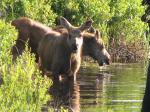
Monday, July 13, 2009 - Temps - Hi 77, Low 37. We tend to be early birds, so we chose to skip the breakfast and head out early for the drive to Poplar Lake. It was a beautiful morning, and we saw a Moose (our 6th since hitting the Gunflint Trail - we had seen 2 Mom's and 3 babies the day before!). We loaded up and headed out on the lake by 6:45....just a short paddle to the 320 rod paddle to Skipper. The portage was a bit overgrown, and of course long, but all in all not too bad. We double portage since we can't seem to pack light, so it took a little bit of time. The second portage to Little Rush was just a float through. However, the next portage was along a creek bed - wet and flowing at the beginning and knee deep mucky water at the end - my least favorite portage of all. I managed to fall in the creek bed on the first trip - lovely colored bruises for the rest of the trip. The final portage from Rush to Banadad was just a little trip along the bridge for the hiking trail. The whole day had been kind of windy, but it seemed better on Banadad. We had our sight set on the Island site and were glad to see it was opened. Our plan was to stay a couple nights because of the long portaging day on the way out. Set up camp and enjoyed a meal of Red Rice and Beans and wild rice brats. To bed early. Tried to keep track of the quote of the day for this trip - today's quote "A BWCA trip is like a marriage encounter - it brings out the best and worst in both of us" Total of 12 miles traveled. 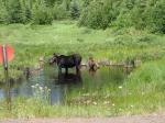


Day 3 of 4
Tuesday, July 14, 2009 Temps High 63 Low 45. Woke up early to a beautiful, calm morning. Nothing is better than a good cup of coffee in the quiet of the wilderness! Ate breakfast and got the canoe out for a paddle around the area. Tried some fishing - no luck except one small northern (but we didn't try very hard). Clouds started forming by late morning, but we expected this. Ate an early dinner as rain looked likely. Some rain about 4:30. Spent most of evening in tent - cribbage, reading, map reading. Our plan was to head out to Long Island Lake in the morning. Typical to bed early as the evening was damp. By 9:30 wind was really picking up and the rain was heavier so we were laying in the tent awake and listening to everything. We had joked about the "talking tree" during the day because it seemed like the tree was talking every time the wind came up. Well by 1030 - the wind was howling and the talking tree was getting louder. Checked the tarp and the wind had pulled out all the stakes - everything was soaked. Crawled back in the tent and about 15 minutes later we heard branches cracking. Pulled on our rain suits and exited the tent in a hurry as we heard branches falling. Ran out to the rocks by the lake where we spent the next couple of hours. Gusts were incredible and we could hear trees falling. When we got back to out tent notice large branch by the door of the tent and a large part of the talking tree about 5 feet away...quite a day! 


Day 1 of 4
Wednesday, July 15, 2009 - Temp Hi 66 Low 58 woke up about 6am to a foggy, gray day. Tent held up well despite everything. Although we did have to tighten stakes during the wind storm. Surveyed the damage - downed were one birch branch, a large part of a white pine (the talking tree) and 3 other pines. Decided to stay put and try to get things dried out. We thought the sun might come out, but other than a peak now and then, it was gray and misty. The wind was our friend though because we got everything dried out. Stayed pretty close to the fire. Saw a couple of canoes go by that were fishing. Plans were to leave for Long Island Lake in the morning. Steaks for dinner. We brought dehydrated portabellas and onions and fried them up. It was fantastic with the steaks! Quote of the day(s) - Life is a blessing - (the previous night had been pretty frightening) 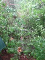

Day 4 of 4
Thursday, July 16, 2009 - High 58 Low 51. Up early for a toasted bagel breakfast before our many mile portage day. We were packed on the lake by 6:45 - everything was kind of damp as it continued to drizzle on and off. Four portages and short paddles through beautiful little BWCA scenic lakes....Banadad to Sebeka 95 rods; Sebeka to Ross 180 rods, Ross to Cave 195 rods, Cave to Long Island Lake 109 rods - total of 7.5 miles which included 580 rods of portages that were double portaged - nearly 6 miles portaging!. Some elevation changes along the way, but not too bad. Wet spots along the way, mosquitos in the swampy areas. Some muck, etc between Ross to Cave Lake. Met a group of young people coming the other direction - we loved their enthusiasm! On and off drizzle, plenty of wind even for small lakes. Decided to try for the recommended camp site on the East island site on Long Island Lake and it was open!! Great site 280 degree views, lots of space, etc. Got set up and everything dried out as it was windy. The gray weather was beginning to damper our spirits. Got some wood cut and thought the weather would have to improve soon. Spaghetti and Cache Lake garlic bread for dinner - yummmm. Drizzle becoming heavier - to tent for cribbage, reading and another early night. Quote for day - Balance is important in life - stay centered, go slow 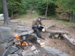

Day 6 of 4
Friday, July 17, 2009 - Temp HIgh 61 Low 49 Up early after a rainy night. Hard to believe this is July - it is staying cold. Decided to stay put, fish a bit and hope for sun. Decision point - do the Kiskadinna portage and loop back to Poplar or go out through Cross Bay? We'll do the Cross Bay route. No luck fishing, stayed close to camp due to the wind. Only saw a group of young men looking for a campsite in the late afternoon. 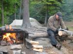

Day 9 of 4
Saturday, July 18, 2009 - Temp Hi 63 Low 42 - total miles - 12. Packed up and out early. Clouds look like they are breaking up so we are hopeful that the sun will be back today. Headed out towards our goal of Cross Bay Lake. We were surprised how pretty Long Island Lake is especially when the sun came out for a bit - we need to come back when there is more sun and less wind to do some exploring. The portage trails today are like highways compared to the previous portages so far this trip. By the time we got to Lower George Lake the clouds were back. Saw our first people on the portage to Cross Bay - asked for a weather report - should be clear tomorrow. Got to the campsite we wanted on Cross Bay - nice site, but everything was wet and kind of muddy. It was drizzling again. Decide to just head all the way out and stay in Grand Marais. Stopped at the campsite where the Ham Lake fire started and just sat awhile and commented on how sad it was for everyone. It was hard to contemplate the magnitude of one person's decision and how tragic the consequences for him and all the others affected. All in all, the paddle today was probably one of the prettiest areas we had paddled but the weather was a downer. Got a shuttle back to our car from Tuscarora - very nice people. Got into Grand Marais about 3pm and got a great room at the Superior Inn - the shower was the best ever! Enjoyed delicious food and views while we were there. While we were disappointed we didn't finish our trip as planned, we ended with a very enjoyable visit to the charming Grand Marais. Quote of the Day - Having a Plan B is always a good thing! 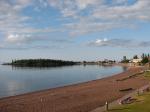

discuss this trip report (2 comments) - last post on June 20, 2012

