

BWCA Entry Point, Route, and Trip Report Blog
October 02 2026
Entry Point 6 - Slim Lake
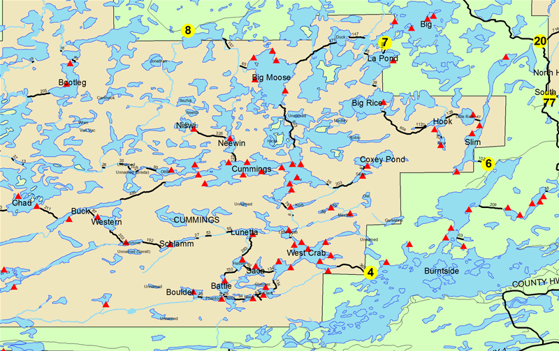
Slim Lake entry point allows overnight paddle only. This entry point is supported by Kawishiwi Ranger Station near the city of Ely, MN. The distance from ranger station to entry point is 23 miles. Access is a 90-rod portage to Slim Lake Portages to three additional lakes.
Number of Permits per Day: 2
Elevation: 1210 feet
Latitude: 47.9958
Longitude: -91.9599
Slim Lake - 6
Number of Permits per Day: 2
Elevation: 1210 feet
Latitude: 47.9958
Longitude: -91.9599
Slim Lake - 6
My Trip on Everytrail.
by Corsair
Trip Report
Entry Date:
July 22, 2013
Entry Point:
Little Indian Sioux River (north)
Exit Point:
Moose/Portage River (north) (16)
Number of Days:
5
Group Size:
8
Trip Introduction:
This trip report is different from most, I use my GPS to track my route along the way. From there I overlay my pictures to the exact spot on the Track.
You can manually click along the route as well as the auto play. I recommend the full screen view.
Enjoy!
Report
Lakes Traveled:
Lower Pauness Lake,
Upper Pauness Lake,
Loon Lake,
Slim Lake,
Fat Lake,
Eugene Lake,
Beartrack Lake,
Thumb Lake,
Finger Lake,
Lac La Croix,
discuss this trip report (5 comments) - last post on August 05, 2013