BWCA Entry Point, Route, and Trip Report Blog
July 05 2025
Entry Point 14 - Little Indian Sioux River North
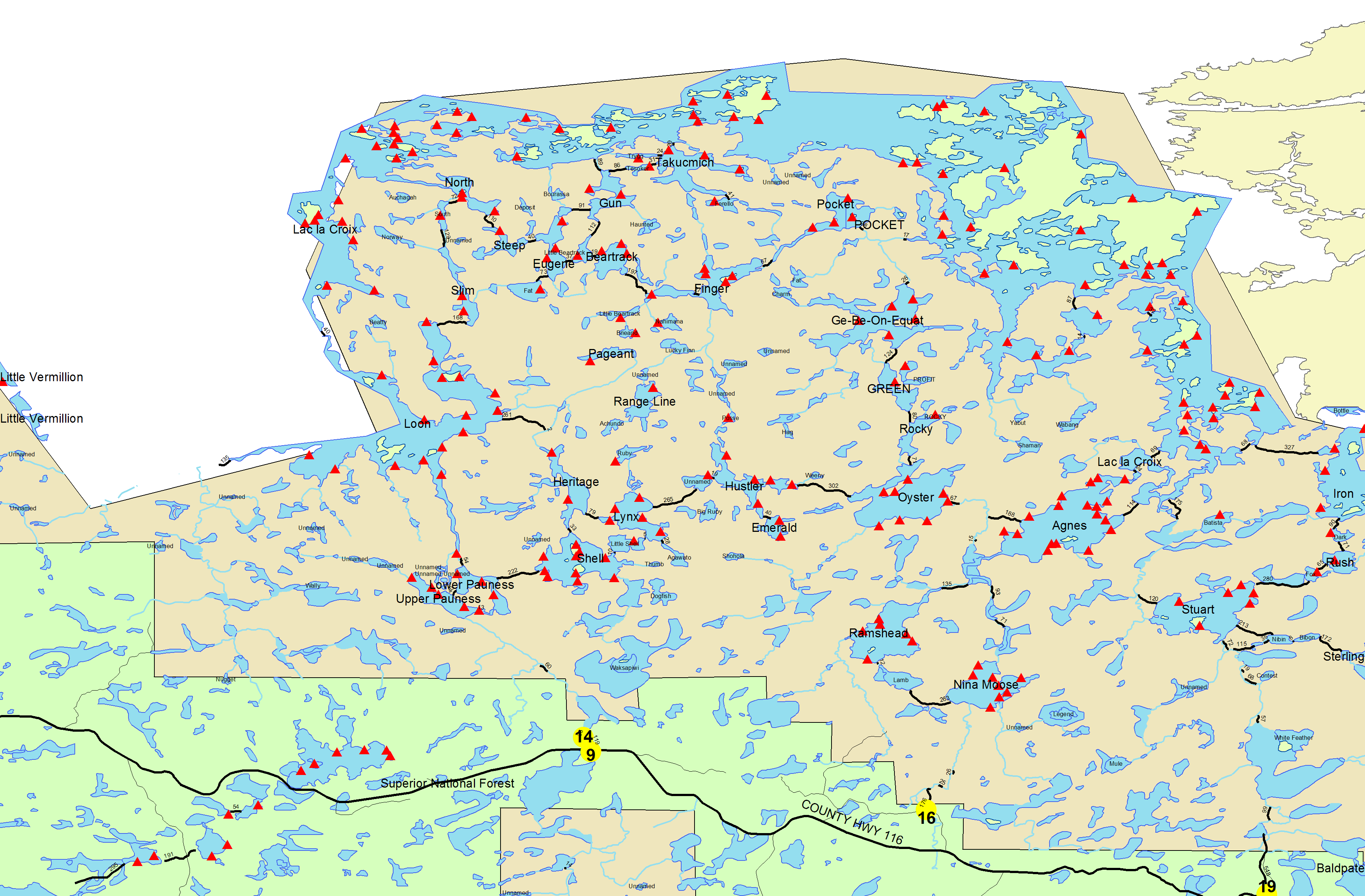
Number of Permits per Day: 6
Elevation: 1364 feet
Latitude: 48.1466
Longitude: -92.2103
Paddling Pageant and the Sioux Hustler portage
Entry Date:
August 22, 2006
Entry Point:
Moose/Portage River (north)
Exit Point:
Little Indian Sioux River (north) (14)
Number of Days:
10
Group Size:
2
In December 2005 - January 2006 during a few email exchanges with my youngest son Jeremy, who was in Iraq with the Marines, we discussed the idea of going to the BWCA after he returned. He's never been there before, and my last trip to the area was in 1974 with the Boy Scouts. I'd been wanting to return ever since, even more so to share it with family, but something always got in the way. However, the realization that death has literally passed within inches of your son puts an added incentive to ensure that you spend some quality time together when you get the opportunity, regardless of the reasons that tend to delay those moments. One of the goals of the trip was to make sure that we did just that.
Another goal was based on the fact that both he and I enjoy challenges and overcoming obstacles. He learned in boot camp that he really thrived when he was challenged, especially physically. So we wanted a trip that would require some stamina and give us something to accomplish (although we had to make some allowances for the difference between a US Marine and an everyday guy in his mid-forties).
I wanted something away from the blowdown areas, and one that would allow us multiple options to re-route our trip at whim, depending on how well we fared (how out of shape I was). Once I narrowed the area down a bit, Bogwalker was a great help to let me know what was possible and practical and what was scenic vs quiet, etc. Once we got a route that made Bogs start to sound excited, I figured we got pretty close.
The entire planned route fit on Fisher F-16 and pretty much covered the whole map. The idea was to see the falls and pictos, then head into a very quiet area and try to bushwhack our way to Range Line Lake, which we understand doesn't often see boats. Double bonus points if we could make it to Pageant. From there out depended upon circumstance.
Left Ohio. Made great time except for around Chicago. Eventually we arrive at Osseo, Wisconsin to stop for dinner at the Norske Nook as Bogwalker had suggested. Sure glad he did, because it was a fantastic place. Just a little restaurant/bakery in a small town that makes awesome meals and "award winning" pies. It appears they've taken home a lot of blue ribbons in a national pie-baking contest. When the food arrived, we dug in and realized why Bogs had recommended this place so highly. Both of the (mandatory) pies we ordered for dessert were great examples of their claim to fame. We definitely planned to stop back on the way home and hit this place again.
Neither of us felt the need to stop yet, so instead of stopping in Eau Claire as Bogs had suggested, we travelled on towards Duluth/Superior. Bad move. We learned that Duluth on a Saturday night is the very definition of "no vacancy". We finally gave up and crashed out in the car at a rest area for a few hours.
The good news was that between Eau Claire and Duluth, we had a great view of the northern lights. It was the first time I'd seen them since my last trip, and the first time ever for Jeremy. That was a goal accomplished already, which was a good sign. I'd actually planned the timing of the trip to coincide with a new moon to try and give us a good chance to see them, but we ended up seeing them on the way up. Very cool.
Didn't take us long to get to Cook, MN and stop at the Ranger station but we found out that we couldn't pick up the permit more than 1 day early. Thankfully, the ranger was able to call the PMA info over to Ely so that we could pick up the permit and the PMA designation there. Evidently the Weeny Lake PMA we were going to was VERY little used, because we were the only people even thinking of being there around that time according to his book. The page was mostly blank except for us.
Headed for Ely and arrived at VNO around 11:30 and checked in to get our room in the bunkhouse. Chatted a bit with John about trying to get our car moved from EP16 to EP14, but decided to leave it at EP16 as the logistics weren't working out, and the distance wasn't too great.
Steve had helped us tremendously with advice on places to go and things to see, not only in the BW but also on the way up, and by a happy coincidence he was coming out of the wilderness with his son Kevin that afternoon, so we hoped to meet up with them for lunch. Jeremy and I went poking through the shops in Ely for a while we waited to hear from them. Within a couple of hours, we were all seated at Sir G's chatting about their trip to Snowbank and beyond. Evidently it was a bit crowded, so they'd had to go further than expected to find a site. Steve made the suggestion that if we were pretty much all set to go, we could always issue ourselves a day permit and get in a day of paddling the next day, which was something I hadn't even considered. He said the bugs hadn't been bad for them, but that the mini bears and bees were pretty thick.
After lunch, we parted ways and headed off to pick up our fishing licenses and a few odds and ends at VNO, and then took a drive to see Fenske and Shagawa Lake. We tried a few casts just to say we did and stretch out the line a bit. Saw a sailboat and a float plane while we were there which was pretty neat. We never see any float planes near home. As the sun started heading lower, we headed back to town. Walked from VNO to DQ for dinner and then off to bed.
Snowbank Lake
Headed over to the Wolf Center to pick up permits, watch video and chat with the Ranger, who was a really nice guy, and pretty informative. As had the Ranger in Cook, this one also mentioned that we'd likely be the only folks out where we were planning on going.
Got back to Ely and chatted with the wife on the cell phone while she checked us out on the web cam. Something at either the Chocolate Moose or the Northern Grounds Cafe on the other side of Piragis sure smelled good, and we resolved to stop there for lunch after we got out of the wilderness. But for that day, we stopped at Pizza Hut. It turned out to be a great plan, because we ordered extra pizza and had it for dinner later while we packed up our gear. In the meantime, we took Steve's advice and headed off to Snowbank Lake ourselves for the rest of the day.
Once we got out on Snowbank, we filtered a couple of liters of water and toasted Jeremy's first taste of BWCA water. He was amazed at how good it tasted. We paddled around a bit, but not having a map of the area we stayed reasonably close to the put-in. It was fairly windy and a little choppy, so we thought that would be a good indication of how the boats would handle some bigger water. Once it started getting late, we headed back to Ely, finished off the pizza, and I checked with Lynn about the location of the pictographs on Rocky and LLC, while Jeremy started treating the clothes with Permethrin. I was thoroughly intrigued with John and Lynn's map book and all the notes they had on it. There's years of experience jotted down in those books.
After we got the clothes all treated and hung up to dry, we went through our gear one last time and hit the sack hoping to get an early start. I was actually surprised that I slept so easily, as excited as I was, but I was pretty worn out so that helped.
Moose River, Nina Moose Lake, Lake Agnes, Boulder River, Boulder Bay, Tiger Bay, Lac La Croix
Finally! The alarm went off at 4:30 and we packed the treated clothes up and headed off. The drive down the Echo Trail was beautiful, with the lakes covered in mist as the sun just started to come up. It was getting light just as we hit the Entry Point and unloaded the kayaks, and we noticed a couple of guys there who'd evidently spent the night in their car. Not a bad idea of a way to get an early start.
We single portaged the 160-176 rods into the Moose River. The water level looked to me to be about 2 feet below the normal waterline, which is about what I expected for a seasonable level. As we headed off, we noticed an incredible variety of vegetation, and I remarked to Jeremy that it was almost like paddling through an "aquatic decor" shop. It was absolutely gorgeous with the mists swirling around us, and then we turned a corner and the mists were gone, just like that. We were totally unprepared with the cameras as a mink swam past us around that time. I guess we were just too busy looking around at everything to think of taking a picture of it. It didn't seem to pay us any attention, just passed by heading in the opposite direction and then dove underwater as he came alongside.
We carried the kayaks over the first 2 short 20-25 rod portages, one of us carrying the front and one of us carrying the back of both kayaks, which seemed to work pretty well and saved us from unloading/loading them. Wouldn't want to do it on a longer one because it hurt the hands though.
Not long afterwards, we were looking at a large rock hill rising up to our right, and it took me a little bit to realize with a a bit of a shock that it was Top of the World, and that we wanted to stop and climb it to get a great scenic overview.
It was that moment that I realized we were actually HERE and that I was finally in the places that for the months we'd been planning, we'd only known as names on a map. Kind like that moment when the coffee finally kicks in and you realize you got dressed, shaved and halfway to work while just about sleepwalking.
We pulled the kayaks over to the side leaving room for the guys behind us, and climbed up to look around from the top. Very cool, and even cooler to see way out on the horizon and realize that we'd be past that in a few days. We watched the guys behind us pass by, and head up towards Nina Moose. We took a few pictures and then headed back down to go that way ourselves. Just before we reached Nina Moose though, we were passed by the guys we'd seen at the Entry Point, so there must have been at least one other group put in right behind us. Busy place at 6-7am!
Some of you are thinking "in a kayak and got passed?" but I should mention that the kayaks we had were very short slow ones (9.5'). We brought them specifically to bushwhack with, rather than to cruise with. We actually took a fair time to consider whether to bring the canoe or the kayaks up to MN, and the kayaks won due to the size and weight. It turned out to be a good choice considering the bushwhacking we did, and the wind we faced.
We single portaged the 70 and 96 rod portages and headed through Agnes, then carried the kayaks again over the 24 rod into Boulder River. We took the river all the way into the Boulder Bay, although time wise, it might have been quicker to take the 65 rod portage. But I enjoy the paddling, and it was a beautiful area. Lynn at VNO said it was good for Walleye fishing, but it was starting to get later in the day than we'd wanted, so we just stopped for a quick lunch (jerky & gorp), and headed on into Tiger Bay. We'd hoped to grab one of the campsites in Tiger Bay, but they were all taken by this time (3:30pm), so we continued on east to the next island on the way to Bottle Portage, and camped at the southeast site which was pretty nice.
The site was on a point and the wind was pretty strong, so there were no bugs, which was a really good thing since we realized upon setting up camp that we'd left the DEET in the car with the take-out bags. We set up the tent, but since there weren't any bugs, we elected to sleep in the hammocks. After a delightful dinner of Beef Stroganoff and gorp, we hung the food from the mini-bears and hit the sack.


Lac La Croix, Iron Lake
The hammocks turned out to be a nice choice, as I opened my eyes to a beautiful sunrise the next morning, right in front of me. I also got an ear full from the red squirrel who was busily harvesting from the cedar trees around us and must have been worried that we wanted some too. He seemed pretty annoyed that we were in HIS trees and made sure to comment about it on a regular basis.
After a breakfast of oatmeal, we got a late start (9:00) and headed across to Bottle Portage after seeing that there was no way around it with the water as low as it was. Thought maybe with the kayaks we could sneak through, but no such luck. We saw a marker for the International border, and ran across some folks who had come over from Crane Lake and were following the border route. They did 1/3 of it last years and were looking to do another 1/3 this year. We also saw a bald eagle for the first time on our way over towards Rebecca Falls. Didn't really get much of a view from the top, so we portaged around to see them from the bottom. Just as we got there, we saw a guy on shore catch what appeared from a distance to be a 12-14" walleye.
We portaged back over to the American side and grabbed a quick lunch of foil packed tuna on tortillas and some jerky before we headed towards Curtain Falls. Saw some otters playing around an island on the way, but they disappeared pretty quick when they spotted us.
I kept teasing Jeremy every time we came across a small set of rapids saying, "Well, there's Curtain Falls, what do you think?", and then laughing and working our way further upstream, lifting over when necessary (not often). We rounded the last corner though, and Jeremy's eyes about popped when he saw them. The level was low, but it was still quite impressive. It evidently didn't spoil his wilderness experience to find a couple of pretty girls in bikinis sunbathing on the top of the falls either.
By the time we got back, it was getting close to suppertime so we put off more sightseeing until the next day. Chicken Teriyaki with Rice and a bit more gorp was dinner, and we sipped some hot cocoa afterwards while we enjoyed listening to the loons.


Lac La Croix, Pocket Creek, Ge-be-on-e-quet Creek, Ge-be-on-e-quet Lake, Charm Lake
Got up to a breakfast of grits and to our surprise we heard wolves howling. We didn't realize there were any in this particular area, and we had expected to hear them in the evening more than in the morning, but it was pretty cool to hear them.
It had been a bit windy the day before, but the wind had picked up a fair amount since. We got a late start (again) and headed off to see Warrior Hill. Saw a towboat on the way and I was glad he saw us because he was really moving.
I'd have loved to see the Indians racing up that hill. We climbed up to the top much more quickly than I expected to though. The view from up there is tremendous. We were wondering about the rocks placed up there and whether they were a recent addition or if they'd been up there for centuries. There were a couple of pretty large stones. I'd hate to have been the guy who had to carry those up there.
Off to see the pictos and found the one set (east ones) but not the others. It was pretty interesting to see the hand prints and wonder why they were placed there. And there was one hand print well above the others. Was that an extra tall Indian, or was it the chief or best warrior? Maybe one with a sense of humor, placing it that high just to make people wonder about it centuries after he was gone. All of the pictos were cool, but I think it was the handprints that I was most intrigued with. There's definitely something personal about seeing a handprint that looked like one you could have put there the day before, and it was rather surreal to realize it's been there for centuries. We finally gave up trying to find the western set and headed northwest through Fish Stakes Narrows where we stopped for lunch (tuna and tortillas again). Finally we were paddling with the wind on this day instead of against it. It had been coming from the north and east which I found odd, and had remained pretty strong for the past couple of days.
Got to Pocket Creek and did a carryover at the 25 rod portage. Ran into a group of folks from Seattle. One of the canoes was a stripper which I always enjoy seeing, and the pretty young lady in it said that her uncle who was a bit further ahead had made it. We ran into them and their dog Ginger a few times during that day (and the next) as we headed up Pocket and Gebe Creeks.
Gebe is a beautiful lake and had very nice looking water, but we elected to push on past the site with the recliners and bushwhack into Charm for our first PMA camp.
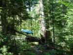
We followed the creek a short way until it got too boggy for us to continue, and then scouted on foot for a way into Charm. We had to work our way to more solid ground, dragging the boats through the grass fairly far, and then followed a moose path most of the rest of the way. It wasn't overly difficult, but took some time. Once we crossed a beaver dam, we were in Charm which is a pretty little lake. We spent quite a while looking for a campsite, however very few places looked inviting. Mostly because nobody had been in here to use some of the downed wood for firewood I suppose. There were a LOT of downed trees and swampy areas around the edges of the lake. We ended up picking a point and then erecting the tarp fairly high up between two trees, and then slung the hammocks bunk bed style beneath it.
We had dinner of lasagna, then tried our hands fishing. Jeremy caught a 17-18" pike on his first cast with a Mepps spinner, then a 19" one on the 3rd cast after that. Three more casts and he had caught his third which was an 18 incher. By that time, I put the camera down and had to try a few casts myself before he caught all the fish in the lake. I caught a 17 incher on my 3rd cast. That was it for the day but we were pretty happy. The 19" one that Jeremy had caught was the biggest fish he'd ever caught in his life, so he was pretty tickled.
Our fuel cannister finally burned out while running the lantern, but that didn't seem to be a problem as we were heading to bed. Little did we know that we were in for a nasty surprise. One of the trees that we'd tied the tarp and the hammocks to had a split in it, and wouldn't hold the weight of both of us. I'd gotten into my hammock, and when Jeremy started getting in his, the tree leaned sharply over (scaring the bejeezus out of me!). With the wind whipping around the way it was, and threatening to get worse (smelled like rain), we had no desire to have the tree blown the rest of the way down on us. Since it was pitch black (new fuel cannisters in the bottom of the gear bag), getting very late, and since we hadn't been able to find a better place in the light, we just laid the hammocks on the ground uphill (and upwind) from the tree with a sleeping pad and bag and slept there. The ground wasn't level and we had to scoot ourselves up a few times during the night, but it wasn't as bad as it could have been.


Charm Lake, Ge-be-on-e-quet Lake, Green Lake, Rocky Lake, Oyster Lake, Hustler Lake, Emerald Lake
In the morning, Jeremy spotted a moose on the other side of the lake, who went to the water's edge and swam across to our side, just around the bend upwind of us. We were hoping to see him again a bit later as we headed out, but no such luck. We skipped breakfast that morning, due to the threat of rain coming, and wanting to get the bushwhack out of the way before it hit.
It did start raining on us before we got to Gebe, and although it never got too bad, it did continue for a good part of the day. After we got back to Gebe we saw the folks from Seattle again through Green, Rocky and Oyster. The portages started to get to me a bit and I started double-portaging at the 120 rod portage from Gebe into Green. I believe it got more difficult for me as we went because as we rummaged through the pack and things got packed less carefully (like when we were trying to hurry earlier in the day), the pack got taller, which made the kayak much more awkward to cary, and wore me out more quickly. Funny how a little thing like that can change circumstances. We stopped and checked out the pictographs on Rocky. Not as "impressive" as the ones on LLC, but they sure made us wonder what the purpose of them was. They obviously were there for a reason, even if it wasn't clear to us.
The Seattle group left us to spend the night at Oyster, and we grabbed a lunch of jerky and clif bars before we headed across the 310 rod portage into Hustler. Expecting solitude in that area, I was amazed that another group caught up to us on the portage. Three pretty girls and a guy. One of the girls was from Wyoming, and said the other 3 were from the WI/MN area. They took a site on Hustler, while we headed south across the short 48 rod up and over into Emerald.
Emerald was our favorite spot so far, except that we didn't had any luck fishing there. That doesn't mean the fishing isn't great, but probably that we're not that good at catching them. We decided to take a layover day on Saturday because it was so nice (and because I needed the rest). The campsite is perfect for pitching tent/tarp or hammock. The rock next to the fire grate has nice level places for stove and water bottles, etc. You can cast right out from the site and 2 feet from the shore is likely 10' deep or more. Interestingly, the latrine is labelled #1, so if anyone was wondering where #1 was, now you know. I couldn't think of any reason why they started numbering them there, other than a dart toss at a map, but it was fun to consider.
Dinner was beef stew. One of the things noticeable about Emerald was the quiet. Other than the loons and a few other birds, we heard nothing else although we did see a beaver swim across the lake.
Got a fire going in spite of the wet wood. Someone was kind enough to stock up wood by the fire grate, but it was sopping wet (as were we) so I had to search for some that had been better sheltered from the rain. There was a mouse who oddly enough kept jumping into the rocks by the fire grate, but we didn't see him anywhere else.
With the threat of more rain, we slept in the tent for the first time. Pitched the tarp over it for extra shelter from the wind.


Emerald Lake
Breakfast of oatmeal. Actually, there appeared to be quite a few ants and bees at this site, but they didn't bother us any. A hummingbird landed on Jeremy's fishing rod after he cast his line from the rocks, and stared at him a few seconds, then took off as he tried to slowly reach for his camera. I guess he was friendly but camera shy. He came by and visited us a couple more times during the day, and Jeremy got his picture working on the flowers next to the fire grate.
Spent the day lazing away and watching the sun burn off the clouds. Took a walk over to the Sioux-Hustler Trail, which passes close by this campsite, and followed it a ways to see what it was like. It was especially interesting to us because we'd planned to be using at least a portion of it to travel between Rangeline and Pageant if we could make it that far.
We tried catching fish for a while with no luck, then figured if you can't beat them, might as well join them, so we went swimming for a bit. Water was cool, but I got used to it pretty quick. Amazingly, there were a lot of small fish that seemed to be real interested in gnawing on us. Can't figure out why there weren't any that wanted to gnaw on the lures at all. Oh well.
Also spent some time taking care of some housekeeping tasks like cleaning clothes and hanging all the wet stuff up to dry from the day before. Went through and inventoried the food bags and realized we'd been eating too much tuna for lunch, so we'd have to be more careful. We had grits for lunch, because we'd brought plenty extra of them.
In the afternoon the wind finally started blowing from the west and it rained for a very short while, but then cleared back up again. We tried for fish again, but still no luck. Fixed spaghetti and meat sauce for dinner. Afterwards, I got a fire going and while I was gathering some extra wood to leave on the pile, we heard wolves howling. Jeremy and I were trying to figure out how far away they were. They sounded close, but who knew how close? They were in the direction of the portage to Hustler, but I don't know how far that sound might have carried. From Hustler? Or maybe on the other side of Ruby? I was thinking no more than 1.5 miles away, but Jeremy was thinking maybe more just due to the way sound carries. But I thought there wasn't any big water for the sound to carry over, so maybe they were closer. Anyway, it was very cool to hear them again, even closer than near Tiger Bay. It felt very "right" to hear them at nighttime out in a less populated area. They moved farther away, but we still heard them off and on throughout the night.


Emerald Lake, Hustler Lake, Hustler River, Posse Lake, Lucky Finn Lake
We had a breakfast of grits and got a late start again (9:30), leaving Emerald and headed for Rangeline. We'd spent some time poring over the map and debating the pros and cons of which way we might try, and the final decision was that rather than take the 280 rod portage into Lynx and then start bushwhacking north into Yodeler and Achundo, we'd try heading north up the Hustler River, cut west over to Lucky Finn and then southwest down Rangeline Creek to Rangeline. Going through Yodeler would have the advantage of knowing that someone had successfully gone that way before, but since we had the kayaks and could float in shallower water, we reasoned that we would find more navigable water heading up the Hustler River. If we were lucky, almost the whole way, with just very short bushwhacks in between.
We were VERY lucky, but unfortunately it was all bad luck. There was almost NO navigable water the entire way. As a matter of fact, there was so little water, that we never bothered to unpack our packs, but rather just tossed them in the seat of the kayak and then sat on top of them to paddle, pry and pull our way across the 20-30' of 'navigable' water here and there. Or even stood on them and poled along like a gondola, so we could try to see a path through the swamp grass. I'm not sure what the grass was called, but I named it razorgrass after slicing myself on it. Within an hour, both of our forearms were bleeding from multiple cuts received when pulling ourselves through the grass, but we seemed to make the best progress by grabbing clumps of it and pulling ourselves along, or poling along by separating our paddles into 2 halves like trekking poles, or the previously mentioned gondola style. Although standing in a kayak is not recommended unless you have REALLY good balance or as in our case, the waterway is so narrow that you can't help but land on soil.
This was a long hard day's work, and although we did travel some small distance, I would not recommend this way to anyone else, especially at this time of the year with the water level as low as it was. By the end of the day, we were beat up, bloody (I'll carry a scar as a memento), and thoroughly worn out, travelling a total of about 5 miles on the day. Both of us went for a swim. Actually, Jeremy did a face plant in about a foot of water, which I thought was rather amusing until he realized that his camera was in his pocket and had gotten soaked. Not too much later, I went in while trying to cross over top of a downed tree in a spot where the channel was about 3' wide and evidently 6' or more deep, because I went completely under except for catching myself on the tree. Jeremy held the laughter back with an incredible display of self-control, and only said that he wished he could have gotten a picture of my face, because my expression was the most perfect mix of surprise and fury he'd ever seen.
I almost neglected to mention that as we'd been travelling through, we'd seen plenty of leeches in the water. I guess it would be a way to illustrate how tough the day was by saying that at the beginning of the day, we tried to avoid slogging through waist-deep water because we really had no desire to be picking leeches off of exceptionally tender areas, but it wasn't too long before we had reached the point where we were so worn out we couldn't have cared less, and in fact, looked forward to the places where we could actually WALK, even if it was in leech infested water, rather than negotiate obstacles.
I'm also neglecting to mention the beaver. They've been really active in this area. I've always wondered how much they really understand about what they're doing when they dam an area up. Do they intentionally drop the logs in certain places in certain ways, or do they just drop them more at random? From what we could see, they just dropped as many logs as they possibly could to hinder our progress. No rhyme or reason, just every tree in the area on it's side, in every possible direction, so we'd have to climb over/crawl under it. It was about 2 miles of obstacle course.
Our battle cry for the day was "Norske Nook!" and it never failed to bring a grin from Jeremy's face. We promised ourselves that come hell or high water (or low water as the case may be), we were going to treat ourselves to another meal and a piece of pie at the Norske Nook if we survived the bushwhacking.
We skipped lunch partly to conserve on food, and partly because we were getting concerned about the lack of distance we'd travelled. It was extremely difficult to determine our position on the map, because some of the features just weren't there. ALL of the small water features that were on the map along the Hustler River were either non-existent, or so shallow that their shapes had changed, sometimes dramatically. Posse Lake was the only one we could identify with some certainty, and that was only a quarter of the way in from Hustler. After that, we had to scout around a good bit to try and keep track of where we were (and find ways around beaver and boulder obstacles). I must say that we did do a good job of that, but it took up some time. Somewhere around 5 pm, we reached Lucky Finn with packs and decided to call it a day. By the time we'd gone back and gotten the boats the last quarter mile and set up camp, it was closer to 7pm.
We were worn out, but the weather cooperated with us, and we didn't need to set up the tent or tarp. Just strung the hammocks up and slept in them, although with head nets to protect from the bugs. They hadn't been bad yet on the trip, but there was a definite increase in number along the swampy area. Turned out we didn't really need the head nets though. Before bed, we grabbed a quick dinner, choosing our favorite of Beef Stroganoff to celebrate making it past the Hustler River. We didn't have a fire that night, as we were in the PMA, and I wanted to leave zero trace. Since we didn't have the time to clean up a fire to where there was no trace of it, we didn't bother.


Lucky Finn Lake, Range Line Creek, Upper Range Line Lake, Range Line Lake
Compared to the day before, this was a cakewalk. At least we'd gotten used to the routine of bushwhacking (swampwhomping?), and we got much luckier. Rangeline Creek was more navigable than we'd expected and we got to paddle much further down it than we'd paddled the entire day before. After that, it was back to drag through the grass, carry over the rocks and downed trees, pull and pole through the navigable areas, and use the moose trails where we could.
Once we reached the place where Rangeline Creek joins Rangeline and Upper Rangeline, we found the Sioux-Hustler Trail [insert trumpet sound and a chorus of Hallelujahs here]. We used the S-H Trail as a portage the rest of the way to the Rangeline campsite. Although the brochure I had on the trail said it was a quarter mile, my GPS said it was more like half a mile.
The site on Rangeline was nice. Pretty close to a tossup between whether we liked it or Emerald better. Emerald was prettier, but the fishing was better on Rangeline. The pike we caught trolling with shad raps were more in the 20-23" range, and we cooked up the biggest. Not being from the area, I'm not used to pike, so I had saved a paper we found at VNO on how to fillet them so that they'd be boneless, but of course I ended up misplacing it so we ended up picking a lot of bones out of them, which got to be annoying as it got dark. The paper later turned out to be folded up inside my map by the way. We mixed some of the fish in with some freeze-dried Pasta Primavera, so I guess it was Pike Pasta Primavera. Pretty good, actually.


Range Line Lake, Pageant Lake
In the morning, we hiked over to see the 3 Sentinels, which are a set of 3 white pines along the S-H Trail that are over 200 years old. They were about 1.5 miles from the campsite on Rangeline. The Sentinels were the biggest I think, but there were quite a number of trees on the way there that were pretty close in size. The trail itself was worth the walk as well. Jeremy was pretty impressed with it and thought he might like to come back just to hike the trail. This part of it was nicer than the part over by Emerald, although we only saw a small portion near Emerald so maybe I'm not doing it justice.
So now that we had a 3 mile hike in, we did the portage to Pageant Lake. We decided to use the S-H Trail for sure now that we'd seen how nice it was. Would be a longer portage that way, but a pretty one, and Jeremy said he'd do the kayaks if I did the packs and I jumped on that offer, because carrying my kayak long distances had been hurting my neck. I'll have to sit down and really calculate the distance sometime, but if I remember right, it was about 2 miles between the 2 lakes, and we double carried, so that was 6 miles, or 9 miles walked for the day, with 4 miles under load, before the boats ever touched water.
We'd thought there was a possibility that Pageant Creek would be navigable to Pageant Lake, but it was dry and bony (as we pretty much expected), so we did the carry all the way to the campsite at the far side of the lake. It was a LONG carry, but I must say we didn't really mind all that much because this portion of the S-H Trail was just absolutely gorgeous. Some places were just stunning. I'd seen in the brochure that the overlooks were very scenic, but we found the trail itself to be just incredible.
Funny how father and son can sometimes be on so much the same wavelength. I hadn't seen much of Jeremy in the past 3 and a half years since he'd joined the Marines, but when he commented that he half expected a unicorn to step out from behind a tree, I laughed, because I'd been just about to say the exact same thing. There were places on that trail that were so surrealistic and beautiful that if you looked up and saw a mythical creature, you wouldn't have been a bit surprised.
When we reached the Pageant Lake campsite, we were stunned by how gorgeous it was. As you come down the spur trail from the S-H Trail into the campsite, you can see that the site is just about totally covered in moss. Some of the soil appears to be peat, and with the moss on top of it you sink ankle deep into it everywhere. With the weather still cooperating, we laid our sleeping bags on our ground cloth over the moss, and erected the tarp over that for our shelter. It was one of the most comfortable beds I've ever slept in.
With the carpet of moss covering everything and softening the sounds, it made the campsite so quiet it was almost surreal. There were some mournful loons in the distance, and the ever present squirrel, but aside from that, it was a soft, comfortable silence. The Pageant Lake campsite is one of those places where you automatically speak in a whisper because it almost seems a sacrilege to talk loudly.
Tried fishing for a bit with no luck, but mostly we just relaxed and enjoyed the peace and beauty of the site. Dinner was Chicken Teriyaki with Rice again, and when it got dark, we laid down on that soft cushion of moss and happily sank into it.


Pageant Lake, Loon Lake, Little Indian Sioux River, Lower Pauness Lake
When we left Pageant the next day, we headed down the S-H Trail to the Loon - Heritage Lake portage. I think it was around 2 miles to the portage trail, then another 180 rods or so on the portage trail to Loon Lake. That part of the Sioux Hustler Trail was the most gorgeous part yet, and solidified our desire to come back some time soon and hike it.
Reaching Loon Lake was a big milestone for us. It was the first sandy beach we'd seen since we'd entered the BWCA. And there was someone at the beach who'd stopped for lunch, and we realized that he was the first other person we'd seen since Day 4. And it was the first lake connected by a maintained portage that we'd seen in 3 days. We could actually PADDLE to our destination rather than bushwhack now!
The guy having lunch had a solo cedar stripper he'd built, and said he'd also built a kayak as well. He mentioned a 17 day trip he'd taken, which made us pretty envious, because we wouldn't have minded having another week to spend out there, and our time was starting to run out. In a way, Loon was also a sad milestone for us, because it meant we'd reached the end of the trip's challenges. It was that bittersweet moment where you cross that line where you're kind of happy knowing that you'll be going home soon and seeing the people you miss, but also sad realizing that you're now leaving, rather than travelling.
The guy in the stripper departed and we ate our lunch on the sandy beach and then loaded up and headed for the Little Indian Sioux River. Of course the wind was in our face again, now coming from the southeast but eventually we reached Devil's Cascade. We saw a large group of people there, and started consistently seeing people after that. The cascade was VERY low. I bet it would have been pretty cool at a higher volume of water, but it was more of a Devil's trickle when we saw it.
We started keeping an eye out for open sites after that and found one on Lower Pauness. It wasn't much, especially compared to the last few sites we'd seen, but it served the purpose, and right across the river from us, we could see the aspens starting to turn gold. I'd hoped to see a bit of color on this trip, and it seemed like just on the last day, we'd noticed the aspens and a few maples starting to turn. Dinner of chicken stew was kind of quiet as we both soaked in our last evening, and enjoyed watching the sun lower itself and deepen the color on the trees.


Lower Pauness Lake, Upper Pauness Lake, Little Indian Sioux River
A very short day, but we needed to make time. The wind tried gallantly to give us a good reason to stay for another day or so. It blew incredibly hard, directly in our face all the way out, making it take a fair while to travel the short distance to EP14, and making us work for every inch of it. I'm guessing it was a steady 20-25mph wind (conservative guess). About enough to make a flag stand out straight on the flagpole and snap on a regular basis. It turned out later that it had been so windy due to the remnants of Hurricane Ernesto passing through the area, spawning at least one deadly tornado near Duluth. That explained why the wind kept shifting direction, and seemed to be in our face most of the time. I suppose we were quite lucky that it hadn't brought too much rain with it, but the wind did make for some difficult paddling. I'm pretty sure that if we'd chosen to bring the canoe rather than the kayaks, we wouldn't have made it nearly as far as we did.
It was another quiet time, with both Jeremy and myself totally immersed in fighting the wind, but still soaking up the last couple of hours because we really didn't want to let them go. There was tons of wild rice on the LIS. There was still some in the kayak weeks later.
A bald eagle really made our day and lifted our spirits though. Soared right over Jeremy's head and landed in a tree next to the river. We got to admire him for a bit and take a picture or two.
When we reached the portage back to the EP, I gave Jeremy the car key and went ahead and started portaging all the gear up to the parking lot while he ran from EP14 to EP16 (7 miles). By the time I was done, I didn't have long to wait. It took him about an hour and 15 minutes to run the 7 miles (and then some actually, considering the access roads as well), and then drive back. Plus he'd evidently stopped for a few minutes and chatted with some bear hunters that he passed along the way. I was pretty amazed.
We loaded up and said goodbye to EP14 and the BW. Saw lots more foliage starting to turn to their fall colors on the way back out the Echo Trail. Once we got back into town, we stopped off at VNO's for showers (oh how nice that was!), then grabbed lunch and a couple souvenirs for family and hit the road south towards the Norske Nook.


kayaks: 9.5' recreational boats. They were slow as molasses, but very stable which turned out to be important in the wind. They were also very easy to maneuver through the woods during bushwhacks. Good choice for bushwhacks, but not for distance. An anticipated disadvantage of using them was the portages, but we planned well for that and they didn't take long. We packed everything in 3 dry bags each, and then dropped the 3 bags into our packs. This made loading and unloading the kayaks a breeze, as well as kept everything bone dry.
Packs: Jeremy used a SealLine Boundary bag (70L) and was quite happy with it. I had a Woods Mason pack and was very happy with it. I was able to carry more weight comfortably than the Boundary bag. Which was nice, but a disadvantage as well depending on your point of view.
Tent: Mine is an old Wenzel Cedar Creek hex dome tent I've had for years. Weighs 5 lbs, and is mostly mesh with a rainfly. They don't sell them anymore. It's a good design but about 6" too short. Seems like my feet always touch the side and wick condensation in.
Tarp: Kelty Noah's 12. Sweet. Love it. Not overly expensive and worth every penny. Weighs 2 lbs, and with both it and the tent we could handle anything. We used both, either or none on different days. Pitched over a so-so tent, you can give it extra protection from wind or rain, and on a ugly day the light color helps make it a lot more cheery.
Hammock: Byer's Traveller. We each had one and this was our preferred bed.Usually used a sleeping pad beneath me. 11 ounces, $18, what's not to like? I take it everywhere.
Sleeping pad: Thermarest Ridgerest. Closed cell, weighs about the same as a feather. Lashed behind me, it gave me a nice backrest and provides extra buoyancy in the event of a flip. Not as nice for old bones on hard ground as some of the inflatable pads, but I slept fine.
Sleeping bag: Marmot Maverick 30 synthetic. Nice. Love it. Discontinued. I've been using it over the past winter with an Alps Mountaineering fleece liner I picked up used from VNO. Good stuff.
Water filter: MSR Sweetwater Microfilter. After looking at the discussions about filters in the BW, I made sure to pick up a siltstopper for my filter to give it extra protection against clogging from the water in the area. I tried using a coffee filter over the intake, but that was a pain in the butt so I quit that pretty quick. Need to find a better way to attach them than twisty ties. With the siltstopper, I found that I had to clean the filter about once every other day, and clean the siltstopper as well. Took some extra time, but the water always pumped well and reasonably quickly. It did a great job for us, and the customer service and warranty on them is awesome. This was my new one. MSR replaced my other one that I'd had some 13 or so years for free.
Footwear: Keen Taos for paddling/portaging. I wet foot. The Taos is a hybrid shoe/sandal that protects your toes, but also drains water immediately and dries reasonably fast. Does not give ankle support, but I don't seem to need it much. They're the most comfortable shoes I own and I wear them a lot. They were expensive but I plan on getting my money's worth out of them. Jeremy saw mine and picked some up as well, and loves them too. For around camp, Crocs. Crocs are the stupidest, ugliest most overpriced things I've ever seen, but they're also incredibly comfortable and water runs right off them. You can't get anything better for hanging out around camp, especially around lakes or rivers. I clipped mine to the kayak with a carabiner and dragged them in the water 1/2 the time, and put them on right afterwards. Smartwool socks can't be praised enough. When you're calf deep in wet, stinking bog most of the day, and your feet are happy, you're happy.
Stove: Coleman Peak 1 Micro. 5.5 ounces and burns butane/propane. Awesome stove cost $20 at WalMart. Make sure you have a level place for it though. Big bonus - they also sell a Peak 1 lantern that screws on to the same fuel cannister, for about the same price. That light was awesome. Love it. One can of fuel lasts for days using both of them.
Food: Dehydrated Mountain House brand for dinner, choice of gorp, jerky, tuna, tortillas for lunch, instant grits or oatmeal for breakfast. Clif bars for added calories. All of it served us just fine, although we were pretty glad to get rid of the weight of the gorp. The whole wheat tortillas last forever. The leftover ones were still good a month later. As a matter of fact, I just checked the pantry, and the leftover ones from 4 months ago are still edible. I'm kind of scared now. What the heck is in those things? 10 days' worth of food was not overly heavy, didn't take a lot of room, and served the purpose. And nothing took more skill to fix than boiling water, which worked well in our case.