BWCA Entry Point, Route, and Trip Report Blog
July 09 2025
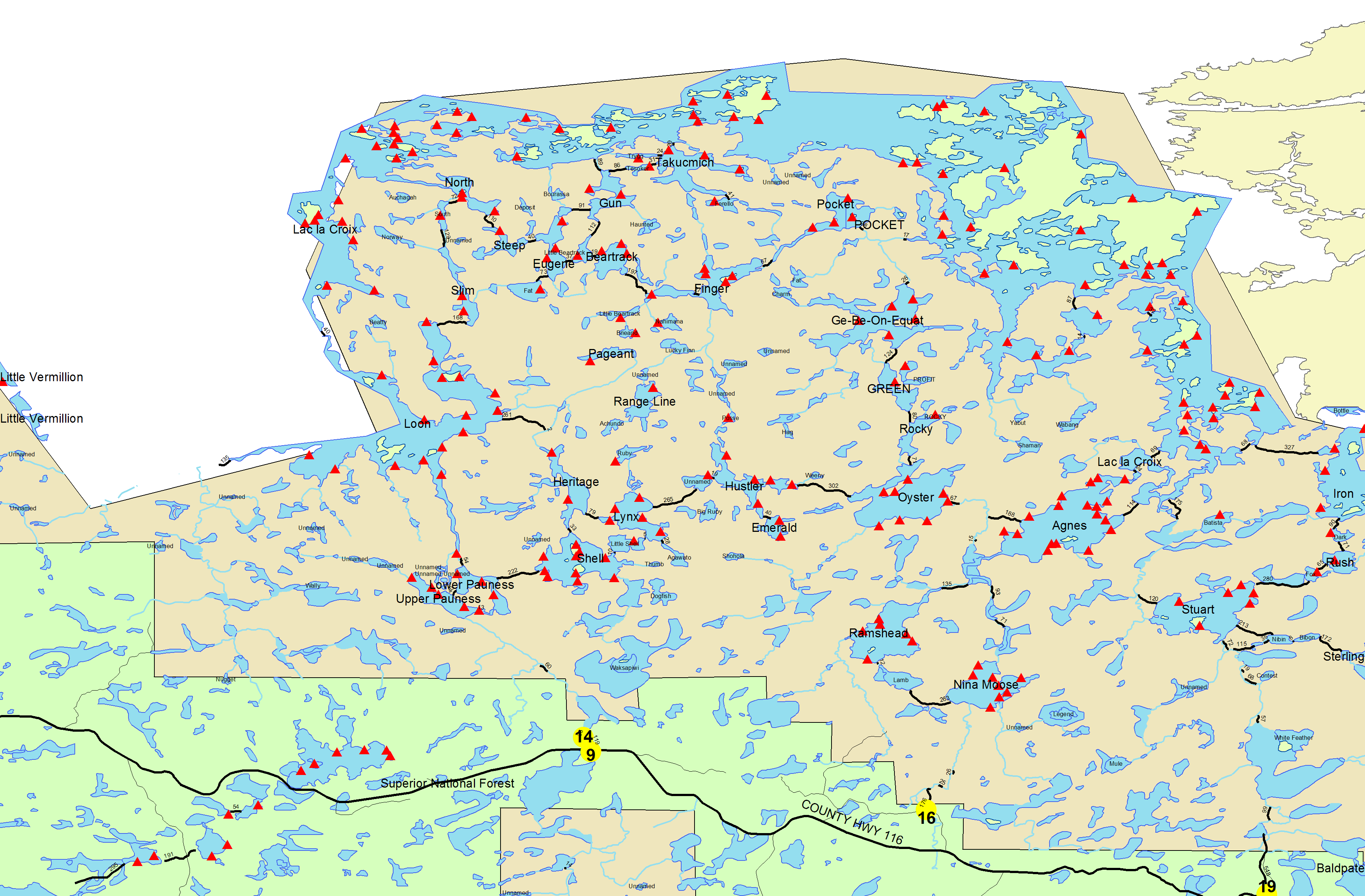
Entry Point 14 - Little Indian Sioux River North
Number of Permits per Day: 6
Elevation: 1364 feet
Latitude: 48.1466
Longitude: -92.2103
Pictorial Trip Report - Lake Agnes in October
Entry Date:
October 08, 2013
Entry Point:
Moose/Portage River (north)
Number of Days:
4
Group Size:
2
I got to take several canoe trips in 2013. But they were all short. Most of the trips were for the Minnesota Breeding Bird Atlas. I agreed to take "ownership" of two "priority blocks" in the Boundary Waters - one centered on Big Moose Lake, and the other on Vera and the east end of Ensign - to complete the atlas survey in those areas in the fifth and final year of the project. So I took five overnight bird surveying trips (including a couple solos) to those two areas, ranging from two to four days, plus numerous day trips into Big Moose.
David, Piwi and I also headed to Quetico for a five-day trip in early July, joined by our friend Banksiana the first several days. It was a great - though warm and buggy - little jaunt. But we thought of it as an appetizer for our long Quetico trip later in the summer.
Unfortunately, that long trip never happened this year. Commitments at home on the Echo Trail kept forcing us to defer our tentative late-summer trip plans, until it finally became clear that it was not going to happen.
So when the forecast called for a stretch of nice weather in early October, we were determined to get out for at least one last short trip. This would be our first October overnight trip. It seemed like a good time of year to go somewhere in the Boundary Waters that would probably be too busy or booked-up during the main season. After thinking it over, we decided to head northbound on the Moose River, a popular area we had never been to before.
And so on a Tuesday in early October, David, Piwi and I left home a little after 8:00 in the morning to get started on our autumn adventure.
Day 1 (Tuesday, October 8, 2013) -
[img]http://img.photobucket.com/albums/v213/billnwashdc/Agnes%20October%202013/ScreenShot2014-01-27at110801AM_zps3d8c3dc8.jpg[/img]
We pulled into the Moose River North entry point parking lot right around 9:00 a.m. We knew we would not have the place to ourselves, but there were more vehicles in the lot than we expected, given the time of year. Apparently we were not the only ones taking advantage of the good weather. After a few minutes organizing our gear, we started on our first trip across the half-mile entry portage, which is a pleasant downhill amble past some really big pines.
When we got back to the parking lot for the rest of our gear, we found a younger couple with a dog who had arrived in the meantime and were getting ready to start their own trip. Piwi excitedly greeted her three new best friends, and we talked for a minute. They were more locals, from Babbitt, seizing the moment for a quick fishing trip up to Lac la Croix. They were single portaging, so after we carried the rest of our gear across the portage, we let them load up first to speed ahead of us double-portaging slowpokes.
Ho Ho and Piwi take a breather while the other group loads up -
[img]http://img.photobucket.com/albums/v213/billnwashdc/Agnes%20October%202013/IMG_7431_zpsba3efc55.jpg[/img]
Water levels were pretty low coming through the rapids above the portage landing -
[img]http://img.photobucket.com/albums/v213/billnwashdc/Agnes%20October%202013/IMG_7432_zps4eaee6e3.jpg[/img]
Once we started paddling, we quickly encountered some new obstructions in the river. It seems that a beaver dam burst on a side stream, dumping lots of muck into the Moose. As a result, we were repeatedly getting in and out of the canoe for short carries at the beginning of our excursion, until the unobstructed stream opened up for us again. From there the river flows through apparently endless expanses of alder before passing a much-used rocky sentinel (which we bypassed without stopping) and opening into grassy marsh flanked by birch-and-aspen forests leading to Nina Moose Lake.
We paused to take some pictures in the open marshy area. The morning haze had given way to mostly blue sky -
[img]http://img.photobucket.com/albums/v213/billnwashdc/Agnes%20October%202013/IMG_7439_zpsab2c2a36.jpg[/img]
A largely submerged beaver dam guarded the final approach to Nina Moose Lake. We had get out of the canoe to pull over one or two other dams along the way, but not this one -
[img]http://img.photobucket.com/albums/v213/billnwashdc/Agnes%20October%202013/IMG_7441_zpsf5e5d817.jpg[/img]
Cliffs line the west side of Nina Moose, as seen from the mouth of the river-
[img]http://img.photobucket.com/albums/v213/billnwashdc/Agnes%20October%202013/IMG_7444_zpscd2c1ca5.jpg[/img]
Zooming in a bit -
[img]http://img.photobucket.com/albums/v213/billnwashdc/Agnes%20October%202013/IMG_7445_zps3d6dda9e.jpg[/img]
The author and Piwi, getting ready to paddle across the lake -
[img]http://img.photobucket.com/albums/v213/billnwashdc/Agnes%20October%202013/IMG_7448_zps9a5c0023.jpg[/img]
The treetops had been swaying in a south by southwest wind all morning, but we were largely protected from it on the river. Now, as we moved away from the shelter of the southern shore to cross Nina Moose, the waves gathered size and force as they rolled across the lake, hitting the canoe at a 45 degree angle between the stern and the right side where I was paddling. It was nothing we could not easily handle, but I was mindful of how cold the lakes already were this fall. So we were content when we arrived at the opposite shore without incident. From there we followed the Nina Moose River to Lake Agnes. Along the way are two easy portages, which weigh in at a quarter of mile and a third of a mile, respectively. We stopped to eat sandwiches at the end of the first portage, then continued on to the second, where Piwi and I checked out the scenery -
[img]http://img.photobucket.com/albums/v213/billnwashdc/Agnes%20October%202013/IMG_7449_zps70f6218d.jpg[/img]
On one of these portages we crossed paths with a group of guys heading out to the entry point after several days camping on Stuart Lake. (Why they used the Moose River entry instead of the Stuart River entry to get there wasn't clear.) They had just passed through Lake Agnes, our destination for the night, and told us they had seen only one of the many campsites occupied. We would have lots of options for setting up camp, as we expected in October.
The southeast wind continued to pick up as we neared Agnes, so we were thinking it would be great to find a campsite without venturing too far out into the lake. As we emerged from the river, we noticed a nice looking campsite just ahead on a point jutting out from the west shore. Then we noticed canoes at the site, and a closer look through the binoculars showed tents set up there too. Crossing that option off the list, we paddled along the sheltered south shore of Agnes toward the east end of the lake, where several sites had been recommended to us.
Before we got there, though, we noticed a nice looking site on the lee side of the broad point that bisects the south shore. We stopped to check it out, and liked the look of its firepit - where we planned to spend some time during the long evenings - as well as the nice lake views in multiple directions and the surrounding open forest we could move around in.
It seemed like a great spot. But given the short days, we thought we would probably basecamp this trip. So we wanted to make sure we made the best choice now. And we were still wondering about the sites that had been recommended to us. Since the wind was blowing on the other side of the point, David suggested that we bushwhack from the site where we were across a very narrow isthmus to reconnoiter the east end of the lake from shore. It turned out that was easier said than done, but our bushwhack made for a fun little adventure. As best we could tell scanning through the binoculars to the east, the other sites there were unoccupied. But they didn't look any better than where we were already, at least from a distance. So we bushwhacked back and set up camp on the point.
This is the fire ring at our site. It was very comfortable, which was a real plus when the sun would set early and we figured on long evening hours sitting around the fire -
[img]http://img.photobucket.com/albums/v213/billnwashdc/Agnes%20October%202013/IMG_7452_zpsd770e157.jpg[/img]
The view from the site's "front porch" -
[img]http://img.photobucket.com/albums/v213/billnwashdc/Agnes%20October%202013/IMG_7458_zpsc046f796.jpg[/img]
And the view of a pretty back bay -
[img]http://img.photobucket.com/albums/v213/billnwashdc/Agnes%20October%202013/IMG_7454_zps92e01dab.jpg[/img]
Piwi contemplates the scene -
[img]http://img.photobucket.com/albums/v213/billnwashdc/Agnes%20October%202013/IMG_7455_zpsa6f72e3d.jpg[/img]
We got to our site around 2:30, so we had several hours before the sun went down around 6:30. After setting up camp, we explored the forest around the campsite and gathered firewood for the evening, then lazed around until it was time to grill steaks for dinner. On summer trips, we usually try to make sure we've finished dishes and other chores before the insect hordes emerge at sunset. But that was not a concern in October - even though we were enjoying warm Indian summer weather. So after eating, we took a break to enjoy the sunset before cleaning up -
[img]http://img.photobucket.com/albums/v213/billnwashdc/Agnes%20October%202013/IMG_7460_zps5875e75f.jpg[/img]
Later we sat by the fire for a couple hours, the ambiance enhanced by some Maker's Mark. After we put out the fire, we spent a few minutes at the lakeshore gazing at the stars, then hit the tent for the night.
Distance traveled on Day 1 (including double portages): 12.3 miles.
[img]http://img.photobucket.com/albums/v213/billnwashdc/Agnes%20October%202013/ScreenShot2014-01-27at110459AM_zps44ecf308.jpg[/img]
I got up with the sun a little after 7:00 on our first morning at our Lake Agnes campsite. While the coffee was brewing, I paused to snap this picture of the eastward scene -
[img]http://img.photobucket.com/albums/v213/billnwashdc/Agnes%20October%202013/IMG_7464_zps06292434.jpg[/img]
David crawled out of the tent a little later and took this picture of me enjoying my first mug of joe down on our lakeside "front porch." Judging from the lichen and vegetation growth, this rock shelf might be submerged during normal high water, which would eliminate one of the excellent assets of this site -
[img]http://img.photobucket.com/albums/v213/billnwashdc/Agnes%20October%202013/IMG_7471_zps6613159e.jpg[/img]
From my perch I could see man and a dog walking along a narrow sliver of beach on the western shore of the lake, north of the occupied point campsite. Eventually they disappeared into the woods. Glancing at the map, I realized that's where the portage to the Oyster River and Oyster Lake begins. That seemed like a great way to start the morning, and I was a little jealous. Somehow, though, I muddled through by drinking a couple large mugs of strong coffee and enjoying the comforts of our own site.
Later in the morning, David took some photos of the autumn scene on Agnes. This picture is more or less the same view as the first one above, a couple hours later -
[img]http://img.photobucket.com/albums/v213/billnwashdc/Agnes%20October%202013/IMG_7473_zpse381def4.jpg[/img]
Aspens brightened up the opposite shore -
[img]http://img.photobucket.com/albums/v213/billnwashdc/Agnes%20October%202013/IMG_7475_zps89702188.jpg[/img]
The fall foliage also highlighted a fair number of oaks on Agnes, conspicuous in their dark rusty crimson hue -
[img]http://img.photobucket.com/albums/v213/billnwashdc/Agnes%20October%202013/IMG_7479_zps130ba5fc.jpg[/img]
Eventually we got ready to embark on our planned day trip to visit the pictographs on Lac la Croix. The forecast before we left home predicted that today would be very calm, which would be perfect for this outing. And, in fact, the day had been completely windless so far. Hoping it stayed that way, we set out a bit before 11:00 for the big lake and international boundary.
We paddled north across Agnes, turned east, shot through a spot of fast water, and arrived at the first of two portages on the day's route, an easy 30 rods into the Boulder River. This picture looks out at the river from the far end of the portage -
[img]http://img.photobucket.com/albums/v213/billnwashdc/Agnes%20October%202013/IMG_7481_zps6229bf4e.jpg[/img]
From there we paddled less than half a mile to our second portage, a 65-rod up-and-over from the river into Boulder Bay of Lac la Croix. La Croix is a big lake that stretches many, many miles to the north and west from where we stood. But the section that we would paddle on this day trip is relatively sheltered, almost like a separate smaller body of water, connected to the rest of the lake by a narrows at the north end.
Still, as we emerged from Boulder Bay and the islands just to its north, even our small section of la Croix opened into a significant expanse. This picture looks across a mile of water toward (what I believe is) Warrior Hill on the Canadian shore -
[img]http://img.photobucket.com/albums/v213/billnwashdc/Agnes%20October%202013/IMG_7485_zps407e8a8a.jpg[/img]
Zooming in -
[img]http://img.photobucket.com/albums/v213/billnwashdc/Agnes%20October%202013/IMG_7483_zpsaf03d0b7.jpg[/img]
Hiking up Warrior Hill is popular, and we brought along our Canadian-issued remote border crossing permits just in case we wanted to do it without committing any border violations. (It's permissible to travel the border lakes and border portages on either side of the boundary without border-crossing documents; going ashore elsewhere is another matter.) But we were not particularly drawn to do it today.
Instead, we thought it seemed like time for lunch. We aimed toward a campsite to stop and eat, but as we got closer we noticed it was occupied. So instead we pulled ashore on a rocky point where we could enjoy the warm sunshine and blessedly light breeze. Here's David and Piwi at our lunch spot -
[img]http://img.photobucket.com/albums/v213/billnwashdc/Agnes%20October%202013/IMG_7489_zps639e05f4.jpg[/img]
Dave-O close-up -
[img]http://img.photobucket.com/albums/v213/billnwashdc/Agnes%20October%202013/IMG_7491_zps126e3466.jpg[/img]
After lunch we continued on our way to the pictographs, which are on the Canadian shore across a comparatively narrow channel from some good-sized islands on the American side. This picture looks across that channel toward the pictograph cliffs -
[img]http://img.photobucket.com/albums/v213/billnwashdc/Agnes%20October%202013/IMG_7494_zpsf9460c69.jpg[/img]
Arriving at the pictos, we were greeted by a moose with a great rack -
[img]http://img.photobucket.com/albums/v213/billnwashdc/Agnes%20October%202013/IMG_7495_zps95ce4b99.jpg[/img]
From there we scouted the cliffs to the north -
[img]http://img.photobucket.com/albums/v213/billnwashdc/Agnes%20October%202013/IMG_7497_zps10fcc22d.jpg[/img]
Cliff close-up -
[img]http://img.photobucket.com/albums/v213/billnwashdc/Agnes%20October%202013/IMG_7502_zps2339ae26.jpg[/img]
Looping back, we found another well-racked moose -
[img]http://img.photobucket.com/albums/v213/billnwashdc/Agnes%20October%202013/IMG_7506_zpse4c1f375.jpg[/img]
Then we explored the cliffs to the south -
[img]http://img.photobucket.com/albums/v213/billnwashdc/Agnes%20October%202013/IMG_7507_zps94687c9d.jpg[/img]
By now it was pretty warm in the sunshine. We soaked up the warmth in our own little world of sky, trees, rock, water -
[img]http://img.photobucket.com/albums/v213/billnwashdc/Agnes%20October%202013/IMG_7508_zpsd2a1fddf.jpg[/img]
Once we had sated ourselves on the painted cliffs, we started on our homeward journey back to Agnes. Not too far was another canoe with a couple and a dog that we thought were the people from Babbitt we met at the entry point yesterday. We saw one or two other canoes in the distance during our visit to Lac la Croix. But on the whole it was very quiet.
We decided to vary our return trip by detouring through a back bay on the west side the American archipelago we had followed northward. One of the islands had a striking outcrop of black basalt-like rock framed by the yellow hardwoods -
[img]http://img.photobucket.com/albums/v213/billnwashdc/Agnes%20October%202013/IMG_7509_zpsaf051c41.jpg[/img]
Group selfie taken near the same spot -
[img]http://img.photobucket.com/albums/v213/billnwashdc/Agnes%20October%202013/IMG_7512_zpsd1891ab8.jpg[/img]
You can see in the picture above that we had we had shed our shirts for the paddle home. It was plenty warm in the bright sunshine with little wind. Apparently the temperature topped 70 in Ely this day, and it felt like it. We would have dispensed with the PFDs too, but we were mindful that the water was a chilly October temperature even if the air was not.
We paused to gather firewood on the portage back into Agnes, then made a beeline back to camp. No one else could be seen as we crossed the quiet lake. Agnes has something like 17 campsites, yet the only ones occupied now were ours and the one of the western point opposite us. I imagine there's quite a hubbub here during the peak summer season. We were lucky to visit during beautiful weather in the fall.
We got back to camp around 4:30 and had an early dinner of brats cooked over the fire. At some point Piwi decided she had to be a lap dog -
[img]http://img.photobucket.com/albums/v213/billnwashdc/Agnes%20October%202013/IMG_7515_zpsd7c53d46.jpg[/img]
Piwi looks comfortable, though I'm not sure David is -
[img]http://img.photobucket.com/albums/v213/billnwashdc/Agnes%20October%202013/IMG_7521_zps2e02f396.jpg[/img]
Lake Agnes during the "golden hour" -
[img]http://img.photobucket.com/albums/v213/billnwashdc/Agnes%20October%202013/IMG_7524_zps3e5aa8d0.jpg[/img]
Later when it was getting dark, we were surprised by a snowshoe hare dashing all over around our campsite. By now Piwi had gotten kind of restless, and the last thing we needed was for her to go in hot pursuit of a crazy lagomorph. So Piwi had to go on the leash while we enjoyed another evening by the campfire, sipping some Maker's Mark, before retiring to the tent for the night.
Distance traveled on Day 2: 14.3 miles.
[img]http://img.photobucket.com/albums/v213/billnwashdc/Agnes%20October%202013/ScreenShot2014-01-27at111020AM_zps6077fa11.jpg[/img]
Thursday morning seemed a bit cooler than the day before, though still warm for early October, probably in the mid-40s. Once again, our "front porch" was a great place to sit and drink a couple mugs of coffee. This morning I used my PFD as a cushion to insulate against the frigid rock, and it worked really well -
[img]http://img.photobucket.com/albums/v213/billnwashdc/Agnes%20October%202013/IMG_7534_zps38903a75.jpg[/img]
David took a few pictures around the campsite. Looking northeast from the front porch -
[img]http://img.photobucket.com/albums/v213/billnwashdc/Agnes%20October%202013/IMG_7535_zpsdda485d8.jpg[/img]
Back bay grasses -
[img]http://img.photobucket.com/albums/v213/billnwashdc/Agnes%20October%202013/IMG_7538_zps13447d5d.jpg[/img]
Northwest across the lake -
[img]http://img.photobucket.com/albums/v213/billnwashdc/Agnes%20October%202013/IMG_7539_zps4bc3167c.jpg[/img]
Our neighbors at the campsite to the west were out walking on their beach again in the early part of morning. But not long afterwards they packed up and paddled south up the river, presumably heading for home. Once they departed, we had Lake Agnes to ourselves.
Today we planned to explore Oyster Lake, and perhaps beyond. At one point we had thought about moving camp to Oyster. But with the short days, it was nice not having to take time to set up and break down camp. Besides, our Agnes site was truly excellent. So for this October getaway, we would stick with our basecamp, and just explore Oyster on a daytrip.
We left camp around 11:15, paddling toward a small gap in the trees on the western beach where I had watched one of our neighbors and his dog disappear the day before. That's where the portage was. As we neared the western shore, a thick cover of green algae appeared on the lake surface. This was the deepest green algae bloom we have ever seen on a Boundary Waters lake -
[img]http://img.photobucket.com/albums/v213/billnwashdc/Agnes%20October%202013/IMG_7543_zpsd540a2ca.jpg[/img]
This photo is called "Reflections (Green on Green)" -
[img]http://img.photobucket.com/albums/v213/billnwashdc/Agnes%20October%202013/IMG_7545_zps7d7534ed.jpg[/img]
From the beach we followed the 2/3-mile portage up and over a ridge to the Oyster River. The put-in on the river was pretty mucky, but then we enjoyed our paddle up this marshy stream -
[img]http://img.photobucket.com/albums/v213/billnwashdc/Agnes%20October%202013/IMG_7548_zps6444ef68.jpg[/img]
Oyster River shoreline -
[img]http://img.photobucket.com/albums/v213/billnwashdc/Agnes%20October%202013/IMG_7553_zps99a08b4a.jpg[/img]
At the far end of the river, we crossed another, shorter portage, which led to Oyster Lake -
[img]http://img.photobucket.com/albums/v213/billnwashdc/Agnes%20October%202013/IMG_7555_zps22086079.jpg[/img]
Oyster Lake immediately impressed David and me with its wild beauty, highlighted by the colorful fall foliage. Unfortunately, we didn't manage to take any photos that truly captured the spirit of this lake. But it will definitely be a destination on a future trip.
We decided to savor the lake by paddling around its circumference next to shore. As we loaded up the canoe, the sun burned through the haze, and it was warm enough, with no breeze, to paddle with our shirts off. Since we were planning to follow the shoreline, we figured we could dispense with PFDs for the moment too.
We set off northward, luxuriating in a warm shirtless paddle in early October. Not far from the portage, we passed an occupied campsite, though no one appeared to be home. As we tucked into the far northeastern bay of Oyster, a light breeze rustled the leaves on shore, adding to the magic of our Indian summer paddle.
But then, as we began arcing westward along the northern shore, that light breeze began to gain force. Almost out of nowhere, it seemed, we were soon buffeted by powerful wind-blown waves that had plenty of time to gain force as they traveled the entire breadth of Oyster Lake before pummeling us from the side. The warmth of the air vanished when it was blown across the surface of the October-cold lake water. Suddenly, shirts - and PFDs! - seemed like a really good idea. But with the wind and waves, we couldn't stop paddling long enough to put them back on.
On top of that, the northern shoreline was steep and rocky, with no place to land. And the shore was exposed to the full brunt of the wind and waves all the way to the end of the long point that juts south into Oyster. But maybe, just ahead, we could find refuge at the north end of the point, where there was an isthmus with a campsite. I had been told before the trip that you can access this site from either side of the point. So if we could land there, we could lift the canoe over the isthmus to the other side of the point, where we should be sheltered from the wind.
The takeout at the isthmus was rocky and lashed by waves, but we were able to unload quickly and pull the canoe up on shore. Piwi bounded ahead to check out the campsite, and then immediately started barking. Going to investigate, I found out why Piwi was excited - there were two men sitting in a canoe at the landing on the other - leeward - side of the point.
These were the guys who were camped at the occupied site we had seen just north of the portage. Like us, they were enjoying a peaceful paddle when the autumn wind suddenly blew up. I invited them to share the isthmus campsite with us for a break, but they were going to head back to their camp for lunch instead.
We decided to take our own lunch break at the isthmus. While we were there, we tried to take a couple pictures of the water conditions. As always seems to happen, the photos look a lot calmer than it felt when we were out paddling. Here's the view looking out from the rocks where we landed -
[img]http://img.photobucket.com/albums/v213/billnwashdc/Agnes%20October%202013/IMG_7557_zps7dfcaeb0.jpg[/img]
Another shot from the same place -
[img]http://img.photobucket.com/albums/v213/billnwashdc/Agnes%20October%202013/IMG_7558_zps4a959bad.jpg[/img]
And here's the relative calm on the lee side of the point, where the guys were in their canoe when we arrived -
[img]http://img.photobucket.com/albums/v213/billnwashdc/Agnes%20October%202013/IMG_7560_zps0bd4cd32.jpg[/img]
David during lunch -
[img]http://img.photobucket.com/albums/v213/billnwashdc/Agnes%20October%202013/IMG_7562_zps783476e3.jpg[/img]
Someone had left a rubber rat sitting at the site - Piwi though it was pretty suspicious -
[img]http://img.photobucket.com/albums/v213/billnwashdc/Agnes%20October%202013/IMG_7566_zps344533f6.jpg[/img]
After lunch, we put the canoe in on the sheltered side of the point and paddled south to complete our circuit of the lake. By the time we got to the end of the point and crossed back into the main basin, the wind seemed to have diminished. In addition, since it was blowing from the south, we were not as exposed as we had been on the north side of the lake. Despite the calm, we kept our shirts and PFDs on for the return trip.
Having circled the lake, we were ready to head back to camp. We retraced our route over the Oyster River and associated portages, pausing to gather a bunch firewood at the Lake Agnes end of the second portage. There was still a bit of a south wind blowing across Agnes, so on our paddle back to camp, I steered the canoe in a southerly arc to shorten the distance crossing open water and stay closer to the leeward shore.
Back at our site, I spent some time sawing, breaking, and sorting the wood so we would be all set for a long evening around the fire, with plenty left over for the next campers (possibly next spring?) -
[img]http://img.photobucket.com/albums/v213/billnwashdc/Agnes%20October%202013/IMG_7569_zps531b8811.jpg[/img]
Piwi decided it was a good time for a snooze -
[img]http://img.photobucket.com/albums/v213/billnwashdc/Agnes%20October%202013/IMG_7567_zps08d8a286.jpg[/img]
David took a few pictures around camp. We had a good pad for our tent. With the warm weather, we slept with the fly off the tent, though we kept it rolled up and ready at the head of the tent, and put it up when we left camp -
[img]http://img.photobucket.com/albums/v213/billnwashdc/Agnes%20October%202013/IMG_7581_zps199f9027.jpg[/img]
Grassy back bay -
[img]http://img.photobucket.com/albums/v213/billnwashdc/Agnes%20October%202013/IMG_7575_zpsda0d5c06.jpg[/img]
Abstract -
[img]http://img.photobucket.com/albums/v213/billnwashdc/Agnes%20October%202013/IMG_7579_zps7c76f766.jpg[/img]
Looking westward -
[img]http://img.photobucket.com/albums/v213/billnwashdc/Agnes%20October%202013/IMG_7571_zps1f3fecda.jpg[/img]
As the sun was setting, we heard gunfire coming from somewhere to the south. I'm no firearms expert, but it seemed like the shooting could not be further away then the closest portage on the Nina Moose River. We thought someone might be grouse hunting on the portage, or possibly duck hunting on the river. But since no one else seemed to be camped on Lake Agnes, whoever was shooting would have some wilderness travel ahead of them after dark. Perhaps someone was camped up on Nina Moose Lake. Even then, there was a good stretch of river and another portage between them and their camp.
A little later, as the sky darkened, a little rain fell from the scattered clouds to our west -
[img]http://img.photobucket.com/albums/v213/billnwashdc/Agnes%20October%202013/IMG_7589_zps99fa7385.jpg[/img]
We felt a sprinkle as well around the time we were lighting our campfire. We pulled the fly up over the tent, then enjoyed some Maker's Mark by the fire, with just a hint of rain falling early on. By the time we doused the fire and were ready to crawl into the tent, the sky was mostly clear again, so we took the fly back down and enjoyed another night with the stars overhead.
Distance traveled on Day 3: 10 miles.
[img]http://img.photobucket.com/albums/v213/billnwashdc/Agnes%20October%202013/ScreenShot2014-01-27at111323AM_zpsce0a6aa0.jpg[/img]
I got up before sunrise on our last morning at our Lake Agnes camp. The eastern sky was soon ablaze with color -
[img]http://img.photobucket.com/albums/v213/billnwashdc/Agnes%20October%202013/IMG_7600_zpsddb7a5c4.jpg[/img]
We were pretty efficient packing up this morning - for us. We hit the water about 9:00 and paddled across the south end of Agnes to the mouth of the Nina Moose River.
Fall colors at the confluence of river and lake -
[img]http://img.photobucket.com/albums/v213/billnwashdc/Agnes%20October%202013/IMG_7604_zpse657b5cd.jpg[/img]
A little while later we got to the first of the two portages on the way to Nina Moose Lake. This picture looks back downstream from the portage landing -
[img]http://img.photobucket.com/albums/v213/billnwashdc/Agnes%20October%202013/IMG_7608_zps5fbf8cdf.jpg[/img]
A view of the river alongside the portage -
[img]http://img.photobucket.com/albums/v213/billnwashdc/Agnes%20October%202013/IMG_7609_zps206996b4.jpg[/img]
A little more paddling brought us to the second portage. The upstream end of this portage is pretty scenic. This is the drop-off in the river where the portage begins -
[img]http://img.photobucket.com/albums/v213/billnwashdc/Agnes%20October%202013/IMG_7614_zpscfb66156.jpg[/img]
Looking downstream -
[img]http://img.photobucket.com/albums/v213/billnwashdc/Agnes%20October%202013/IMG_7622_zps2144ad18.jpg[/img]
Your correspondent, enjoying the scene -
[img]http://img.photobucket.com/albums/v213/billnwashdc/Agnes%20October%202013/IMG_7615_zps7824a1a7.jpg[/img]
Piwi looking around -
[img]http://img.photobucket.com/albums/v213/billnwashdc/Agnes%20October%202013/IMG_7618_zps05c02bb8.jpg[/img]
Along one of these two portages we were passed by a father-and-son duo heading into the wilderness. They were single portaging and moving along at a good clip. But I was content to be heading in the other direction, back home. Based on the weather report before we left, the few days of Indian summer we had enjoyed on this trip were about to come to an abrupt end. We could not have asked for better conditions for an October trip. I was happy to paddle out while the weather was still great.
The wind had been gathering force from the southeast all morning, however, and we still had to paddle into it across Nina Moose Lake. But we were able to stay sheltered most of the way behind the large point that bisects the north half of the lake. As we crossed from the end of the point to the south shore, a solo paddler came into view in the southern lee. He was following the shore fishing, and though our paths almost intersected, they didn't quite. So we just passed nearby in silence, leaving him to his solo world.
A little further on we passed by the solo paddler's campsite, and then headed for another site just west of the mouth of the Portage River for an early lunch. Everyone always says that Nina Moose is an unremarkable lake that you should just hurry through on your way to Agnes and the border lakes. But on this October trip it was a beautiful place to be. I could easily imagine making it a destination for an easy solo this time of year. That solo paddler drifting quietly along shore in the autumn breeze seemed to be onto something.
We took a few pictures from our lunch site. Looking across the mouth of the Portage River -
[img]http://img.photobucket.com/albums/v213/billnwashdc/Agnes%20October%202013/IMG_7634_zpse41e09cd.jpg[/img]
Autumn grasses -
[img]http://img.photobucket.com/albums/v213/billnwashdc/Agnes%20October%202013/IMG_7629_zpsc365e3c3.jpg[/img]
The western shore -
[img]http://img.photobucket.com/albums/v213/billnwashdc/Agnes%20October%202013/IMG_7626_zps53b6ef9e.jpg[/img]
Piwi -
[img]http://img.photobucket.com/albums/v213/billnwashdc/Agnes%20October%202013/IMG_7640_zps363d1c0d.jpg[/img]
Looking toward the mouth of the Moose River, where we headed next -
[img]http://img.photobucket.com/albums/v213/billnwashdc/Agnes%20October%202013/IMG_7638_zps285bd814.jpg[/img]
After lunch we made our way back up the Moose River toward the entry point. The wind was really gusting now, so we were glad we had crossed Nina Moose Lake earlier in the day. The last mile on the river seemed to take a long time with all the extra portaging around the obstructions from the burst beaver dam.
Finally we made it to the half-mile portage back to the parking lot. The first part of the portage traveling in this direction goes pretty steadily uphill, but it was a very pleasant autumn walk. On our second trip across with the rest of our gear, we heard shotgun fire from further up the trail. Soon we crossed paths with a grouse hunter working the portage. I told him that Piwi had probably already flushed all the birds further down the trail. But we all agreed that it was a beautiful day to be walking in the woods no matter what.
We finished the last leg of the portage around 2:30, loaded up the Jeep, and headed down the Echo Trail with the windows cracked open and WELY on the radio. Forty-five minutes later, we were home.
That night a front moved through, and temperatures started dropping. We had highs around 70 every day of our trip, with lots of sunshine. Soon after we got back, the highs were in the forties, with lots of rain. A week later, we had our first snow. We were lucky to get out on a short trip during the last warm days before a long cold winter. Now, as I finish this report in early April, there's still several feet of snow on the ground. But the thaw has started. Even if ice-out comes late this year, it's just a few weeks away. I can't wait to go on the next canoe trip.
Distance traveled on Day 4 (including double portages): 12.4 miles.