BWCA Entry Point, Route, and Trip Report Blog
July 01 2025
Entry Point 33 - Little Gabbro Lake

Number of Permits per Day: 1.5
Elevation: 1235 feet
Latitude: 47.8481
Longitude: -91.6357
Little Gabbro Lake - 33
Island & Isabella river tour, chasing the ice out
Entry Date:
May 06, 2022
Entry Point:
Island River
Exit Point:
Isabella Lake (35)
Number of Days:
3
Group Size:
1

 As I sit on the steep rock on shore, I rig up a couple of rods for slip bobbers and just think how dang lucky we are to be able to see and experience such a quiet and peacefull place. Anna is off hiking in the hills behind our camp and looking for some good pictures with our new camera. Surprisingly neither of us are very sore. My back pain is put in the back of my mind, were it should be. Ten minutes into fishing, wow, hunny it feels big. I didn't have a tape measure but I would guess 20 to 23 inches. A nice walleye for dinner.
  After a nice eggs and bacon and fresh veggie bake, we went out for a little more fishing and site seeing. We couldn't even get out of our own bay and this thing grabbed my shad rap.
  We didn't wonder too far as the winds were up a little so we ducked in between a few small islands and I was looking for some fish on the lowrance. With some structure and fish at the narrowest part of two island points we fished. I was jigging 1/4 ounce fireballs with leeches and Anna was slip bobber fishing with a fairly small blood red hook. I ended up with a few small eater walleyes and she was catching a few pound, pound and a half crappies. Only I forgot to take some pictures of her and her contributions to dinner. This lake was like heaven.
 We have fresh walleye and crappie for lunch and relax the afternoon around the campsite and make steaks and mashed potatoes with corn and fruit for dinner. I'm glad we stopped by Stu and Michelle of Boundary Waters Journal to pick up a poly food box with the insulating foam. Stu was just wrapping up the up coming summer edition. A fire and stars top off the night. The sound of beavers tails pounding into the water awaken me in the middle of the night.
Normally on travel days I usually just have a quick easy breakfast; pop tart, Clif bar or oatmeal. But this morning I take the time to cook some scrambled eggs. Maybe, subconsciously, I just want to use my new fry pan again?
Clouds moved in overnight and its noticeably colder this morning. Fortunately, it hasn’t rained yet but it looks like it wants to. I delight in the unhurried pace as I tear down and pack up camp. 
I have to work a little extra to propel the fully loaded Black Pearl upstream in the strong current of this pinch point before entering Rice Lake. The same 2 beavers are still waiting out the flood waters as I paddle by approaching the 106-rod portage. While I cautiously paddle around the washout flume, I’m still quite wary as strong backwater eddies can sometimes do strange things to a canoe. I pull into the landing, grateful for the uneventfulness of the moment.
Upon completing the portage, I can’t help but notice that the wind has kicked up. Providentially it's not on par with yesterday but, it's still concerning enough as, I don’t want it to gust and turn me around at the top of these big rapids. I keep the wood in the water and make it to where I determine is a safe distance up river before letting off the throttle a bit. On cue it begins raining.
Having just enjoyed two gloriously warm days, Mother Nature apparently doesn’t want me to fail to recall her bitter, wintry breath just yet. It’s not a downpour but, the droplets are exceedingly cold. And, not knowing how long this will last or, wanting to compromise my currently warm countenance, I pull off to suit up in my raingear.
Just after passing by campsite #1930, I now enter back into the flood plain and the inimical moment is upon me. On my way in, I hadn’t seen a way around the extensive Island River rapids that, once bypassed, will eventually lead back to the parking lot where my van is parked. A bushwhack there didn’t look too enviable either. So, after a quick prayer, I take a vote. Since it’s just me, it’s unanimous! After I quick study of the map, I realize I should be able to just use the Pow-Wow hiking trail to get out. Or, if I’m incredibly blessed, Isabella Lake with be free enough of ice that I can paddle to that much shorter portage.

First order of business is the 20-rod portage into the Isabella River. Could’ve run this one had I been heading the other way but, it is an easy enough trail. There is a nice downstream landing, a very flat, user-friendly trail before a short little drop down to the river on the upstream side.
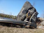
It appears the Island River is providing most of the flood water as this portion of the Isabella River, while flooded, doesn’t appear to be nearly as inundated. There are several large boulders in the river that I paddle past while battling the pesky headwinds.
At about the halfway point to the lake there is a nice little campsite on the northern shore. The fire grate is right on the water but, there are a couple of really nice tent pads. Jack pines dominate the backdrop, though none are large enough for tarps or hammocks. I can’t imagine this one gets a lot of use.

Initially I continue fighting the head wind as before but, am afforded a most welcome reprieve as I enter the wide expanse before the final portage into Isabella Lake. This is perhaps the best extended paddling conditions I’ve encountered on this trip and, I truly savor these invaluable moments.

I pull up to the exceptional downstream landing for 42-rod portage to Isabella Lake. I bring my first load to the intersection of the Pow-Wow hiking trail and veer off to inspect the trail to the bridge over the river. The water is high enough that it’s also coming down the off-chute channel where there is no bridge. The water here is only ankle deep but, even though it’s likely a fool’s errand, I can’t resist the urge to check out Isabella Lake. So, I haul all my gear to the lake end where its open water as far as can be seen.
As I paddle out, it doesn’t take long before I discern a huge sheet of ice. However, there appears to be open water along the southern shoreline so I eagerly press forward. I paddle closer and discover that while there are indeed open water sections along the south shore, there are also sections of ice pressed tight to shore that I would have to cross. If I could guarantee that it was only the short stretch in front of me, I think I might go for it. But, as it is, while seeing the lake in this state is certainly a spectacle to behold and I don’t regret checking things out, the task appears to be far too daunting to safely undertake so, I retreat back to the portage.


The channel I need to cross is probably only about 25 feet across and, as mentioned, the water is only about ankle deep at the intersection. Furthermore, its only knee deep just downstream so, I’m not overly concerned about getting washed downriver but, I certainly don’t want to slip and get soaked in the icy water. There is a downed tree that aids in navigating my way across but, not wanting the Black Pearl to roll in the rapids I use one hand to steady my ship and end up slipping a bit. I bang my shins and some water floods in over my boots before gingerly hopping up on the other side.

The water is chilly but, it's not concerning as long as I keep moving. Just across the bridge there is a very nice campsite where I stage my gear. This site is more situated for hikers of the Pow-Wow trail but, the with the flood waters I surmise it may have been more prudent to have tried to land here and bushwhack up to this site. Hindsight is 20/20.

It’s amazing that this site is virtually untouched by the ravages of the Pagami Creek fire, while only a stone's throw in any direction will get to a heavily burnt area. I juxtapose this phenomena to the current circumstances of my life.
It was nearly a year ago that my divorce became final. That fire severely ravaged my life but, it has not destroyed me. Much like this campsite, there are untouched sanctuaries of my persona that can offer comfort & rest while the surrounding area is slowly renewed and replenished. In a sense, not unlike the natives of generations past who purposely burnt this land to propagate more bountiful future crops of blueberries. If I don’t lose heart and abide in Him, I will also unlock the possibility of bearing much fruit.
The Pow-Wow trail shows unmistakable evidence of a trail clearing crew having just passed through. The better percentage of the trail could be driven down, as it resembles a road. In fact, I believe that is exactly what this trail once was. The ghost town of Forest Center was once located here so, while I now consider it a wilderness; this was once literally someone’s back yard. There are several fascinating threads on bwca.com discussing this area, complete with testimonies from people who grew up in Forest Center – which was abandoned in 1964.
Plodding along, I am compelled to wade through a few areas that are underwater. The depth here is also over the top of my boots so, once again looking for the silver lining, I feel a little better about having gotten soaked crossing the river. The wilderness boundary is about the halfway mark so, this becomes my drop spot while I go back for my next load. 
Light rain is falling on and off as I finally emerge at the empty parking lot. I ever so briefly contemplate bringing my first load with me on the mile long walk back to my van at the Island River entry point parking lot. Once there, I note that the water has risen slightly since I entered. If it comes up another 8-10 inches, it will begin flooding this parking lot. I drive back to the Pow-Wow trail/Isabella Lake parking lot and then finish portaging the rest of my gear.

I’m looking forward to a warm meal and cold drink but, most places in Ely are closed today so, I drive down to Neighbors BBQ just south of Tower right off highway 169. No sooner do I sit down, when a friend from church Jason (who was along on the infamous “Paddling with Padres” trip up to Crooked Lake a couple of years ago.) invites me to join him and his wife Katie. They’re indisputably a great pair and are thoroughly entertaining dinner companions. I am thankful they allowed this stinky camper to join them. Also, for anyone who likes smoked meats & craft beer, I think Neighbors BBQ will be to your liking.
As I write this there have been several harrowing stories of swamped canoes circulating. But for the grace of God, I could have been counted among their ranks. I really appreciate all the people who had the courage to share their tales of woe. I think it goes right to what I shared about Thomas Merton when he said, “in a certain sense, one must die.” The valor these people have shown in putting themselves ‘out there’ to share their stories for the benefit of others, opening themselves up to criticism and scoff (and thus, in a sense dying) exemplifies his point. I just want to say I’m thankful they’re ok and, once again, applaud them for selflessly sharing.
What a blessing this trip was! So grateful things worked out and I was able to thoroughly enjoy a couple of peaceful nights in canoe country. Ad Maiorem Dei Gloriam!