

BWCA Entry Point, Route, and Trip Report Blog
October 02 2026
Entry Point 6 - Slim Lake
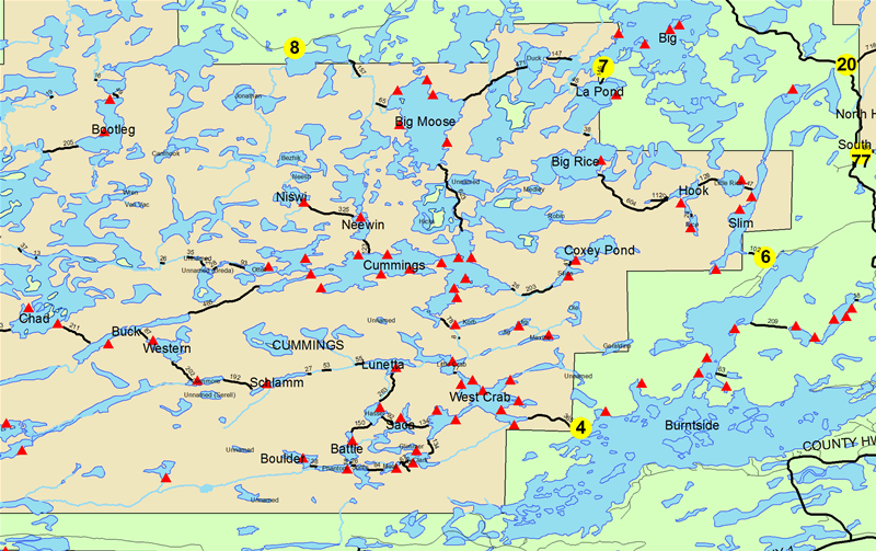
Slim Lake entry point allows overnight paddle only. This entry point is supported by Kawishiwi Ranger Station near the city of Ely, MN. The distance from ranger station to entry point is 23 miles. Access is a 90-rod portage to Slim Lake Portages to three additional lakes.
Number of Permits per Day: 2
Elevation: 1210 feet
Latitude: 47.9958
Longitude: -91.9599
Slim Lake - 6
Number of Permits per Day: 2
Elevation: 1210 feet
Latitude: 47.9958
Longitude: -91.9599
Slim Lake - 6
BWCA Sept 2017 EP14
by hangnout
Trip Report
Entry Date:
September 18, 2017
Entry Point:
Little Indian Sioux River (north)
Number of Days:
7
Group Size:
2
Trip Introduction:
This was our first trip to BWCA. We started off with a group of 4 and ended up with 2 making the trip. We lost the trip leader due to Hurricane Irma. We spent time on Lower/Upper Pauness, Shell, Heritage, and Lynx lakes.
Report
We spent 7 days and 6 nights exploring the lakes near EP14. This was our first trip to BWCA and it did not disappoint!
Below are the lakes we visited on this trip.
Day One - EP14 to Upper Pauness Lake
Day Two - Upper Pauness to Shell Lake
Day Three - Shell Lake
Day Four - Shell Lake to Heritage Lake
Day Five - Heritage Lake to Lynx Lake
Day Six - Lynx Lake to Upper Pauness
Day Seven - Out to EP14
Videos of the Trip
Gear Prep and Packing
Gear Review after trip
BWCA 2017 Trip Video
Photos from the trip





discuss this trip report (3 comments) - last post on October 11, 2017