BWCA Entry Point, Route, and Trip Report Blog
July 15 2025
Entry Point 55 - Saganaga Lake

Number of Permits per Day: 15
Elevation: 1184 feet
Latitude: 48.1716
Longitude: -90.8868
Saganaga Lake - 55
July 2019 Trip - 5 days
Entry Date:
July 22, 2019
Entry Point:
Little Indian Sioux River (north)
Number of Days:
5
Group Size:
4
On the water about 10 AM paddling into a stiff north breeze. We were going to try to make it to Lac La Croix and Sandbar Island but didn't feel like paddling into the whitecaps on Loon.
We made it to Upper Pauness and found all the campsites full - a bit of a surprise. Easy portage to Lower Pauness and found an open campsite in the narrow area between the two bays of Lower Pauness. Kind of buggy but OK campsite - 5 out of 10.
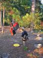
We had steak and green beans that night which were great. See the pic. The steak was still frozen when we reached camp.
Weather was not so great. The forecast before we left was for nice weather but there were two rounds of thunderstorms AND our tent leaked. Things were damp Tue morning. 
We decided to make the trip shorter in light of the headwinds and just paddled up to Loon Lake. We got one of the best campsites in the BWCA IMHO 10/10 - SE corner of Loon lake where it joins up with East Loon Bay. You are maybe 50' above the lake facing NW so the wind keeps the bugs back in the woods.
We paddled over to Canada to say we had done it - even found a little maple tree :-) Otherwise looked a lot like MN.
Nice sunset and NO RAIN. Things dried out nicely.
Loon lake IS a bit disconcerting because motors are permitted in Loon Lake/East Loon Bay. While the area is supposed to be 25hp limit, this boat moved like it had a 250hp motor. 

Portage to Heritage Lake. The portage is hard to find on East Loon Bay - look for a sand beach and a "V" shaped pine. The portage is a narrow trail in the grass behind the trees.
The map reads 220 rods but I count my steps as I walk and I estimate that the portage is more like 300 rods. Almost a mile. It certainly felt like it! I was double packing so we could get across in one trip and the top pack was tilting to one side pretty bad by the time I got across.
The portage comes out on Heritage Creek which is a very pretty with flowering water plants that I forgot the name of.
Paddle down to Heritage Lake which seemed VERY lightly used. Two campsites I think but there was just a guy in a one man kayak fishing on the lake. If you want isolated, try this lake.
We paddled through Heritage to the portage to Lynx which was reasonable.
We got to Lynx early enough that though our preferred site on the east shore opposite the portage was full, the NE campsite was open. VERY nice - 8/10. I marked this one on my map.
We also found blueberries at the campsite and collected some for pancakes. We did not see any bears but with the blueberries you probably want to be careful. 

So we packed up after breakfast with blueberry pancakes and headed back to Lower Pauness.

While there is a portage from Lynx to Little Shell, the water was high enough that you could paddle through. Yeah!! Paddling across Shell was no problem though the wind was starting to come up even at 9 AM.
The portage from Shell to Lower Pauness is easy to find, however, depending on water level it is what I call a "mud" portage. This year the water was high enough that you could pretty much paddle up to some logs the Forest Service had placed. In previous trips howevr, the water was lower and you had to wade though knee deep mud. I have a vivid memory of coming up to this portage when it was mud. Two older, apparently experienced men, were sitting in a canoe watching some teenage boys trying to get into their canoe coming out of the portage. The boys were wearing bluejeans and sneakers. And were mud past their knees. Their comment we could hear well out in the lake was "This s####*" . Be prepared for the BWCA!
And speaking of surprises, we got about 80 rods into the portage and some busy beavers had decided to build a dam someplace nearby and 3-4 rods of the portage were under water. WELL underwater. One of our group waded it - waist deep. The rest of us wimped out and loaded the packs into a canoe and I paddled/poled across the deep area. You could see the boards the Forest Service had installed over the normally muddy section of the trail now about 3-4 feet below the surface of the water.
The rest of the portage was easy and we made it to Lower Pauness without a problem. The nice rock ledge campsite on the peninsula was open but we decided to look on Upper Pauness again. We checked out the campsite just to the north of the 40rod portage and it was very nice - another 8/10. There are also A LOT of sites to pitch a tent on this campsite. At least three areas to pitch tents which would be nice for groups of 9.
Thunderstorms again tonight at dinner time so we didn't cook supper - just a quicky supper and made for the tent. Pitched our tent on a slight downhill slope which turned out to be wise because the other tent was on a lower, flatter region and they had water in their tent during the storms. 
Very glad we came out a day early since there were severe thunderstorms all across the BWCA on Fri night.
We were going to eat in Ely but there was Blueberry Festival going on and it was a zoo!
Still a great time in the BWCA and I have the mosquito bites to prove it!!