BWCA Entry Point, Route, and Trip Report Blog
May 31 2026
Entry Point 20 - Angleworm Lake
Number of Permits per Day: 2
Elevation: 1260 feet
Latitude: 48.0659
Longitude: -91.9303
Angleworm Lake - 20
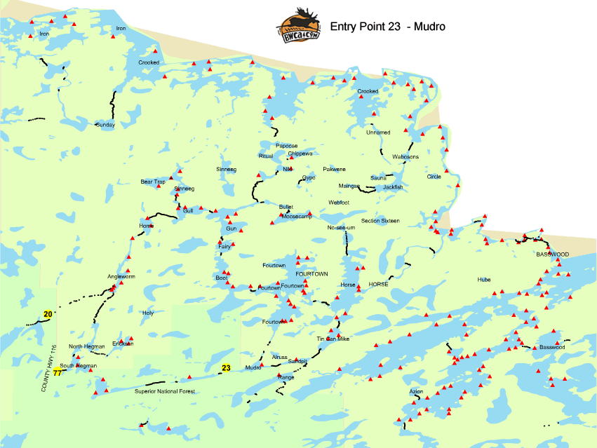
Mudro Loop
Entry Date:
August 26, 2024
Entry Point:
Mudro Lake
Number of Days:
9
Group Size:
4
We had good weather, with only 2 significant storms. One that knocked over a tree by our camp and left a few trees across the one-mile portage. We were not wind bound, but planned to be in camp before each storm hit. The weather forecast that we got from my InReach was very accurate.
I made a video report of our trip which can be viewed on Youtube: https://www.youtube.com/watch?v=wyhjWMFlkIc
Our route was: Day 1: Mudro Entry to Horse Lake Day 2: Layover on Horse Lake Day 3: Horse River to Crooked Lake (near Table Rock) Day 4: To island between Thursday and Friday Bay Day 5: Layover Day 6: Friday Bay to Chippewa Lake Day 7: Chippewa Lake to Gun Lake Day 8: Gun Lake to Fourtown Lake Day 9: Fourtown to Mudro
We'd recommend doing the loop this direction. You travel down the major rivers. Also, we were glad to do the Billy Goat portages last (from Fourtown to Mudro) because they were more challenging (very rocky). We only had competition for campsites on Gun and Fourtown.
One tip: We were able to verify location on our maps by using Google Maps. It gives you a GPS map even though you don't have cell coverage. This is only to verify your location on a regular map, you don't get details like campsite info.
Lakes we through - Mudro Lake, Sandpit Lake, Tin Can Mike Lake, Horse Lake, Basswood Lake, Crooked, Papoose Lake, Chippewa Lake, Nikki Lake, Wagosh Lake, Gun Lake, Fairy Lake, Boot Lake, Fourtown