BWCA Entry Point, Route, and Trip Report Blog
September 02 2025
Entry Point 43 - Bower Trout lake
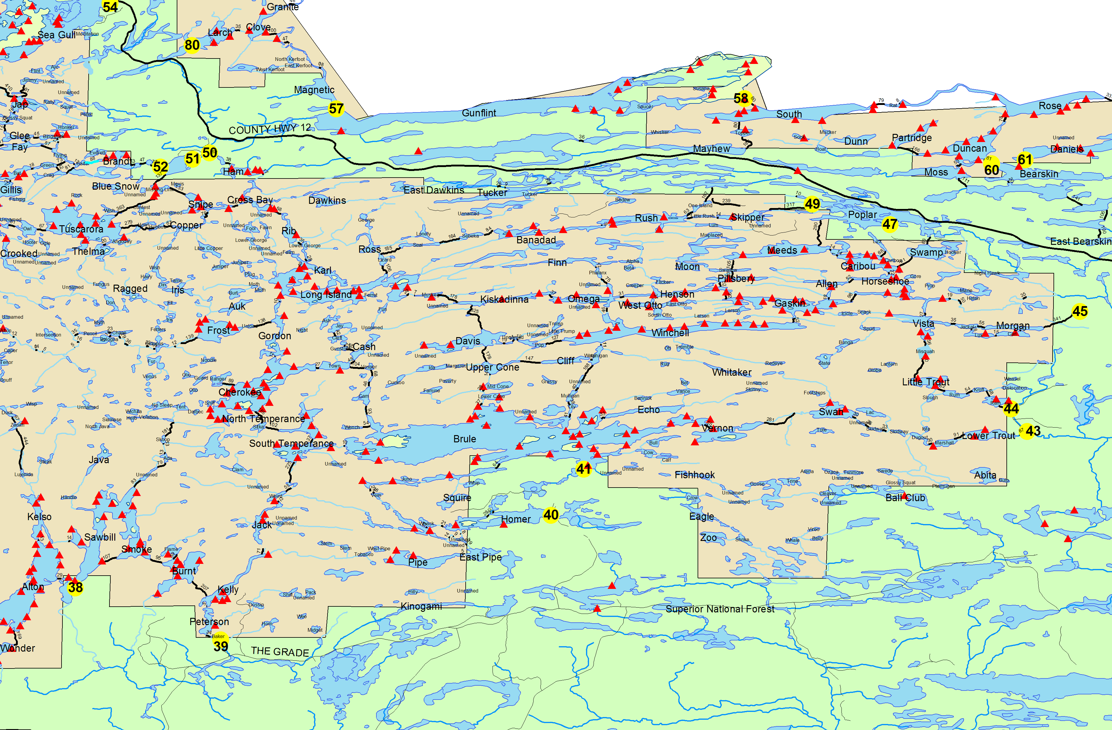
Bower Trout Lake entry point allows overnight paddle only. This entry point is supported by Gunflint Ranger Station near the city of Grand Marais, MN. The distance from ranger station to entry point is 25 miles. Access is a 72-rod portage from small parking area into Bower Trout. This area was affected by blowdown in 1999.
Number of Permits per Day: 1
Elevation: 1650 feet
Latitude: 47.9469
Longitude: -90.4442
Bower Trout lake - 43
Number of Permits per Day: 1
Elevation: 1650 feet
Latitude: 47.9469
Longitude: -90.4442
Bower Trout lake - 43
Adams Knife Loop
by PWS
Trip Report
Entry Date:
July 25, 2017
Entry Point:
Seagull Lake
Exit Point:
Saganaga Lake (J)
Number of Days:
10
Group Size:
2
Trip Introduction:
Followed the Adams Knife Loop described in the Boundary Waters Book. Entered Seagull lake and ended at American Point in Saganaga Lake where we were picked-up. We were out for 10 days. The book said it could be done in 7 days but we made it a 10 day trip because we are old (but young at heart) and had our dog with us. We spent 2 nights at our last campsite. Our total mileage includes water and portages was 83.37 miles. We can never do single portages, so this mileage accounts for double portages. I have the GPS. route; if you are interested, please contact me pwstaver2@aol.com.
Report


discuss this trip report (1 comments) - last post on June 24, 2019