



BWCA Entry Point, Route, and Trip Report Blog
May 26 2026
Entry Point 12 - Little Vermilion Lake

Number of Permits per Day: 6
Elevation: 1150 feet
Latitude: 48.2995
Longitude: -92.4268
Little Vermilion Lake - 12
May Solo - #14 LIS to #16
Entry Date:
May 20, 2026
Entry Point:
Little Indian Sioux River (north)
Exit Point:
Moose/Portage River (north) (16)
Number of Days:
5
Group Size:
1
Overall, I was very happy with the progress made on Day 1. What started out as a cold and cloudy morning turned into being a warm, sunny day and was the biggest push I had made during this trip. When looking at the forecast, it looked like Saturday was looking questionable in terms of rain and some windy, so I wanted to get as close to my final lake, Nina Moose, as possible and do 2 nights there.
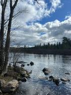
[paragraph break] Day 2: From Ruby, cut through Huster Lake into Oyster and canoed around for most of the day enjoying the weather, setting up camp and starting some of the books I had brought. It was definitely windier in the PM so I was happy to be all set up by 2:30 or 3 PM.
 [paragraph break]
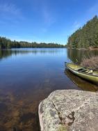
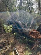
Day 3: Left Oyster and began the portage into Oyster River. On this portage there was a huge downed tree that was laying parallel to the portage path and required some off trail bushwhacking to get the canoe around it but not impossible. I continued down the river to the split off of either continuing down the river or portaging into Agnes. I chose to play hard and portage into Agnes as I heard it was a beautiful lake and wanted to paddle on it for a bit. When I got through I noticed it was quite wavey and very windy. The waves were head onto the canoe trying to go straight out, and with NW solo (which I think is a little lower) water was crashing into the boat a bit when I was moving along the waves to follow the shore toward Nina Moose River. Not impossible to deal with, but had me thinking I shouldve just went over the dam on the river and hooked up with Nina Moose River and avoided the Lake altogether, but we made it! Going down the Nina Moose was pretty straight forward although it felt like there was just a constant headwind the entire way, so definitely a higher effort day, compared to the idea I had in my head that I would just float down! Eventually made it to Nina Moose Lake and took a site that felt like it was a bit sheltered from the wind and had a great view. The rain moved in at around 6:30 PM - which was perfect because I was hitting the good parts in my books so I just read for the rest of the evening
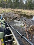
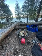
[paragraph break] Day 4: Was still raining a bit in the morning, but took the opportunity to sleep in and relax. When the rain let up, made some breakfast sandwiches and tried to take the scenery in. One of my favorite moments in general is having coffee in the morning and listening to the loons on the lake. [paragraph break] Day 5: Woke up pretty early, packed up camp and shot down Moose River to the exit. Hinted at this earlier but this was the first time I have seen beaver dams and/or huts and there were plenty on moose river. There was only 1 dam that required getting out and pulling over, the rest were pretty floatable although im not sure if thats a result of the water levels or not.
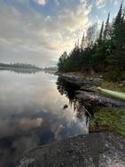
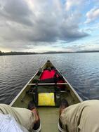
[paragraph break] Overall what a great trip, the weather overall was ideal with temperatures not being too cold and the wind being manageable (last year on my Lake One entry I remember it being much worse). Have one more trip planned in September with my fiance and will continue day dreaming of being back until then.