BWCA Entry Point, Route, and Trip Report Blog
July 12 2025
Entry Point 57 - Magnetic Lake

Number of Permits per Day: 3
Elevation: 1554 feet
Latitude: 48.0969
Longitude: -90.7621
Trout Lake - 1
Granite River Route - Summer Revisited
Entry Date:
August 03, 2011
Entry Point:
Magnetic Lake
Number of Days:
5
Group Size:
4
 [paragraph break] dd2 (dear daughter 2) was the only one of my three kids that was up for this adventure - ds would have his own trip three weeks later, and dd1 had her own trip the following month. dd2 drove a hard bargain and insisted that she be permitted to bring her very own tent. I agreed, provided that it went in HER pack :) The "Solo" pack would prove to be just perfect for her. [paragraph break] We were fortunate that the water levels did not dry up this year as is typical, so we proceeded with high hopes for low bugs, high water and a great time. All three came true! [paragraph break] B & S went ahead and scouted parking areas, got advance "intel" on blueberries,and watched moose and a lakeside sunset. [paragraph break]
 [paragraph break] I worked a full day, packed the car, and drove after dark. I wonder who got the better deal on that one? Not me! [paragraph break] dd2 & I made it to the Gunflint Lodge in about 5+ hours... and then had an adventure finding the instructions to our bunkhouse. Although there were few clouds, it was dark as pitch! When we made it to our front door, B let us in and we discovered a bunk room with bunks stacked three high. dd2 and S took the middle bunks (which were already higher than a regular bunk) and B and I were on "ground floor". We grownups chatted away, excited to connect on the eve of this trip. dd2 and I had just missed the howling of a wolf pack (or perhaps we scared them away with our car and people noises). We were excited to get in on the northwoods action & couldn't wait for the next day to begin!
 [paragraph break] We had a delicious breakfast at the Lodge. Then, everyone else shuttled a car to Trail's End for the return, while I loaded boats. We pushed off just before 11am. dd2 & I started in the "new to me" Penobscot 16, making its maiden voyage with me. We had 2 GG Solo packs, 1 GG Superior One pack, and 1 "Seattle Sports" PVC pack, plus I think B & S had a small day pack. We carried one extra paddle in each boat and had two fishing rods. I took a dip at the beach with my cell phone in my pocket (a first!) and had to leave it behind to dry out in B's car. [paragraph break]
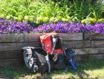
 [paragraph break] Alas, the Penob didn't handle so well with a child in the bow, and the wind on Gunflint picked up midway across the lake... Using every paddle muscle I had left, we crossed the wind and pulled ashore on a point on the far side. B & S were in the Heron, having no trouble at all. I walked a ways along the shore until we had to paddle hard again for the narrows ("Cow o Bob e Cock") to Magnetic Lake. The channel was marked with milk cartons, and we floated through to find a place to swap boats with B & S. dd2 wouldn't have anything to do with that green boat the rest of the trip! Crisis averted, we paddled Magnetic Lake and enjoyed imagining life on an island cabin (yellow) just outside the BW. [paragraph break]
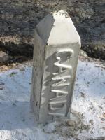
  [paragraph break] We passed out of Magnetic Lake and pulled into the first portage just ahead of a pontoon boat - seriously. This wasn't the BWCA - yet. This portage would be in Canada! dd2 was the first of my kids to technically leave the country! [paragraph break] At the portage were two day trippers, lounging right where we took out, not understanding the portage concept. They soon got the picture as we landed and began unloading our gear. We carried it a short ways before putting in again and paddling to the top of Little Rock Falls - the beautiful site of an old Hamm's Beer commercial. There, we carried the gear again over more rocky terrain to the end of the portage. The nasty, rocky, ankle-twisting portages were blessedly short. Plenty more than 9 people (BWCA limit) were gathered at Little Rock Falls. [paragraph break]
  [paragraph break] A perfect "jump rock" can be found at the bottom of the falls, with a nice pool below it. We took turns jumping off (I did hit the bottom) and enjoyed the cool water. Then a snake reclaimed its spot on the ledge and the jumpers took a break :) [paragraph break]
 [paragraph break]
 [paragraph break] When we paddled on (at about 2pm), our next destination was a secret blueberry patch. B & S had directions from Bruce Kerfoot, and just before Wood Horse Portage, we pulled over and scaled the granite walls to find a plateau of blueberries as far as you could see. We filled four plastic containers (GLAD I brought them) in short order even when we were eating 1/2 of what we picked! [paragraph break]
 [paragraph break] We crossed Wood Horse portage and said we'd take the first site we found since after Clove Lake, it's a ways to the next site. [paragraph break]
 [paragraph break] The campsite up on a cliff after the portage was taken, so we continued. We took the Pine Portage over to Clove Lake, and found the campsite at the end of the trail available. The other two sites were taken. Lucky!! [paragraph break] Clove Lake was just beautiful - the water was shallow and we floated the canoes over to the site. There was room for our tents (including dd2's) and a nice view of the sunset. We arrived just after 5:30pm. The only issue with that location (besides being near the portage) was that the latrine trail was straight up! You kind of had to pull yourself up the hill, holding on to plants... Site gets 4 stars, latrine 1 star. [paragraph break] After setting up the three tents, we made a fire and boboli pepperoni pizza. MMmmmmmmm. Perfect meal at the end of a great day. During dinner, dd2 whispered to me that she was a little scared of sleeping in her own tent, so we raced back to her tent and took it down lickety split. The new Taj 3 was more than big enough for both of us. [paragraph break]
  [paragraph break] We had one couple come through looking for a camp site - we offered to share if they couldn't find one, but they headed to Larch Lake and never returned. The night was clear and we didn't even bother setting up a tarp! I hoped we wouldn't regret it, and we didn't. About time I got some good weather up here (see May trip to Little Indian Sioux River). [paragraph break]
Our group of 9 old friends rose early Monday morning to enjoy a hearty breakfast prepared by the wonderful staff at Clearwater Outfitters. Around 8am, we were headed to Gunflint Lake to begin our adventure. There was a strong breeze over the lake, presenting the first of the day's several challenges (particularly as it had been a year since any of us were in a canoe). Nevertheless, we pushed through the choppy water quickly enough, determined to make it up to Gneiss and find an ideal spot to base camp and fish for a few days. We were able to take a brief rest on a tiny island where Magnetic narrows into the Pine River, and were delighted to discover a plentiful blueberry bush. Continuing on, we made our way up the Pine and around Little Rock Falls. The breeze persisted, and at times the sky appeared ominous though there had been no rain or storms in the forecast - perhaps this was an omen for the remainder of our day. 
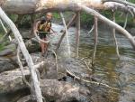
Heading towards the portage to Clove Lake, we searched for the landing. We searched, and searched, and searched. We stuck close to the shore, scanning every bit of land between the falls and the portage marker on the map. We got out of our canoes and searched on foot. At this stage I longed for the route to be as heavily trafficked as the message boards had warned. A couple of hours passed as we continued our search in vain, hoping other paddlers would appear out of the brush and reveal the hidden portage. No such luck. Eventually we decided to travel north, wishfully thinking that maybe the map was inaccurate and the portage lay ahead. We rounded the bend and the current picked up, bringing us to the top of impassable rapids. Fortunately we found a rocky landing to the left of the falls, and were able to locate a path. Could this be the portage? Then, from behind us, came unfamiliar voices. Another group! They were locals and didn’t seem to think they had missed the portage, which gave us a bit of a confidence boost - maybe we were on the right course after all. All of a sudden, however, they were pulling their craft out of the water on the Canadian side of the river, disappearing as quickly as they appeared. We followed the path we had found - a short but steep traverse to avoid the unmarked waterfall. At the bottom of the falls, an abandoned canoe - not the only wreckage we would encounter on this leg of the journey.
As we loaded our gear, the other group emerged on the opposite side of the falls, waving to us before pressing on. We wouldn't run into them, or any other folks, for the rest of the day. Making our way up the winding river, we located what we believed to be the swamp portage and determined our earlier navigation issues were a result of a very poorly drawn section of map. Except, this portage wasn’t swampy at all. It was quite rocky and, as the defined path gradually widened and vanished about 100 feet past the landing, the only thing to guide our way were piles of stones left by former travelers. The abundance of blueberries in the area indicated this route had not seen a lot of traffic. It was a long enough portage that led to a small, circular pool with no sign of a path on the other side. It did not appear as the end of swamp portage on the map, and as the sun began to drop in the sky, a bit more dread began to creep in. Crossing the pool in a few short strokes, we climbed out. Ahead of us lay several hundred feet of jagged, rocky terrain covered by a shallow flow of rushing water. Beyond that, we saw a lake. By now it was evening, and not having passed a single campsite for hours we knew there was only one way forward. Our group split, as half of us unloaded the canoes and began to caravan gear across the water to an overgrown path on the southern side of the river. Our sturdiest travelers took the task of portaging the canoes directly through the water, as the path was a tunnel of trees unable to accommodate the vessels. It was a slow process, brave canoe carriers taking extremely conscious and careful steps to avoid ankle injury by dangerous combination of a strengthening current and slick, jagged rocks. A much needed moment of triumph came once we had safely delivered all our gear, canoes, and bodies to the lake that the shallow rapids emptied in to. But we were beginning to lose light, and we still didn’t know where we were. We spotted what we thought looked like a site on the opposite side of the lake, and pushed hard to cross, relieved to find that we were right.
Upon our arrival, the disappearing sun illuminated a cloud in a brilliant shade of pink, like a floating quartz lantern. A welcome and comforting glow signalling refuge after many hours of somewhat agonizing uncertainty. As the mosquitoes began to make an appearance in full force, we hastily set up camp and began to prepare dinner. It wasn't until then that I thought to turn on my phone and open up google maps, which unbeknownst to me was tracking our location the whole time. A shameful admittance to use such a tool, but worth the cost of my pride for the feeling of security that came with finally knowing our location. We were on Clove Lake, far from where we thought. A journey that should have taken a few hours at most, took a full day. In retrospect, we found the section of the map that featured the route we ended up taking to be inaccurate. It was difficult to look across the lake and discover the clearly visible landing to the portage we were meant to come from and not feel completely inadequate. But at that point, all we could do was laugh and share gratitude for knowing exactly where we were for the first time in about 8 hours. A much more draining day than we anticipated, we ate, sipped on some whiskey by the fire, and crashed. 
Day 2
We woke up slowly - a couple early risers took a morning dip, discovering only after we emerged that we were sharing the shallow water with a sizable snapping turtle. It seemed displeased that we were using the warm rock to enjoy our breakfast, a premium sunning spot. Not to worry, we’d be off soon enough. Now that we knew exactly where we were, we’d follow our initial goal to find a great site on or around Gneiss to make our home for a couple of days. We began to pack up and heard some paddlers in the distance, the type of group you hear LONG before you see them. We were ready to go just by the time they approached, so we had to wait a bit to allow for the appropriate amount of space. 
Still running on the high off the knowledge of our exact location, we had a carefree day paddling north. Weather was perfect, traffic was light, portages were smooth as could be, and we arrived on Gneiss by mid-afternoon. The scouted and sought-after island site was inhabited, so we rounded Devil’s Elbow to find a beautiful spot (#1949) ideal for a group of our size. A gorgeous elevated site with magnificent views of the lake, plenty of trees for hammocks, and a perfect rocky landing to sun on and swim off. A small cliff on the southern end of the site begged for a plunge into the lake (after very careful depth inspection, of course). We set up camp and went for a swim in the sparkling blue. Later, about half of the group set off into the lake for a fishing session at dusk. If I recall correctly, a few bass were reeled in and then spared, as we wouldn’t have enough time to cook and responsibly rid of the scraps. 
Returning to the site, the group collectively enjoyed a stunner of a sunset and began to make arrangements to create a refuge from the mosquitoes about to descend on us. Unlike the previous night, we would be better prepared for what would become known as “bug hour” at this site. I had purchased a cheap net made for a king-size bed to attach to trees with the hope that we could all squeeze inside and find some protection from the inevitable evening swarm. Luckily, all 9 of us fit, and it became ritual to have the tent set up as our makeshift kitchen each night. By the time the sun set, we’d be enclosed - a desirable alternative to retreating to our separate tents. We’d pass “bug hour” (which was really closer to two) eating and playing Pass the Pigs by headlamp. 
Day 3
This would be our long awaited day of leisure. We spent the day fishing, floating down gentle rapids, swimming, sunning, reading, snacking. The fisherpeople caught a wealth of bass as well as a pike, on both sides of the Gneiss portage. On our way back to camp, my paddling partner and I caught a spectacular show of nature as we witnessed a fully grown bald-eagle in a mid-air battle with a bass almost equal in size. It would be dinner for the 2 or 3 baby birds crying out from a massive nest high above the Canadian side of the river. The eagle disappeared in the forest across from her nest, to finish the job and prepare the meal. 
That evening, the group reconvened at the site to feast on the fish - a dish delicious on its own but elevated by a couple of packs of vacuum sealed olives. After dinner the very vocal (read, constant screaming from canoe to far away canoe and travelling at an extremely slow pace) group we had encountered on Clove began to make their way towards us. Disappointed that our site was occupied, they sarcastically pleaded to stay with us before crossing the lake to make camp directly across from us. We’d be very aware of their presence for the remainder of the evening. Despite the disruption, it was hard to be too bothered given the blissful couple of days we’d been blessed enough to experience. After our bug hour ritual, we enjoyed a peaceful campfire, not without a twinge of disappointment at the fact we had to leave this perfect place the following morning.
Day 4
Our mission for this day was to make it to big Sag and begin heading south towards Seagull River before finding a site. We planned to get to our exit point by early afternoon on day 5, and wanted to give ourselves plenty of time should we encounter any challenging conditions on the huge lake. It was a calm and sunny day, and we traveled up through Maraboef with no issues whatsoever. The only travelers we passed on this stretch were loons. We found the portage around Horsetail rapids to carry a bit of magic, with a mossy wall of trees providing a soft sanctuary from the rough waters. We took our time here, pausing to enjoy its beauty. Our first traffic jam of the trip came at the Sag falls portage. Another large group was moving at an extremely relaxed pace as they transported their canoes and gear up from the base of the falls. With plenty of room to hang out in the water, we cast a few lines and had a couple of bites as we practiced patience (all eager to make camp at this stage in the late afternoon). 
Once the path was clear, we portaged around the falls and ran into a local fisherman who gave us the relieving news that the forecast was relatively clear for the next 24 hours. Evening was setting in so we paddled hard, circling all the way around campers island before settling for a site on the southeast side (#368). It wasn’t ideal for a group of our size - very rocky and limited tent pads - but darkness was coming and the winds seemed to be picking up. We made it work and enjoyed an early dinner outside the bug tent, hungry from a day of paddling. Though the site was exposed and the breeze was strong, the mosquitoes were not deterred! We rigged up our bug hour tent in a clearing in the woods behind the site, our final practice of this now strangely beloved ritual. 
Day 5
Fortunately, the fisherman we had met the evening before was right and conditions on the lake were favorable enough for our exit. After a serene morning packing up camp, we loaded into the canoes and set off towards Seagull River where we’d arranged to be collected. The water certainly wasn’t calm, but it wasn’t anything to complain about given the size of the lake. We quietly paddled all the way to our exit point with no breaks, feeling both ready for the cold beers and warm showers waiting at the lodge yet mourning the return to society. Everything went according to plan and we were back at the lodge, bathed and beers in hand, by late afternoon. We traveled in to Grand Marais for a final collective feast and a waterfront stroll, returning to the lodge to recall our trip and swap stories with another guest who’d been spending summers in the BWCA for decades late into the night .
Day 6
Reluctantly, and it will always be with great reluctance that I leave the Boundary Waters, we’d hit the road for the long drive to the respective cities we call home. Places where it takes no time for the reverse culture shock to set in, but armed with the bliss that accompanies a week in the wilderness creating home and a constantly cooperative experience with people I love.
 [paragraph break] Waking about 7am, we had a lovely blueberry pancake breakfast, with no need to scrimp on the blueberries! [paragraph break]
  [paragraph break] The blueberries we picked on the first day of paddling were holding up well - thanks to the hard sided plastic containers we kept them in. I'd hate to see what they looked like in just a plastic bag. Blueberry juice? [paragraph break] dd2 was pretty proud of sleeping all night long in her own tent - she posed for some rockin' pictures with the perfect "I pitch my own tent" T-shirt on! [paragraph break]
  [paragraph break] After we packed up, I needed to do one last thing for dd2. She really wanted to see if the campsite had a "jump rock". We thought we found one, but I insisted on scoping out below it before she could jump. A resident snapping turtle had discouraged my exploration the previous night. S stood on the only rock obstacle and dd2 caught some serious air! Summer in the BWCA is fun! [paragraph break]
  [paragraph break] We were on our way before 11am. Today we had only two portages, but I expected Horsetail Rapids to be a doozy based on Spartan2's description. We landed there at about 12:30pm. I was pleasantly surprised, but it was still a challenge with downed trees making an obstacle course for us all. [paragraph break]
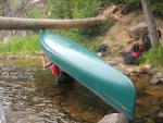
 [paragraph break]
 [paragraph break] The 2nd portage would be around Saganaga Falls (at about 1:30pm) - a short up and over some rocks with a tricky put-in below the falls. Some young'uns with no PFDs simply lowered their metal boat stright down the falls and made it look easy! Not gonna do that with my boats! [paragraph break]
 [paragraph break] Below the waterfall was another popular place accessible by motor. We caught the current and shot out away from the falls to a calm bay where we had lunch and S cast his fishing line. This time, S had some luck and caught a bass for us to admire! On the stringer it went after being captured on camera several times. Hope that snapper isn't around for his lunch :) [paragraph break]
  [paragraph break] Now we entered the infamous "Big Sag". I was nervous about wind and waves, but it was blessedly calm. dd2 was nervous about finding a spot to camp, and tired of traveling all day every day I think. As I paid her some attention inside the boat (parent-speak for trying to re-regulate kiddo), I failed to pay attention outside the boat, even as I kept paddling. [paragraph break] Next thing you know, I was sure that S & B were headed the wrong way; and they were sure I was headed the wrong way. We were too far apart to hear even a whistle from each other - although we could see paddles waving and arms beckoning. dd2 & I let the wind blow us to S & B. We compared maps and sure enough I was headed the long way around Conner's Island. Thanks guys! [paragraph break] As we approached the south end of Camper's Island, the 1st site was available, though there was no decent landing. S and I went to check out the southernmost site for comparison. In the end, S selected the southern site for the tent pad with a view - the "Penthouse Suite". [paragraph break]
  [paragraph break] This site also had no reasonable landing, but we made do. Skies were darkening and we hustled to set up camp about 5:30pm. S & dd2 paddled to "Filet Island" to carve up the bass, and we ate it as an appetizer. Mmmmm, good. When it started to sprinkle, we decided once again to take down dd2's tent and bunk together for the last night - I was glad, even though it had taken me a while to get her tent up using logs and roots as tie-downs! We had dinner and sat by a nice fire enjoying each other's company and not wanting the trip to end. [paragraph break]
  [paragraph break]
 [paragraph break] I've never been so happy to wake up to calm water! Big Sag could easily be more than we could handle, though the route was sheltered. [paragraph break] We made one more round of blueberry pancakes, rationing syrup. We packed up camp, making sure to get pictures of the MOST wide open latrine I have ever seen. The "Amphitheater Latrine" made you feel as if you were on stage, sitting in the bottom of a pine forest "bowl" with a steep trail down into the bowl and back out. We also snapped pictures of our respective homes, and the lot where dd2's home was until it sprinkled :) We were on the water by 9am. This big lake was definitely cooler water than the river system we had come through. That was a welcome change when swimming! [paragraph break]
  [paragraph break] We headed south down the motor corridor. A few motorboats passed us heading north, but in general it was a peaceful paddle. We probably had another canoe "race" just to keep a certain bow paddler motivated. This tactic had worked before and it worked again for a short time. [paragraph break] After the fork at the Seagull River, we stopped at Voyageur Canoe Outfitters (VCO). I was using a paddle bearing a logo the VCO owner, Sue, had designed and sold to help fight breast cancer. So we stopped at VCO and I said THANKS to Sue and then we paddled on. In this area, we were no longer in the BWCA, so we paddled past camps and homes and outfitters. Strange. dd2 was determined to attend a sleepover camp up there next summer. We shall see! [paragraph break] We paddled past an adult loon feeding two chicks - that was a first for me and a thrill. At last we arrived at Trail's End and the paddle was over, sniff sniff. We had the car loaded and were taking our last swim by about 11:30am. That's another spot I could swim in all day long. I didn't want to leave that glorious water! [paragraph break]
 [paragraph break] But we had more to do... I wanted to stop at the new Native American museum nearby, so we did a quick pass through "Chik-Wauk" museum, learning about Native Americans, legendary white folks, and Voyageurs. The aerial map of this route was on the wall there and I took a photo of it and used it in a photo book. A film about Voyageurs was fascinating, and an interactive exhibit about portaging had us all trying to lift 90 pounds, as a Voyageur would have done. [paragraph break]
  [paragraph break] Next we returned to Gunflint Lodge to get S & B's car and meet Sheryl (a treat). [paragraph break]
 [paragraph break] Finally a big lunch at Trail Center where everyone got their own malt and no one finished it. A paddling group of women and girls was ending their trip at the table near us and it was fun to see them bubbling over with the same kind of excitement we had. Made you wanna wear a sign that said "I just came out of the BWCA!" As if they couldn't tell by our appearance... Time for goodbyes to B and S. dd2 and I would explore Honeymoon Bluff and Palisades on the way home, while B and S would head home directly. What a good team we made - I'll be forever grateful that S suggested this trip. [paragraph break]
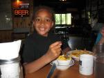
 [paragraph break] dd2 and I went off to climb the steps at Honeymoon Bluff and look out over some enormous and gorgeous lakes. dd2 made friends with some people walking a dog (no surprise there) and we had a good hike before getting in the car for a long drive. [paragraph break]
  [paragraph break] One more stop at Palisades to watch the rock climbers and take a picture of Shovel Point, and then we headed home. [paragraph break]
  [paragraph break] Thanks to B for the warning about I-35 traffic, we cut over through Superior, Wisconsin and came home on blissfully empty back roads. What a trip! [paragraph break] THE END: This turned out to be one of the best BWCA paddles of all time. I loved actually "traveling" somewhere again, though I easily could have spent 2-3 days at each place we camped. I loved paddling with dd2 - she was such a good sport. It was hard to pack up every day and paddle without knowing where we were going to stay... but she did it, and portaged her share without complaint. I loved spending quality time with friends B and S away from the hustle of city life. I loved paddling when the water was "friendly" and warm - what a paradigm shift after years of only paddling during hypothermia seasons. [paragraph break] It was amazing to see the re-generation of the area after the 2007 Ham Lake fire. Some places seemed untouched (islands, some campsites, the Canadian side of the waterway, etc.) and others were scarred visibly, leaving precarious charred trees and exposed granite. I never saw it before the fire, so I cannot compare, but if it was more beautiful than it is now, that would be a sight to behold. It was fun to follow the international boundary. A treaty from the 1800s gives U.S. and Canadian citizens the right to be on either side of the border while traveling (no overnights). We had an international vacation! [paragraph break] To S: Thank you for suggesting the trip and making time for it. Special thanks for your patience with dd2 as a shadow and for the extra gear you hauled just because you could. You've got a special place in my heart and I look forward to hearing about more of your wilderness adventures. [paragraph break] To B: Thank you for your thorough planning help, the encouragement to buy a new pack, ha! and for being game for anything and everything... and for listening and caring. You made sure nothing dropped off the list and added valuable info collected before we paddled. Thanks for sharing your photos, without which this report couldn't be complete. I look forward to many more paddles with you and any others willing to come! [paragraph break] To dd2: YOU made this trip fantastic for me. It was a joy to watch you jumping and swimming and fishing and paddling and sleeping in your own tent.. I LOVED having you as my partner and sharing the wilderness with you. THANK YOU for coming with me - I hope we have lots and lots more trips together. I love you - you ROCK!!!!